Norwegian Mountains, Møre og Romsdal
Skardhornet, 1043m
Humpen, 708m
| County/ Municipality: | Møre og Romsdal county/Volda | ||||||||
| Maps: |
1219-III Hjørundfjord (Statens Kartverk, Norge 1:50 000)
1119-II Volda (Statens Kartverk, Norge 1:50 000) | ||||||||
| Primary factor: |
Skardhornet: 433m Humpen: 105m | ||||||||
| Hiked: | May 2013 | ||||||||
| See also: |
| ||||||||
| See also : | Other Møre og Romsdal mountains on westcoastpeaks.com |

Introduction
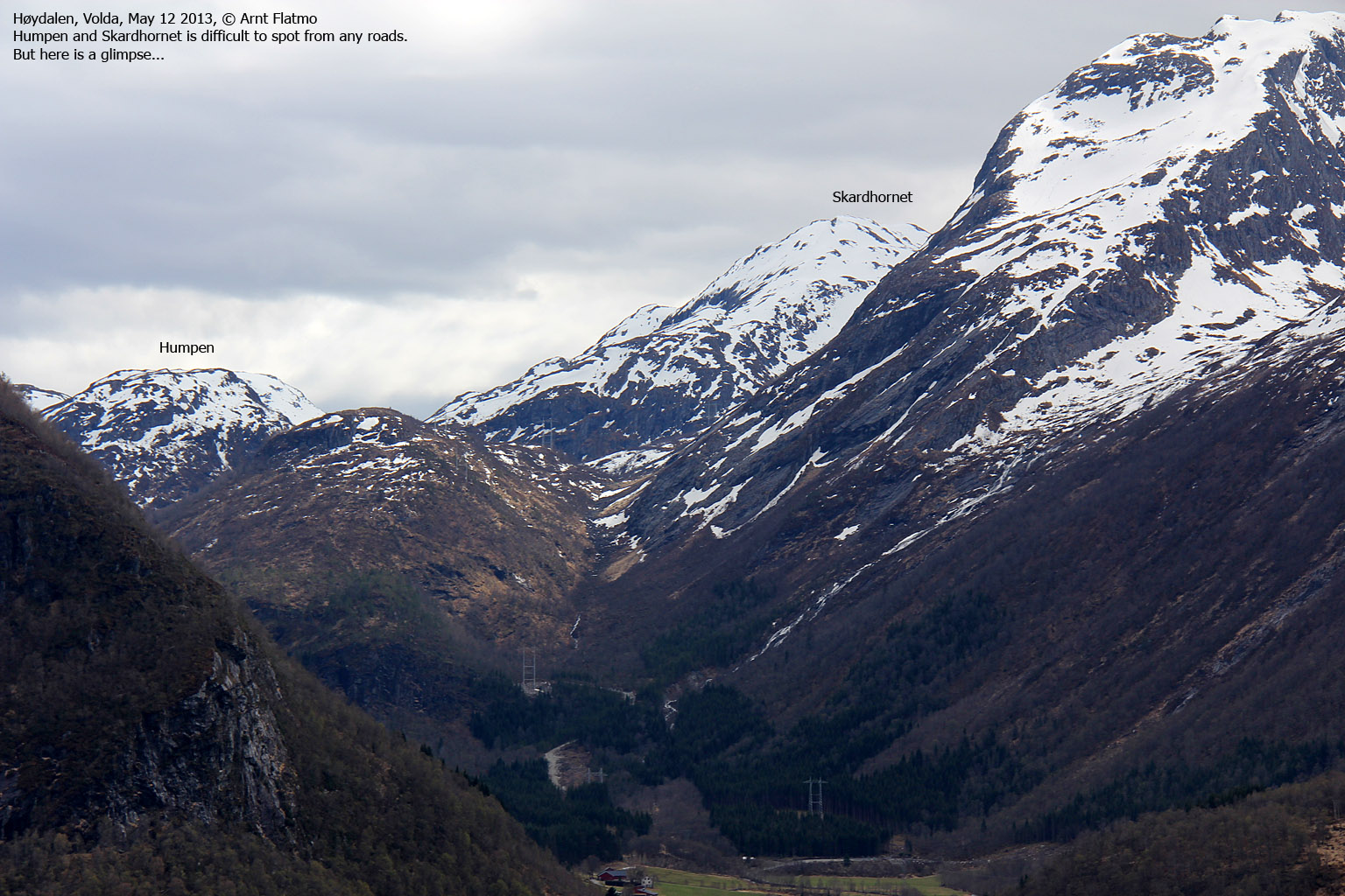
Skardhornet and Humpen are located between the Eidskyrkja and Matøskja massifs, and are difficult to see from any roads. The tops are also seldom visited, so if you're tired of crowded Sunnmøre mountains, these tops might catch your interest...
Thanks (arguably as always...) to a toll road that run deep into Langedalen (a continuation of Høydalen/Høydalsdalen), both tops are quite accessible despite some cumbersome terrain. There is a path leading up to lake Heimste Rinddalsvatnet, but there are no trails leading up to the mountain tops.
Skardhornet

(Click for larger image)
Primary factor:
Skardhornet (Norge 1:50,000: 1043m, Økonomisk Kartverk: 1043m, UTM 32 V 353433 6879737) has a primary factor of 433m towards the higher parent mountain Tverrelvhornet (1264m). The defining saddle is found between Vassdalsvatnet and point 916m. Ref. Norge 1:50,000 (20m contours), the saddle is with the range 600-620m, interpolated to 610m.
Humpen (Norge 1:50,000: 708m, Økonomisk Kartverk: 708m, UTM 32 V 354552 6880980) has a primary factor of 105m towards the higher parent mountain Eidskyrkja (1482m). The defining saddle is found between these two mountains. Ref. Økonomisk Kartverk (5m contours), the saddle is with the range 600-605m, interpolated to 603m.
Humpen

(Click for larger image)
Google map
Google's interactive map. You can zoom, pan and click on the markers.
|
|
Route descriptions
| This disclaimer is regarding all of the literature and instructional guides posted on the westcoastpeaks.com website. These instructions are guidelines only, and should not be used in lieu of common sense or judgment when attempting any of the actions involved or instructed. Westcoastpeaks nor myself will not be liable nor will it indemnify any form of compensation to anyone who has injured, harmed or even killed themselves or others while following any of the instructions written within the website. It should be noted by any persons willing to undertake any of the instructions provided that mountains offer varying levels of risk, regardless of size or incline. Risks to be considered are as follows but not limited to: wild animals, weather, the terrain, bad judgment, inappropriate or insufficient equipment, improper training or experience and of course, bad luck... |
|
Route 1: Langedalen - Skardhornet
|
|
This route description is valid per May 2013
Access
(all distances are approx. distances)
This route description begins in Volda. Here you have the option to a) take the ferry to Folkestad or b) drive around Austefjorden.
Option a) take the ferry to Folkestad, drive to Straumshamn, turn left towards Fyrde and drive along Austefjorden until you reach Høydalen. Turn right when you see the "Høydal Skole" signpost (N62.07369 E6.22084). Drive 1,8km into Høydalsdalen until the road forks. Pay toll here (N62.06050 E6.21268 - not sure what the fare is - most likely NOK 20,- or 30,-). Continue 3km on the toll road until it ends (N62.03819 E6.21420), deep into Langedalen.
Option b) take the Kvivsvegen road and exit at Fyrde. Drive through Fyrde and along Austefjorden until you reach Høydalen and seen the "Høydal skole" signpost. See option a) for further driving instructions.
The routes:

The routes, as seen in Google Earth

(Click for larger image)
Common:
Continue southwest along a tractor road for 150-200 meters, then turn left onto a forest path that begins by an old winch. Cross the river on a bridge, and locate the Rindalsætra/Fairdalen signpost. Turn left and follow a visible zig-zag path up to the dam (N62.03162 E6.21580) by lake Heimste Rindalsvatnet. Be aware of rock-fall and avalanche (given the season) on your way upwards. Rocks stuck in trees tell a story...
Skardhornet:
At the dam, turn right (west) and deal with thicket until you raise above the timberline. Make your way up to the ridge and follow the ridge crest all the way up to the summit (N62.02147 E6.19912). Be aware of east-facing cornices. The high point should be obvious, except in fog - as it is not marked. The distance from the dam to the summit is 3,1km.
Humpen:
At the dam, turn left (east) and follow a path to a cabin down by the lake. From here, go off-trail and continue north towards the summit (not marked). There are some cumbersome sections along the way. Some might even call them steep. Humpen summit (N62.03305 E6.21944) is not marked.

Pictures and Trip reports:
- Skardhornet & Humpen, May 12 2013
 westcoastpeaks.com
 Other Møre og Romsdal mountains
 Other Norwegian mountains


