Norwegian Mountains, Sogn og Fjordane
Jordalsnipa, 1453m
Holefjell, 1440m (ca.)
Brekkenipa, 1387m
| County/ Municipality: | Sogn og Fjordane county/Sogndal | ||||
| Maps: | 1317-I Fjærland (Statens Kartverk, Norge 1:50 000) | ||||
| Primary factor: |
Jordalsnipa: 203m Holefjell: 15-20m Brekkenipa: 70m | ||||
| Hiked: | Oct 2012 | ||||
| See also: |
| ||||
| See also : | Other Sogn og Fjordane mountains on westcoastpeaks.com |

The Jordalsnipa - Holefjell plateau

(Click for larger image)
Introduction
The tops Holefjell, Jordalsnipa, Brekkenipa and Vardafjell form a horseshoe around the Hamradalen valley - which is located just south of the Fjærland village. Jordalsnuten is the highest of the peaks.
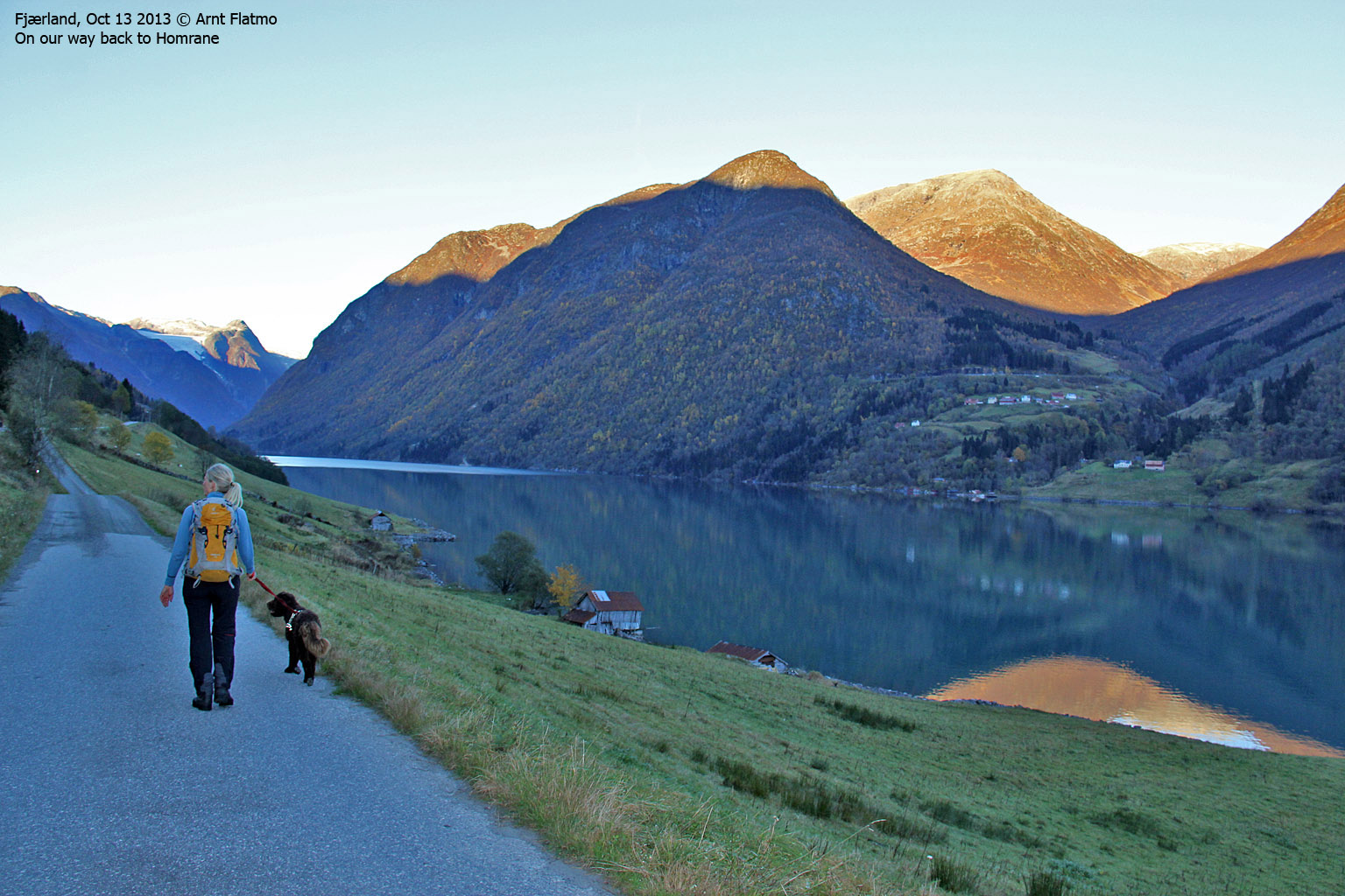
This horseshoe offers a nice round trip hike (starting at Homrane), but this site recommends a variation to this route; instead of descending into Hamradalen via Vardafjell (the route is not obvious and the terrain is steep), descend via Distadfjellstølen. There is a path from Distadfjellstølen and down to the fjord. If you do not have a car waiting, you're facing a 2,4km walk along Fjærlandsfjorden.
Walking along Fjærlandsfjorden

(Click for larger image)
On the Holefjell - Jordalsnuten plateau, you have a good view towards the classic Meneseggi route to the west and the Fjærland - Sogndal - Luster mountain range to the east. Any which way you turn, the views are quite impressive...
View towards Meneseggi

(Click for larger image)
Primary factor:
Jordalsnuten (Norge 1:50,000: 1453m, Økonomisk Kartverk: -, UTM 32 V 374466 6807747) has a primary factor of 203m towards the parent Heimstegretta (1394m). The defining saddle (approx. 32 V 374491 6808684) is found between these two tops. Ref. the 1:50,000 map (20m contours), the saddle is within the range 1240-1260m, interpolated to 1250m.
Brekkenipa (Norge 1:50,000: 1387m, Økonomisk Kartverk: 1387m, UTM 32 V 375301 6806184) has a primary factor of 70m towards the parent Jordalsnuten. The defining saddle (approx. 32 V 382388 6820988) is found between these tops. Ref. the 1:50,000 map (20m contours), the saddle is within the range 1320-1340m, interpolated to 1330m. However, GPS tracks shows that the saddle point is lower. Based on these tracks - AND aligning with other sources, the saddle point is set to 1317m.
Holefjell Ø-1 (Norge 1:50,000: - [highest contour is 1280m], Økonomisk Kartverk: -, UTM 32 V 375652 6808068) has a primary factor of 50m towards the parent Jordalsnuten. The defining saddle (approx. 32 V 375509 6808121) is found between these tops. Ref. the 1:50,000 map (20m contours), the saddle is within the range 1320-1340m, interpolated to 1330m. However, GPS tracks shows that the saddle point is lower. Based on these tracks - AND aligning with other sources, the saddle point is set to 1317m.
Brekkenipa

(Click for larger image)
Google map
Google's interactive map. You can zoom, pan and click on the markers.
|
|
Route descriptions
| This disclaimer is regarding all of the literature and instructional guides posted on the westcoastpeaks.com website. These instructions are guidelines only, and should not be used in lieu of common sense or judgment when attempting any of the actions involved or instructed. Westcoastpeaks nor myself will not be liable nor will it indemnify any form of compensation to anyone who has injured, harmed or even killed themselves or others while following any of the instructions written within the website. It should be noted by any persons willing to undertake any of the instructions provided that mountains offer varying levels of risk, regardless of size or incline. Risks to be considered are as follows but not limited to: wild animals, weather, the terrain, bad judgment, inappropriate or insufficient equipment, improper training or experience and of course, bad luck... |
|
Route 1: Homrane - Nesagaugen - Holefjell - Jordalsnipa - Brekkenipa - Distaddalen
|
|
This route description is valid per October 2013
Access
(all distances are approx. distances)
This route description takes Fjærland as the starting point. From RV5, take the "Mundal" exit (signposted). Follow the main road (at first westbound, then southbound) for 4,6km to Homrane. Locate the Nesahaugen information board. This is where the path begins. There is also parking for a few cars.
The route:
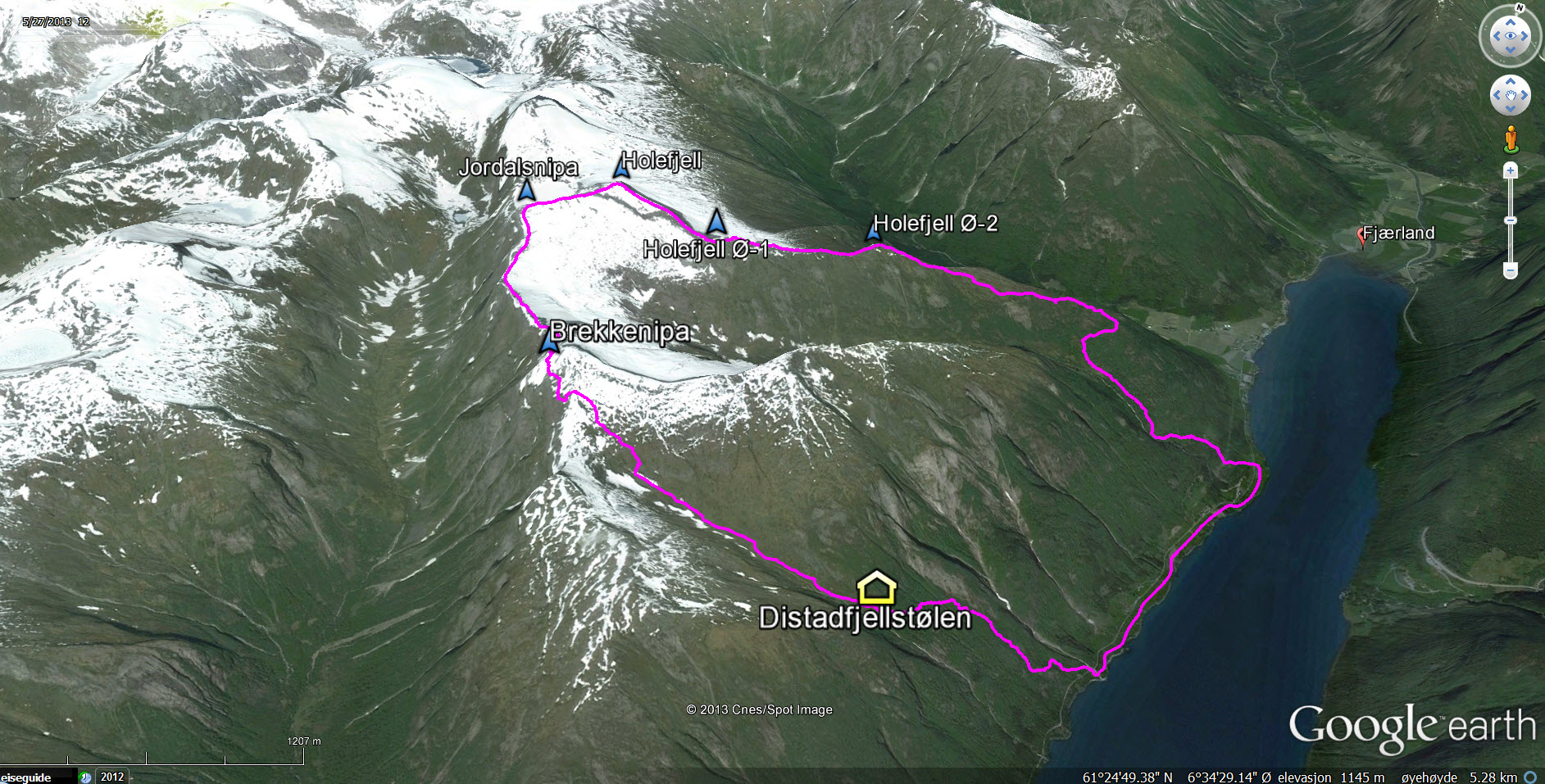
The round trip route

(Click for larger image)
Follow a marked path (signposted "Nesahaugen") up the forest. After approx. 1,6km you reach Hamrastølen (N61.39052 E6.72018). The path continues to climb up to Nesahaugen (N61.39427 E6.71866). From here on, you're mostly off-trail although you can pick up traces of paths here and there.
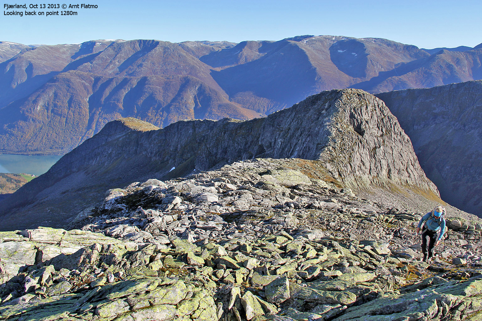
Continue - now above the forest - towards point 1097m (N61.39099 E6.68986) and just try to pick the best line through some minor bush belts. The terrain up to point 1280m (N61.38660 E6.67222 - aka. Holefjell Ø-1) is easier and the route is altogether obvious...
The ridge route to Holefjell

(Click for larger image)
From point 1280m, follow a vague path that takes you safely down the steep ridge and to the saddle between point 1280m and Holefjell. The leg from the saddle and up to Holefjell is a bit steep, but uncomplicated and absolutely not airy. Holefjell summit (N61.38855 E6.65804) is marked by a medium-sized cairn.
From 1280m to Holefjell

(Click for larger image)
From Holefjell, it's a 0,8km walk to Jordalsnipa summit (N61.38334 E6.65026) - not marked by any means.
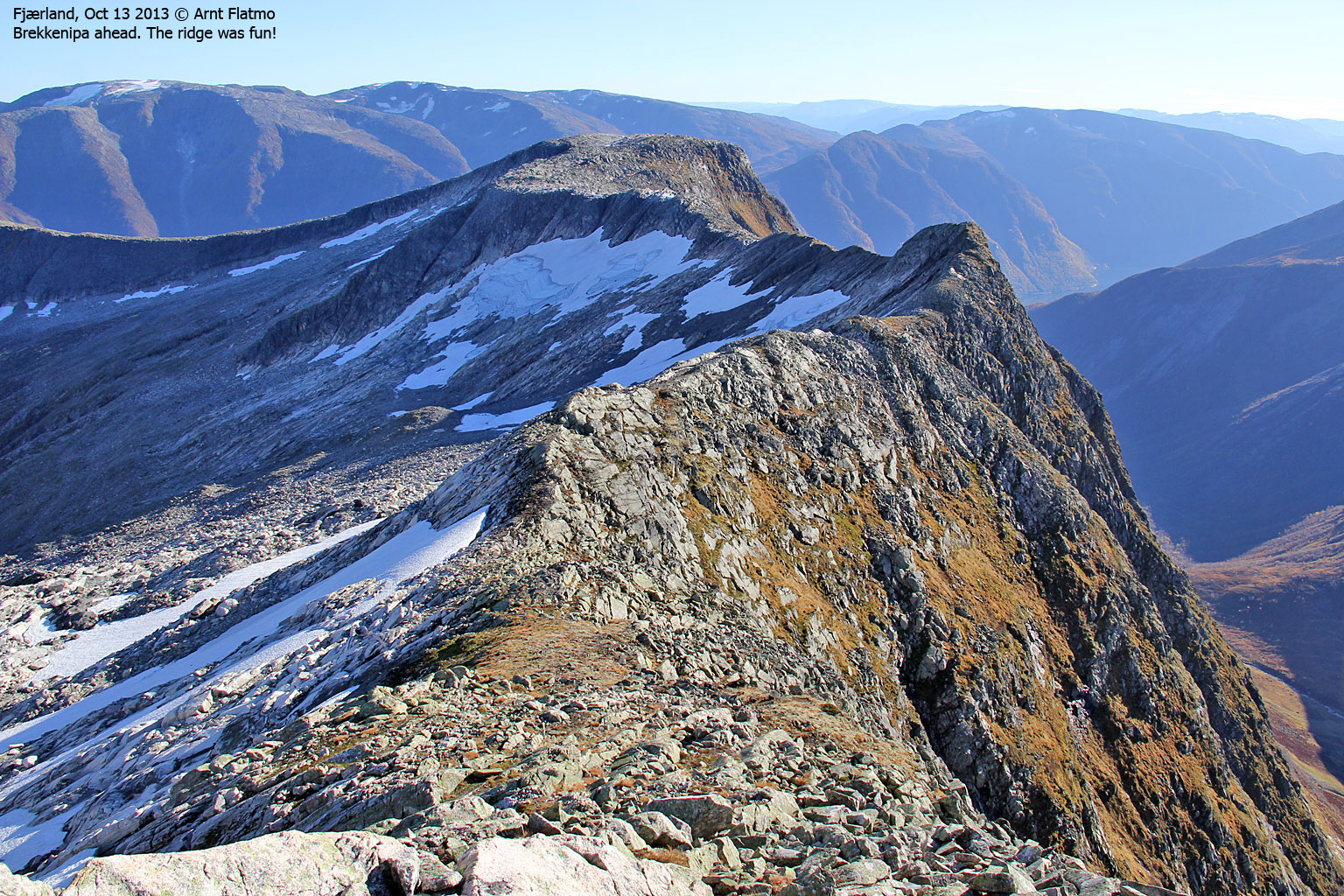
From Jordalsnipa, descend along the ridge in the direction of Brekkenipa. After the initial descent, you pass a narrow section along the ridge (see the below picture). If you don't feel like testing out your balance here, pass more safely on the right-hand side of the crest. Once past this section, set a direct course for Brekkenipa.
Fun section between Jordalsnipa and Brekkenipa

(Click for larger image)
From the unmarked top of Brekkenipa (N61.36959 E6.66692), continue the descent along the ridge for approx. 250 meters, then turn left and descend into Distaddalen. That is - unless you want to visit Stigen and Lyngsetefjellet.
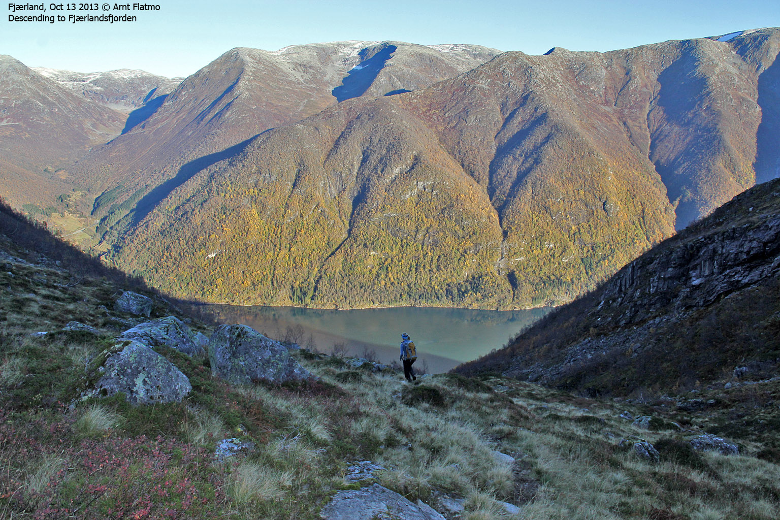
Descend Distaddalen to the ruins of Distadfjellstølen (N61.36450 E6.70469). From here, it is very important that you find the path that runs northeast and takes you down to Fjærlandsfjorden. It will get pretty ugly if you don't...
Descending Distaddalen

(Click for larger image)
Pictures and Trip reports:
- Holefjell, Jordalsnipa and Brekkenipa round trip, Oct 13 2013
 westcoastpeaks.com
 Other Sogn og Fjordane mountains
 Other Norwegian mountains
