Norwegian Mountains, Sogn og Fjordane
Jordalsnipa (1453m),
Holefjell (1440m),
Brekkenipa (1387m) round trip, Oct 13
2013
To the main Jordalsnipa/Holefjell/Brekkenipa page (maps, pictures, other trip reports)
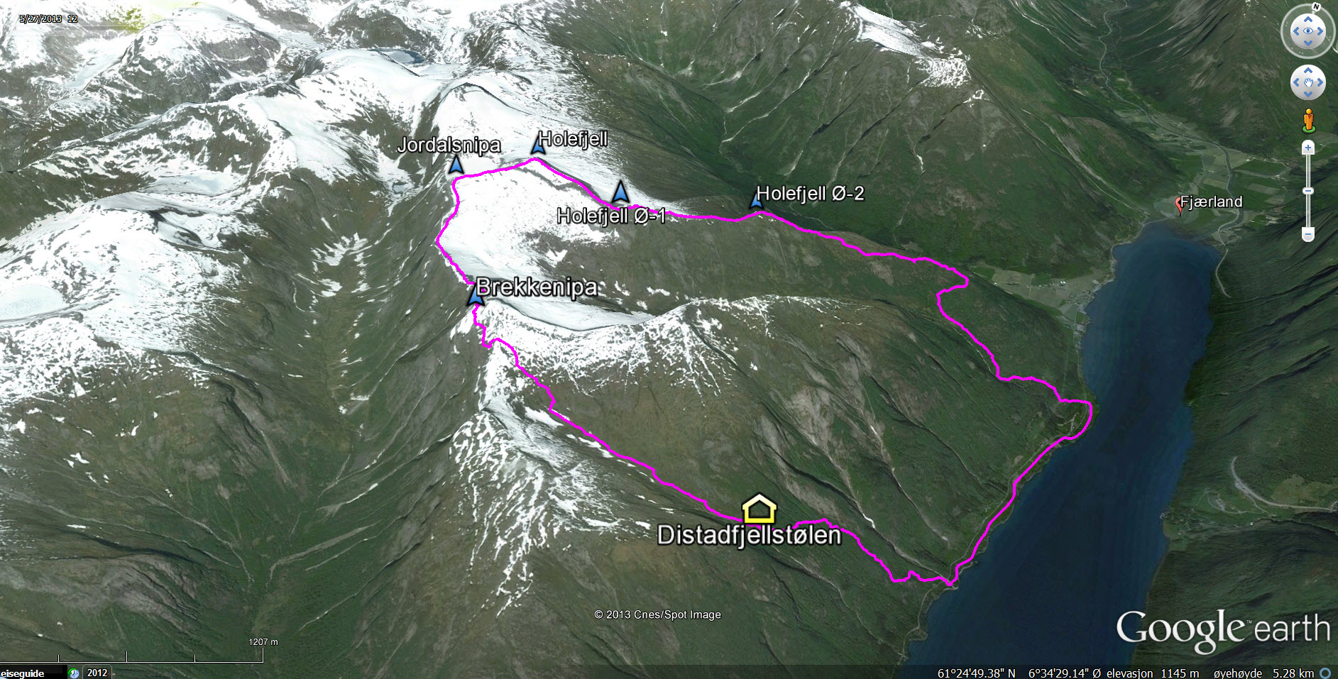
The round trip route

(Click for larger image)
Yesterdays' fantastic hike to Kvannholtenipa was history, but the stunning weather stayed with us for one more day. Anne and me decided to go back to the Fjærland region and continue "working" on our list of Sogndal municipality peaks. The main target for today was Jordalsnipa.
After studying the map, a round trip hike soon presented itself as the obvious choice; the horseshoe around Hamradalen valley. The time was 10:35am when we had parked the car at Homrane and were ready to head out.
It took us 45 minutes to reach Hamrastølen and additional 30 minutes up to Nesahaugen (665m). We were now above the forest and the views got more and more impressive by the minute...
Above Nesahaugen

(Click for larger image)
On Point 1097m (12:50pm), we took a short break and enjoyed life for a little while. The route ahead towards Holefjell and Jordalsnipa seemed easy, and we had already learned from a farmer by the trailhead that the north side of point 1280m wouldn't offer any problems. Karma had a great day of course. There was just a million different scents around...
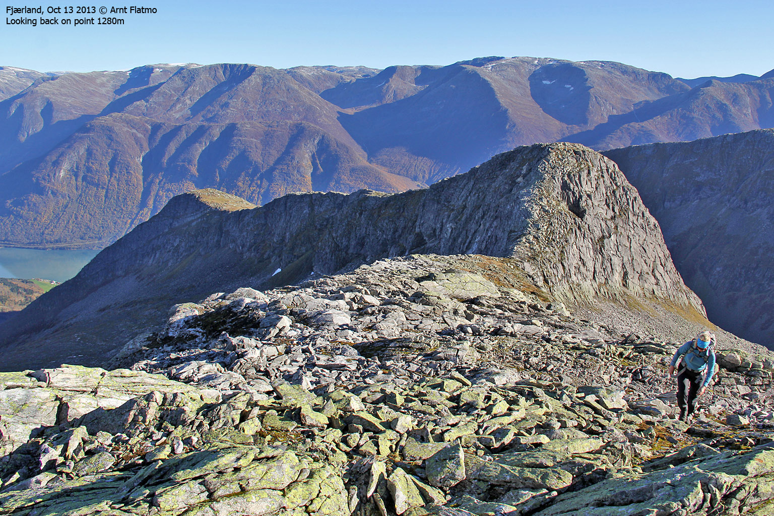
We continued up to Point 1280m (1:32pm) and it seemed that the farmer was right. The descent towards Holefjell wouldn't cause us any problems. We had now been walking for 3 hours and I was pretty eager to set my foot on a bona fide summit. Hence, we didn't stay long on this top and moved on.
From 1280m to Holefjell

(Click for larger image)
The time was 2:09pm when we arrived on Holefjell, but Jordalsnipa - my bona fide summit was still 0,7km to the southwest. After a short round of pictures, we moved on.
We arrived on Jordalsnuten 2:32pm, and my first action was to photograph the peaks along "Meneseggi" - which I skied back in 2004. That was a very, very memorable trip in my mountaineering career...
View towards Meneseggi

(Click for larger image)
During our ascent, we were a bit worried that the descent via Vardafjell and Lakkenipa could be quite cumbersome. The farmer had told us that we had to find the ledge that would bring us into Hamradalen in a "civilized manner" (my own interpretation). As we were not convinced that this would be a trivial task, we decided to descent into Distaddalen instead. The map promised some kind of path from Distadfjellstølen, and that was the path we put our money on...
But first, we had to get to Brekkenipa. The ridge ahead looked fun, and it actually got a bit narrow in one point. As I didn't fancy hauling Karma over this airy section, we took the safer route down on the right-hand side...
Fun section between Jordalsnipa and Brekkenipa

(Click for larger image)
We reached the top of Brekkenipa at 3:35pm. It was now 5 hours since we left the trailhead and we were now above 1400 meters. If we ran into obstacles during our descent, dinner would be late today...
The descent into Distaddalen went well. And when we got to the Distadfjellstølen ruins at approx. 600 meters, we also found the (partially marked) path down to the fjord. I cannot even try to imagine the world of pain we would have been in - had we not found this path...
Down by Fjærlandsfjorden

(Click for larger image)
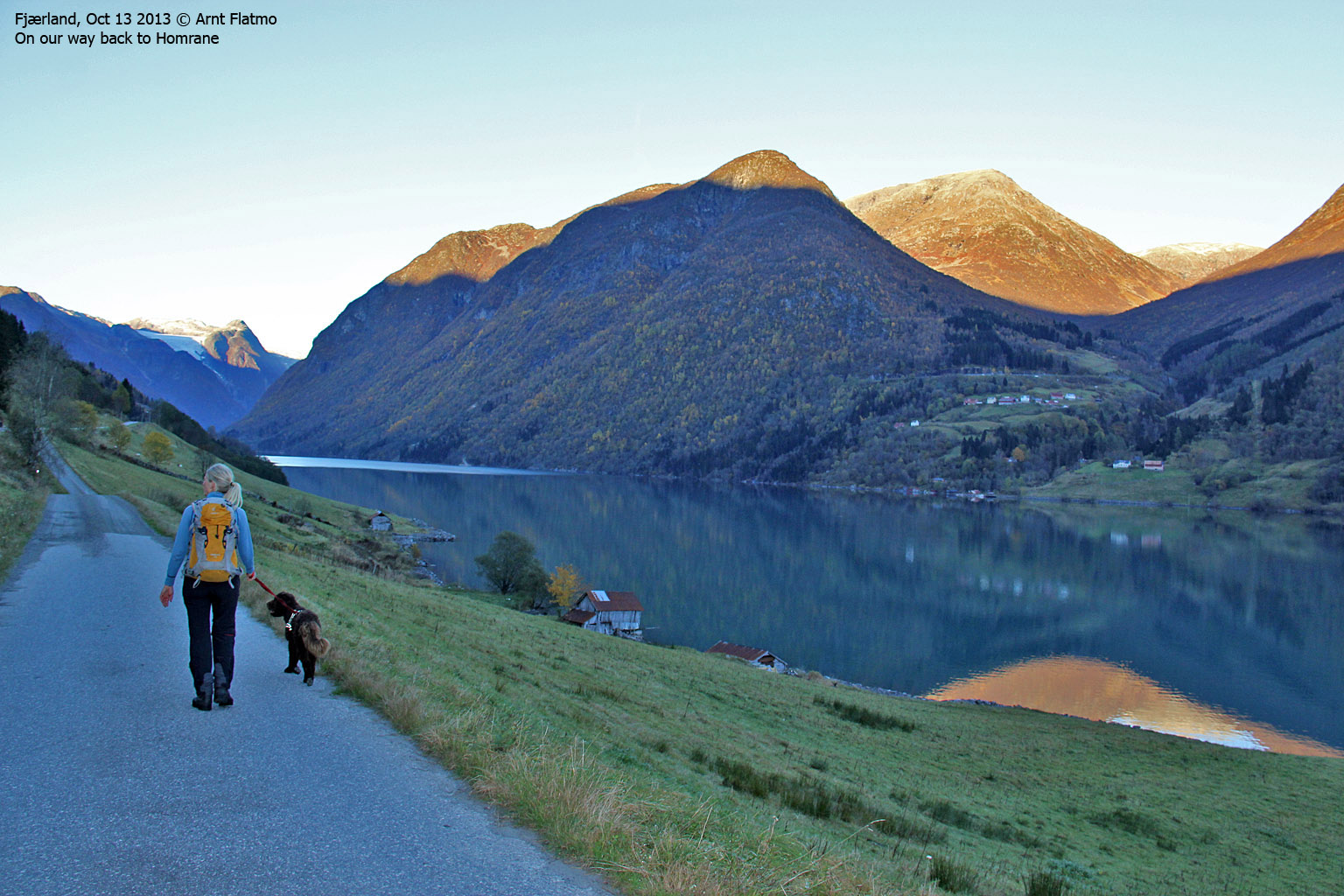
We had 2,4km along the road to Homrane. I am not to crazy about doing kilometers along a road, but when it's along Fjærlandsfjorden I can surely make an exception. We returned to the trailhead 6 o'clock sharp - 7h:25m after heading out. Dinner sure tasted good that evening!
Walking along Fjærlandsfjorden

(Click for larger image)


