
A new Jostedalsbreen main page is under construction...
A traverse of the Jostedalebreen glacier can be done in several ways, but the Erdalen - Fjærland route stands out as the "classic" route. In Norwegian, this traverse is called Jostedalsbreen på langs, or Josten på langs in short. JPL in its shortest form.
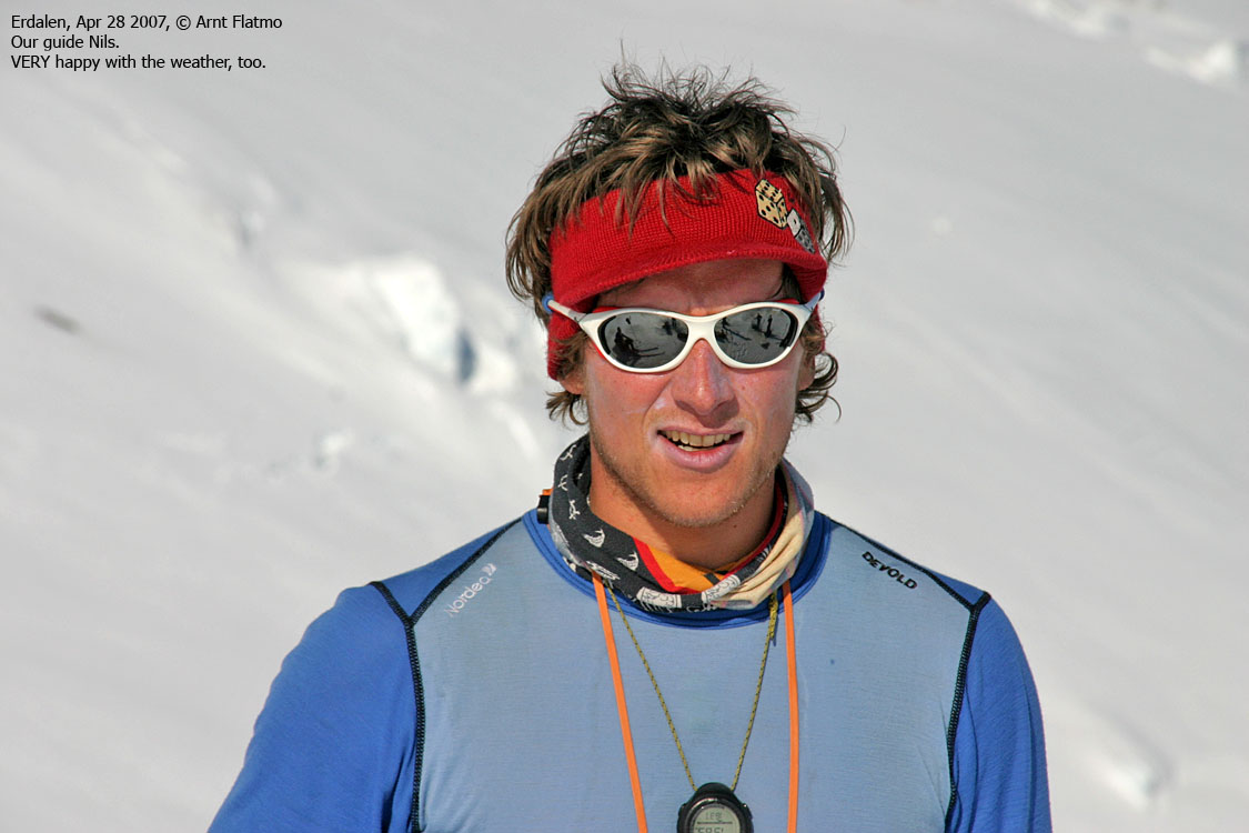
This particular traverse was a company trip, organised by a specific department. This department needed a few extra persons, so my colleague Terje and I signed up for this trip too. They had hired a guide (Nils) from Breoppleving, and we were 10 persons altogether.
This is NOT a company trip report. This is a subjective report from my point of view. The factual stuff is in plain text, while my personal views and thoughts have been enclosed in shaded table rows. Everyone in the group have OK'ed that they appear on pictures, and last names have been omitted. To protect the innocent.
Below is a trip summary and the first day, and then the following days presented on individual pages.

Jostedalsbreen
The group met in Stryn on Friday afternoon, 27/4, 19:00PM. After a quick dinner, we drove to Greidung in the valley Erdalen and parked our cars. We walked on foot to Storesætra and proceeded on skis to Vetledalsseter, where we put up camp.
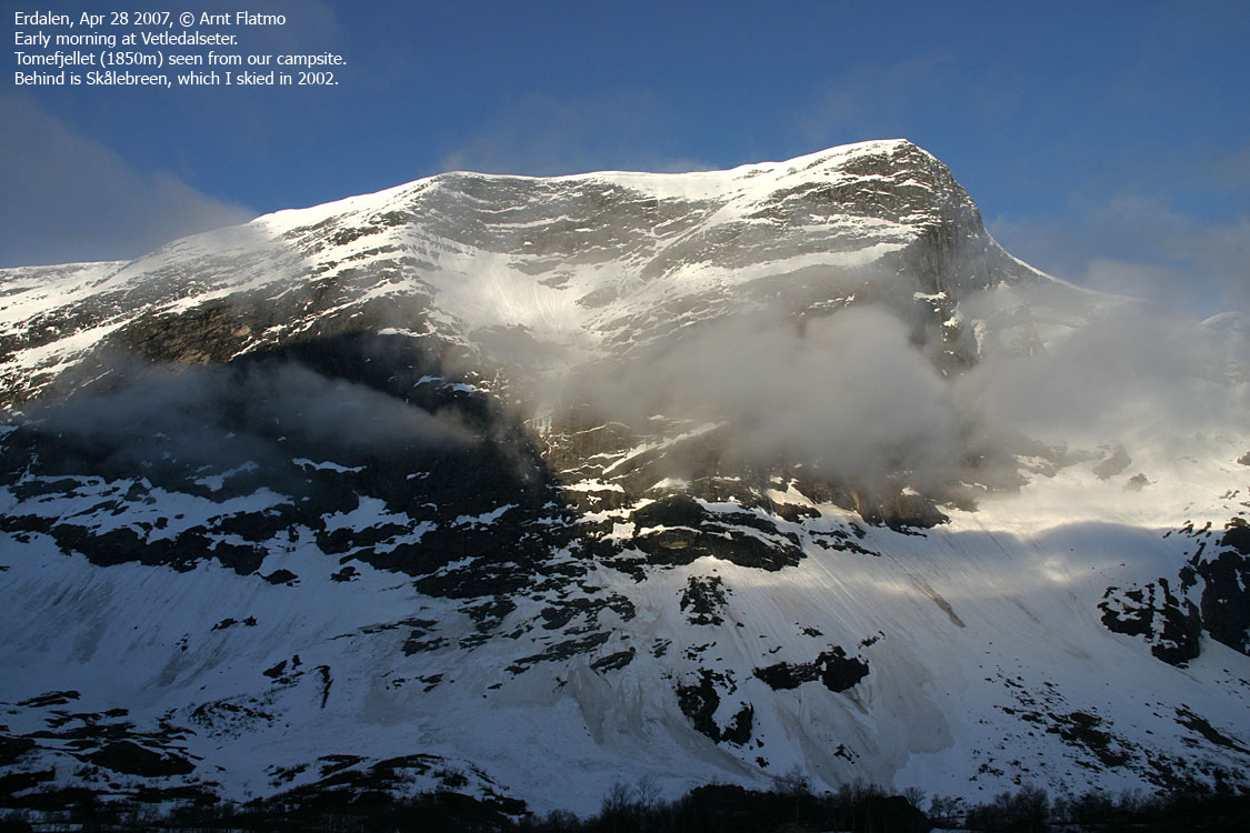
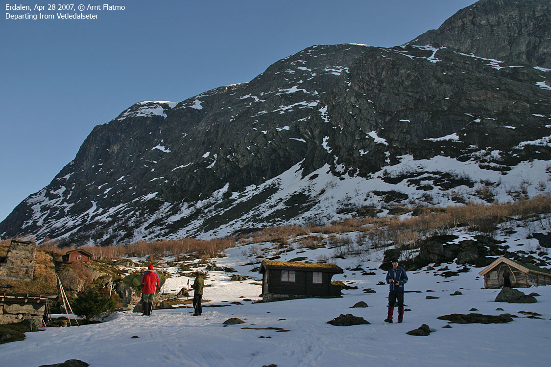
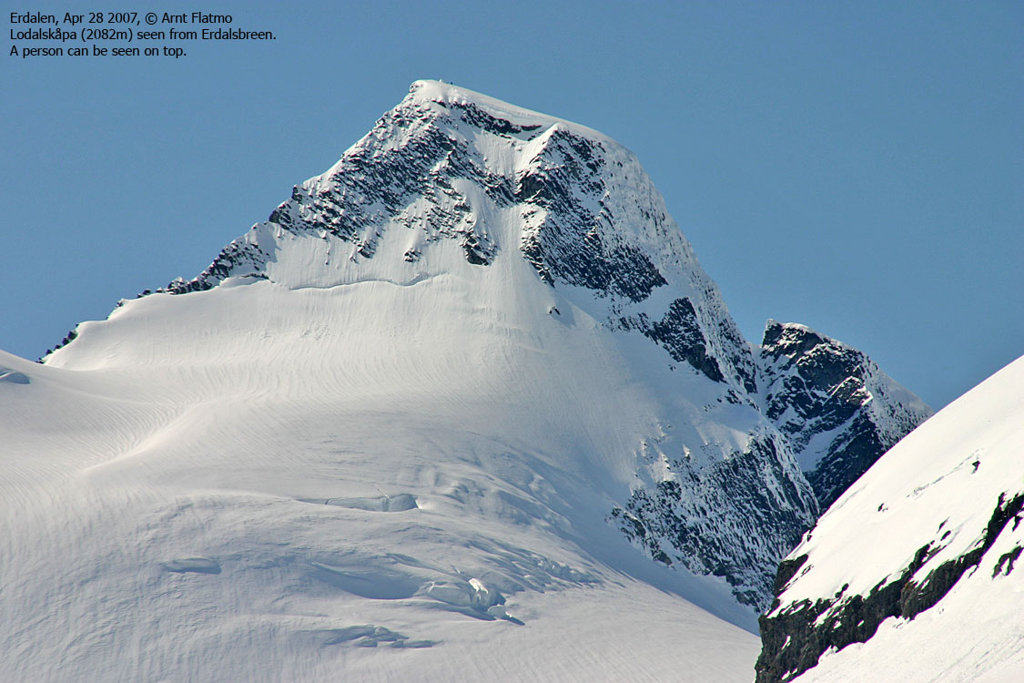
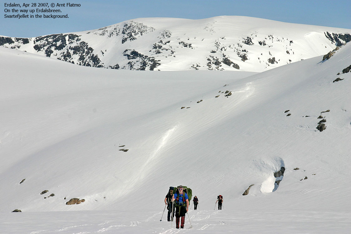
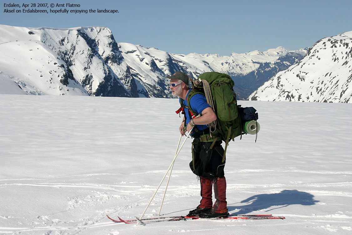
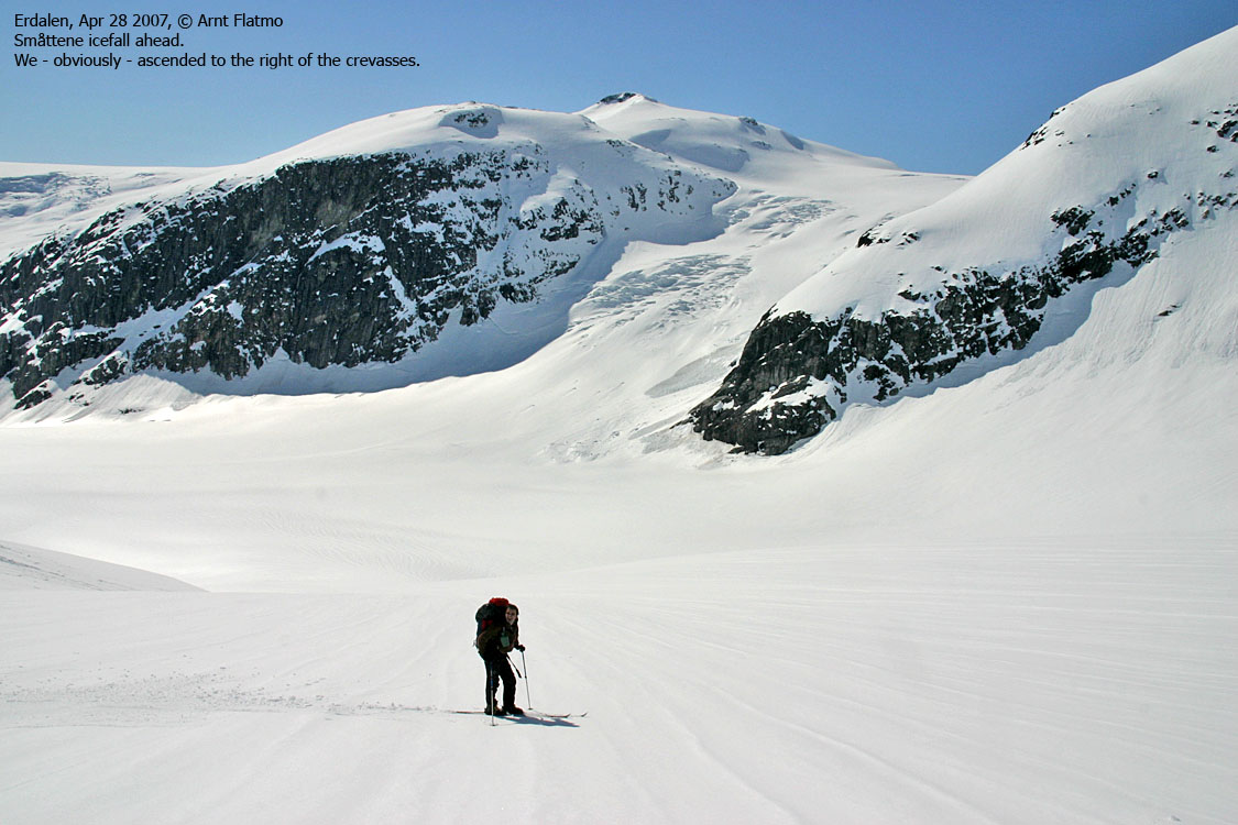
Saturday morning, 28/4/07, we broke camp and headed up the Erdalsbreen glacier, descended the Lodalsbrekka glacier (the upper part of Lodalsbreen glacier) before ascending the Småttene icefall as a roped team. We established a campsite just west of Brenibba (1820m elev.), and visited Brenibba (2017m) later in the evening.
Sunday morning, 29/4/07, we headed across the Jostedalsbreen glacier. We made a short stop by Kjenndalskruna (1830m), passed Høgste Breakulen (1957m), Kvitekoll (1915m) and Ramnane (1844m) to the north, before heading across the snowdome 1874m, descending via Bings Gryte and setting camp at 1660m elev., just south/southwest of Grensevarden.
Monday morning, 30/4/07, we stopped by Suphellenipa (1731m) before descending Suphellebreen glacier to Flatbrehytta. Because of rotten snow, we descended from Flatbrehytta on foot. We arrived Øygarden trailhead 14:00PM and were picked up by a shuttle 15:00PM, which took us back to Greidung.
It was raining light on Friday afternoon, but Saturday, (most of) Sunday and Monday offered gorgeous weather. The snow conditions were brilliant. Just a few centimeters of snow on top of the hard crust. We skied on skins up to the Brenibba camp, and skied on vax the rest of the route, except from the hill up from Bings Gryte.
The word describing this trip is "perfect". Perfect in all ways - the weather, the guide, the group, the execution, the works. I'm confident that this will be a trip that none of us forget any day soon.

Map of the route
(Help text (ALT) is available when your cursor is above the thumbnails. Make sure you've got the ALT switch turned on in your browser)


No Javascript:
I have on several occasions stated that I will never ski across the Jostedalsbreen glacier. But then this trip surfaced, and I had to think twice about this. I have nothing against Jostedalsbreen. Infact, I love everything about it. Since 2002, I have made several trips up to this glacier, and I am stunned about the scenery this region has to offer. But to ski 40Km across the glacier? Why? This particular route would give me two "new" ascent/descent routes to the glacier, which was tempting. But would I be willing to "pay the price" by skiing 40Km across the glacier for it? The answer was yes, after thinking it through. I concluded that this was a good way to find out if I was experienced enough to plan the "perfect trip". After all, JPL deserves to be referred to as a mini-expedition. I defined two goals for myself: a) I would use every item I brought on this trip (pack light, but wise), and b) I would NOT miss any other item along the way. In addition, I was very curious if I could ski the glacier on vax-free skis. I was 100% confindent about my physical condition, and I felt quite confident about my ability to plan for the trip. The execution would give the answer. The planning phase was going just fine, until I changed tires nine days before the trip. An ugly noise was heard from my back, and two days later, I had to visit the chiropractor. The following week consisted of three more visits to the chiropractor, nervousity, easy forest walks and a crazy Saturday. The day before the trip, the chiropractor "certified" me for JPL WITHOUT a backpack, and wished me good luck. Probably expecting another visit within the next week. You know that undertaker in Lucky Luke? "Customers... hi hi.." Jokes aside, I would never have been on this trip, if it hadn't been for this chiropractor. JPL without a
backpack is not an option. I stopped weighing when I passed 20Kg on my
item-list. Thursday afternoon, I walked around my front yard with the
backpack on. Heavy, yes, but I've carried more. Darn.. it's a go. Come
what may. In April.. |
Day 1, Apr 27 2007: To Vetledalsseter
The rendevouz point was the Johans Pub in Stryn. I drove from Ålesund via Stranda. The rest of the group came from Ulsteinvik. We met before 19:00PM, and Nils - the guide - joined us within half an hour. We ordered food, ate quickly and then headed for Greidung in Erdalen.
At Greidung, we parked our cars and were ready to go by 20:30PM. It was raining light, and the weather didn't seem all that great. We walked on foot to Storesætra, where we put our skis on. It was getting more and more dark, and after a while, a few of us put on headlights. Fortunately, someone had been skiing here earlier in the day, and we followed their tracks. This saved us some time. We arrived Vetledalsseter 22:55PM, and it was dead dark by now.
7 other persons had gone to sleep inside the cabin, which has 7 beds. The group inside made some space for a few guys in our group. The rest of us put up tents.
Seconds after departing from Greidung, my back felt weird. Something was simply OUT OF ORDER. It felt as a couple of knockles were having a big argument about positions, and I had to consider the fact of turning around. The back was downright aching. The correct word for the situation was DISAPPOINTMENT. Shortly after, we had a short break. After this break, I decided to carry on a little further. When I put the backpack on, the argument seemed to have settled. Yippi-Kay-Yeah, problem seemingly solved. I liked everyone in the group, and looked forward to have Terje as tent-mate. We've been on several hikes together, but nothing "bigger" than Slogen. I liked the guide too. Nils (age 25) seemed like an easy-going and very competent fellow, with no big need for pulling rank. The group was diverse in age, but everyone seemed to have a fair portion of mountain experience. What I didn't look forward to, was to spend the night at Vetledalsseter. I have taken a stand about mountain cabins, and won't, if I can help it, spend any more nights inside them. I was willing to be flexible on a trip like this, as there was no need to be the only one spending the night in a tent. Fortunately, the cabin was full, and Terje and I raised the tent. Terje, not suffering from screwed-up standpoints like mine, was a bit disappointed . He had looked forward to a comfortable night inside the cabin, but chose to be loyal to his "roomie". Terje needed this night to get into the "tent rhythm", and didn't have a tremendously good night. I found peace and tranquility fairly quickly, and fell asleep to the relaxing sounds of avalanche thunder in the valley. A Greenland expedition back in 2004 seemed like yesterday, and everything I learned about tenting on that trip, came to good use here. |
Pictures
(Help text (ALT) is available when your cursor is above the thumbnails. Make sure you've got the ALT switch turned on in your browser)


No Javascript:
Day 2, Apr 28 2007: Up to the glacier
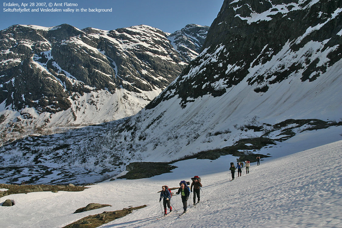
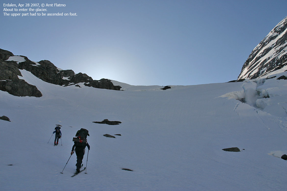
Our guide gave us instructions to be ready for departure at 08:00AM. Some in the group were slower than the rest, and the group wasn't moving until 08:20AM. The weather was simply outstanding. We all knew about the positive forecast, but now that we saw the blue sky, we started to believe in it. We were able to ski all the way from Vetledalsseter, ascended Ulvestigen and then headed towards lake 865m, which marks the beginning of the glacier.
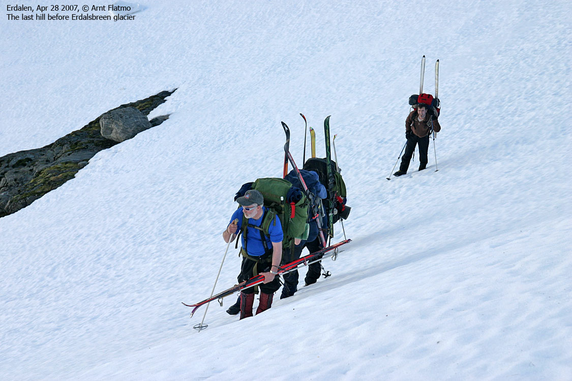
We had to ascend the lake (hidden under the snow) on foot. The hillside was a bit steep, but nothing of the problematic kind. Slightly cumbersome was a Bergschrund where Nils lended a helping hand. We skied until the glacier began to rise, and took a break. Nils decided that we could ski this glacier unroped, and by 12:50PM, we were on top the glacier, approx. 1510m elevation.
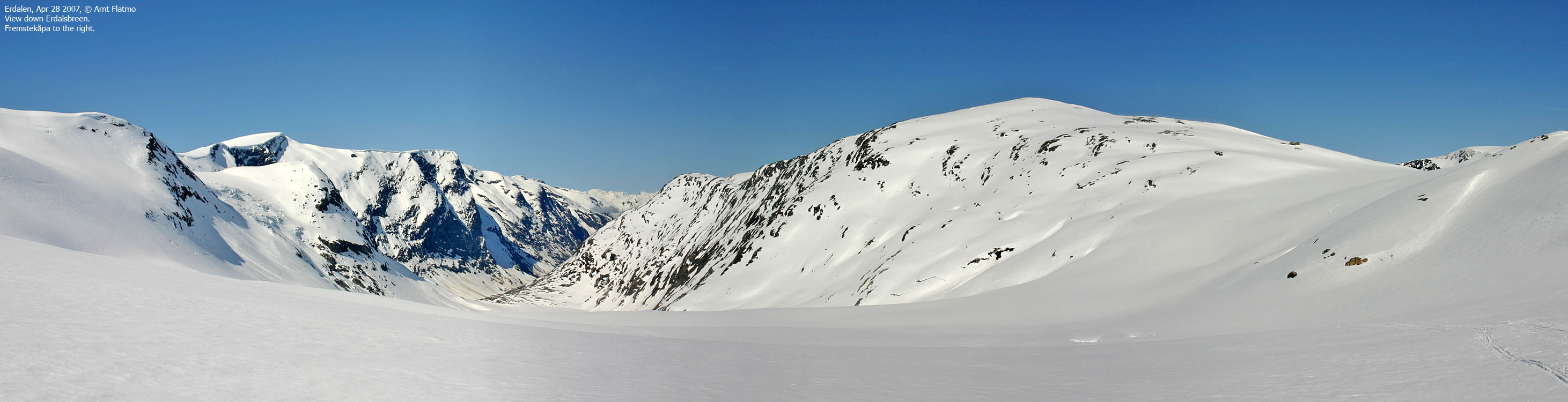
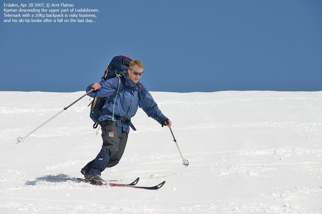
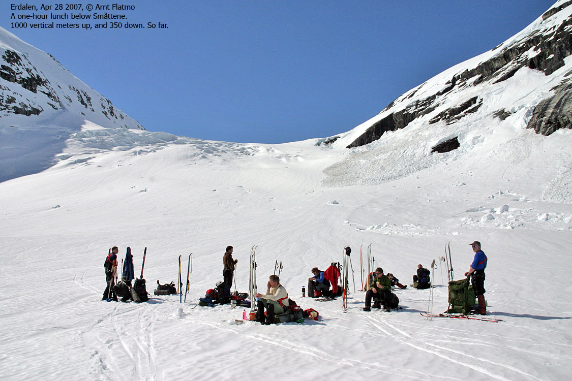
In order to reach the Småttene icefall, we had to descend the upper part of Lodalsbreen glacier. This part is known as Lodalsbrekka. Nils zig-zagged down the upper part, defining our sixty degrees of freedom. Half-way down Lodalsbrekka, he sent us off at our own pace, with the order to pause for lunch below Småttene.
We had a long break for lunch and melted more snow. The 2 liters of water we melted in the morning were just enough on a hot day like this. We had ascended 1000 vertical meters (and descended 350m) and, naturally, some did not look hilariously forward to the remaining 700 vertical meters up to the campsite.
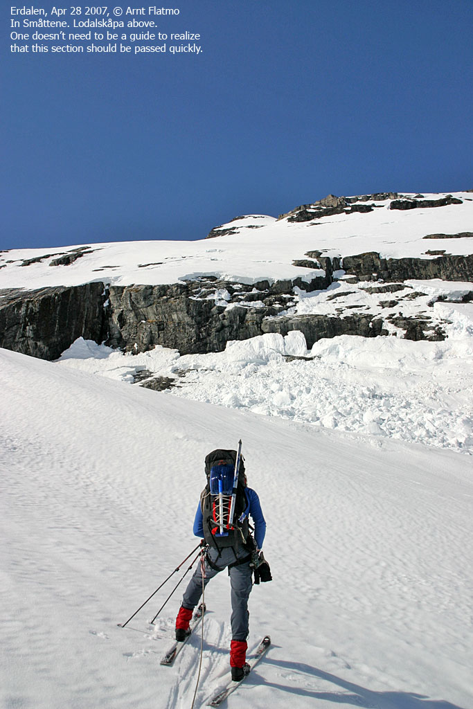
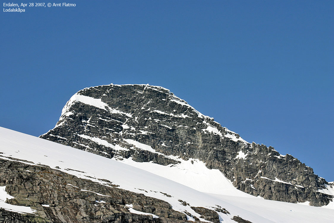
After lunch, we roped up, and headed up the icefall. The icefall looked quite harmless with all the snow. More "worrying" was the avalanche-prone slabs beneath Lodalskåpa. We had to pass fairly close in order to avoid the crevasse area. Higher up on the glacier, we unroped, and skied up to our campsite at 1820m, arriving 17:55PM. Everyone had so far been skiing on skins from Vetledalsseter (except down Lodalsbrekka, of course).
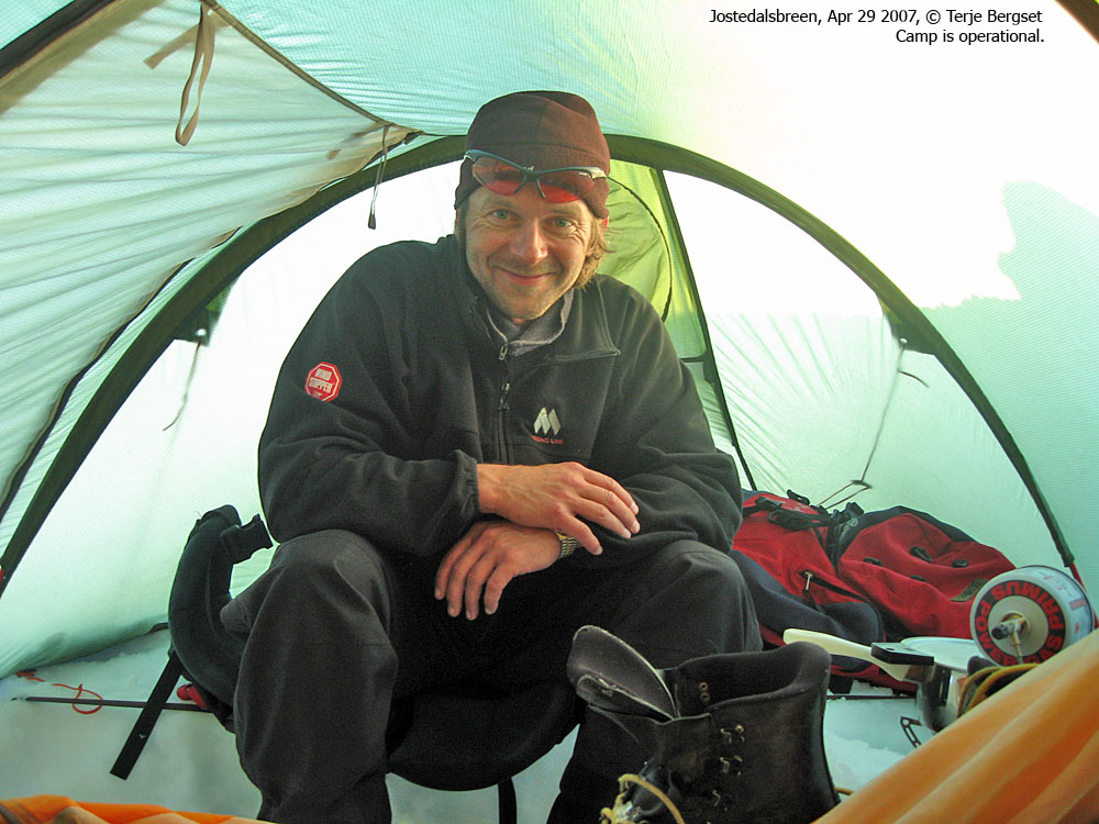
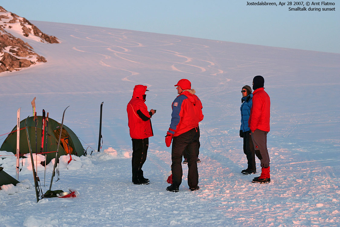
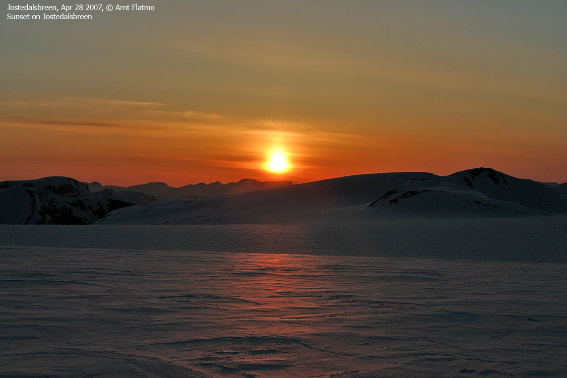
19:00PM, all of the tents were "operational", and some of us headed up to Brenibba (2017m). It took us only 40 minutes up to the summit, where we had a spectacular panorama view with deep, intense evening shades and colors. After pictures, we skied back down for supper. By 10:00PM, the "lights" were out in most of the tents.
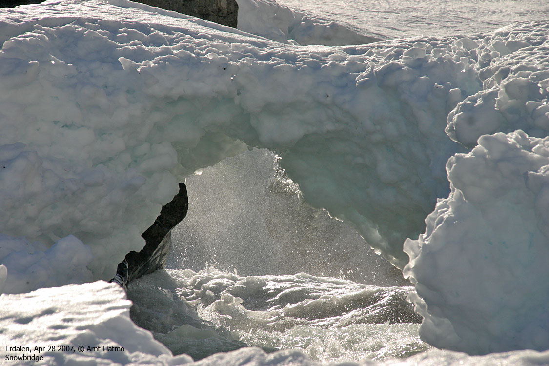
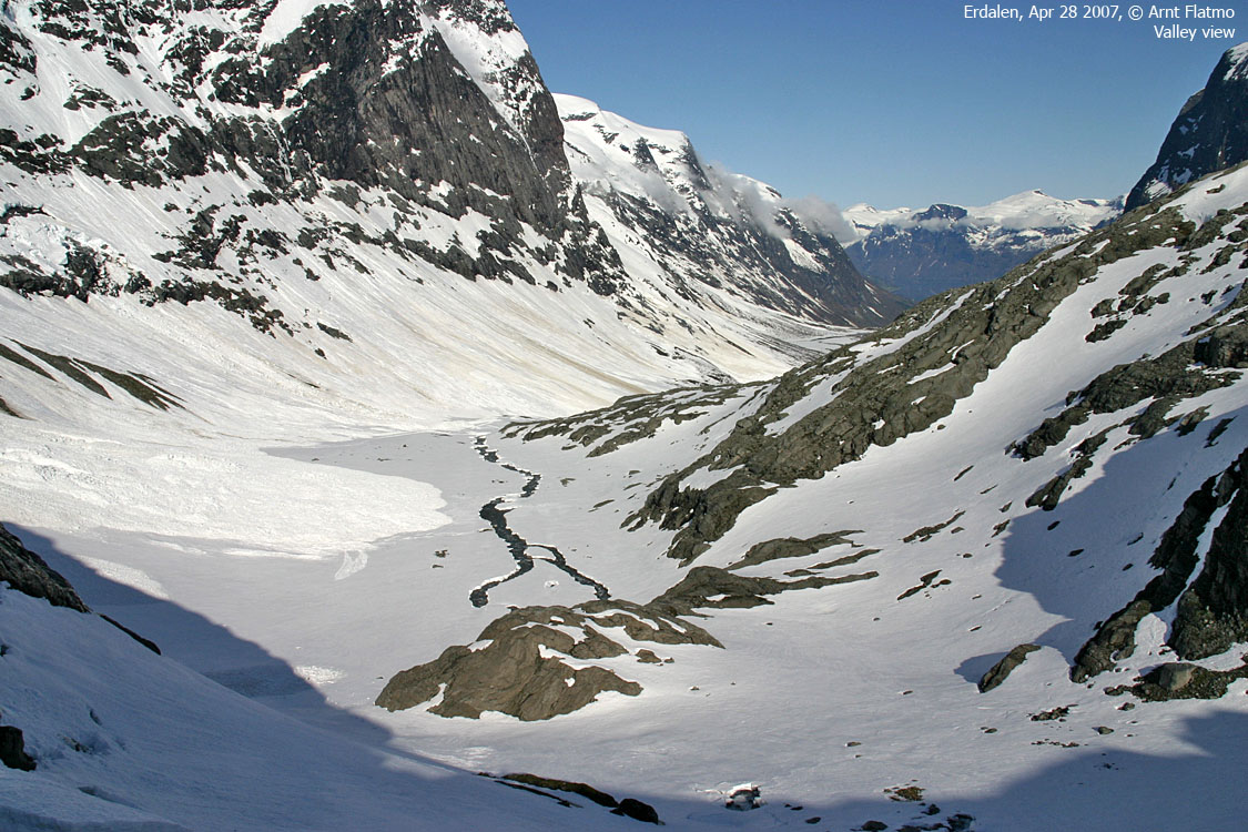
My back was quite OK when I woke up this Saturday morning, and that was the last time I thought of it during this trip. The Erdalen valley scenery was breathtaking, and I went back and forth, and high and low for my pictures. The guide probably thought I had a disorder of some kind, or simply a problem with sticking to a group. As we were about to cross a cumbersome Bergschrund just before the glacier, the guide lended a helping hand to everyone. I wasn't particularly interested in being helped up this - fairly trivial - section, and while pretending not seeing him, I lost one of my poles down in the Bergschrund. Luckily for me, the pole didn't disappear, and Terje was able to pick it up, using his pole. But it was a hard lesson learned for me. Pride isn't always a pretty sight. The lower section of the Erdalsbreen glacier was just amazing. Especially where the river surfaced, unveiling numerous motifs for amateur photographers. Skiing went well, although the backpack was heavy. No complaints, though, well realizing that the backpack could NOT have been lighter. Skins came off on top of Lodalsbrekka. Now I got to practice Telemark with new, narrow skis and a heavy backpack. I was fairly happy about the outcome. Terje didn't care much for Telemark skiing. He was given a GO by the guide, half-way down Lodalsbrekka, and ran straight down the mountain in an incredible pace. I got sick just by watching. A fall could easily be very, very bad, but those who are bold enough to head down a slope like this, probably know what they are doing. Being a ski-jumper, I can imagine that he feels skiing downhill is the easiest thing.. At lunch, I might have expected to see a tired group, but I didn't. Everyone had big smiles on their faces, yet I knew that 1000 vertical meters with 20Kg on your back doesn't happen without some sort of fatigue. They hid it well. Setting camp below Brenibba went quite fast. Terje was now "in the rhythm", and the job instructions were clear. I put up the tent while Terje was putting up wind shelter (blocks of snow). When the tent was up, I tossed in my gear and took over the wind shelter job. When Terje was all settled, I got settled, and then we cooked dinner. Terje was now much more comfortable than the previous night, and camp life was just good. We fell asleep quite early. I had positive dreams about the 33Km leg across the glacier the next day, and was uplifted by the chance of "bagging" a few tops along the way. |
Pictures
(Help text (ALT) is available when your cursor is above the thumbnails. Make sure you've got the ALT switch turned on in your browser)
Leaving Vetledalsseter:


Up to Erdalsbreen:


Up Erdalsbreen:


Down Lodalsbrekka:


Up Småttene:


To Brenibba:


Wide-angle view from Brenibba:

50mm views from Brenibba, 3 parts:


Zoom view from Brenibba, towards Jotunheimen:

Campsite moments:


No Javascript:
14 15 16 17 18 19 20 21 22 23 24 25 26 27 28 29 30 31 32 33 34 35 36 37 38 39 40 41 42 43 44 45 46 47 48 49 50 51 52 53 54 55 56 57 58 59 60 61 62 63 64 65 66 67 68 69 70
 Back
to westcoastpeaks.com Other Sogn og Fjordane mountains
Other Norwegian mountains
Back
to westcoastpeaks.com Other Sogn og Fjordane mountains
Other Norwegian mountains
