Norwegian Mountains, Møre og Romsdal
Kolåstinden, 1432m
Storegjøltinden, 1338m
Fingeren, 1188m (ca.)
Sætreegga, 1089m (ca.)
| Fylke/Kommune : | Møre og Romsdal/Ørsta | ||||||||||||
| Maps : |
1219-III Hjørundfjord (Statens Kartverk, Norge 1:50 000) 1219-IV Sykkylven (Statens Kartverk, Norge 1:50 000) |
||||||||||||
| Primary factor : |
Kolåstinden: 1164m Storegjøltinden: 48m Fingeren: 56m Sætreegga: 59m |
||||||||||||
| Hiked : | Kolåstinden: Apr 2006, Fingeren: June, Sep 2011 | ||||||||||||
| See also : |
| ||||||||||||
| See also : | Other Ørsta mountains |
Kolåstinden

(Click for larger image)
Introduction
Hjørundfjorden cuts deep in between two large peninsulas that hold the most rugged and wild mountains on Sunnmøre - the southern part of Møre and Romsdal Fylke (county). Kolåstinden ("The Kolås peak") is located on the westernmost peninsula, where the valleys Standalddalen/Follestaddalen and Bondalen form three major mountain regions. Kolåstinden is the highest peak north of Standaldalen/Follestaddalen, and this region is also known as "Kolåshalvøya" (the Kolås peninsula). Dalegubben (1344m) dominate the Standaldalen - Bondalen region while Skårasalen (1542m) dominate the region south of Bondalen.
There is an everlasting (and futile) debate - which is the most spectactular peak on Sunnmøre?. The two widely accepted candidates are Kolåstinden and Slogen (1564m, located east of Hjørundfjorden). As there will never be a winner in this "contest", Kolåstinden is known as the "king" while Slogen is the "queen". Genders being equal seems to be a good solution to the "problem".
One of the pioneers in Norwegian climbing history, William C. Slingsby, was never in doubt, and referred to Kolåstinden as the "monarch of Sunnmøre". As a matter of fact, Slingsby stood on Slogen when he delivered the famous sentence;
| "I know of no alpine environment, be it in Norway, Switzerland or the Alps in general, which possesses such magnificent beauty as that to be found in Sunnmøre." |
Kolåstinden

(Click for larger image)
Kolåstinden is mainly visited in the April-May timeframe. Traditionally, the glacier has caused some challenges at Stretet, but as the glacier keeps melting, these challenges decrease. The Kolåstinden enthusiasts are however likely to visit the top any given month of the year.
Nowadays, the standard route runs from Standalsætra (or Standalhytta), continues north up Kvanndalen and up to Kvanndalsskardet. The route from Ytre-Standal through Romedalen also comes up here. You pass a ridge of pinnacles through a narrow point called "Stretet", enter the glacier and continue up to the summit. This route is described in further detail in the route description further down on this page

Kolåstinden in spring

(Click for larger image)
In earlier days, the peak was named "Kjølåsstenen" and later on "Kjølåstinden". It is assumed that the peak was first climbed in 1880 by Anders Hovden, Betzy Kjeldsberg and Nils Kolås (the elder). Slingsby made an attempt in 1876, but because of fog, it cannot be stated if he was on the highest of the tops that surround the glacier. Various sources do however state that Slingsby did the 1st ascent of this mountain on the standard route in Kvanndalen and then directly up the glacier.
Other routes are (a.o.) the southwest wall (climbed in 1933 by H. Hagen and E. Heen), the west ridge (climbed in 1939 by E. Kraus and R. Mørch), west ridge pinnacles (5 were climbed in 1875 by E. Mohn and the highest pinnacle was climbed in 1895 by C. W. Patchell and J. Simpson). The northeast (Romedal) and southeast ridge had not been climbed per 1953m.
Source for the above information has been "Rock Climbs in Sunnmøre" (Norway Travel Association, 1953) and "Sunnmøre", 5th edition (Kristoffer Randers).
Standalhytta is a popular place to stay for those who set out for skiing or "peak-bagging" in this area. The cabin is owned by Ålesunds Skiklubb. A self-served annex w/10 beds, kitchen, living room and shower has been made available to Ålesund-Sunnmøre Turistforening, a branch of the Norwegian Touring Association (DNT).
Standalhytta

(Click for larger image)
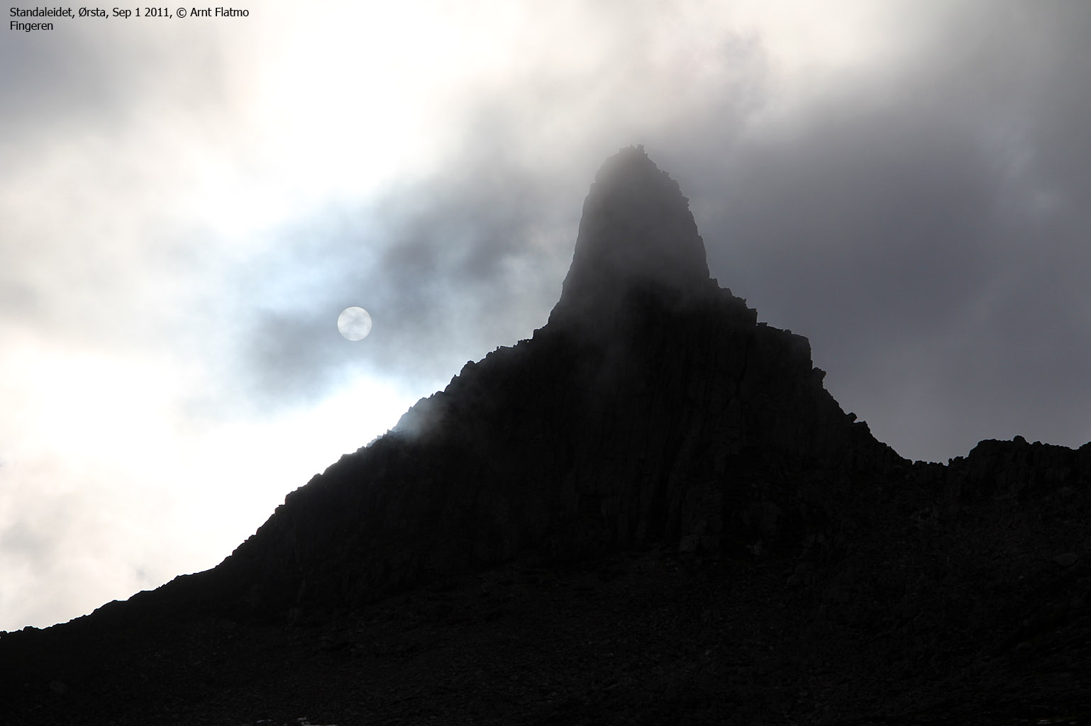
Fingeren ("The
finger") is a distinct rock feature, located 620 meters southwest of
Kolåstinden summit. Fingeren is steep, airy and is one of the most popular
of the alpine peaks in the Sunnmørsalpane mountain range. Standalhytta is the
normal trailhead and you follow a visible path almost all the way up to the Sætreegga - Fingeren - Sylen - Kolåstinden ridge. From the ridge, you are facing
some serious airy scrambling in order to get to the of this 50-60 meter high
"obelisk". If you don't have a head for heights, don't even consider going up
here. But the personal reward is great for those who make it to the top.

Sylen is a pinnacle, located between Fingeren and Kolåstinden. This is a popular climbing route, but not described on this site. Search for Sylen Standalhytta Klatrefører on the internet.
Storegjøltinden is one of the tops that you pass on the way from Stretet to Kolåstinden. Consider stopping by for additional views.
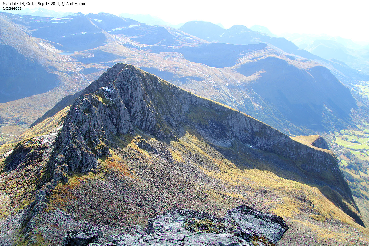
Sætreegga is found south of Kolåstinden and Fingeren. The ascent is a bit steep and somewhat rugged, but is far, far easier than Fingeren. A suggestion of a round trip route is found further down on this page.

Primary factor:
Kolåstinden (Norge 1:50,000: 1432m, Ø.K.: -, UTM 32 V 360383 6905926) has a primary factor of 1164m towards the higher parent mountain Skårasalen (1542m). The defining saddle (approx. UTM 32 V 358887 6893392) is found along highway RV655 at Bondalseidet. Ref. Økonomisk Kartverk (5m contours), the saddle is within the range 265-270m, interpolated to 268m. On this map you will see the 270m contour between Lakes Tretjørnane and the road.
Storegjøltinden (Norge 1:50,000: 1338m, Ø.K.: -, UTM 32 V 360542 6906719) has a primary factor of 48m towards the higher parent mountain Kolåstinden. The defining saddle (approx. UTM 32 V 360447 6906403) is found between these two tops. Ref. Norge 1:50,000 (20m contours), the saddle is within the range 1280-1300m, interpolated to 1290m.
Fingeren (Norge 1:50,000: -, Ø.K.: -, GPS-based estimate: 1188m, UTM 32 V 32 V 360163 6905343) has a primary factor of 56m towards the higher parent mountain Kolåstinden. The defining saddle (approx. UTM 32 V 360159 6905405) is found between these two tops. Ref. GPS readings, the saddle is approx. 1132m.
Sætreegga (Norge 1:50,000: -, Ø.K.: -, GPS-based estimate: 1089m, UTM 32 V 360333 6904760) has a primary factor of 59m towards the higher parent mountain Kolåstinden. The defining saddle (approx. UTM 32 V 360307 6905126) is found between these two tops. Ref. Norge 1:50,000 (20m contours), the saddle is within the range 1020-1040m, interpolated to 1030m.

Google map
Google's interactive map. You can zoom, pan and click on the markers.
|
|
|
Trail descriptions
| This disclaimer is regarding all of the literature and instructional guides posted on the westcoastpeaks.com website. These instructions are guidelines only, and should not be used in lieu of common sense or judgement when attempting any of the actions involved or instructed. Westcoastpeaks nor myself will not be liable nor will it indemnify any form of compensation to anyone who has injured, harmed or even killed themselves or others while following any of the instructions written within the website. It should be noted by any persons willing to undertake any of the instructions provided that mountains offer varying levels of risk, regardless of size or incline. Risks to be considered are as follows but not limited to: wild animals, weather, the terrain, bad judgement, inappropriate or insufficient equipment, improper training or experience and of course, bad luck... |
The route descriptions are valid per Sep
2011.
|
Route 1: Standaleidet - Kolåstinden (spring - on skis)
|
|
Access
(all distances are approx. distances)
The starting point for this route description is Ørsta. Follow highway RV655 in the direction of Sæbø. At the Follestaddalen/Sæbø junction, continue straight ahead and drive 7,7km up Follestaddalen. At the road fork near Kolåsen, turn left towards Standal and drive 4,4km up the valley. Turn left and drive up to Standalhytta (N62.24698 E6.34971) (signposted Standal Alpesenter) on Standaleidet. The road across Standaleidet is now open all year around and is not a toll road.
From Ålesund, follow highway E39 towards Bergen/Volda to the ferry at Solavågen. Take the ferry over to Festøya. Turn left in the direction of Standal and follow the road 14,8Km to Standal where the road turns to the southwest. Continue approx. 5Km up to Standaleidet.
In winter/spring, find parking on Standaleidet where appropriate. You don't absolutely have to start from Standalhytta.
The route

A good place to start is just west of the stream coming from Noklane (not the Kvanndalen river). After 800m, turn north towards the entry of Kvanndalen valley. Continue up the valley which takes you up to Kvanndalsskardet pass. The route from Romedalen also comes up here. From Kvanndalen you may see tracks down the icefall from those who (hopefully) determined that it was safe to descend the glacier.
Head south-to-southwest from Kvanndalsskardet up to Stretet - the glacier entry point. Just ski along the ridge up to your left, and you will find this entry point. The hillside up to Stretet is a bit steep, and you will be better off with crampons if the snow is hard as ice.
The route from Stretet to the glacier is considered dangerous in summer/autumn, but is fairly straightforward on safe snow. Once on the glacier, head upwards and follow the natural route to the base of Kolåstinden.
Some skiers continue on foot directly north of the summit, some ski higher and walk only the last hill on foot. A few bring their skis and ski down from the summit. The final hill to the summit looks trivial when you are standing in front of it. However, the upper 5-10 meters suddenly become very steep and the ice-axe (or poles) can be a useful tool if you aim to stand on top of the very summit. The summit ridge is extremely airy, and if you want to touch the highest point, you have 10 airy meters ahead of you. Be *very* focused up here, and don't step on any cornices. Depending on the conditions, getting on and off the summit ridge may require YDS class 3 moves.
Descend your ascent route, but consider also visiting Storegjøltinden (point 1338m) for a great view towards Kolåstinden and Romedalen.
This route is described in the book "Skiturar i Sunnmørsalpane" and is rated "Vanskeleg", which means hard or difficult. Nevertheless, it is one of the most popular skiing routes on Sunnmøre.
|
Route 2: Standalhytta - Fingeren (summer/autumn)
|
|
Access
See route #1 above. The starting point is Standalhytta (N62.24698 E6.34971).
The route

The route to Fingeren and Sætreegga

(Click for larger image)
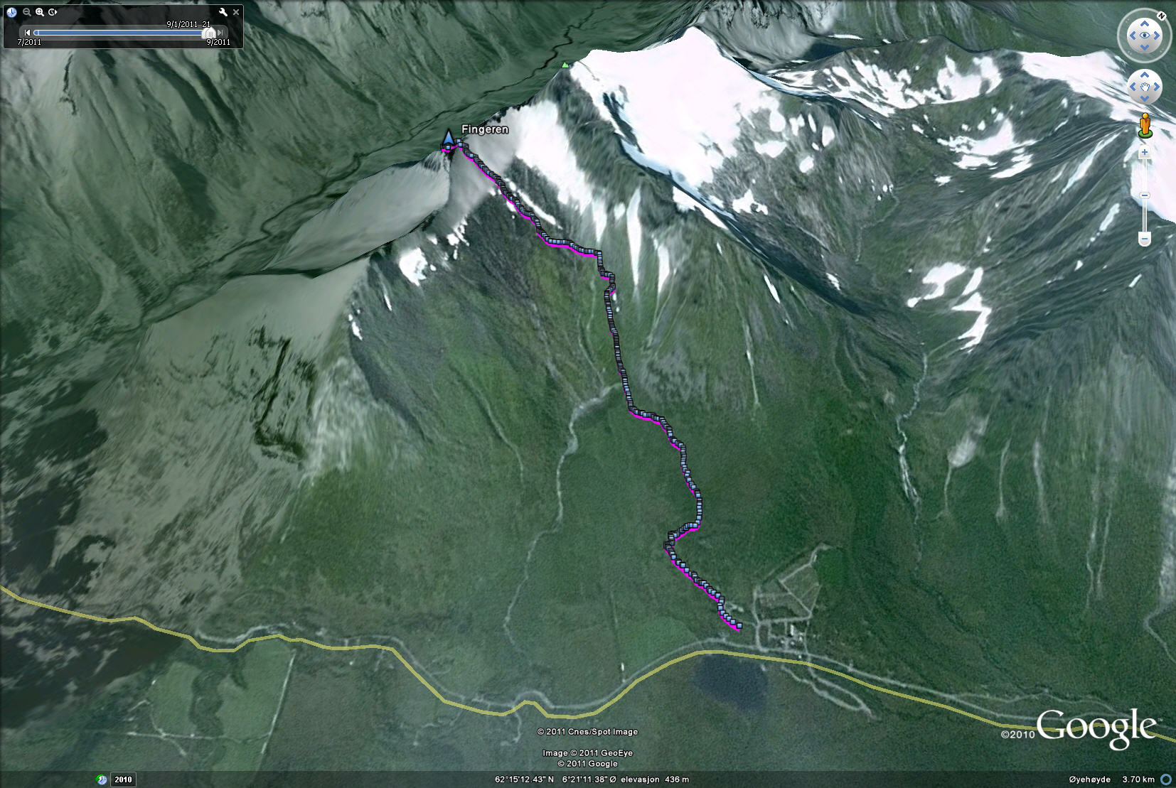
From Standalhytta, follow a visible path towards Fingeren in the northwest direction. This peak is easy to identify from Standalhytta unless there is fog. The path (boggy in places) is visible all the way up to 800 meters, where it fades out in the boulder. Just keep heading for Fingeren and top out on the ridge just north of Fingeren. The scrambling begins here (N62.25417 E6.30711).

The Fingeren route, seen in Google Earth

(Click for larger image)
Follow a visible path in the direction of Fingeren's north ridge. The ridge turns right and after a very short descent, the first scrambling section is an easy "duct". Continue in the same direction until you are forced left into a "stairway". The "steps" are a bit airy and you have to actively look for handholds at one point. Continue upwards in the same direction until Fingeren's north ridge forces you to the right. You will now traverse from the north ridge to the west ridge, across some slabs.
The slabs should be "handled" with great care. The traverse doesn't offer a lot of good handholds, and it is an airy section. The slab traverse ends in front of Fingeren's western "satellite top".
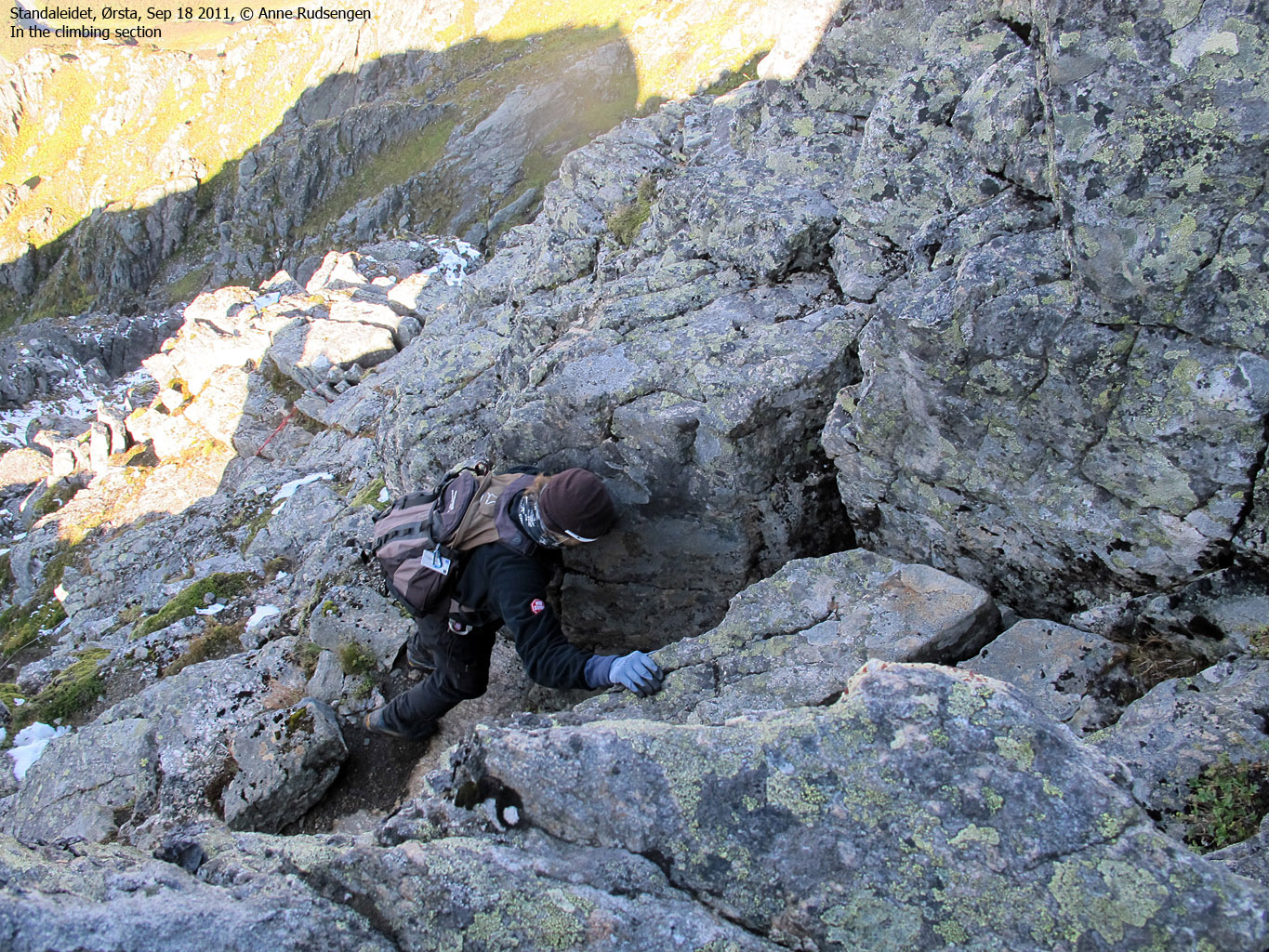
The third and final section involves the most serious scrambling / climbing on the entire route. Follow the visible path until you are standing below a wall. The path fades away here, and you have to look hard for traces of people. But there is only one (good) route, and it runs up in center of the wall, up a "crack" and up to a "balcony" above the wall. Get onto the "balcony" (can be an awkward move), go left and scramble up a minor "chimney". Then turn left again and scramble the final yards up to the summit (N62.25362 E6.30724) - marked by a small cairn.

Scrambling on Fingeren

(Click for larger image)
Sætreegga
Upon descending Fingeren, consider stopping by Sætreegga. Walk alongside the ridge where you see fit, pass below the Gluggen hole and ascend a distinct, steep grassy hill. This route leads you up to the highest point (N62.24845 E6.31097), which is not marked on the maps. Then follow the ridge southbound (pass the steepest part of the ridge on the right-hand side) up to trig. point 1086m (N62.24769 E6.31130).
Descend the ridge to the southeast. Pass a fallen trig. point at 1000 meters (N62.24576 E6.31349) and leave the ridge at approx. 900 meters. Either traverse the hillside in the direction of your ascent route, or follow one of the moraine ridges towards Myklebustsætra.
Sætreegga

(Click for larger image)
Pictures and Trip reports:
Fingeren w/Fredrik, Sep 8 2018
Kolåstinden on skis, Apr 15 2012
Fingeren, Oct 1 2011 (w/Trond)
Fingeren, July 2 & Sep 18 2011
Cold winter, Jan 9 2010
Kolåstinden on skis, Apr 30 2006
 westcoastpeaks.com
 Other Møre & Romsdal mountains
 Other Norwegian mountains


