
European
Mountains, Montenegro
Maja Kolata, Prokletije
Rodi e Kolates/Maja e Koljats (2556m), Zla Kolata (2535m), Dobre Kolata (2526m), July 11 2012
"The good, the bad and the ugly...."
To the main Kolata page (route descriptions and maps)

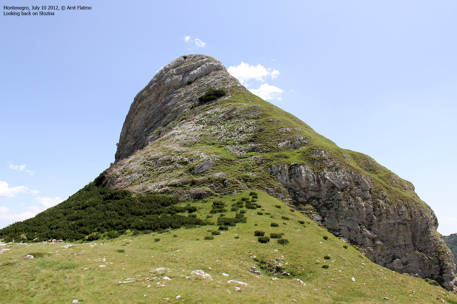
The Kolata peaks
(Click for larger image)
Breakfast? доручак?
On our fifth day in Montenegro, we woke up early in Hotel Kula Damjanova and were ready for breakfast at 7pm. At least that was how we understood it to be. There were already a number of people at work, but no one that seemed to be in designated for breakfast. So when we realized that breakfast could take a while, we settled for coffee (I love Montenegro, but hate the coffee they serve everywhere...) and a mobile breakfast from the local bakery.
To the mountains...
This time, I did not have full control over the mountains we aimed to visit. We had been unable to find a hiking map, and I was confused about where the highest point was located. On the internet, one name replaced the other; Zla Kolata, Dobre Kolata, Good Kolata, Bad Kolata, Kolata e Keq, Kolata e Mire, Maja Kolata, Ravna Kolata, etc... I could only hope that "time will show" would come into effect here. Apparently, Zla Kolata is the country high point, although the official version seem to be that Bobotov Kuk is the highest peak in Montenegro - seemingly because it's nowhere near the Albanian border...
We found the road to the Vusanje and the Zla Kolata trailhead, where we were curious about the police control post and army barracks that we had read about in books and on the internet. It is fair to say that the literature is outdated. The control post looked like a hot dog stand wrecked by hooligans...

The former control post
(Click for larger image)
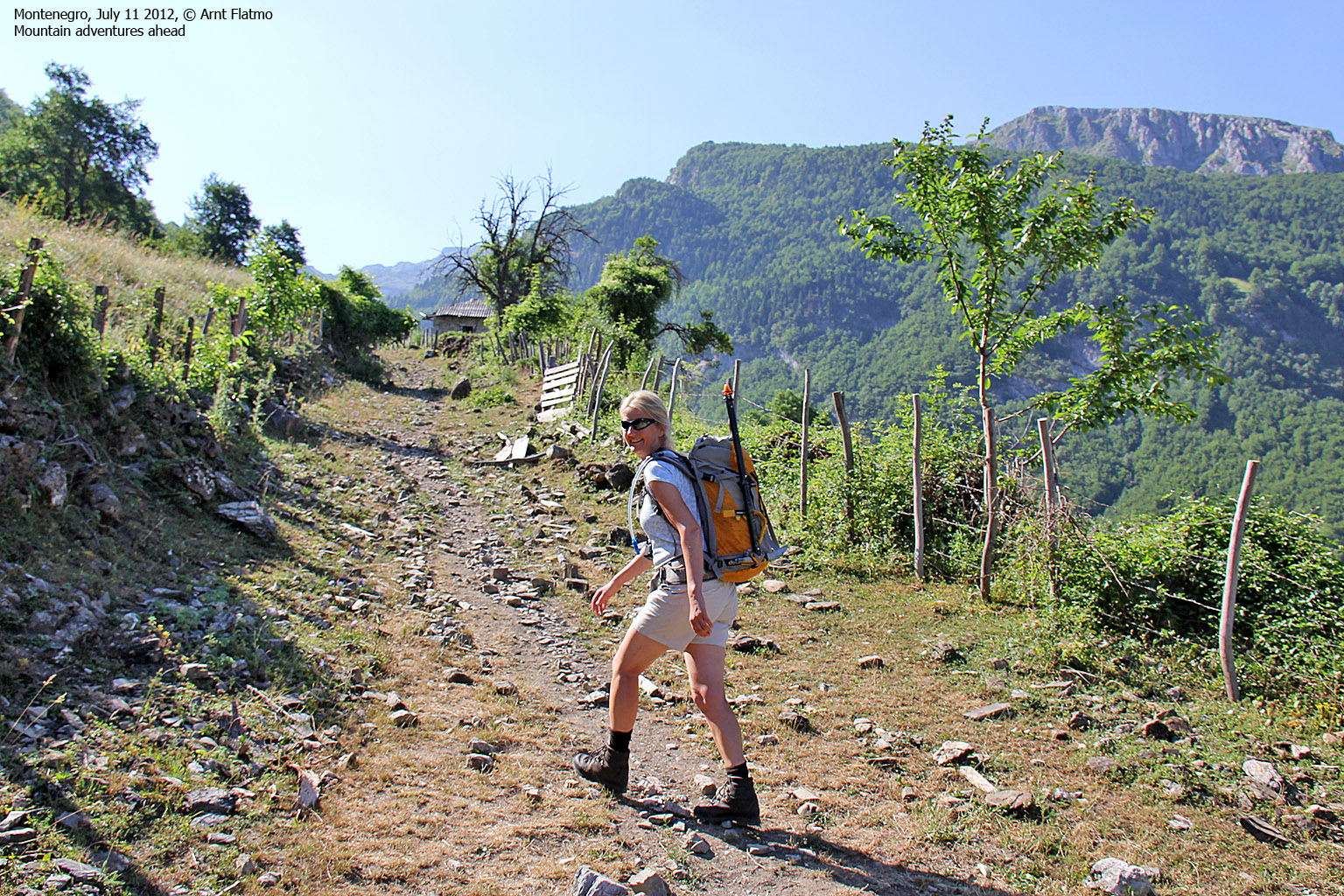
On the trail...
8:50am, we were on our way to the Kolata mountain. 8:52am, a small dog tried to eat us for breakfast. And the next dog we passed looked scary, and although it was tied to a tree, Anne and me decided to arm ourselves with sticks.
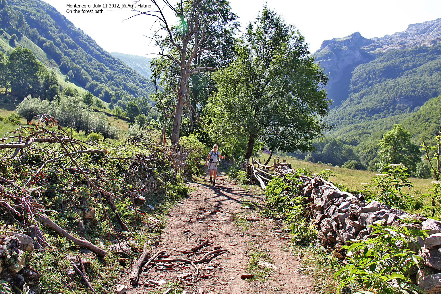
We were supposed to pass a village called Zarunica. But I never figured out what Zarunica was. Ruins? In any case, we were definitely on the right forest/mountain trail and our mountain future on this beautiful day seemed bright.

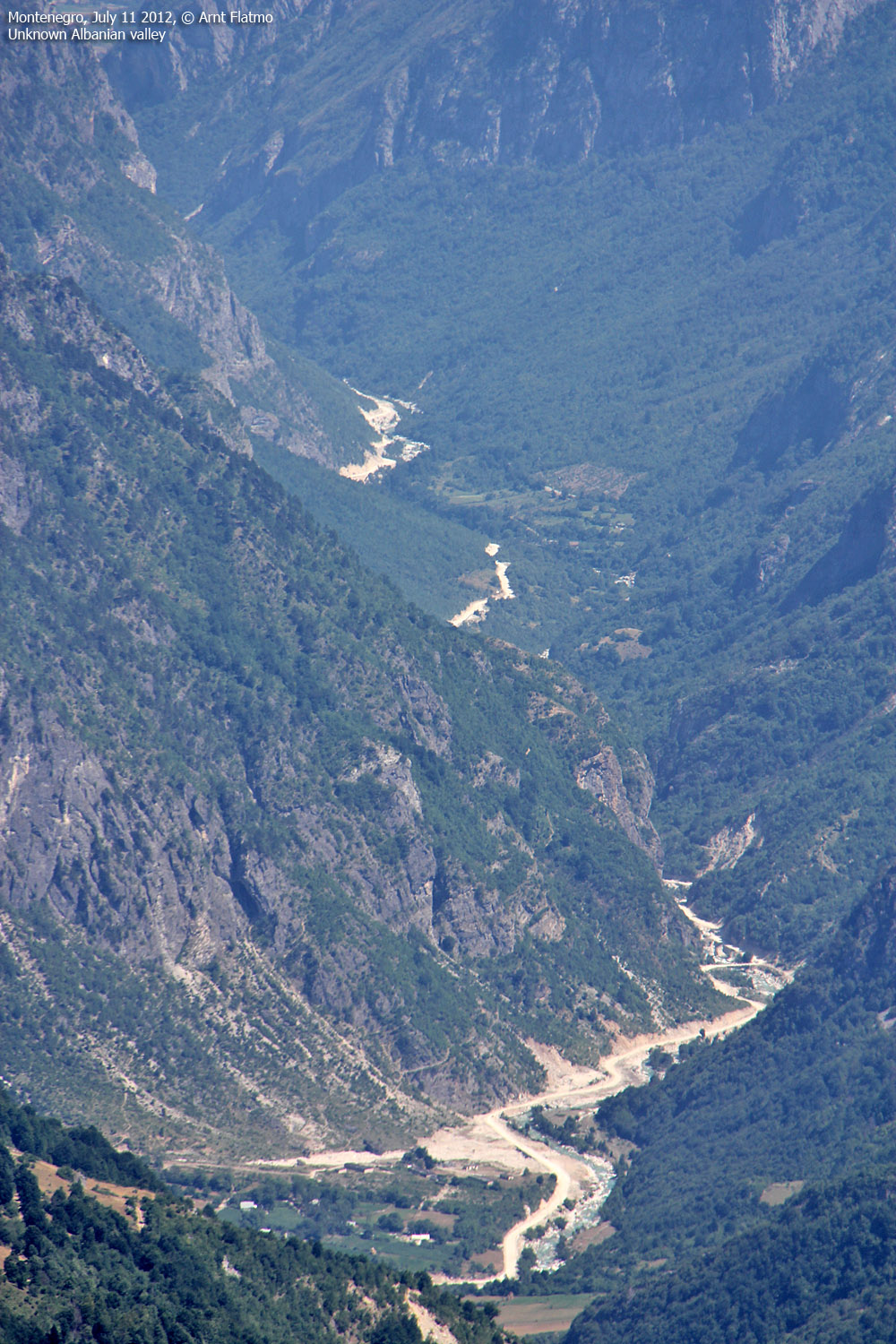
Ropojana valley - beautiful!
(Click for larger image)
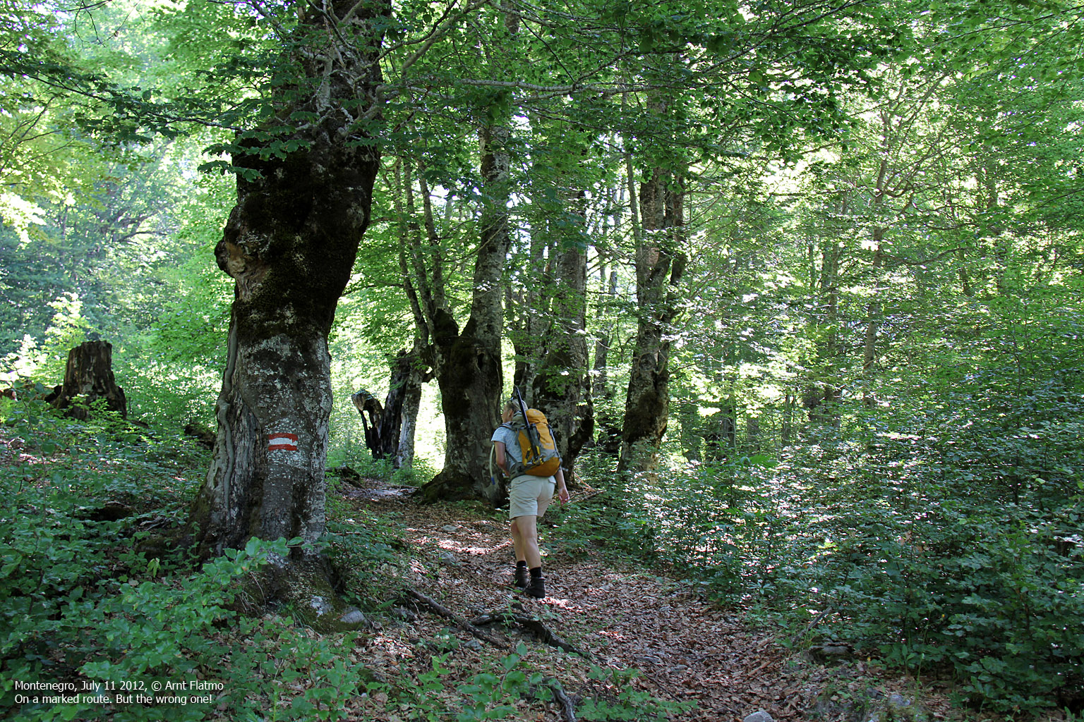
At 2,1km, we arrived at a trail fork, but didn't notice it. Hence, we took the wrong path and ended up deep inside the forest - below a steep cliff. We searched and searched, but didn't find the path. 30 minutes later, we had to make a decision. I was in favor of heading up the ultra-steep forest, but Anne said we ought to cross the river and get to the open pastures she had seen glimpses of. Brilliant idea! Of course the path would run across the pastures.
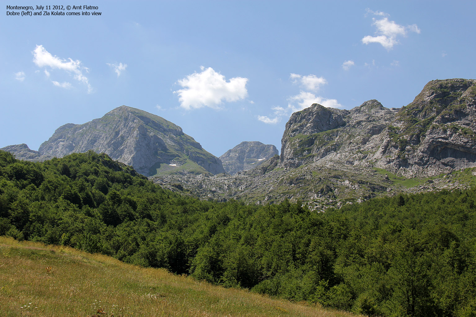
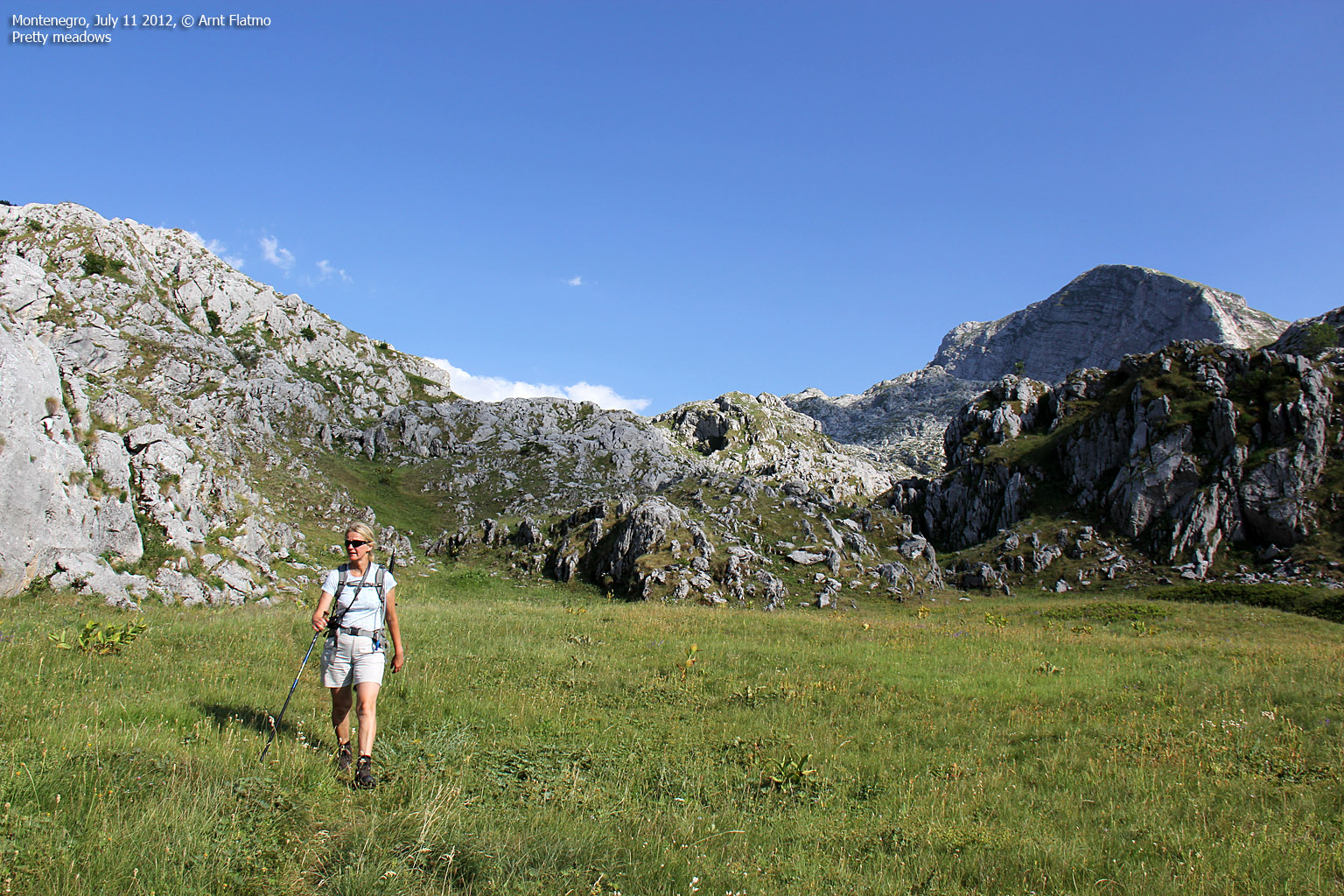
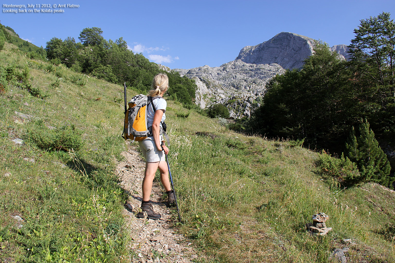
55 minutes after losing the path, we got back on it - 0,9km further up the valley. It's fair to say that the trip would have been a nightmare had we not found it again. A little while later, the Kolata mountain came into view and spirit was high...

Kolata peaks come into view
(Click for larger image)
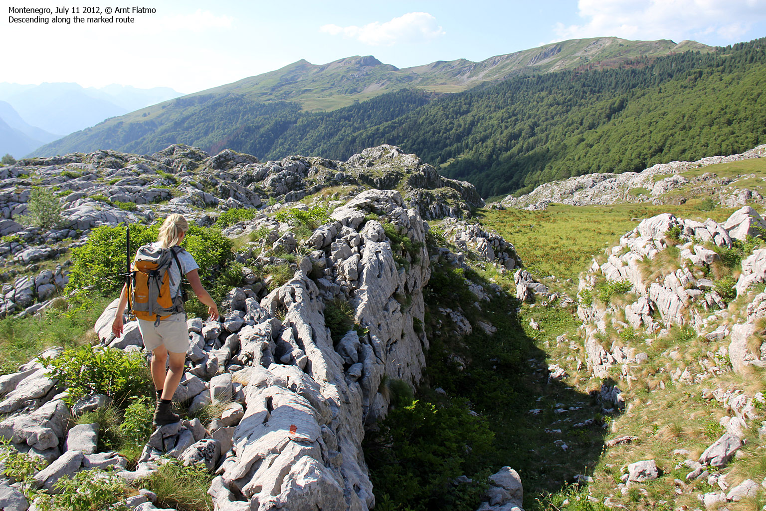
0,6km after the shepherd's cabin at 1560m (seen on the above picture) and 0,1km after a water source, we missed another important fork and were heading southeast towards the top of the valley and the Albanian border. But we knew that the route up the mountain followed the valley to the southwest, so it was just a matter of finding the easiest way - passing the beautiful fields around Cafa e Borit on the way.

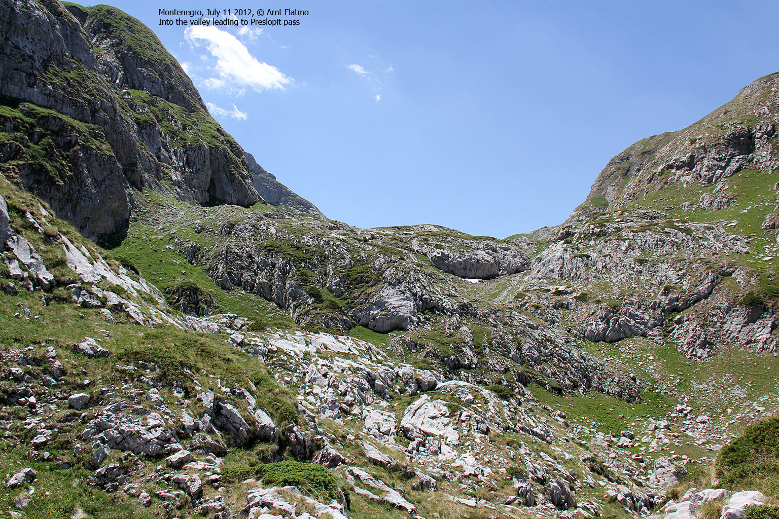
Route runs up the pass in center
(Click for larger image)
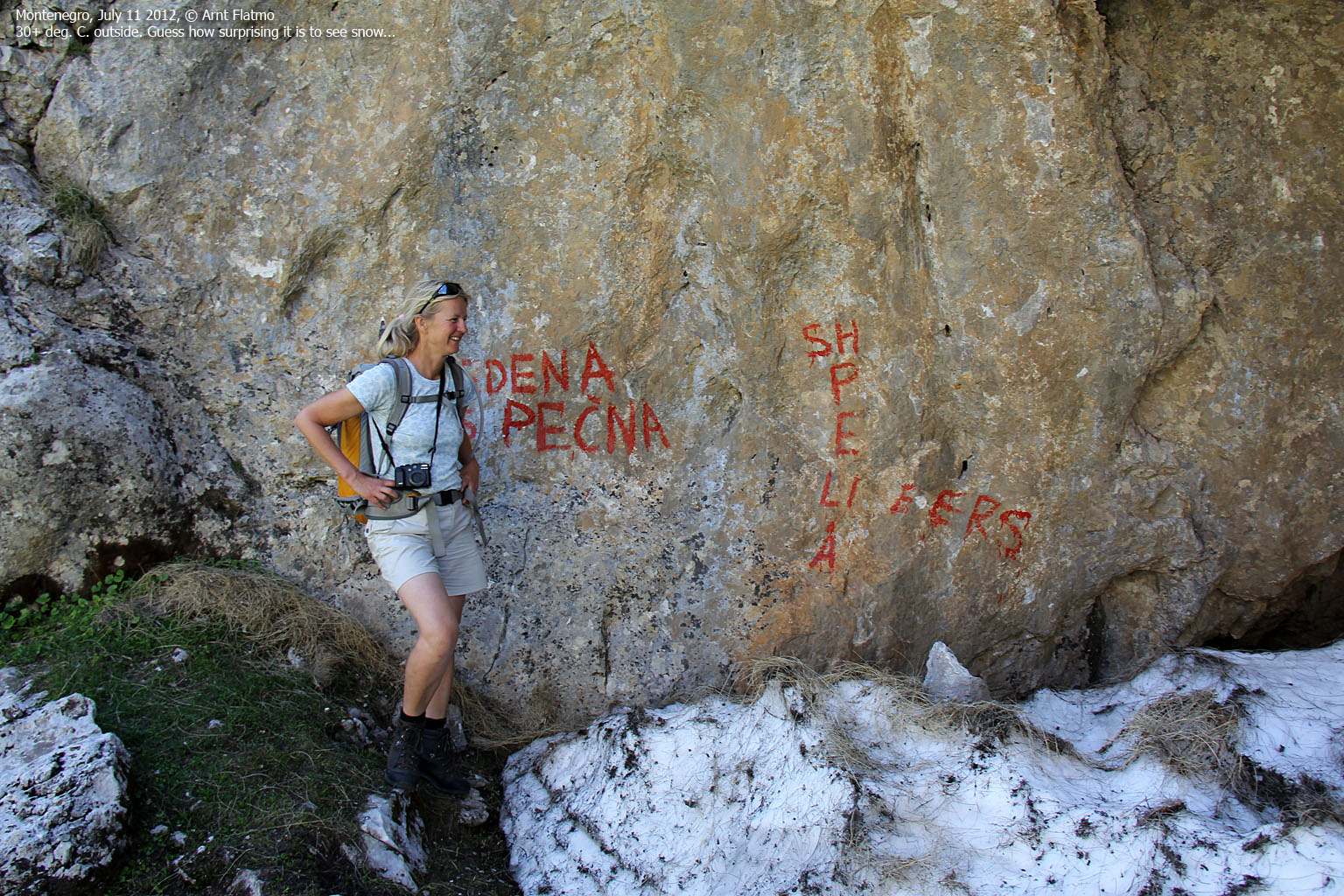
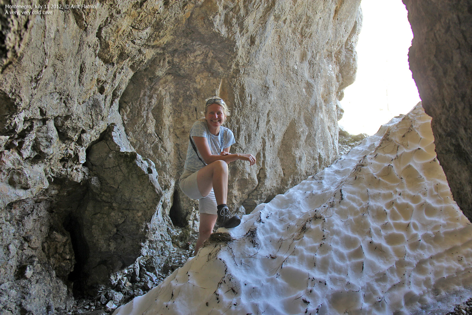
Soon after advancing up to the first pass and the valley leading to the Cafa e Preslopit pass, we passed a cave (Ledena Pecina) with snow on the inside. The weird thing was the incredibly cold wind that came out from the cave. Freezing cold, actually...
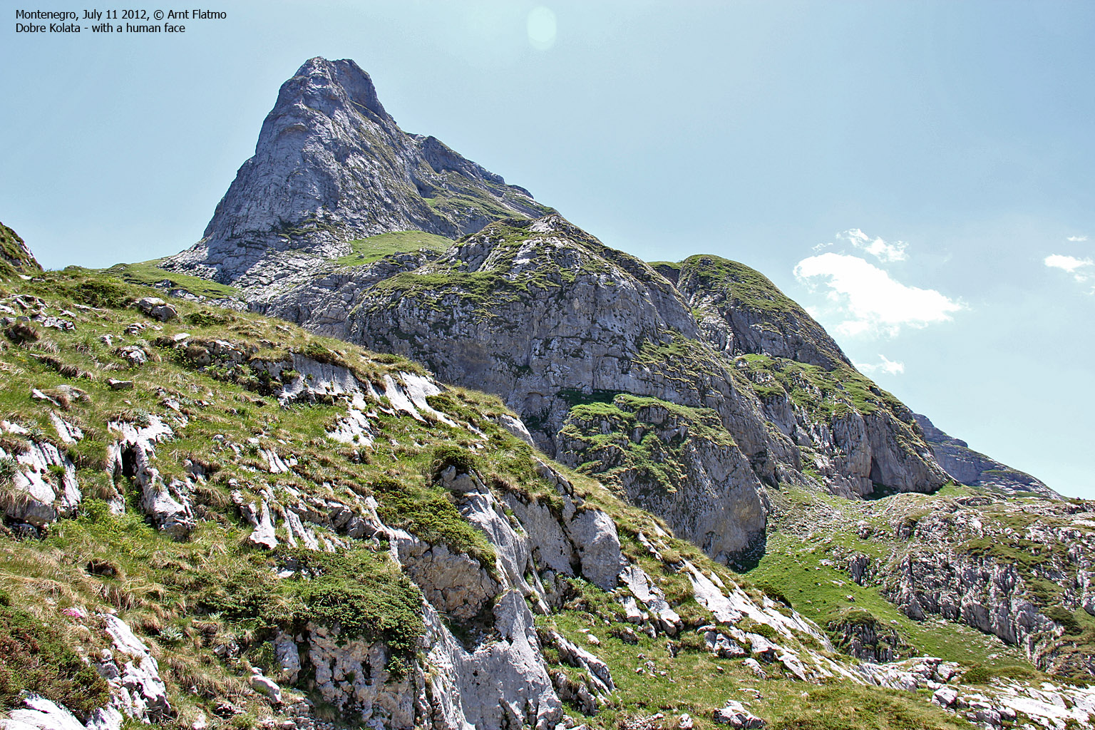
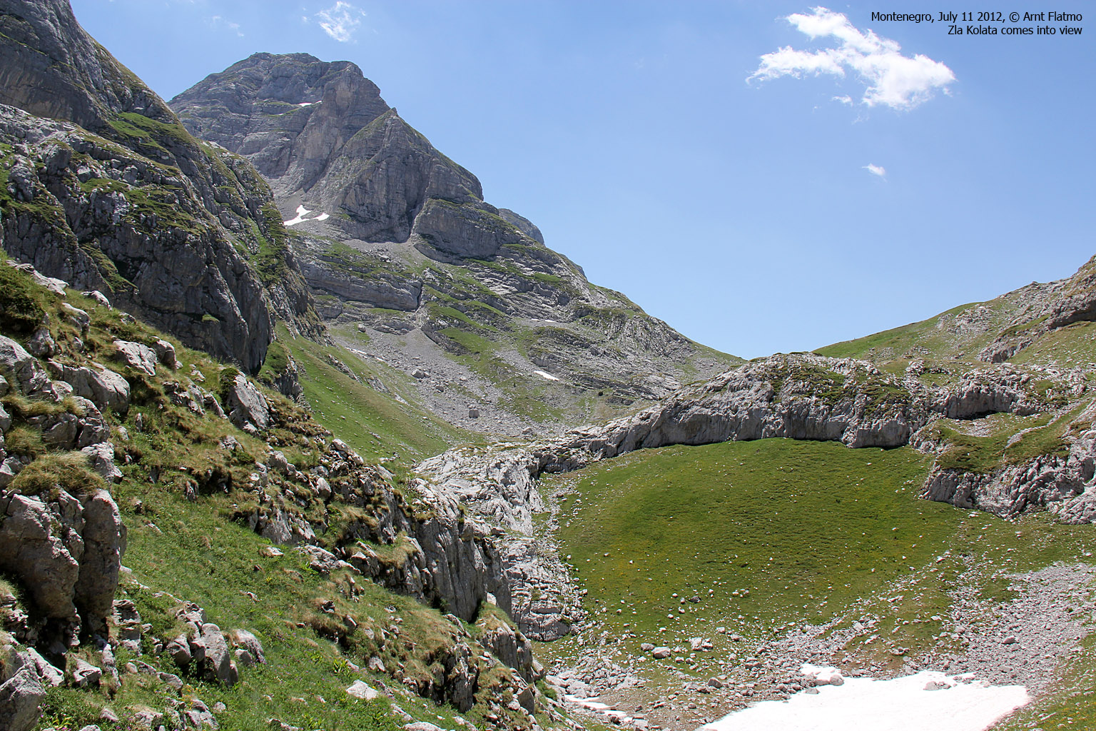
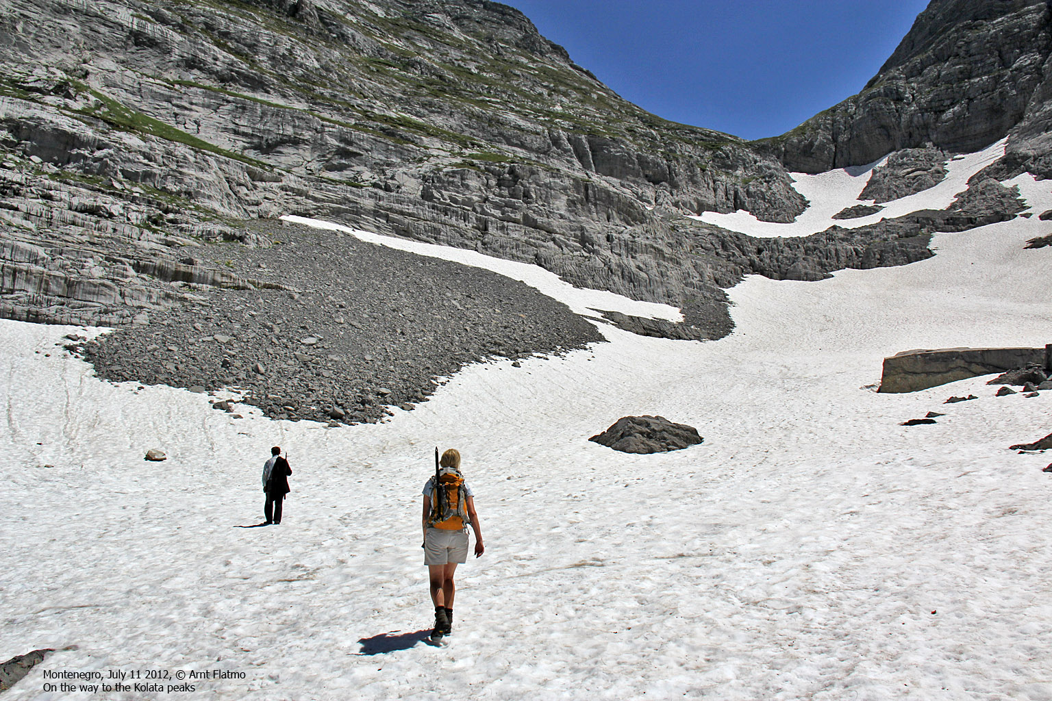
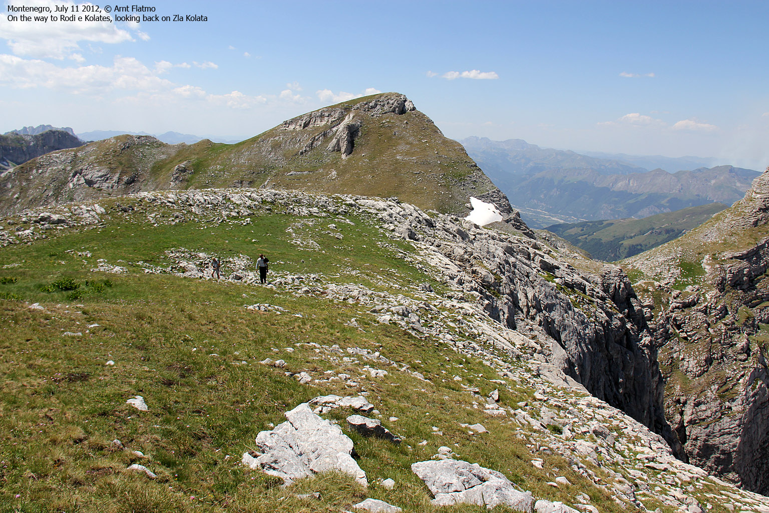
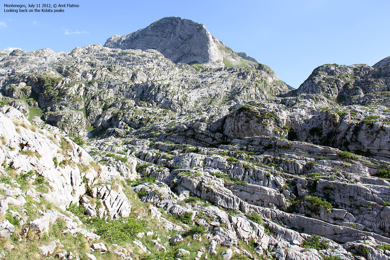
We knew we were in the right valley, on the right side of the mountain, etc., but we didn't know where the route up the mountain went. When I took the below picture, I had a hope that it would be Zla Kolata. We hoped that answers to our questions would soon present themselves. And they would - sooner than we thought.

Our route up the mountain
(Click for larger image)
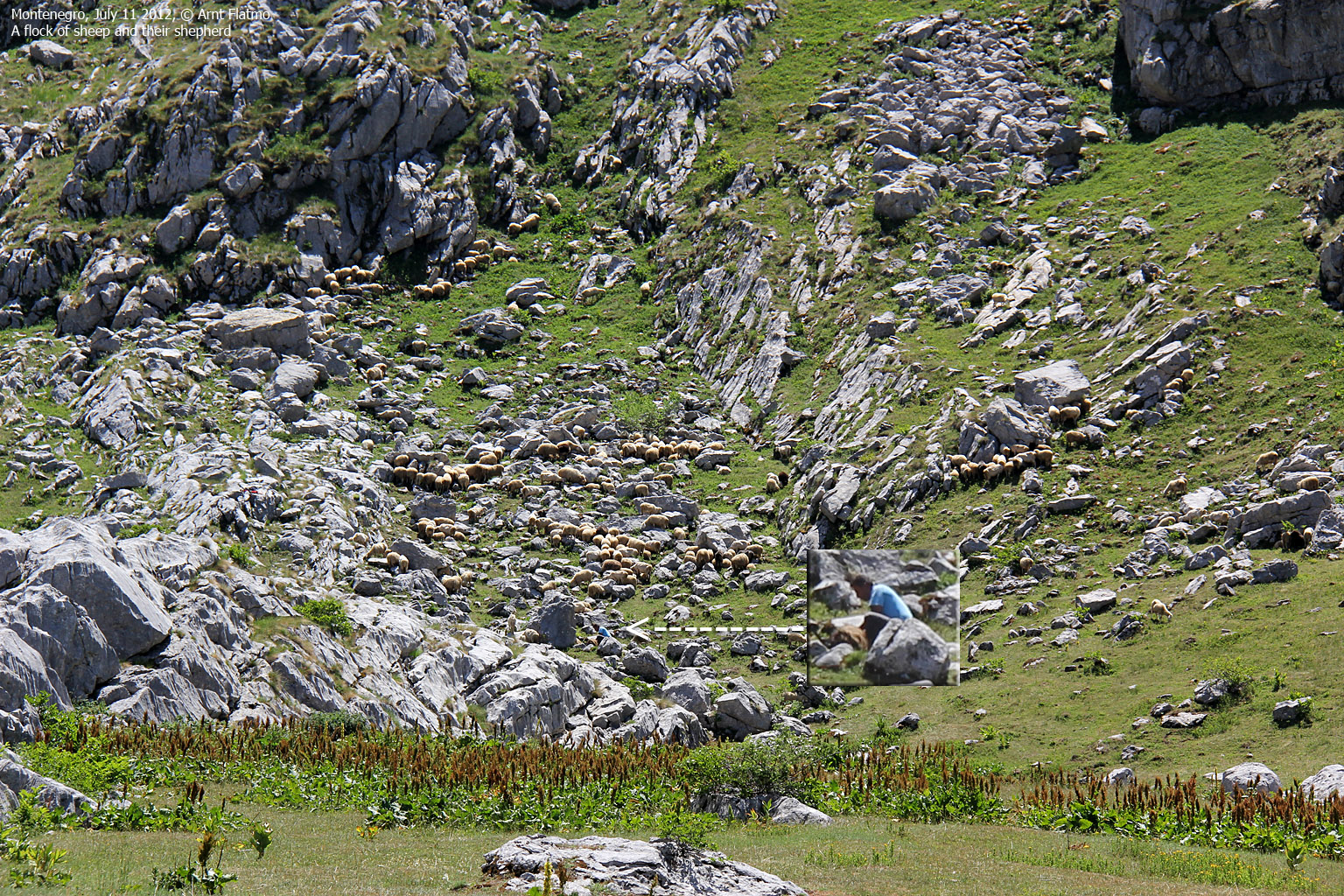
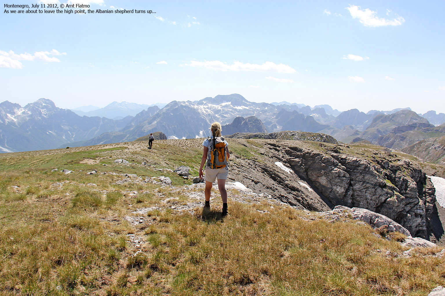
The Albanian shepherd...
As we approached Cafa e Preslopit, we noticed two men that we assumed were shepherds. We had already passed one (and waved at him) at Cafa e Borit. When I noticed that one of them had a rifle, my paranoia went off the charts (again) and I put half of my money and credit cards in my socks. Encounters with poor people in no-man's-land could go one of two ways. Hope for the best, plan for the worst...
They were indeed shepherds; the man (impossible to guess his age) was impeccably dressed while his son - or grandson - had a more casual appearance. We didn't understand a single word he said, but our lives did no longer seem to be in acute danger. Embarrassed, I noticed that one of my credit cards was trying to escape from my sock. Hopefully I was able to hide it again before anyone took notice...

The Albanian shepherds
(Click for larger image)
Which way up?
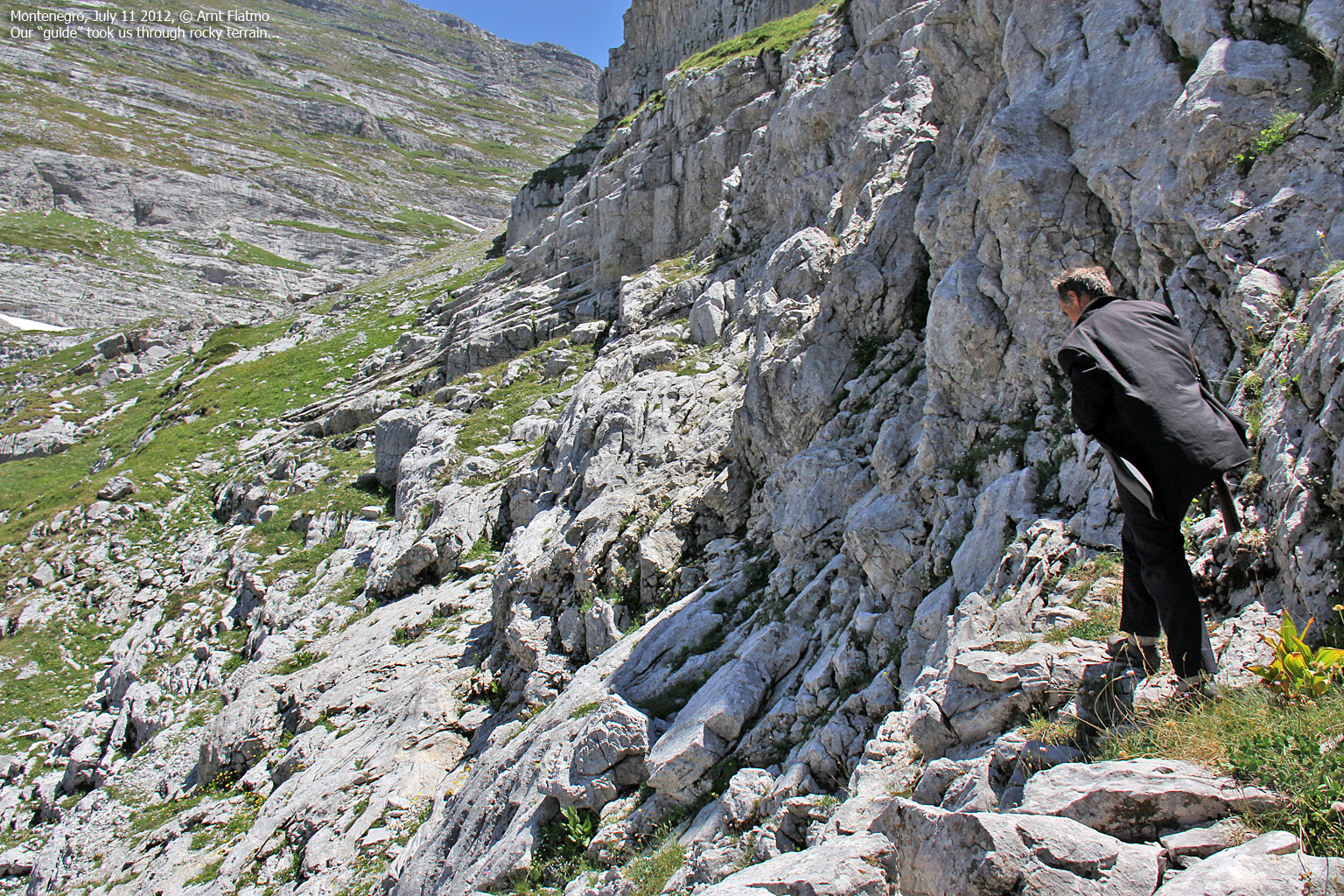
We asked him -through unorthodox sign language - where the route up the mountain went. He could either a) just point or b) talk and talk while pointing in different directions. Unfortunately, he chose b). Another shepherd came up from the Albanian side (with his flock of sheep) and contributed to the discussion of route by talking and pointed in different directions. When "our guy" realized that this discussion was getting nowhere, he gave some instructions to his son/grandson and signaled us to follow.
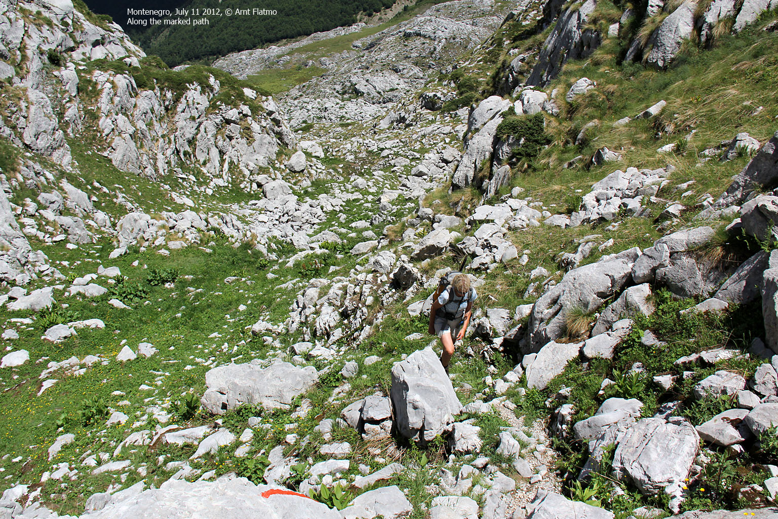
Our new guide
We had ourselves a guide, although we expected (and hoped) that he would just lead us a couple of minutes, point the way and return. Not so. He seemed determined to take us all the way up to the mountain. Within minutes, we came across the marked route, and the road ahead seemed obvious; up the valley between the two Kolata peaks and across some snow fields. "Tourista", our guide said with a mocking voice, and pointed to the red and white circles painted on rock...
We discovered that there is no way - at least no apparent way - to politely say "thank you, we'll manage from here" in sign/body language. Anne tried something that looked like something you would do to get a cat out the house, and I felt an urge to stop her.
Speaking of cats - our new guide surely moved like one. I'd never seen anyone move so swift and effortlessly as he did. He stopped several times and signaled me to help Anne, but as she was in no need of any help, I ignored him.
Halfway up the valley, we took a pause and I offered him bread. He declined. I insisted and he took the bread and he obviously enjoyed it. Fresh bread from the town! I then got a brilliant idea; I gave him 10 Euros to signal that we were grateful for his time and guidance. The plan was to let him understand that the job was over. He declined. I insisted and he accepted the money. Then he looked up the mountain and said something that very well could mean; "come on - it's still a long way to go".
I know when I'm beaten. So before moving on, I took one more zip of water and offered him some. He declined. I insisted, but he declined again and started to pack snow into our water bottle. I made him stop, and then he realized that we were offering him water, and not asking for help to find more. Then he broke into a scornful laughter, and went over to a tiny water source by some rocks. I assume he must have thought that we could not survive one hour on the mountain without him...

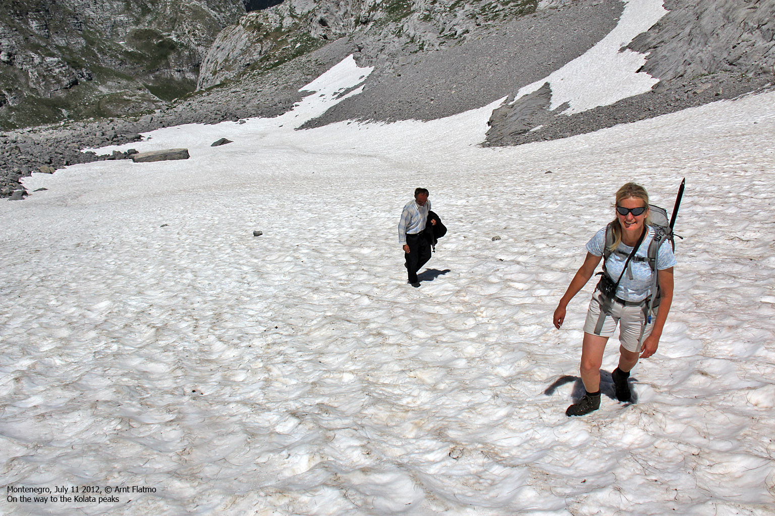
Up the valley with our new guide
(Click for larger image)
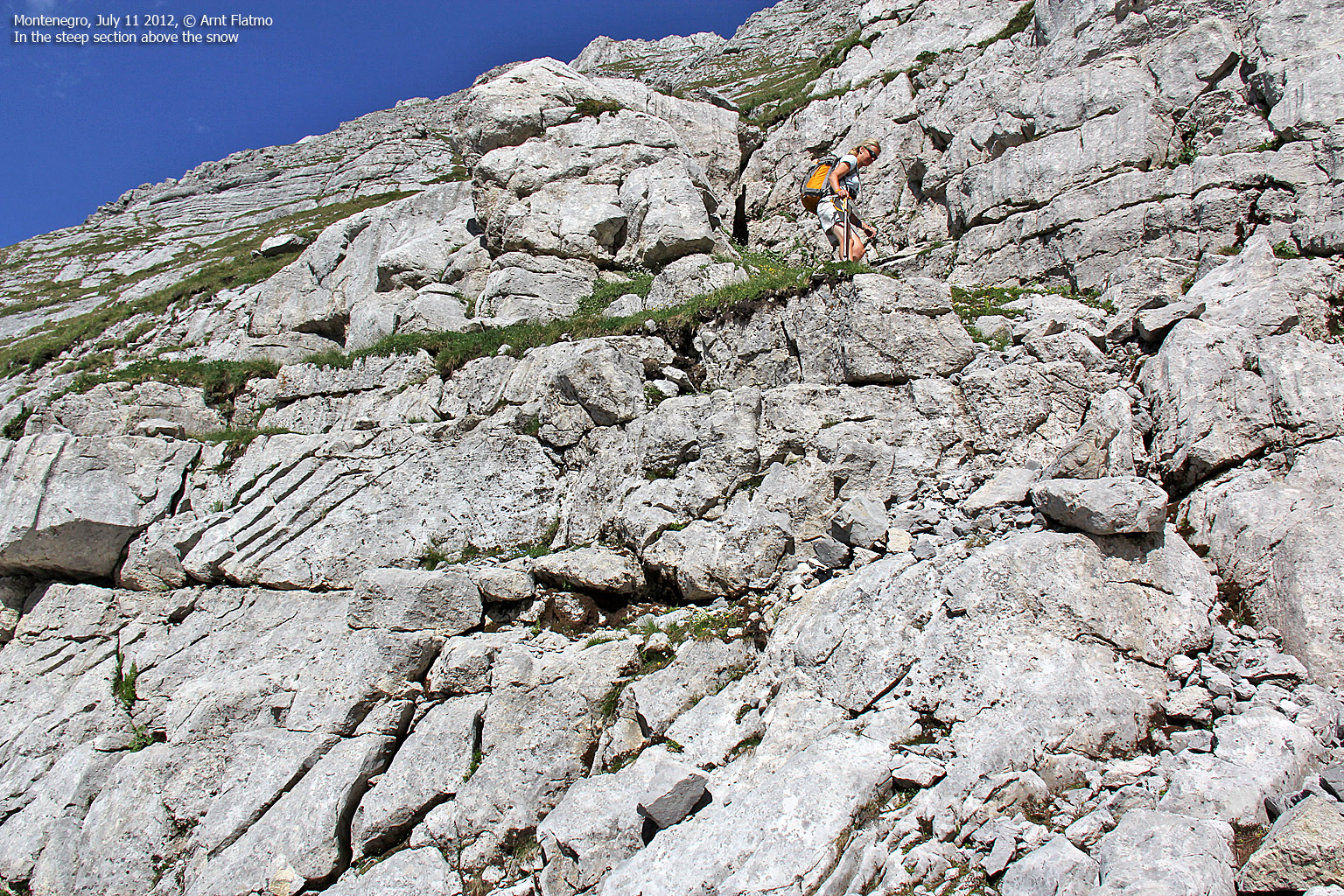
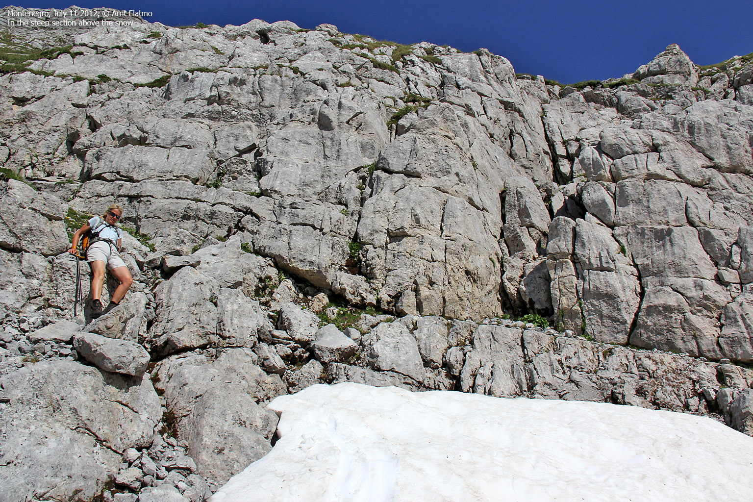
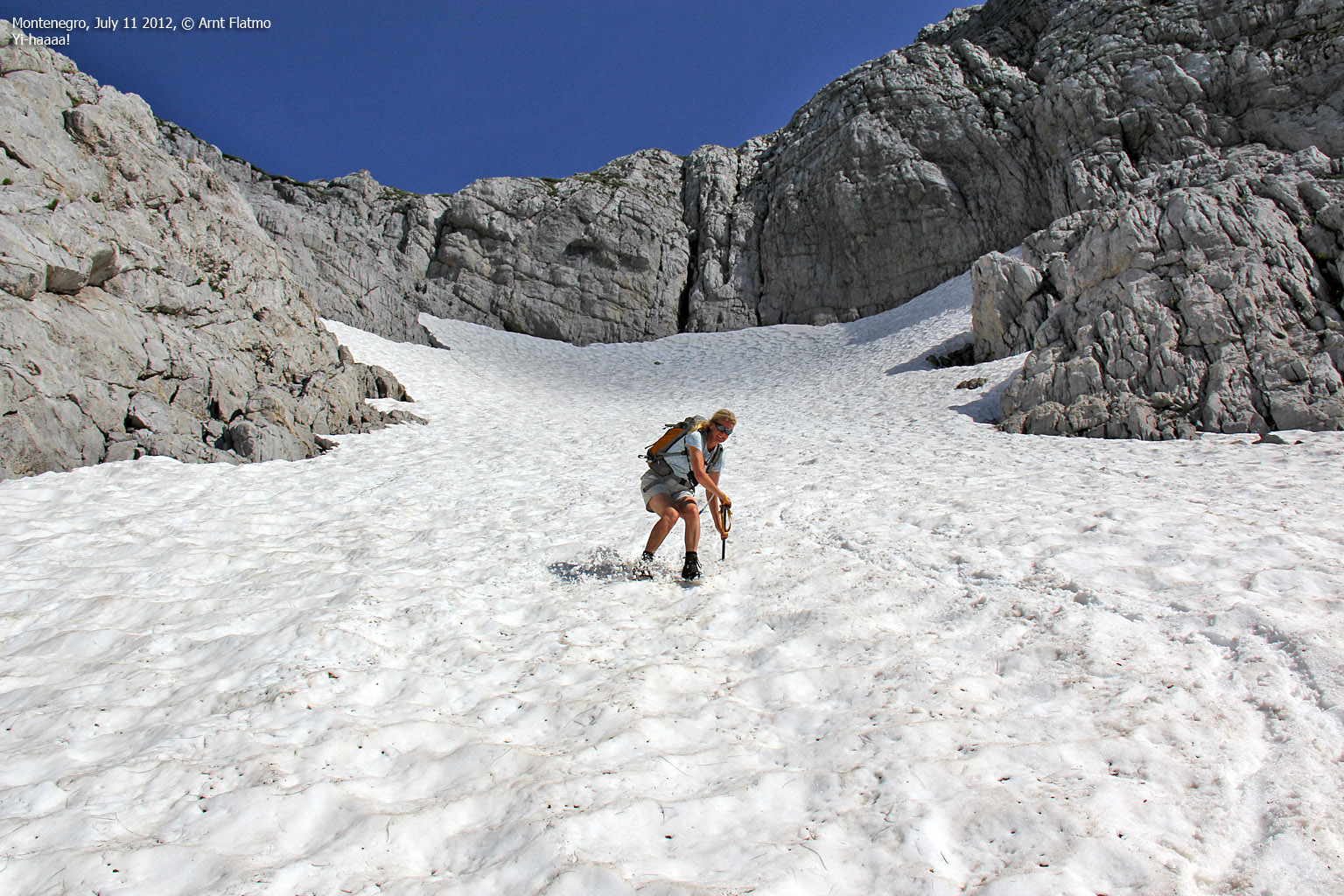
As the snow fields got steeper, Anne and me decided to use our ice-axes. Our man didn't seem concerned, but as he was wearing regular shoes, we made sure to make our steps deeper than we otherwise would have. Gradually, the gap between us and him got bigger, but we didn't wait for him.
The main reason why I didn't want him to be up there with us was that I didn't know where the country border went, and if it came to the point where we would have to cross the Albanian border to get the Montenegro high point (some internet literature claimed we needed to), I certainly didn't want to risk discussing this with someone that I couldn't understand.
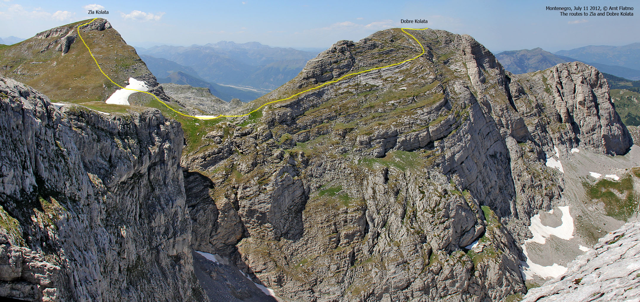
Zla Kolata
Eventually we reached the mountain plateau - first at a pass (Dvojni Prevoj - Double Pass) between two peaks that I suspected were Zla and Dobre Kolata. Further to the southwest was another top that I guessed was well inside Albania, but I didn't understand why we would have to cross the border to get to the Kolata peaks. But to be sure, I wanted to visit all of the peaks and Anne gave thumbs up.
We went up to another pass (10 meters higher) - and ascended the peak that is called Zla Kolata (approx. 2535m) - unofficially ranked as the highest peak in Montenegro. We reached the top 2:05pm - 5h:15m after heading out from the trailhead (including the time we spent looking for the trail in the forest). We had ascended approx. 1600 meters and walked 11km (2km more than necessary). The words "Zla Kolata" were painted on a rock, so that at least a "proof" of being on the high point. But my GPS reported 2516m - 18-19m lower than most maps. Hmm!!
And in the meantime - our guide had arrived on the plateau and was now taking a nap in the pass between Zla Kolata and the Albanian top that we were about to visit...

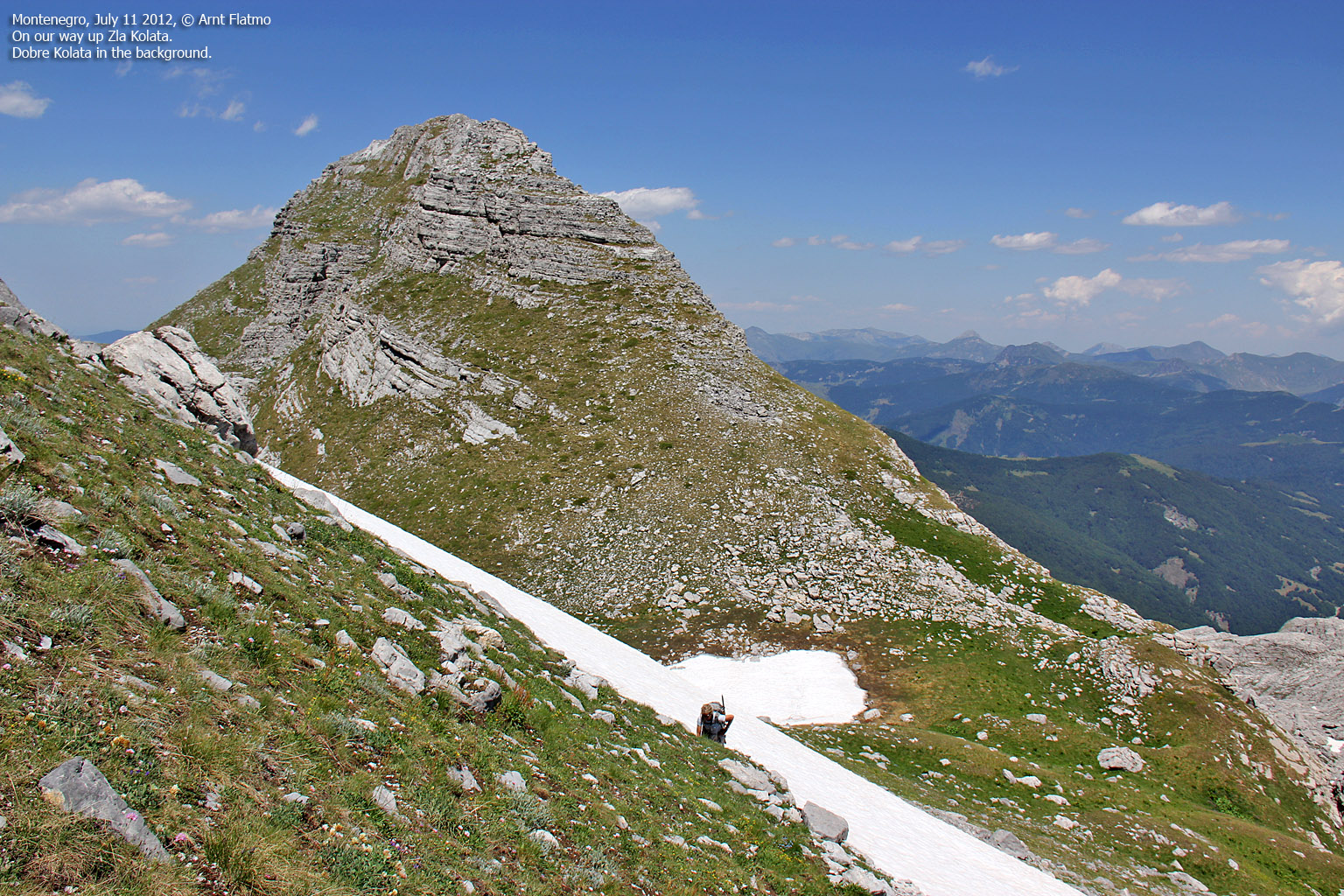
On Zla Kolata. Dobre Kolata in the background
(Click for larger image)
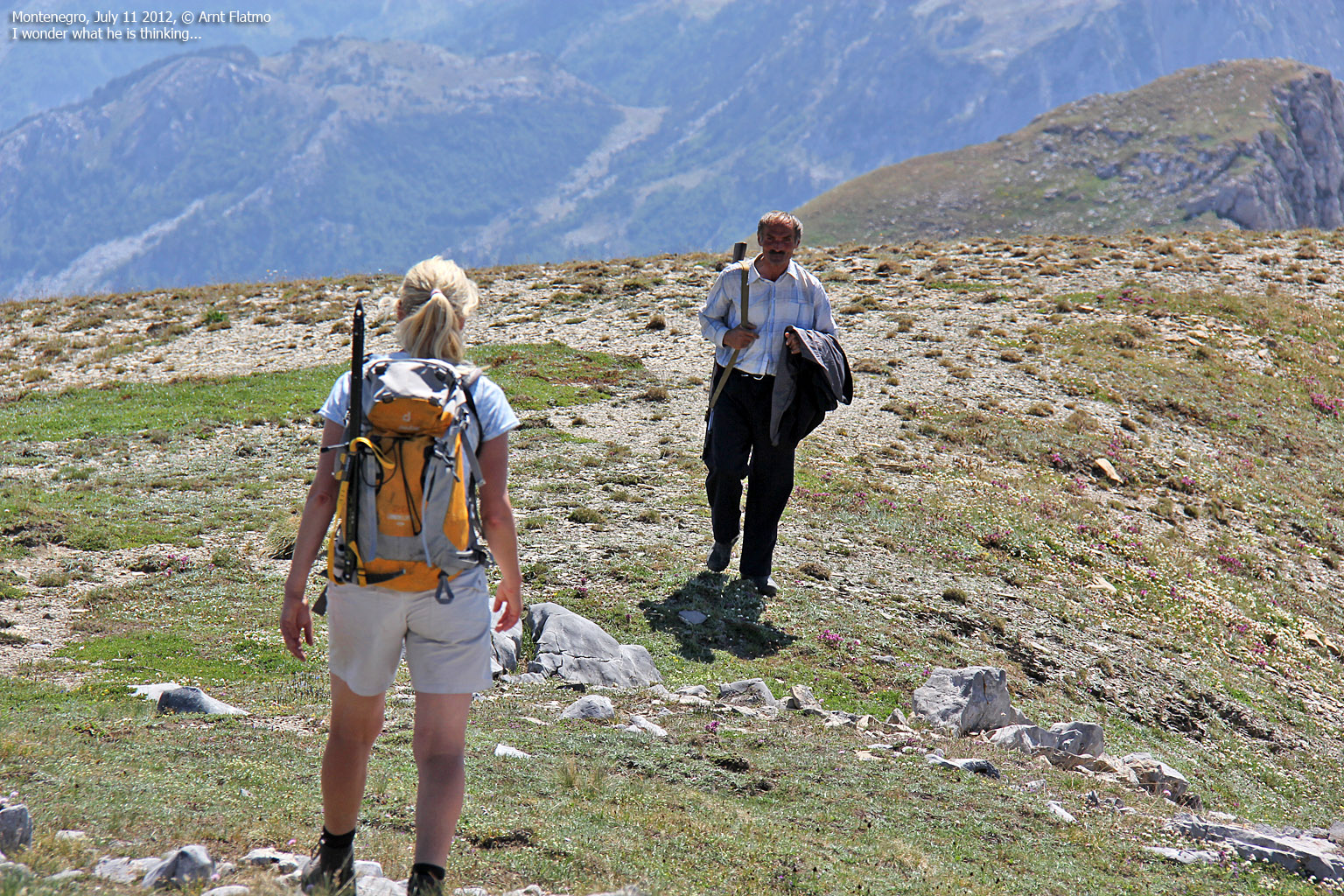
Uhm... hello again!
We got reunited with our guide and we couldn't tell by his face what he was thinking. He kept on talking and we still didn't understand anything. I pointed in the direction of the Albanian peak to let him know that this was where we were going next. He seemed to have something important to say about it, but to no avail. When Anne and me sat course for Albania, he followed...

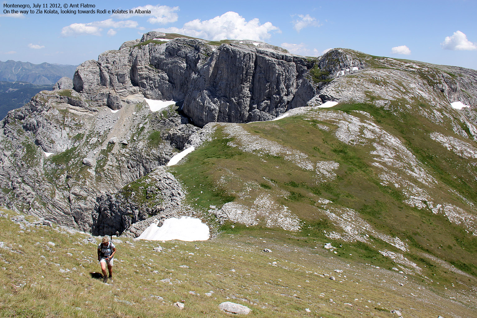
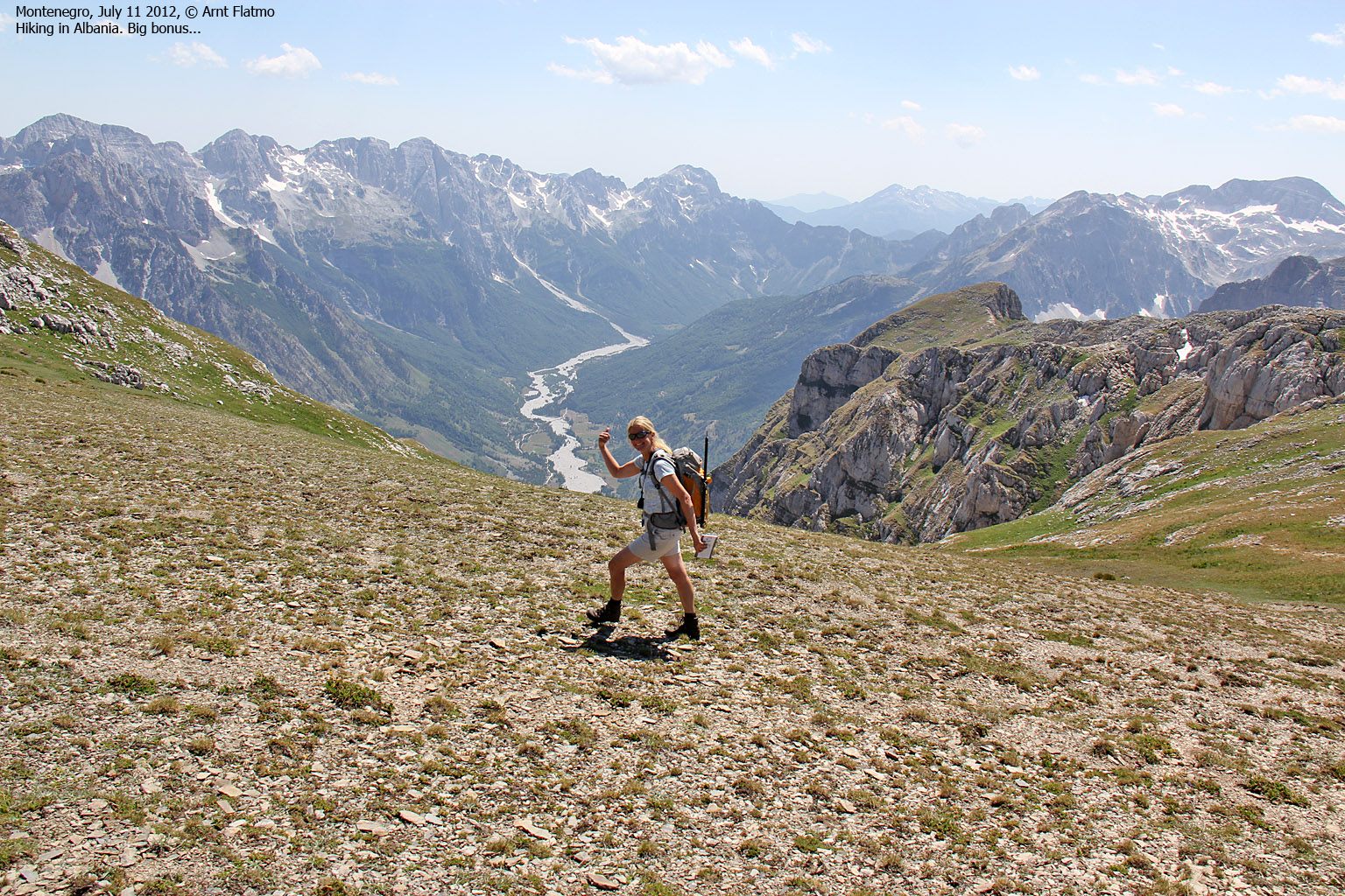
On our way to Albania. Zla and Dobre Kolata in the background
(Click for larger image)
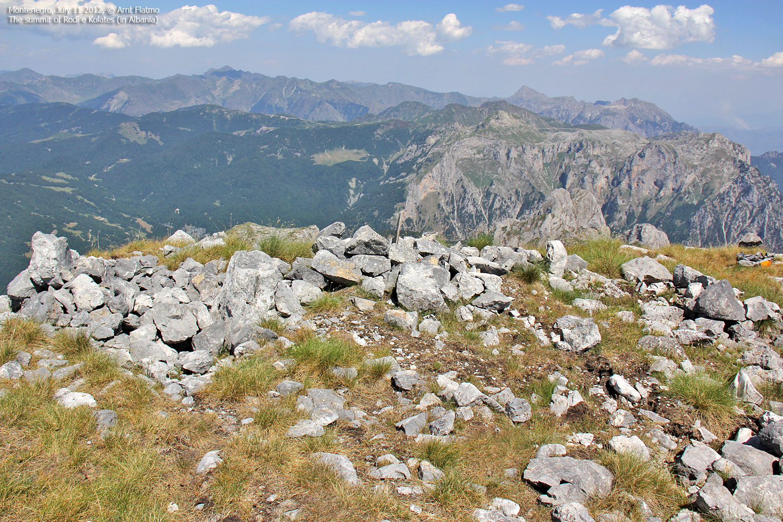
Rodi e Kolates / Maja e Koljats
The walk from Zla Kolata to Rodi e Kolata (Maja e Koljats) was 1,3km. We reached the summit point 2:48pm after visiting a viewpoint 250 meters to the south. The GPS showed 2556m - and this was clearly the highest peak on the Kolata massif.
The Shephard hadn't been able to keep up with our pace, but joined us on the summit. He seemed more happy on Albanian turf than on the other side, and had a lot to say about the views.
"Tropojë, Tropojë", he shouted out and pointed to the east. The name rang a bell, but I could not recall where I heard it. Later, I remembered that it was the sentence "Marco from Tropoja" in the movie Taken with Liam Neeson....
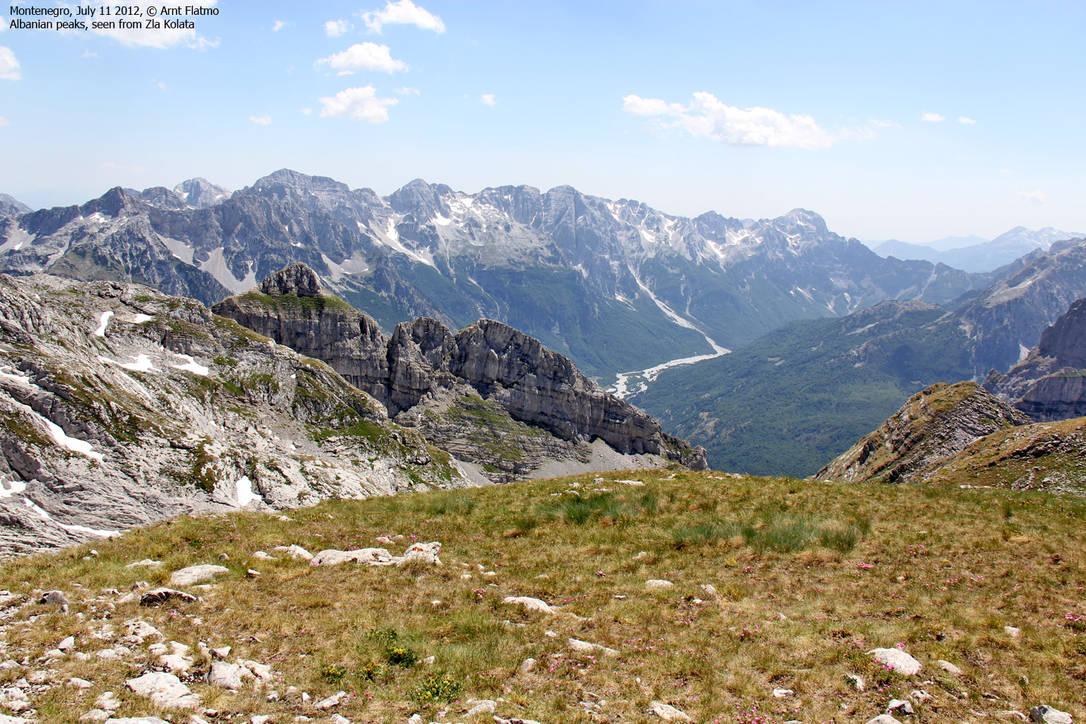
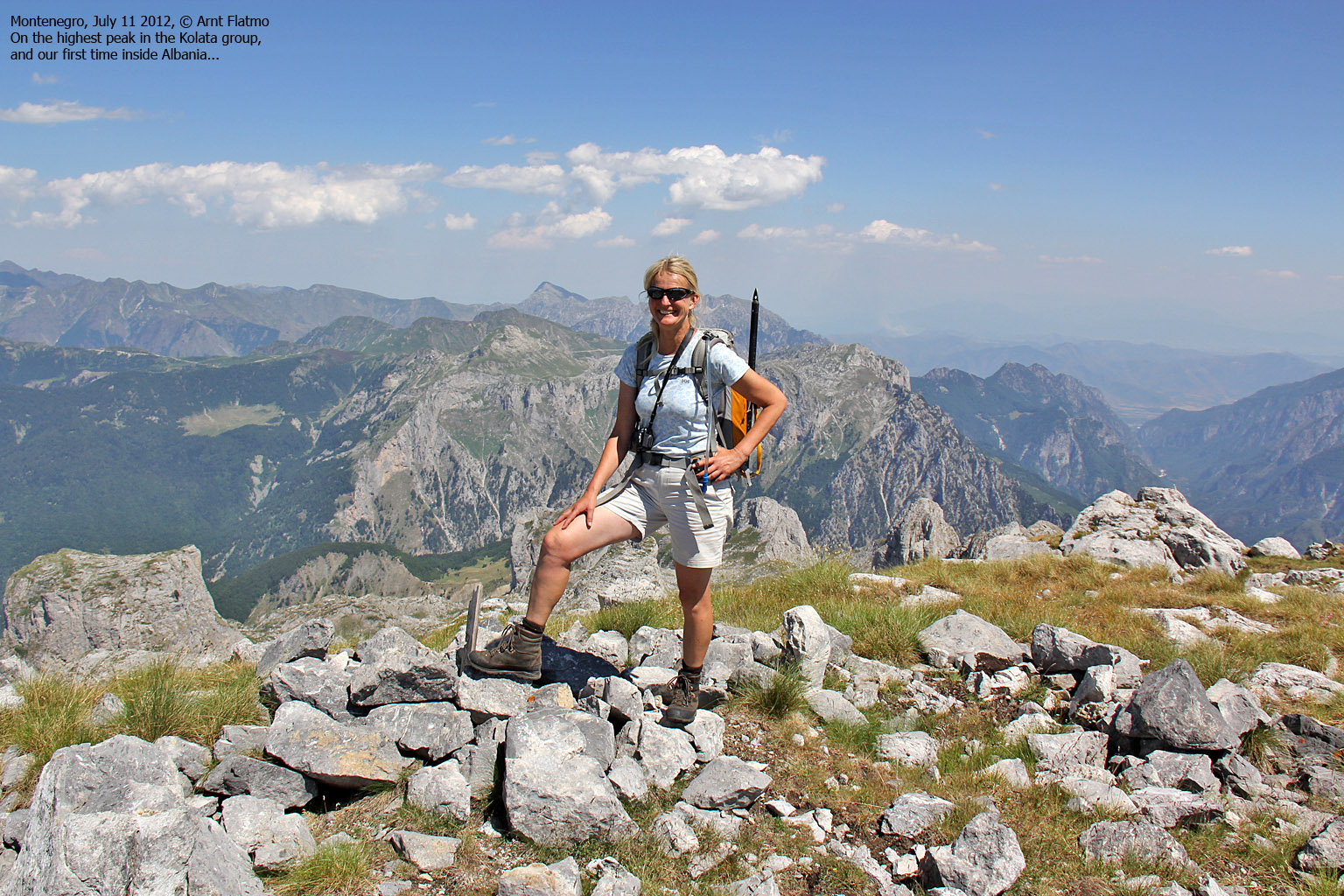
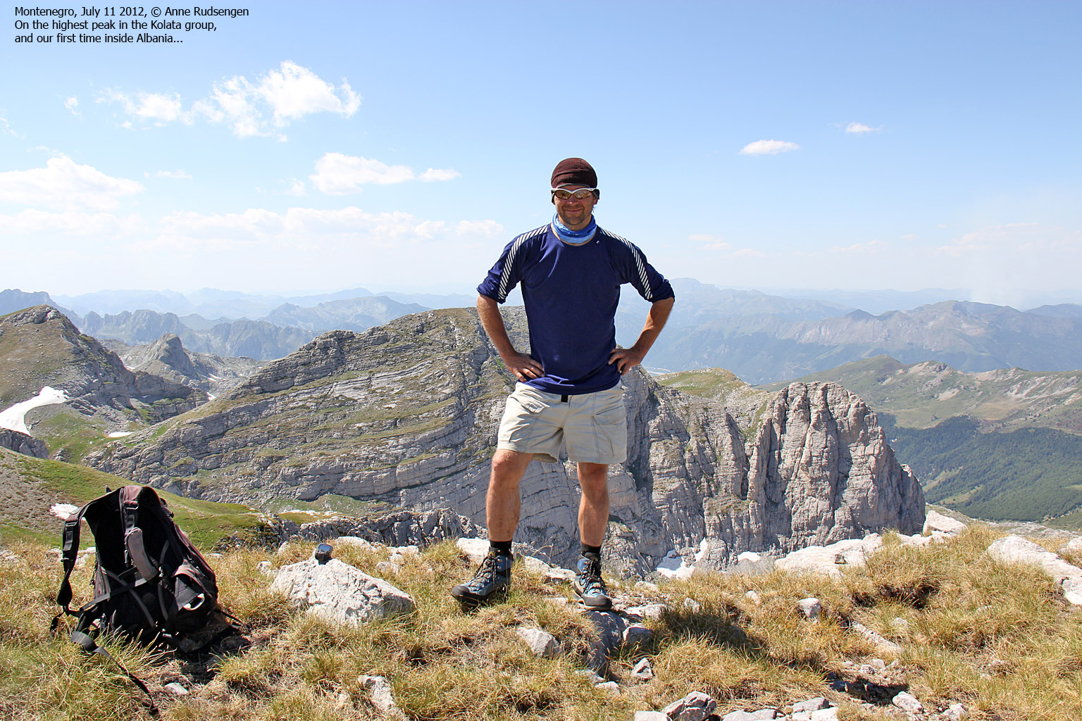
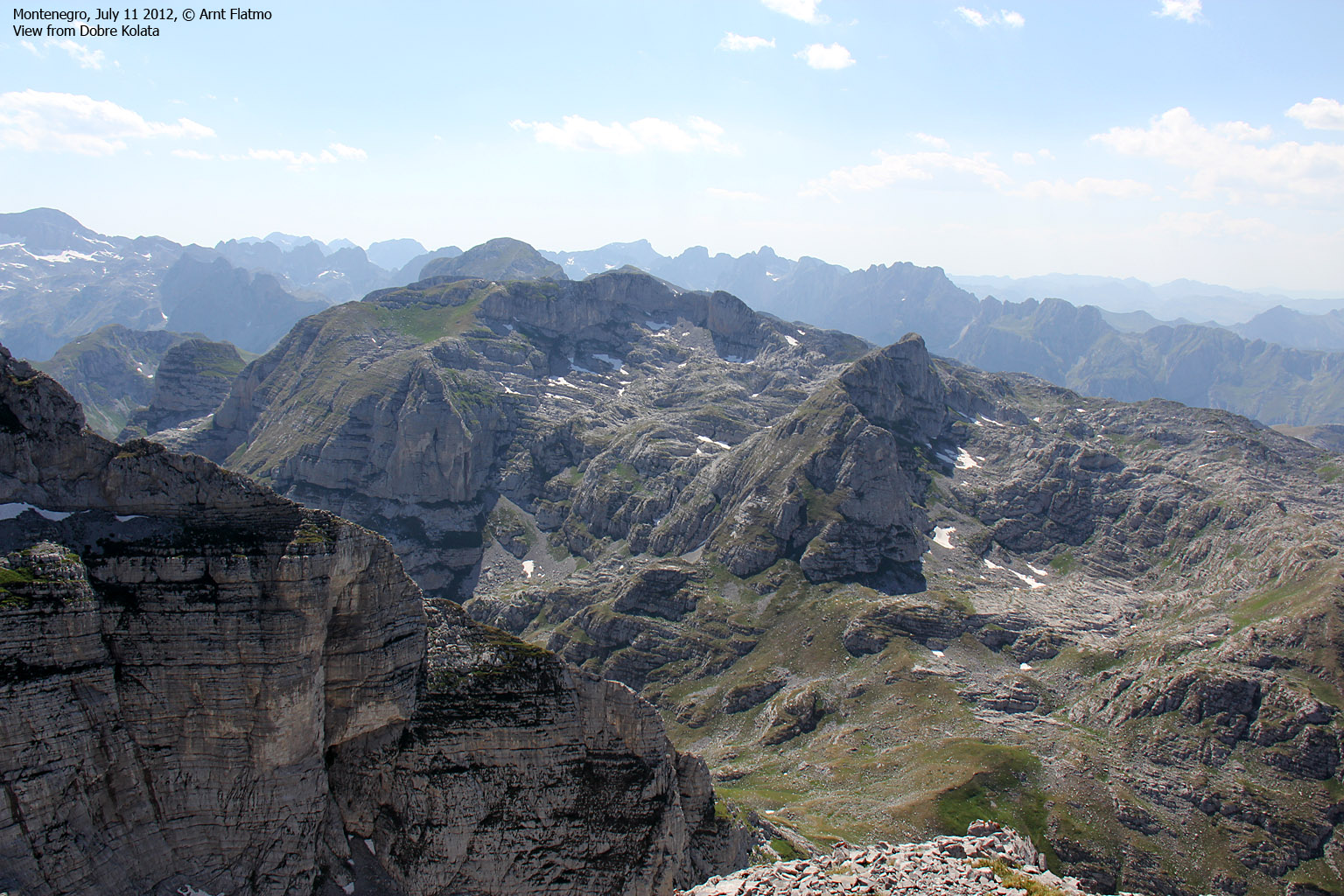
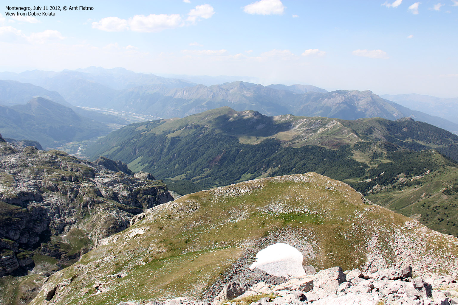
The view from the top was breathtaking. Although we are rather blessed with wild mountains in Norway, the Prokletije range was something else. This was one of the most unexplored mountain ranges in Europe and - oh boy - did I want to explore it...

View from Rodi e Kolates/Maje e Koljats
(Click for larger image)
Dobre Kolata
When we began our descent from Rodi e Kolates, our guide probably thought the job was done. He seemed to be in a good mood and kept shouting things to Anne, and we took them for compliments. Perhaps we wasn't used to see women in the mountains?
In lack of things to talk about, I told him that we had just visited Durmitor. He replied with several "Pah! Pah!'s", and although I didn't know what they meant, it had "hair in the soup" written all over it. I decided to stay away from subjects related to Montenegro.
I decided to give the conversation one more try and pointed towards a big peak in the horizon and said "Maja Jezerce?" The Albanian shouted out in pure joy and clapped me on my back. Slam dunk at last!. Home run! The peak was clearly the highest one in miles around, and I assumed it was the highest peak in Prokletije, and the one my friend Petter had visited.
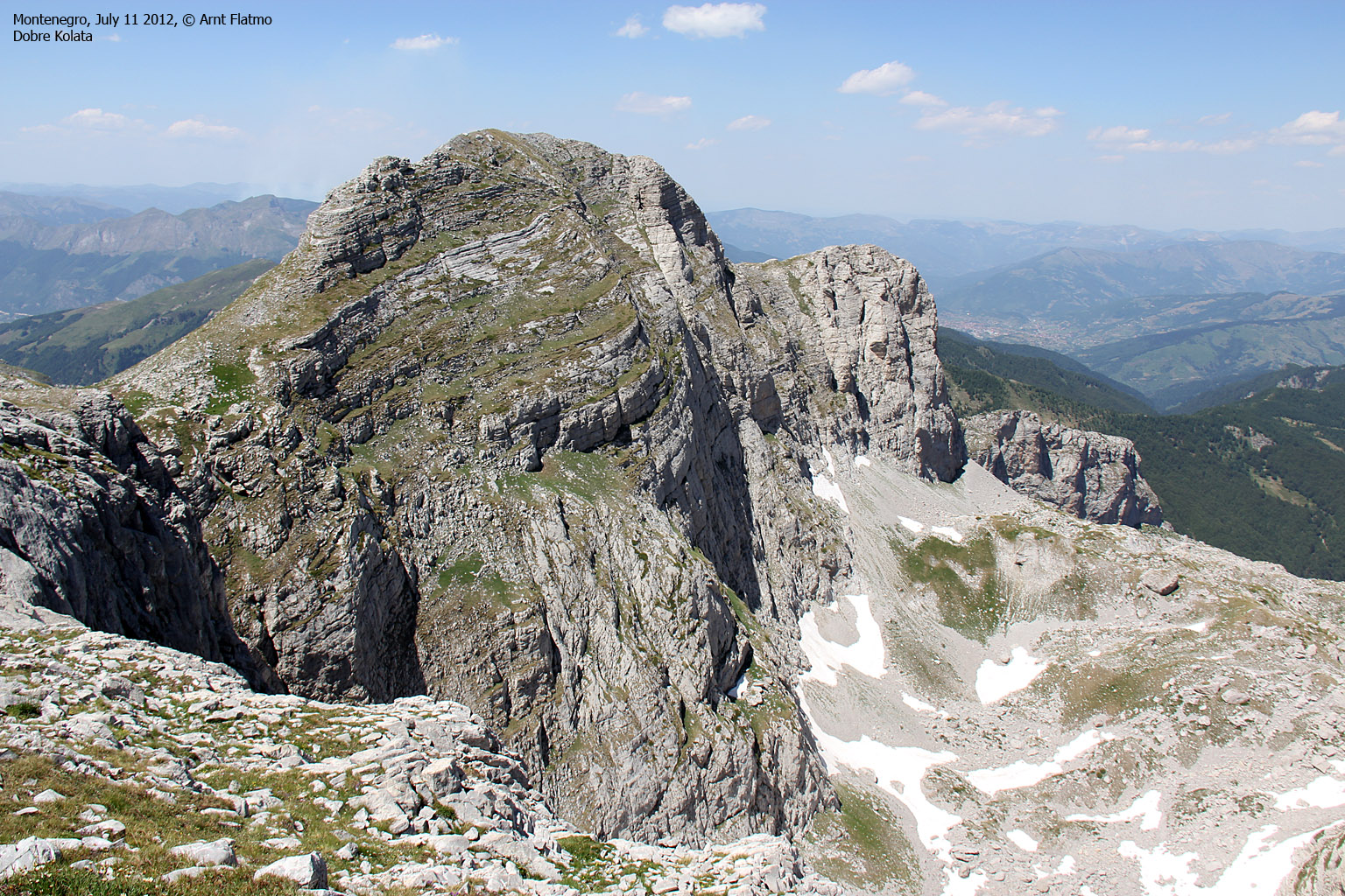
By the time we reached the pass between the two Kolata peaks, Anne and me sat course for Dobre Kolata while our guide had a lot to say about it. When he understood that there was little to be done about the matter, he headed down the valley and the snow fields while Anne and me went up to Dobre Kolata.
After a 0,5km walk, we reached the summit 3:37pm, and the GPS reported 2526m - 10 meters higher than on Zla Kolata! Double hmmm!. In any case, the third and final Kolata peak was in the bag, and this was a big moment. After all the research, planning and traveling - we had finally done it. Not that the mountain was challenging in any way or form, but it's still a long way from Norway to the Montenegro-Albania border.

Anne on Dobre Kolata
(Click for larger image)
Descent and a kid called Toni
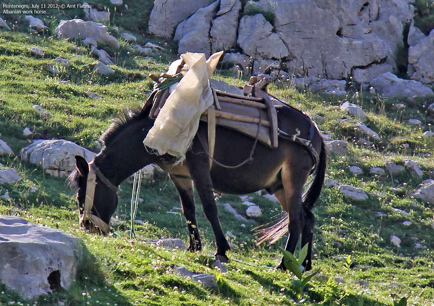
We descended along our ascent route and when we reached Preslopit, we could see that more shepherds had arrived, some on horses. Two kids came heading our way - one of them was the one we met earlier, but the other kid presented himself as Toni (or was it Tony?) and could speak English rather well. He came prepared with lots of questions like "Are you not tired", "where do you live?", etc. He lit up when we said "Norway". That was clearly a place he had heard about.
We answered his questions and he seemed puzzled about the fact that we went all the way from Norway to visit these mountains. In retrospect, I regret not asking him where they lived and where he learned to speak English, but I was a bit uneasy (paranoia striking again...) with all the new shepherds around and just wanted to get moving.
Finally, Toni invited us to stay with him and his family in their house in Albania. We kindly declined and said that we were on our way back to Budva. Which was the thruth of course. We asked what the shepherd's name was, and Toni replied Ganeh, Ganesh, or something like that. Anne asked for an address so she could send pictures we took of the shepherd, but after a short discussion, the kids concluded that this was something he probably not would want. We decided not to ask why, but told Toni to tell him that we appreciated that he showed us the way up the mountain. Toni said he would do that and then we parted. And I was in a hurry to get out of the valley...

Leaving Preslopit
(Click for larger image)
The descent to Vusanje was fairly uneventful. We were able to follow the path all the way and found a good water source. Fairly close to Vusanje, we met another Shepherd who spoke a little English. When he heard that we had met Albanian shepherds, he had to take a time-out. He shook his head repeatedly and it was due time for a new subject...
We returned to the car 6:50pm - 10 hours after heading out. It had been a long day in the mountains and we looked forward to return to hour hotel in Plav for a nice dinner and a cold beer/glass of wine.

Farewell to the Prokletije region
(Click for larger image)
Epilog; the good, the bad and the ugly
Yes, you read this at the top of the page, and here's what it means;
Upon return to Norway, I spent quite a number of hours on the internet to find as much information as I could about these mountains, including the link between Zla Kolata, Good Kolata, Evil Kolata, Kolata e Mire, Kolata e Keq and Dobre Kolata. And I learned that Good is Dobre in Serbian and Mirë in Albanian, and that Bad is Zla in Serbian and Keq in Albanian. Aha - the pieces were coming together, and now I've nominated the Albanian peak to be the ugly one - Ružan Kolata or Shëmtuar Kolata. How about that? ;)


")
")
")


")


