
Norwegian Mountains, Møre og Romsdal
Sandfjellet from Koparneset, Mar 15 2009
To the main Sandfjellet page (maps, route descriptions, other trip reports, etc.)

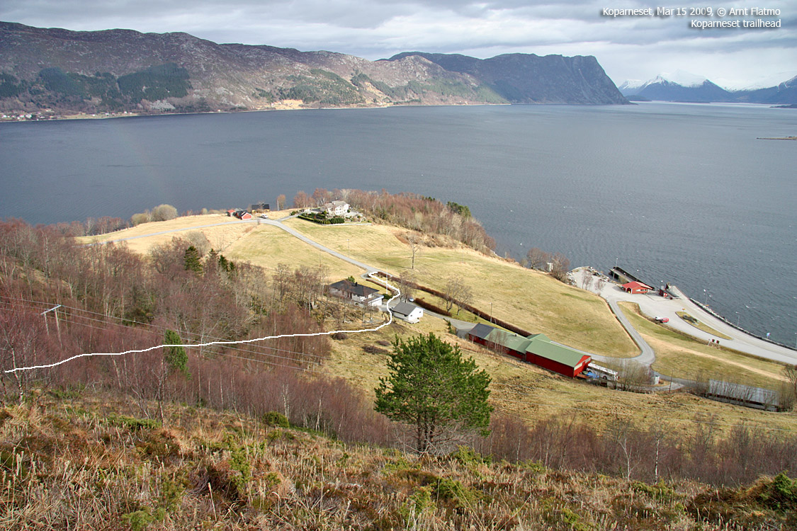
The route up Aksla
(Click for larger image)
The plan for this Sunday was to visit Sandfjellet above Koparneset, and then move on to Gurskøya and do a couple of tops there, weather permitted. The walk up the Koparnesaksla ridge looked nice and easy, and I hoped for some good pictures of the fjords and the Breiteigsfjella mountains (aka Syvdsalpane).
Using the Vanylven Turkart map, I tried to find the path that the map promised would be there. But I couldn't find it, and I had to ring someone's doorbell. The man who answered explained where I could find the path, and I was also offered parking on his property. It seems that people are, for the most part, very friendly towards strangers who ring their doorbells, asking mountain questions. The exceptions stand out as fun moments; the elderly man who shouted SO loud, the man who never came out of his living room, and the time when I told an elderly man that I was planning to go up the nearby mountain. "It's there", he said, pointed and left.

On the way up Aksla
(Click for larger image)
It still took me a little while before I found the vague, vague path, and then it started to rain lightly. That was a bit disappointing, but also very much out of my hands. The hike was enjoyable enough without the sun, and I had a nice walk up the ridge. I passed a (very surprising) gap, and wondered if I should scramble on the steep walls. I chose not to, and continued upwards. A small moment of bravery (while considering) and a big moment of defeat (the conclusion). He he, that's life..
Higher up on the mountain, it was windy beyond appreciation. That was however not surprising, and the wind had been the main reason why I wasn't aiming for something higher on this Sunday. But they make good clothes these days, and the summit stay was tolerable. It had taken me only 1h:20m to stroll up this ridge, and I wanted the hike to last longer. If it hadn't been for the wind, I would have continued towards Bjørlykkjehornet. In the end, I decided to save Bjørlykkehornet for a less windy and more sunny day.

Bjørlykkjehornet
(Click for larger image)
The descent was uneventful, except for that I now was able to follow the path all the way back to the farm. The plan was now to hike Saursegga and then Aregjell. But then I met Bjørn Skoge on the ferry, and the plan was slightly shifted around.

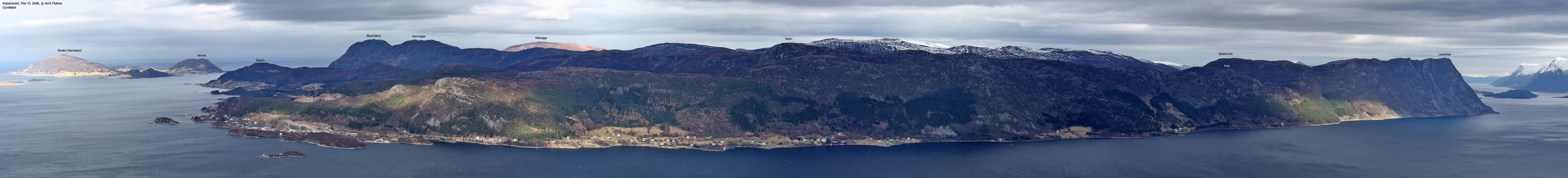
Volda peaks seen from Sandfjellet
(Click for larger image)


