
For Information, maps, trailhead and route descriptions, click HERE.
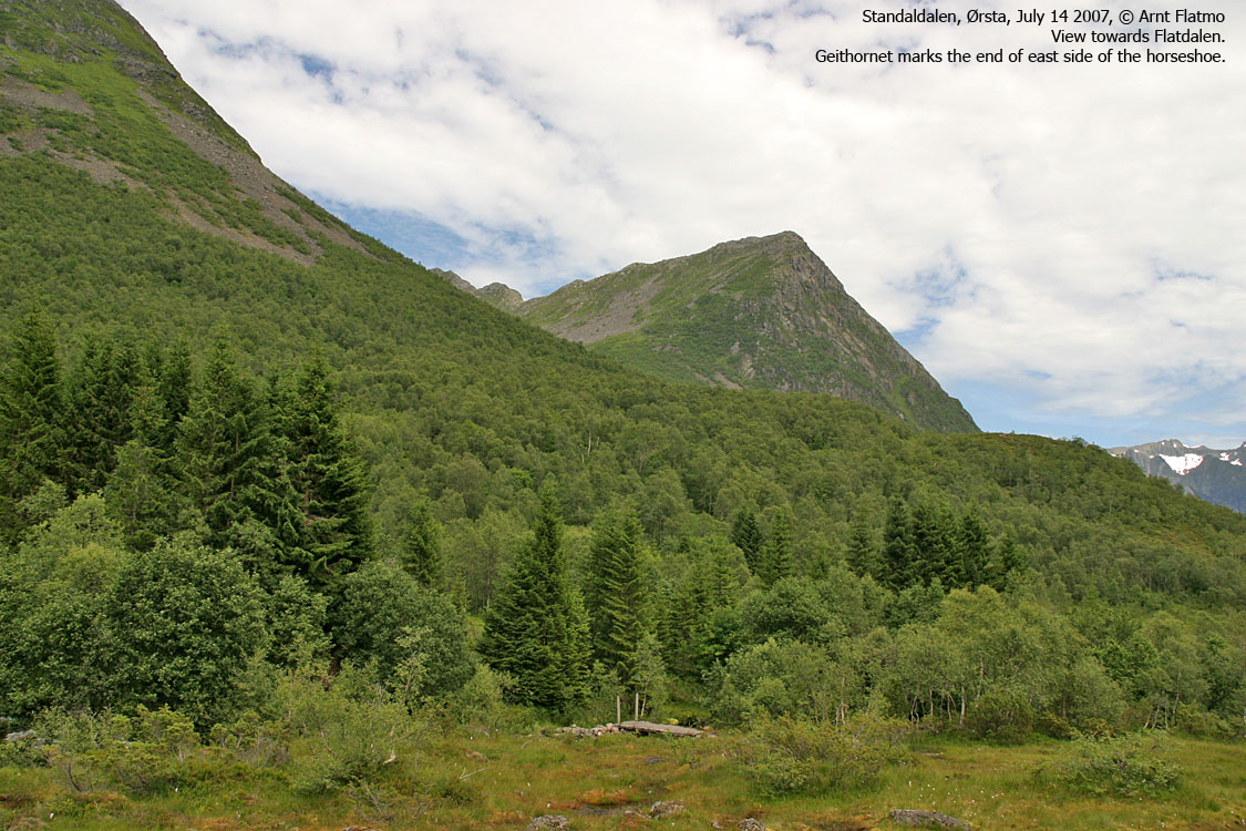
I didn't have any specific hiking plans for this Saturday. I hadn't even checked the weather forecast, but noticed that it was a brilliant day. I didn't get out of bed until 09:00AM, and had a late and long breakfast until I figured that I really should be doing something. Being a bit lazy, I wanted a short drive and a "short" hike. My first thought was Sylvkallen, but then I decided to go to Langenestinden. Perhaps I could get a good view towards Hundatinden, that I visited two days earlier. Without seeing much...
I took the 12:40PM ferry from Solavågen and by 13:35PM I was ready to get going from Standaldalen. My dog Troll came along on this hike. Given that he has retired from mountain ascents, there was nothing to do but carry him up the mountain. If he could walk down from the lake, that would be a bonus. Gradually, the sunny day turned into a grey day. Up in the valley, I met a hiker who told me it would start raining later on.
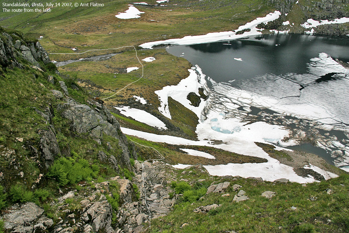
I reached the lake in exactly one hour, 14:35PM. I looked up and wondered WHICH couloir that I was supposed to follow. There were plenty. Then I noticed a group of hikers coming down, and the correct couloir was identified. I stopped for a quick chat with the group. They told me that it wasn't only supposed to rain, but there would be a GALE. Holy smoke. Better get up that mountain...
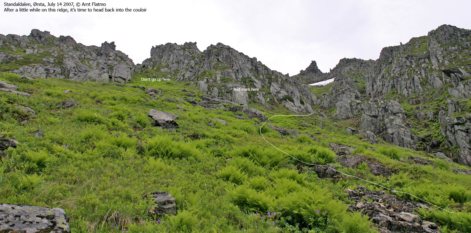
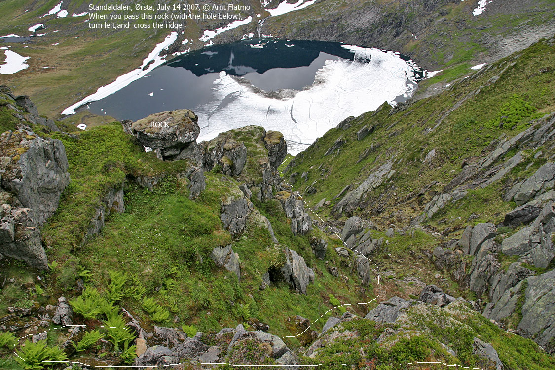
The couloir wasn't hard to ascend, but the terrain called for some respect. A slide could easily make the day a bad one. There was no one above me, which was good. So I didn't have to worry about rockfall. I came up to an intersecting cliff, and I could go either left or right. I went left, and that was wrong. Back down 50 vertical meters and then I headed into the main couloir, annoyed about not having looked for tracks left by the other group.
Once back on the right track, there were no more navigation errors, and Langenestinden summit was reached 12:45PM. The detour had costed me 10 minutes, and without it, I would have been there in 2 hours - my estimate at the trailhead. The height of the cairn was totally unnecessary, making a 360 degree panorama impossible. I put the dog in a safe spot (with a firm instruction about NOT to move) and had a look around. The ridge to Høgenipa looked awesome. Svein and Geir did this route in August 2005. Click here for the trip report.
Rain was obviously moving in, and I decided to get down from the mountain. Carrying a dog, likely to make a sudden shift in position, in this terrain was awkward. I never felt any discomfort upon ascent, but that sensation wasn't very far away, as I headed down the mountain. I felt a slight sense of relief when I reached the lake, because now it had begun raining. Troll was my hero of the day, walking all the way down from the lake. Probably YDS class 4 terrain, seeing it from the dog's point of view. We were back at the trailhead 17:40PM, approx. 1,5 hours after leaving the summit.
To Flatdalsvatnet


Up the mountain


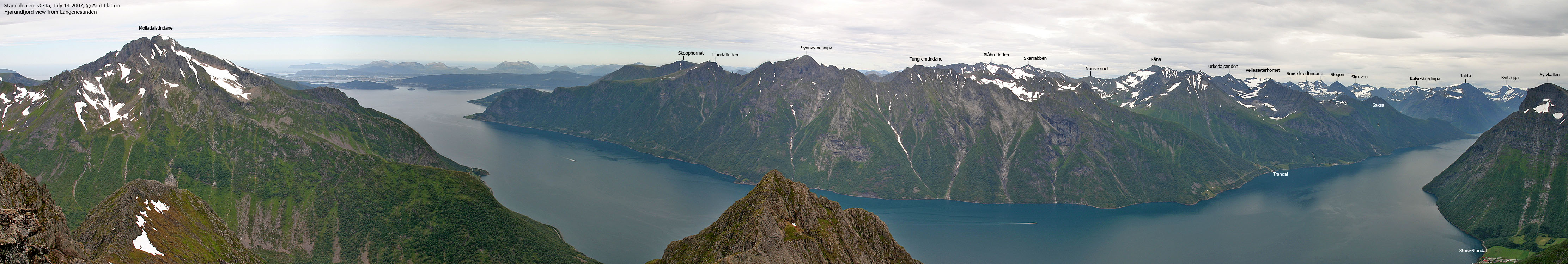
Wide-angle panoramas from Langenestinden


50mm panoramas from Langenestinden, 360 deg., 3 parts


Zoom panoramas from Langenestinden


Other pics from Langenestinden


No Javascript:
1 2 3 4 5 6 7 8 8 10 11 12 13 14 15 16 17 18 19 20 21 22 23 24 25 26 27 28 29 30 31 32 33 34 35 36 37
 westcoastpeaks.com
Other Møre & Romsdal mountains
Other Norwegian mountains
westcoastpeaks.com
Other Møre & Romsdal mountains
Other Norwegian mountains