Norwegian Mountains, Møre og Romsdal
Sætrehornet (Runde), Leinehornet and Leinebjørnen (Leinøya), Feb 5 2012
To the main Runde and
Leinøya page (maps, pictures, other trip reports)
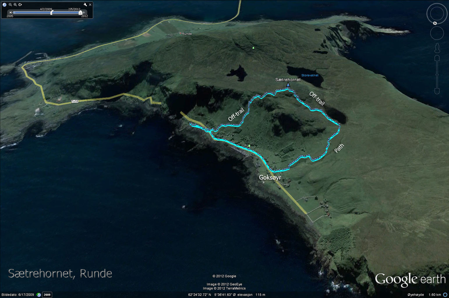
Sætrehornet (230m) - Runde

My round trip route across Sætrehornet

(Click for larger image)
Sætrehornet was one of the very last named tops in the municipality of Herøy which I hadn't been to, and on this Sunday, I decided to wipe the top off my to-do list. I drove to Runde island, parked at the Goksøyr parking and headed (off-trail) straight up to Sætrehornet. The ascent was steep, but never exposed.
It is always nice to come to Runde, and I promised myself to come here more often. There is so much to explore on this island. On most maps, this top is called Storehornet, but Økonomisk Kartverk states that the highest point is called Sætrehornet and that Storehornet is a lower viewpoint - in the direction of Goksøyr.
Taking in the views

(Click for larger image)
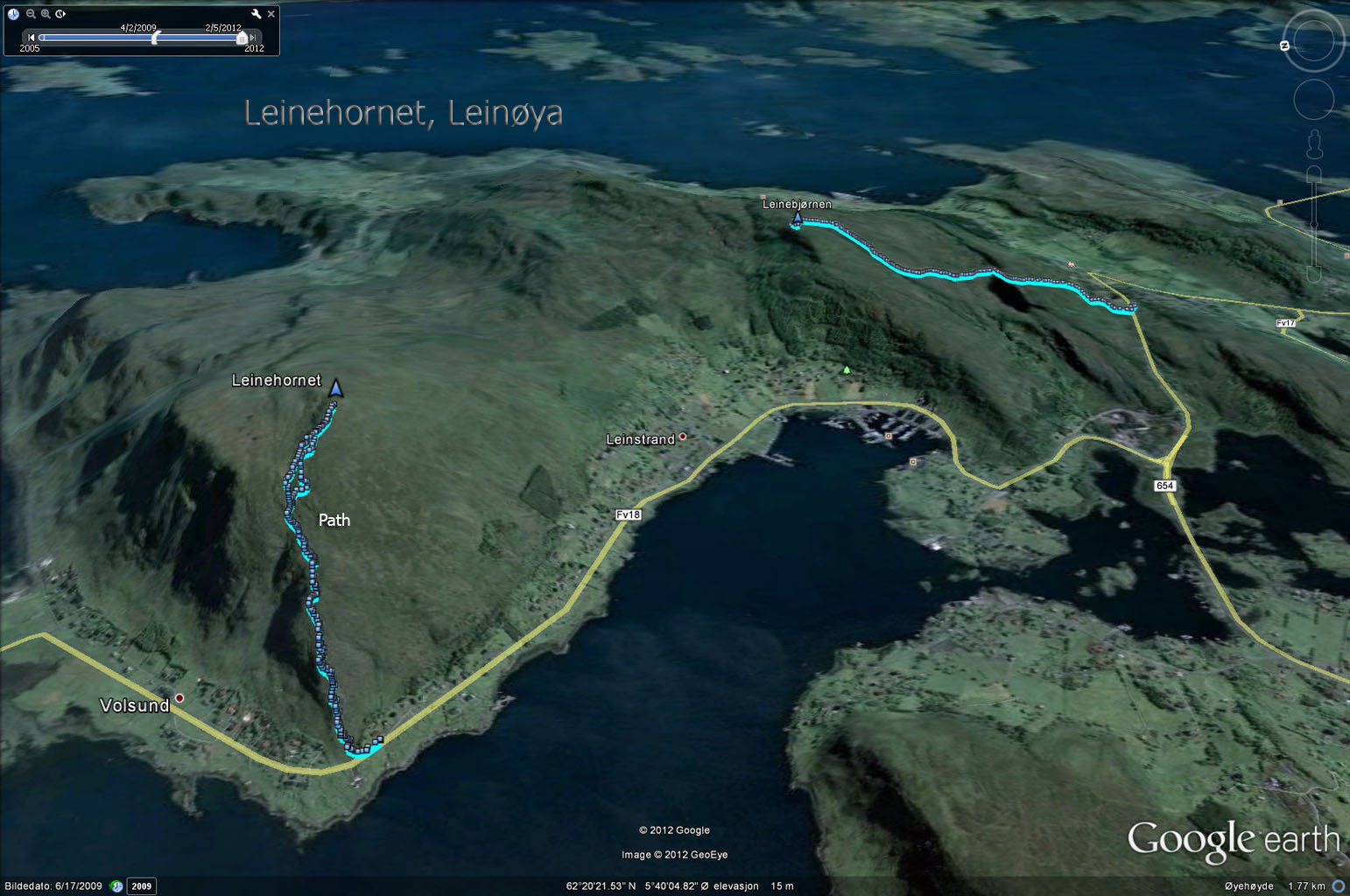
Leinehornet (366m) - Leinøya
After having been to Runde, I decided to do a quick hike from Volsund and up to Leinehornet. I really, really like this route. Partly because the views from Leinehornet are fantastic, but also because this ridge route is quick!
The route from Volsund to Leinehornet

(Click for larger image)
The wind was really ... aggressive ... on this Sunday, and I found myself holding on to my hat on the way upwards. But the sun was shining, and I looked forward to take panorama pictures from the top. And once the pictures were in the bag, I hurried back down.
Hareidlandet seen from Leinehornet

(Click for larger image)
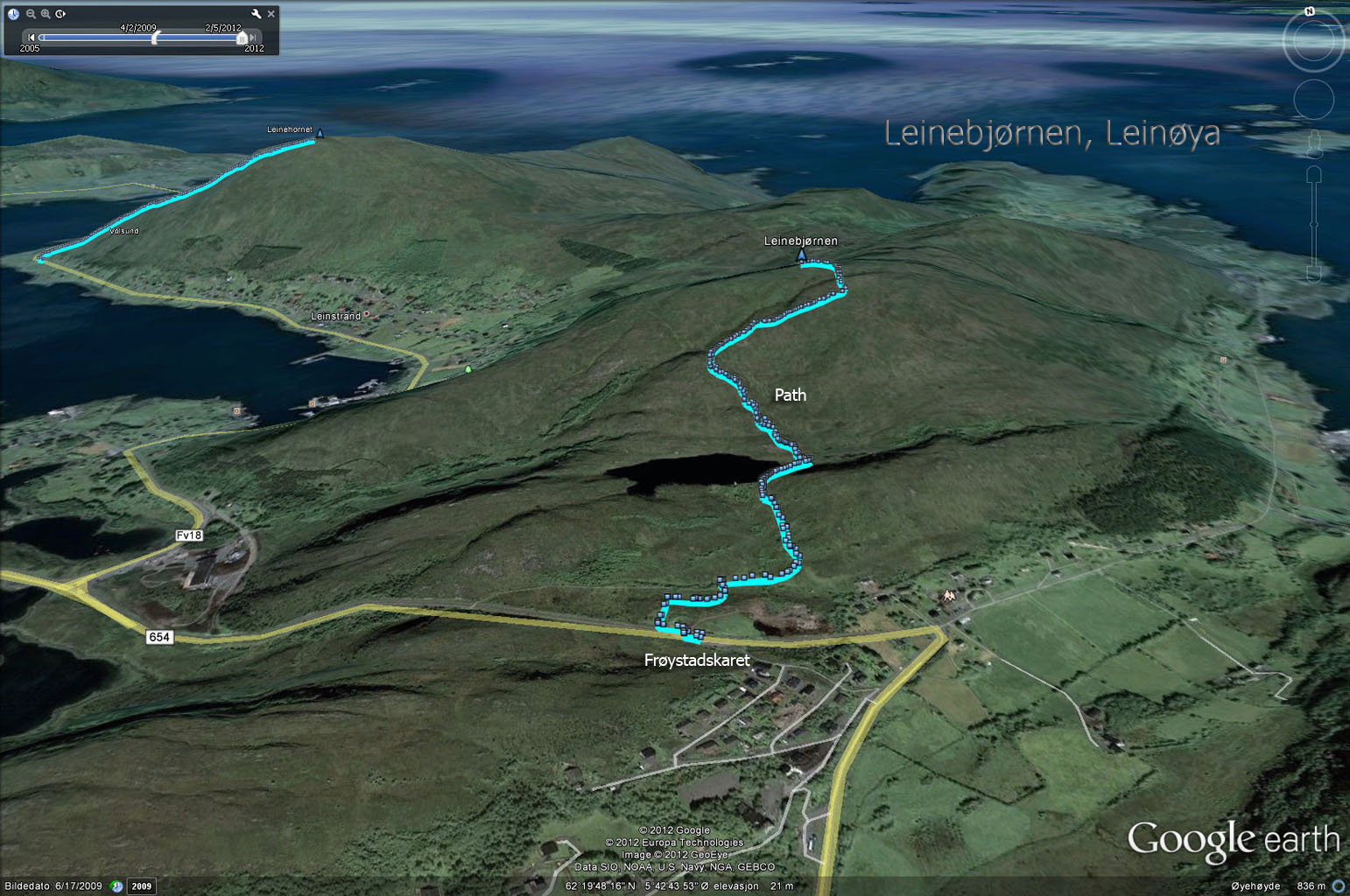
Leinebjørnen (271m) - Leinøya
I was sort of happy with two coastal tops, but now that I was out here - I decided to hike the route from Frøystadskaret to Vardeheida and Leinebjørnen. This was a route that I hadn't done before.
The route from Frøystadskaret to Leinebjørnen

(Click for larger image)
This was also a quick hike. It took me only 40 minutes to Leinebjørnen (via Vardeheida) and back. Even if this was a lower top than Leinehornet, I liked the views a bit better. There was nothing between me and the string of mountain tops from Nordøyane to Stadlandet that obscured the view.
Sunlight hits Moltudalen

(Click for larger image)
A bit later in the evening, I hiked Huldrehornet. What was supposed to be a "lazy day" ended up with 1200 vertical meters in total...


