
Norwegian Mountains, Sogn og FjordaneMolden, 1121m
|
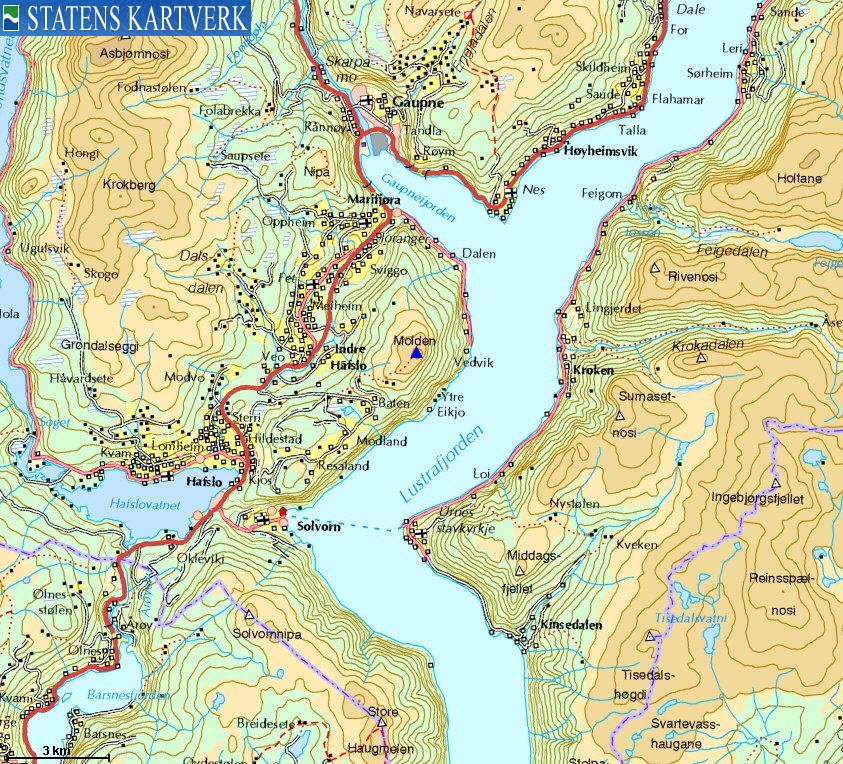
| Fylke/Kommune : | Sogn og Fjordane/Luster | ||||||||||||||||||||||
| Maps : | 1417-IV Solvorn (Statens Kartverk, Norge 1:50 000) | ||||||||||||||||||||||
| Primary factor : | 808m | ||||||||||||||||||||||
| Hiked : | Dec 2009 | ||||||||||||||||||||||
| See also : |
| ||||||||||||||||||||||
| See also : | Other Sogn og Fjordane mountains on westcoastpeaks.com |

Molden seen from the air
(Click for larger image)
Molden is one the finest viewpoints along Lustrafjorden - an arm of Norway's longest fjord - Sognefjorden. The mountain is popular in all seasons, and in addition to the mountains surrounding Lustrafjorden, you have (a.o.) view towards the Hurrungane mountain range, the Jostedalsbreen and Fresvikbreen glaciers.
A marked path runs up the south ridge, passing the Skjødnaklanten viewpoint (view towards Indre Hafslo) and the old mountain farm Svarthiller along the way. There is a transformation station on the summit, while the Molden cairn is found 200m northwest of the high point. The interesting question is why the cairn has put so far away from the summit - AND one of the finest viewpoints in this region. Especially since it is tempting to assume that the cairn was built before the transformation station.
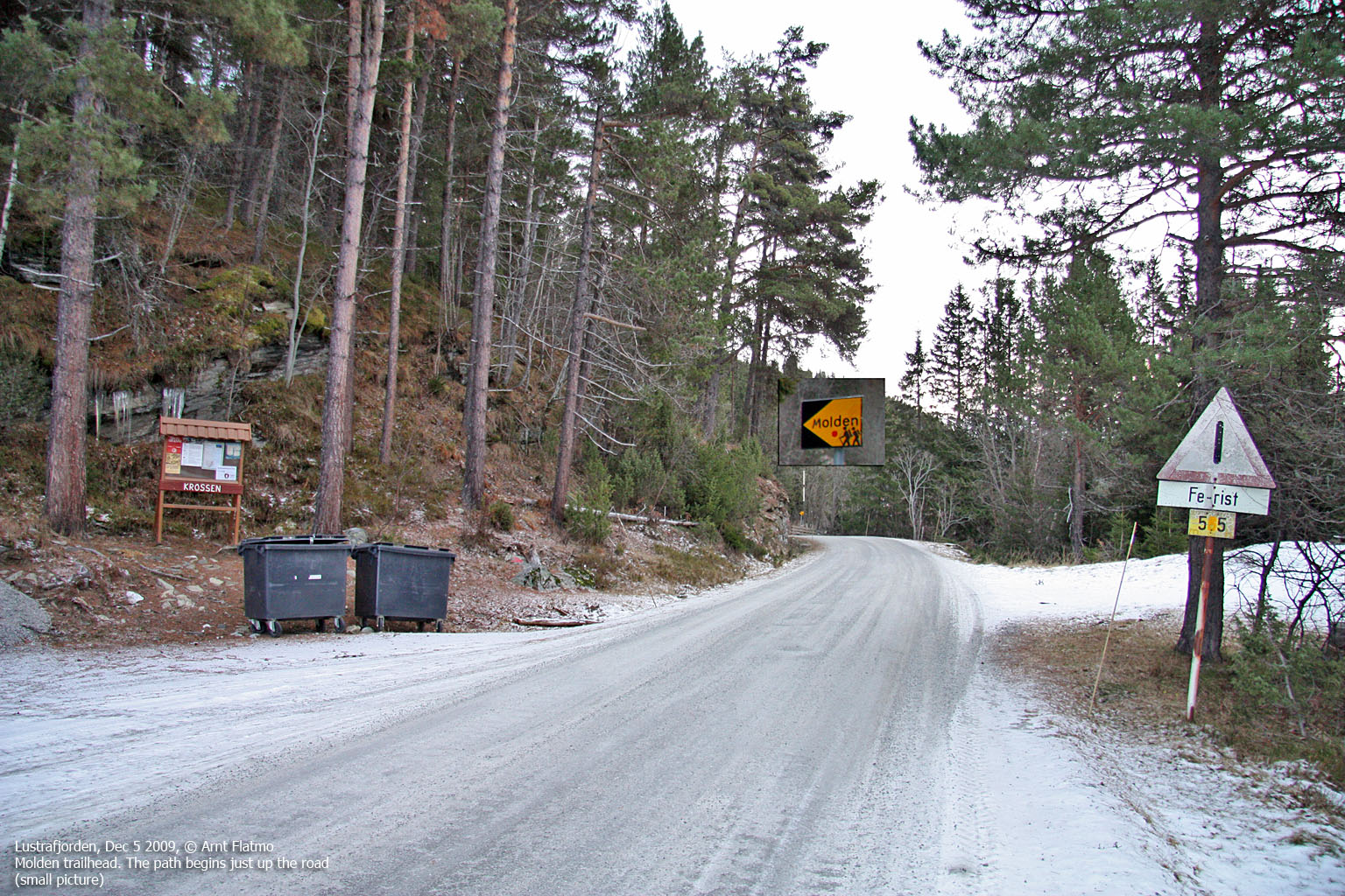
Molden can also be hiked from Marifjøra. Look for this signpost at Marifjøra.

Molden seen from the air
(Click for larger image)
Molden (Norge 1:50,000: 1120m contour, Økonomisk Kartverk: 1120 contour ~ 1121m, UTM 32 V 410111 6802286) has a primary factor of 808m towards the higher parent Krokberg (1356m). The defining saddle (approx. UTM 32 V 404624 6801152) is found near Heggmyrane. Ref. Økonomisk Kartverk (5m contours), the saddle is within the range 310-315m, interpolated to 313m.
GPS measurement read 1124m (on the ground), averaged over a 10-minute period (error margin +/- 2,4m). The height 1121m was set for this web page in accordance with Petter Bjørstad's primary factor list of Sogn og Fjordane mountains. On the 1:50,000 map, the official height is 1118m, but Økonomisk Kartverk shows that there is a 1120m contour here.
The Molden cairn is located 200m to the west. This point is defined as 1114m on the official maps. GPS measurement on this point read 1118m (on the ground), averaged over a 5-minute period (error margin not recorded).

The Molden cairn
(Click for larger image)
Google's interactive map. You can zoom, pan and click on the markers.
|
|
|
|
Route 1: Molden from the south (summer/autumn)
|
|
This route description is valid per Dec 2009
Access
(all distances are approx. distances)
The nearest bigger town is Sogndal (has an airport). From Sogndal, follow highway RV55 (Sognefjellet, Lom) to the north. Not too long after passing Lake Hafslovatnet (on your way to Gaupnefjorden), turn right towards Mollandsmarki (signposted). Follow this road 2,4km until you reach the Molden parking.
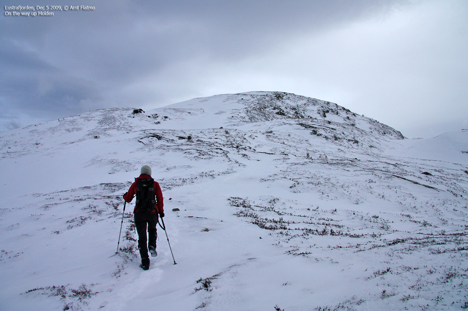
The route
From the parking, follow the road 50m to the east until you see the Molden signpost. Follow this path to the east until you intersect with the forest road from Baten (this is the winter route). Follow the forest road towards the north and stop by the Skjødnaklanten viewpoint. Continue up the forest road until it ends, and then proceed along the marked forest path.
At approx. 870m, you reach the Svarthiller mountain farm. From here, follow Molden's southwest ridge up to the high point (next to the transformation station). If you will, stop by the Molden cairn 200m to the northwest and sign the visitor's register (if it is present). Descend your ascent route.

On the Molden summit plateau
(Click for larger image)
|
|


