
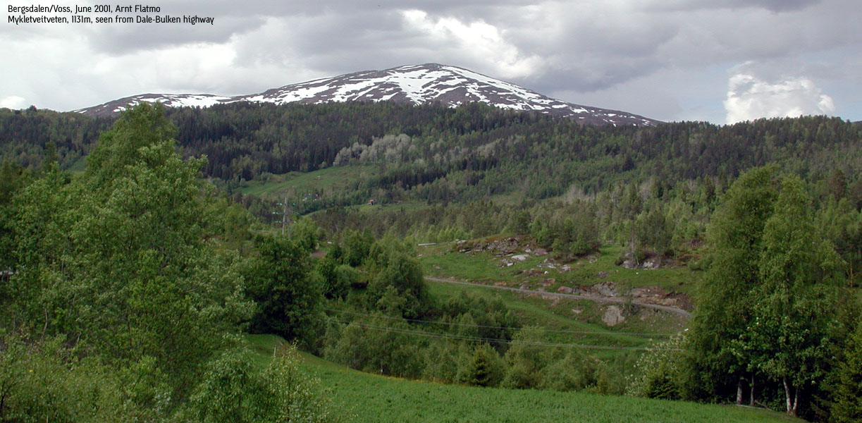
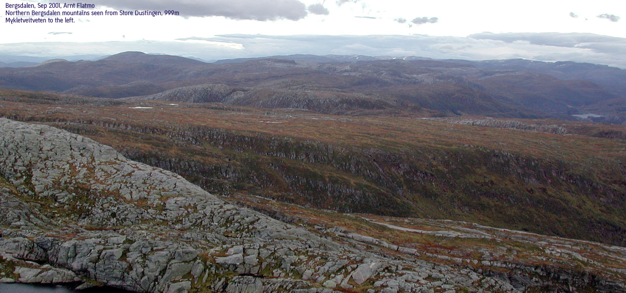
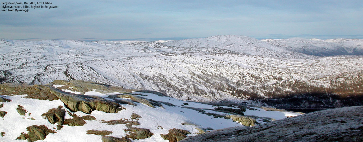
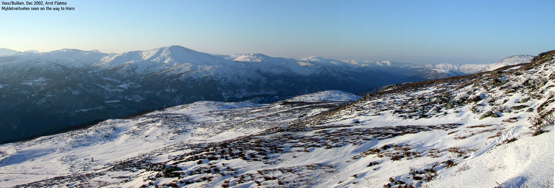
Mykletveitveten, 1131m
|
 Mykletveitveten seen from Styveshorgi |
Access (Alexander Grieg):
On highway E16 Bergen - Voss, from Dale or Bulken (near Voss) take the former main highway over Hamlagrø On the western side of lake Hamlagrø, look out for a sign to "Alexander Grieg Hytten" (hut). There is parking near the sign.
Access (Hatlestad):
On highway E16 Bergen - Voss, from Dale or Bulken (near Voss) take the former main highway over Hamlagrø At Hatlestad (16Km from Dale), locate a small farm road that begins, heading north. There is a large farm at the beginning of the road. You may park on the roadside.
The Alexander Grieg trail:
|
Follow the signs to the Alexander Grieg hut, and locate the trail that runs next to a couple of cabins, before you head on north through wet terrain, incl. river crossing. The trail takes you up to the Kvanngjelet pass. At the top of the pass, turn right and walk to the top of Hamlagrøhornet (1080m). Then, continue over Hamlagrøsåta (1070m) and set course for the east side of Mykletveitveten (1131m). There are no trails to follow here, but the direction is pretty obvious. Ascend Mykletveitveten from the east, the lesser steep side. From the top, find a pass and head south, or go back down same way you came. You will pick up a trail east of Hardfjellet. The trail takes you by Lonaselet hut before you rendevouz with the Kvanngjelet pass.
The Hatlestad trail Pass the farm on your left and continue on the gravel road which turns into a forest trail just after the second house. The trail runs up the Hatlestadlii valley, and after approx. 5,5km the trail leaves the forest and enters open terrain at approx. 650m. Before the valley ends, one walks along side a fierce river. There is a bridge over this river at the top of the valley, in case you want to cross over. From Lonene, the trail becomes faint, but just continue in NE direction over Hardfjellet (905m). From Hardfjellet, you see the lower parts of Mykletveitveten, indicated by a standing rock at approx. 1020m. From this point, you see the main summit a little further NE. |

|
Notes:
The Alexander Grieg approach is a long hike. Plan 6-7 hours all together.
Beautiful view from Hamlagrøhornet towards
the Bergsdalen and Gråsida mountains around Voss. Expect lots of sheep at the Lonaselet hut in summer.
I hiked the Hatlestad trail rather quickly. I reached point 1020m in two hours. I didn't go to the summit this time, as my target was Blåsåta in the west.
Hardfjellet is probably the least significant mountain in Norway, but it's on the map, it has a name, and I've been there. I was actually standing on top of Hardfjellet, wondering where it was. So I mistook the lower parts of Mykletveitveten for being Hardfjellet. But *then* I took out the map.
Various pictures: (move cursor to read notes, and click on the images to see full version)
Some of the thumbnails may have been cropped to fit the format


 Other hordaland mountains
Other Voss K. mountains
westcoastpeaks.com
Other hordaland mountains
Other Voss K. mountains
westcoastpeaks.com