
|


Nystøylhornet is the northernmost top on a peninsula defined by Syvdsfjorden, Hallefjorden, Haugsfjorden and Vanylvsfjorden. Its characteristic top is easily recognized from great distance. Although Nystøylhornet has a prominent appearance, it is among the lower Vanylven mountains.
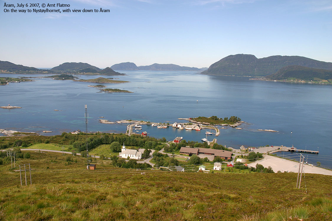
This coastal peak is easily reached on path from Åram. There is no forest, no steep sections and no difficulties. You'll enjoy the views, and perhaps recognize Gjegnen (Blånibba), Bukkenibba, Ålfotbreen, Plogen, Saga, Keipen and Hornelen in Sogn og Fjordane, as well as Jønshornet, Saudehornet, Slogen, Trollvasstinden, Felden and Klakken in Møre og Romsdal. The panorama is quite extensive.


Nystøylhornet (Norge 1:50,000: 600m, Økonomisk Kartverk: 599,96m, UTM 32 V 316684 6899028) has a primary factor of 382m, towards the higher parent mountain Store Krokhornet (654m). The saddle (approx. UTM 32 V 317083 6896053) is found at the west side of Lake Sandvikvatnet. Ref. Økonomisk Kartverk (5m contours), the saddle height is within the range 215-220m, interpolated to 218m.
Google's interactive map. You can zoom, pan and click on the markers.
Notes: Class ratings are in reference to YDS. Click here for more information.
The trails described below are not necessarily the *easiest* trails to this mountain.
|
Åram - Nystøylhornet (summer/autumn)
|
|
Access
(all distances are approx. distances)
The nearest larger city is Ålesund. From Ålesund, follow highway E39 towards Bergen, and then RV61 towards Hareid. Take the Sulesund - Hareid ferry, and from the roundabout in Hareid, follow RV61 3Km to a roundabout outside Ulsteinvik. Proceed 5,4Km along RV61 and make a sharp right turn (Måløy/Fosnavåg). Stay on RV61 2,9Km and turn left towards Måløy. Follow RV61 17,7Km to Larsnes. You can leave your car at Larsnes, unless you want to have a look around in the Vanylven region.
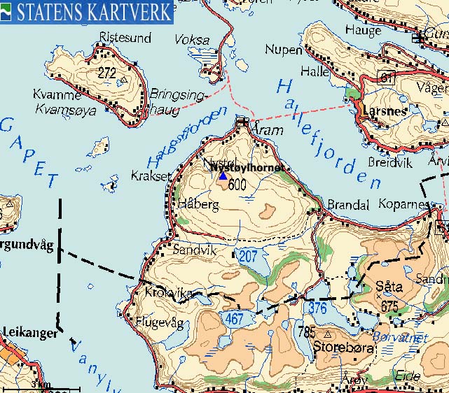
Take the Larsnes - Åram - Voksa ferry. At Åram, drive 280m and park by the church, UTM 32 V 317465 6901204.
The route
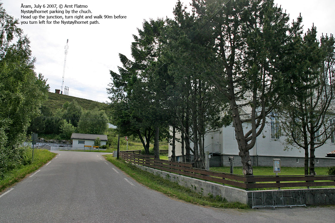
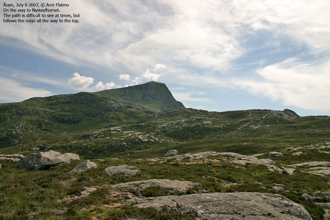
From the church , head up to the road (60m) and turn right. Walk 90m and turn left when you see the Nystøylhornet trailsign. Follow the path up the Aksla ridge. The path passes an antenna before turning southwest, towards Nystøylhornet. At 250m elevation, you get a better view up the mountain.
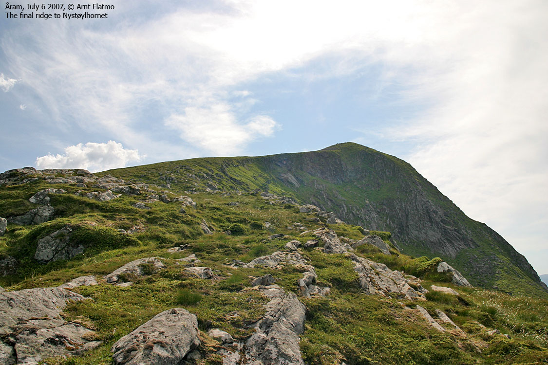
Ahead of you, the mountain ridge has a gap. You'll head into this gap before taking on the final ridge walk. You're in rocky terrain, but the path runs on slick rock or grass. The path is (at best) vague up the final hill. A proper cairn marks the top of Nystøylhornet.
 westcoastpeaks.com
Other Møre & Romsdal mountains
Other Norwegian mountains
westcoastpeaks.com
Other Møre & Romsdal mountains
Other Norwegian mountains

