
|

Olsskavlen seen from Seldalsnuten |
"Fairly" official, Olsskavlen is the highest point in Voss and Granvin Kommune. Between Voss and Granvin, there is an ongoing debate. Granvin Kommune says that the Kommune border runs just north of the summit. As all summit points on the Raundalsegga ridge (which includes Horndalsnuten, Skipadalsnuten, Seldalsnuten and Nordbotnnuten) are on the Kommune boundary, it would make sense if this applied to Olsskavlen too. On the other hand, the M711 map shows that the trig. point (which may be the summit) is just south of the Kommune border. On my GPS vector-based map, the Kommune border is 54,1m north of the summit. The deviation is almost zero for the the other peaks on the ridge, so speculation is valid. But for all practical purposes, until new information appears, I consider Olsskavlen the highest point in Voss and Granvin Kommune.
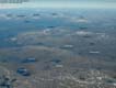
In addition to the great regional views that you get from this ridge, you can also see Hurrungane from Olsskavlen. The shape of Store Skagastølstind in center is easy to identify, although the mountain is nearly 110Km (direct line) away. On the high peaks in this region, you have view towards three major glaciers; Hardangerjøkulen, Fresvikbreen (Sogn and Fjordane) and Folgefonna.
Reaching Olsskavlen from Raundalen is a fairly easy hike. As it takes 3,5-4 hours of hiking to the summit, you should be accordingly fit. If you are exceptionally fit, you may also include Seldalsnuten on your hike. There is also a possibility of making a long round-trip which includes Seldalsnuten (which means you don't have to go back to Olsskavlen), but the route described on this page applies to Olsskavlen only.
Primary Factor
Olsskavlen has a primary factor of 586m towards the higher Skorafjellet. The saddle is found E of Nordbotnnuten, in Fallet. The last adjacent 20m contour lines on the M711 map are 1000m. The saddle height has been interpolated to 990m.
Note: Class ratings are in reference to YDS (Yosemite Decimal System).
Note: The trail described below is not necessarily the easiest trail to this mountain.
|
Voll - Olsskavlen (summer/autumn)
|
|
Access
From Bergen, follow highway E16 towards Oslo. From the central traffic light in Voss, drive straight ahead (towards Gjernes, not Oslo). Drive approx. 1.8Km and turn right onto highway 13 (towards Granvin/Bruravik). Follow this road for approx. 700m and turn left towards Mjølfjell. Follow the Mjølfjell road for approx. 20,3Km. You should now see the road down to "Reime St." on your right. Continue on the main road for yet another 3Km (rough estimate, not based on odometer!). You have now passed the buildings at Voll (and a "Voll" sign on a house on the right hand side of the road). Continue until you see a pile of wood on the right hand side of the road. There is a fee parking here. Alternatively, park a little further up the road on smaller turnouts.
The route
The trail begins at the fee parking, continues down through two gates before you cross the river over the bridge. Just after the bridge, the trail forks into two trails. Take the right (the left goes back to the river, further up). Continue for 10 minutes (700m) and when you're close to another river, the trail forks again. Take the left trail. This trail is partially T-marked, but is very visible.
The trail continues up to Vollseter huts. At Vollseter, go towards the first hut on the righthand side. Find the bridge just behind the hut, cross the river and pick up the trail on the other side. This trail is difficult to follow. Basically, you're heading in the same direction as the bridge points, straight up to Tungefjellet mountain. Aim for a square-shaped rock at the top of Tungefjellet.
Once up, the route up to Olsskavlen is pretty obvious. Follow the ridge that runs on the left-hand side, or head straight for the permasnow that runs all the way down. On top, first you get to the cairn that marks the triangular point, and immediately after, you get to the top cairn.
It took me 3 hours up and 1.5 hours down. I chose to follow the permasnow from the foot of the mountain rather than hiking on rock further left. If you follow the snow, it's pretty steep from 1150m to 1450m. The view from the top is spectactular. Grand view towards the Hardangerjøkulen in the east, and towards Lønahorgi and Stølsheimen in the northwest. Also, you see Folgefonna glacier in the south, but bright sunshine blocked my view towards south that day.
On my way down, I chose to slide down the snowfield with Troll in my lap. This was the first time I ever done a long snowfield like this, and pretty soon things got slightly out of control. Using my feet as brakes sent me off in a spin, and I was moving down the snowfield pretty helpless. Just before I reached the boulder at the end of the snowfield, I managed to rotate and hit the rocks with my backpack first. And just meters before I hit the rocks, I pushed Troll backwards. Then I could capture him as he followed a fraction of a second later. The poor guy was pretty confused, and I decided to be careful with snowfields in the future.
Move cursor to read notes, and click on the images to see full version.
Some of the thumbnails may have been cropped to fit the format.
Pictures are presented in the order they were taken.
I had a "use-once" camera, and the pictures are of bad quality


 Other hordaland mountains
Other Granvin K. mountains
Other Voss K. mountains
westcoastpeaks.com
Other hordaland mountains
Other Granvin K. mountains
Other Voss K. mountains
westcoastpeaks.com

