
|


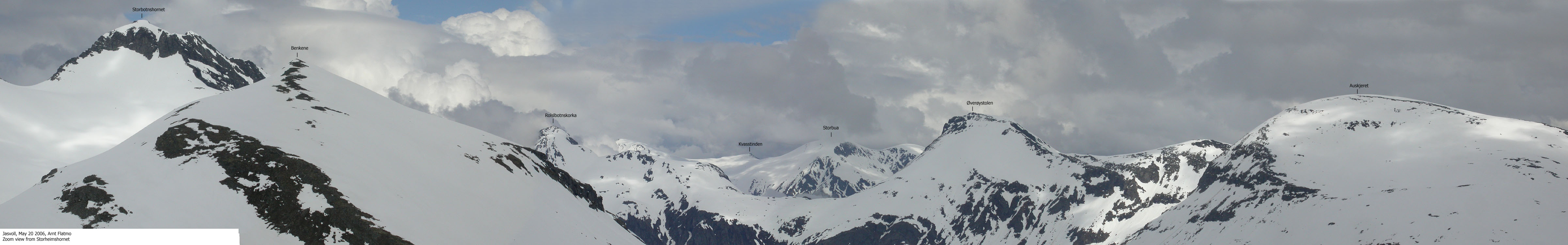
An alpine mountain range rise above the Jasvollbotnen valley floor. Lauparen is the highest of the tops in this range, while Øverøystolen is the second highest. In this region, Øverøystolen is locally known as Stolen - The Chair. Other fine tops on this mountain range are (a.o.) Storbotnshornet, Rollsbotnskorka and Brudefølget. This mountain range dominates the region defined by Storfjorden, the Vaksvik - Tresfjorden road, the Øvstedal (Tresfjord) - Øverøye pass, and the road between Stordal and Øverøye.
While Øverøystolen is a dominating mountain in this region, it is not among the highest 10 tops in Stordal kommune. Seljebottinden (1531m) is the highest top, and 11 mountains exceeding 1400m (with 100m as the primary factor minimum) are also higher than Øverøystolen.
Øverøystolen is visited both in summer and winter. A direct ascent from Øverøye, up the east ridge, is the most used route. You can also asend via Kollen and the south ridge, and in summer, it is not uncommon to ascend via the north ridge - perhaps visiting Rollsbotnskorka and Øverøystolen on the same hike.
Various maps and signs differ in the use of "Øverøye" vs "Overøye". This web-site only adds flavour to the confusion, by using both on various pictures.

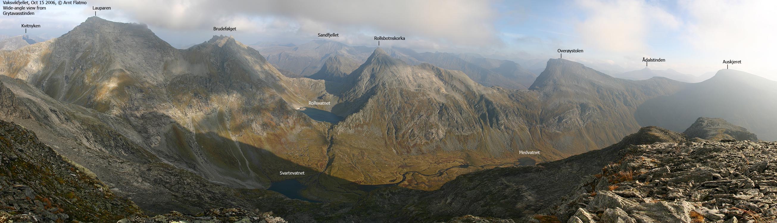
Øverøystolen (Norge 1:50,000: 1393m, Økonomisk Kartverk: 1392.94m, UTM 32 V 405919 6923452) has a primary factor of 483m, towards the higher parent Lauparen (1434m). The saddle (approx. UTM 32 V 404998 6925667) is found between Brudefølget and Rollsbotnskorka. Ref. the Norge 1:50,000 map (20m contours), the saddle is within the range 900-920m, interpolated to 910m.
Kollen has no map height, but according to the map, Kollen's height is between 1220 and 1239m. For internal use, this web-site operates with 1237m as height for Kollen. 1237m is a result of interpolation between average samples on top, and from the track profile. The interpolation result was 1241m, and 4 meters have been subtracted for snowdepth and GPS error margin.
Google's interactive map. You can zoom, pan and click on the markers.
Notes: Class ratings are in reference to YDS. Click here for more information.
The trails described below are not necessarily the *easiest* trails to this mountain.
|
Øverøye - Øverøystolen (winter traverse, on skis)
|
|


Access
From Ålesund, follow highway E136->E39 towards Åndalsnes. From the E136/E39/Olsvika roundabout near Breivka, follow E39 approx. 28Km to the RV650 junction just after Sjøholt. Turn right onto RV650 (Geiranger/Stordal) and drive approx. 25,1Km (passing the place Stordal) and turn left towards Overøye. Drive 9,7Km to the parking area at the ski-resort. There may be a parking fee when the resort is open.

The route
Ascent
From Øverøye, follow the slalom trek westbound to Lake Heimste Øverøyvatnet (761m). Traverse the hillside north of this lake and rise gradually northwest to Kollen. From Kollen, descend to Øverøystolen's south ridge on a gentle slope. Øverøystolen's south ridge is a bit airy, and on a icy surface, crampons are mandatory. In good snow conditions, experienced skiers may choose to ski up this ridge. Proceed up to the plateau, and head northbound to the Øverøystolen cairn.
Descent
Locate the entry point to the east ridge. Be very careful not to begin your descent too far to the north, where you will find overhanging cornices and a steep drop. UTM point 32 V 405952 6923368 can be a useful reference as the ridge entry point, in case of poor visibility.
The upper hillside on the east ridge is steep, and may become dangerous in icy conditions (slide). Evaluate the snow conditions and potential avalanche danger. The optimal direction is southwest, towards Fremste Øverøybotnen, and above the river. Once on the south side of the river, proceed southwest through open birch forest, down to the main road.
 westcoastpeaks.com
Other Møre & Romsdal mountains
Other Norwegian mountains
westcoastpeaks.com
Other Møre & Romsdal mountains
Other Norwegian mountains

