
Norwegian Mountains, Møre og RomsdalRaudtua, 590m
Raudtua seen from Sjurvarden
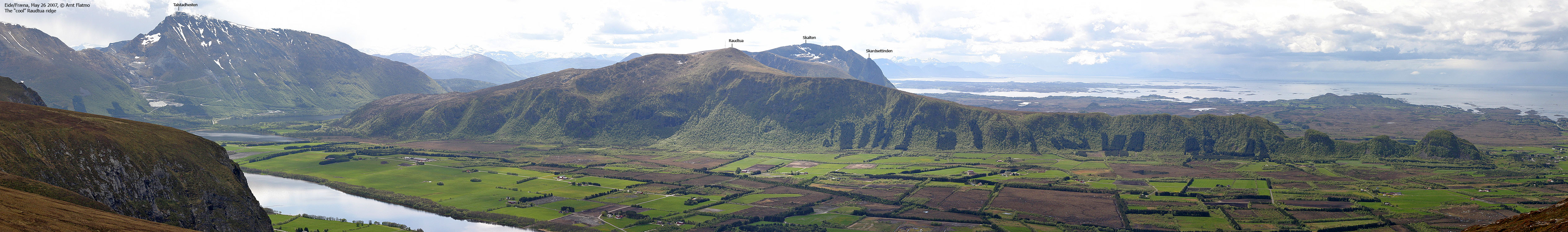
IntroductionRaudtua is the highest point on a long ridge that rises up from Hustadvika bay, infamous for its rough sea. Raudtua is Skalten's neighbour, and these two tops form a standalone mountain massif northwest in the municipality of Fræna. Roads enclose this massif on all sides. Routes run up from all sides of the mountain, but the easiest and shortest route run from Lake Herskarvatnet and up the southeast ridge. This is the route described on this page, and is well suited as a family hike. The trail is well worn and well marked, there are no steep sections and normal hiking time is 1-1,5 hours. Primary factor:Raudtua (Norge 1:50,000: 590m, Økonomisk Kartverk: 590,13m, UTM 32 V 405926 6977847) has a primary factor of 392m towards the higher parent mountain Skalten (682m). The defining saddle (approx. UTM 32 V 406189 6975797) is found southeast of Herskarvatnet. Ref. Økonomisk Kartverk (5m contours), the saddle is within the range 195-200m, interpolated to 198m. Personal GPS measurement on Raudtua read 593m (1,5m error margin) as average over 5 minutes.
Google map
Google's interactive map. You can zoom, pan and click on the markers.
Trail descriptions
Notes: Class ratings are in reference to YDS. Click here for more information.
The trails described below are not necessarily the *easiest* trails to this mountain.
Access (all distances are approx. distances) From the city of Molde, follow highway E39 eastbound to the "Eide/Elnesvågen" junction (4,1Km from the roundabout near the Vestnes-Molde ferry). Turn left and follow RV64, pass the Tussen tunnel and pay toll on the other side (NOK 15,- for passenger cars per May 2008) and continue to Sylteosen (11,6Km) where you turn left in the "Bud/Eide/Elnesvågen" junction. Follow highway RV663 15,5Km and turn right towards "Hustad". Drive 6,6Km until you see the "Hustad/Stavik/Venås" sign. Don't follow any of these signs; turn right onto an unsigned gravel road (no toll per May '08) which you follow 2,6Km to the Raudtua trail head. Note that the gravel road is quite rough the last 400m. Consider parking by the waterwork and walk the remaining 400m up to the trail head. The route

The ridge route to Raudtua
Follow a tractor road 250m (parallel to the Herskarvatnet road), then turn left (signed) and follow a forest path up the forest. You'll follow a pipeline until you reach a ridge. Turn right and follow the ridge path (see picture above) all the way to Raudtua summit. The path is well worn and well marked. Raudtua summit is marked by a cairn. Note; You may find running water in a creek near the path.
Just follow the pipeline.
Pictures and Trip reports:
|


