
|

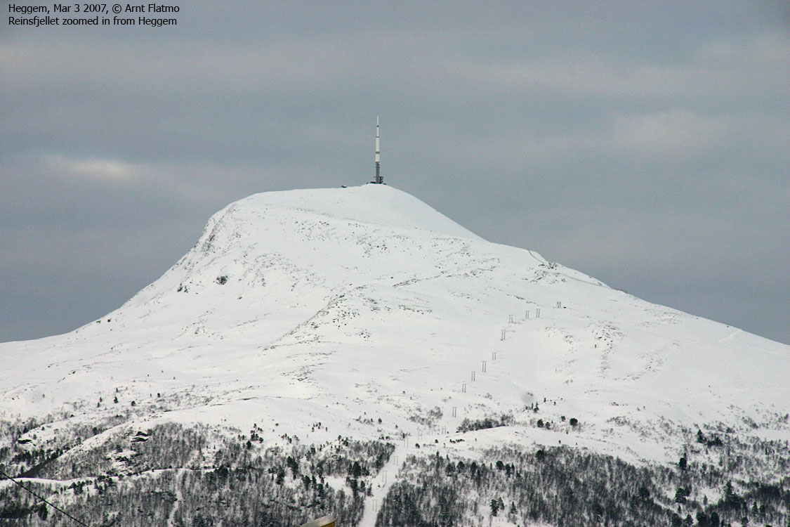
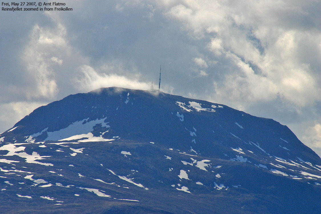
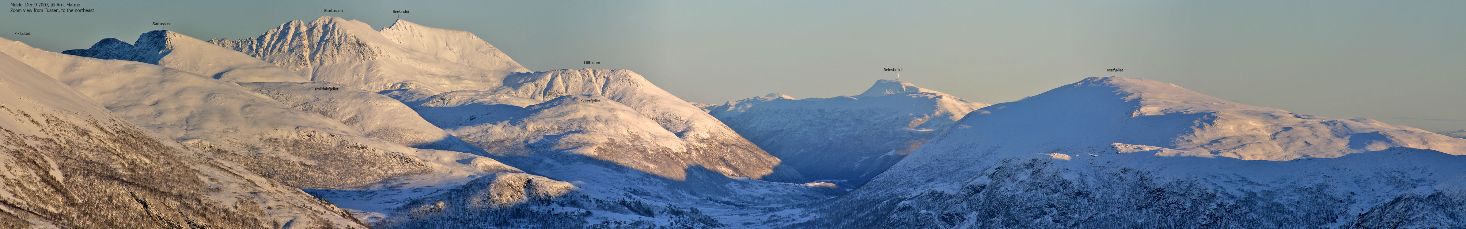
Reinsfjellet (Caribou Mountain) is through its height - one of the highest tops on the Moldehalvøya peninsula, and through the radio & TV mast on top - a landmark that can be identified from a much wider region. A mountain service road runs all the way to the top, making access quite trivial. The mountain is popular both in summer and in winter.
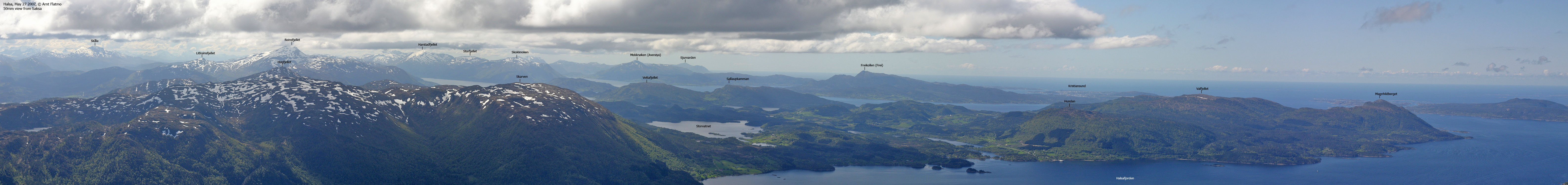
Reinsfjellet is the 3rd highest top in Gjemnes kommune (preceeded by Snøtinden, 1027m and Harstadfjellet, 1004m) and has the 2nd highest primary factor (preceeded by Snøtinden). The entire mountain is enclosed by roads, and Tingfjollfjorden and Batnfjorden meet north of the mountain.
Litlreinsfjellet (Little Caribou Mountain) is a smaller top which you pass on the way to Reinsfjellet. Although you pass its foothills, allow one extra hour for collecting this "bonus top". Litlreinsfjellet has a couple of cliffbands that are easily bypassed on the south side.


Reinsfjellet (Norge 1:50,000: 994m, Økonomisk Kartverk: 996,15m, UTM 32 V 445510 6978310) has a primary factor of 823m, towards higher mountains. The saddle (approx. UTM 32 V 444491 6973920) is found just south of the Reinsfjellet mountain service road. Ref. Økonomisk Kartverk (5m contours), the saddle is within the range 170-175m, interpolated to 173m.
Litlreinsfjellet (Norge 1:50,000: 703m, Økonomisk Kartverk: 702,86, UTM 32 V 446955 6976929) has a primary factor of 131m, towards the higher parent Reinsfjellet (996m). The saddle (approx. UTM 32 V 446065 6976780) is found between the two tops. Ref. Økonomisk Kartverk (5m contours), the saddle is defined through a fixed point - 572m.
Google's interactive map. You can zoom, pan and click on the markers.
Notes: Class ratings are in reference to YDS. Click here for more information.
The trails described below are not necessarily the *easiest* trails to this mountain.
|
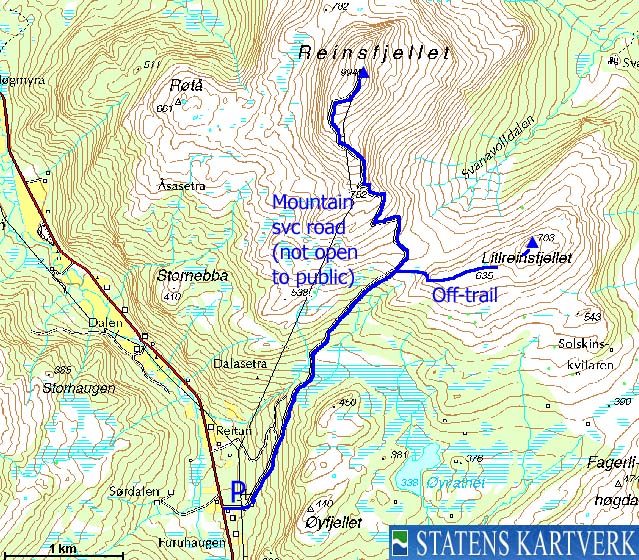
Reinsfjellet via the mountain svc. road (winter, on skis)
|
|

Access
From the city of Molde, follow highway E39 eastbound (Kristiansund). After 19-20Km, you reach the E39/RV62 junction, and you have two alternatives:
A: Turn left and proceed on E39. Drive to Batnfjordøra (36,7Km from Molde - 1st junction after the ferry) and turn right towards Angvika. Proceed on RV666 12,2Km to Torvikebukt. Turn right towards Heggem and drive 19,3Km. The mountain service road to Reinsfjellet starts from the top of a small hill and should now be on your left.
B: Turn right and proceed on RV62. Drive approx. 14Km and turn left towards Angvika. Drive RV665 9,5Km to Heggem where you turn left onto an unsigned road. Drive 2,5Km (along Heggemsvatnet) to Brekkskiftet junction. Turn left towards Torvikbukt and drive 800m. The mountain service road to Reinsfjellet should now be on your right.
Drive 100m up the road and find parking on the left-hand side.
The route
Reinsfjellet
The mountain service road requires no elaboration. It runs fairly straight up to the Litlereinsfjellet - Reinsfjellet pass, and begins to switchback up to the summit. On the top, you find a large antenna (mast) and a building.
Litlreinsfjellet
From the Litlreinsfjellet - Reinsfjellet pass (approx. 570m), head straight up to the nearest top. Stay south to avoid cliffbands. Once on the ridge, proceed 1,1Km eastbound to the summit. Again, stay south of cliffbands on the summit ridge. The summit is marked by a cairn. Descend your ascent route.


No Javascript:
1 2 3 4 5 6 7 8 9 10 11 12 13 14
 westcoastpeaks.com
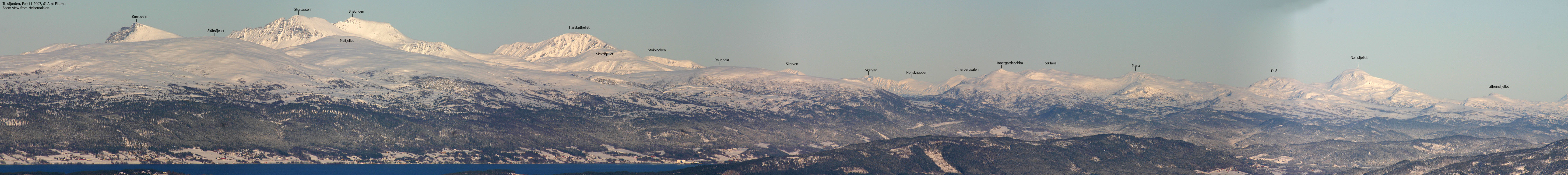
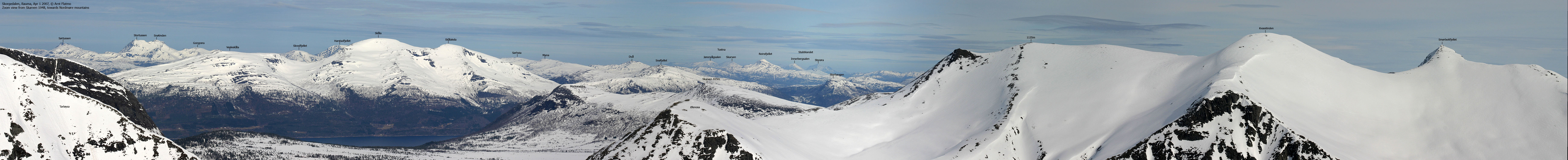
Other Møre & Romsdal mountains
Other Norwegian mountains
westcoastpeaks.com
Other Møre & Romsdal mountains
Other Norwegian mountains

