
Norwegian Mountains, Møre og RomsdalRoppehornet, 412m

Roppehornet seen from Godøya
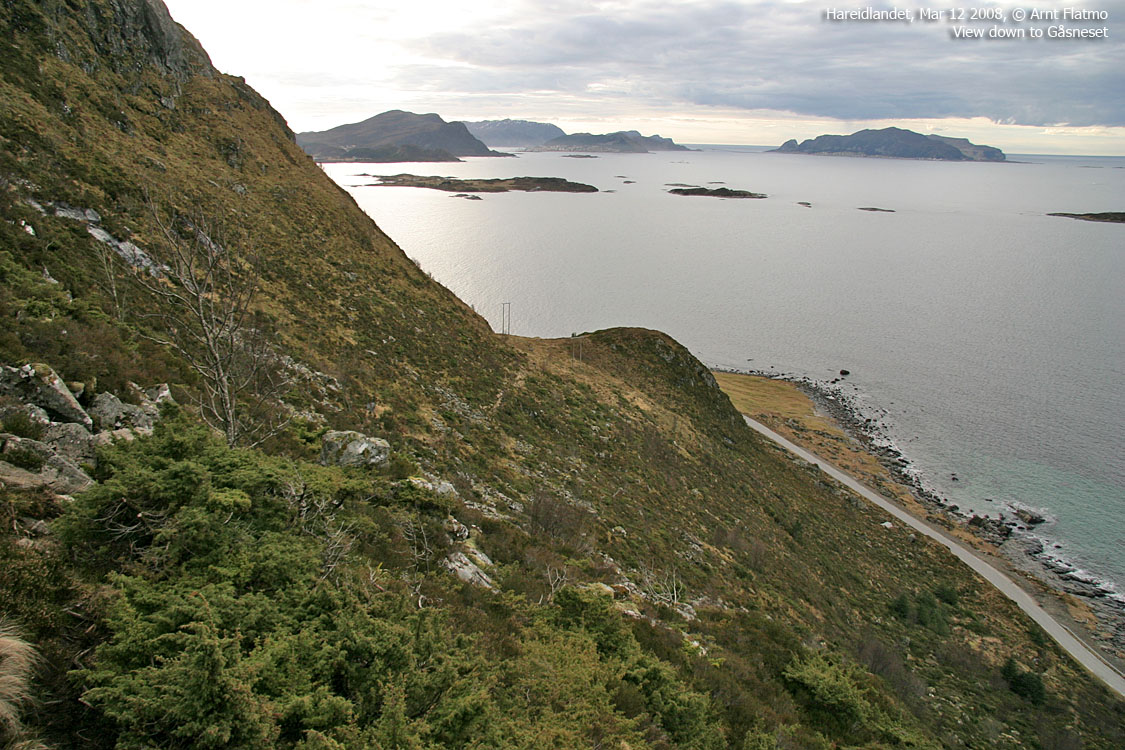
IntroductionRoppehornet is located on Hareidlandet island's west side. The top rises steep up from the Flø coastline and connects to the island plateau via Trollvassegga, Breidfjellet, Sarshornet and Brørne. The top is frequently visited. A road up Indreflødalen takes you up to Roppemarka, and Roppehornet is easily reached from road end. Alternatively (and recommended) is a nice path from Gåsneset, passing below Ulsteinhetta (323m) in the beginning. The coastal view is tremendous, but the island plateau blocks most of the view towards the Sunnmørsalpene mountain range. However, you can see the top of Kolåstinden, Åvasstinden, Bergehornet and Liahornet, to name a few. Primary factor:Roppehornet (M711: 412m, Økonomisk Kartverk: 412,36m, UTM 32 V 336754 6921463) has a primary factor of 45m towards the higher parent mountain Breidfjellet (534m). The defining saddle (approx. UTM 32 V 336782 6921213) is found 250m south of Roppehornet. Ref. Økonomisk Kartverk (5m contours), the saddle defined through a fixed point: 366,5m ~ 367m.
Google mapGoogle's interactive map. You can zoom, pan and click on the markers.
Trail descriptions
Notes: Class ratings are in reference to YDS. Click here for more information.
The trails described below are not necessarily the *easiest* trails to this mountain.
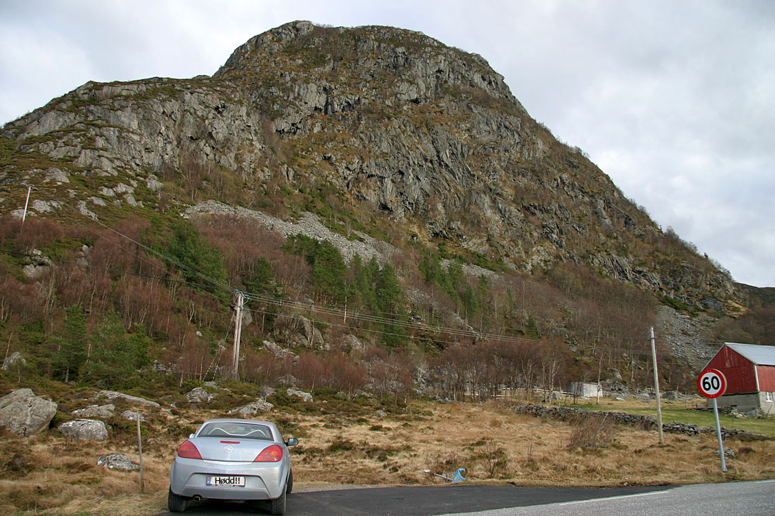
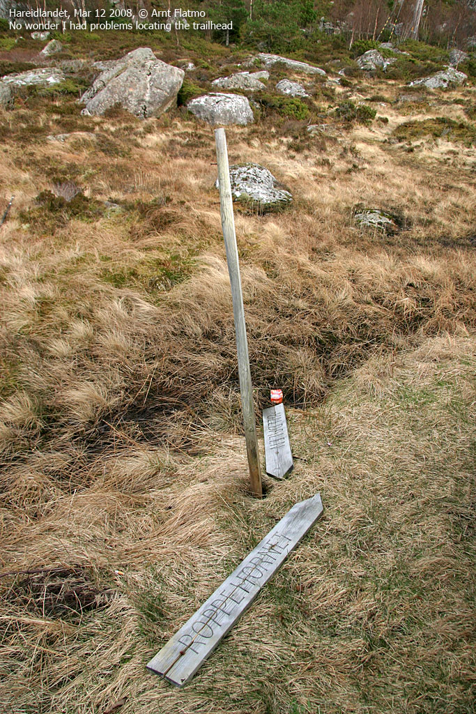
Access (all distances are approx. distances) From Ålesund, follow highway E39 towards Bergen, and then RV61 towards Hareid. Take the Sulesund - Hareid ferry. From Hareid, follow RV61 to the town of Ulsteinvik. In the middle of the town (1,8Km after you left RV61), turn right towards Flø (signed). Drive 4,2Km and locate a small pocket for parking just below Ulsteinhetta. Per March 2008, the Roppehornet trail sign was on the ground.
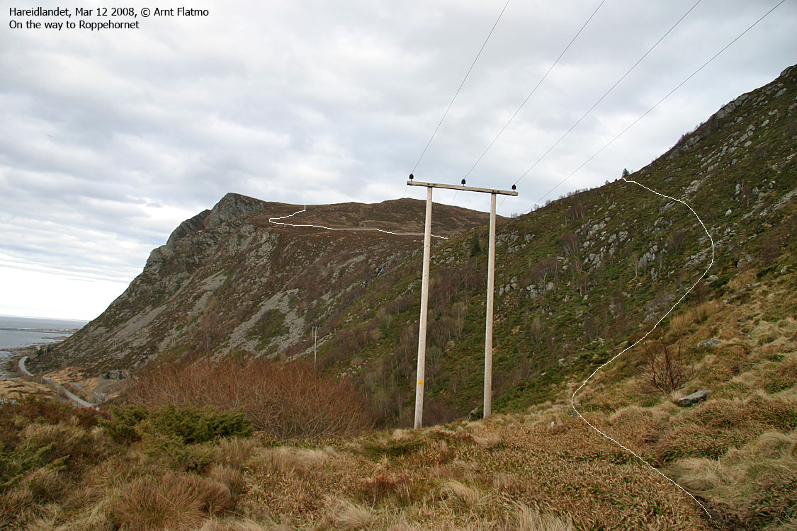
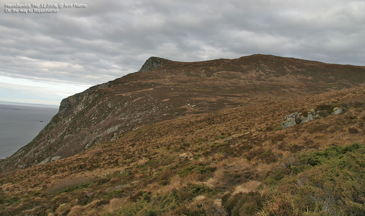
The route The path crosses Ulsteinhetta's north shoulder and traverses a boulder area eastbound towards Uldalen. In Uldalen (which can be boggy), you cross the creek at 180m elevation and begin the gentle ascent towards Roppehornet. The path runs along the edge of the cliffs. Roppehornet's high point is marked by a few bolts. You will find a visitor's register in a canister near the top. Descend your ascent route or follow the road down to Indreflø. Although the 4,2Km along the main road can be a discouraging factor.
Pictures and Trip reports:
|


