
|

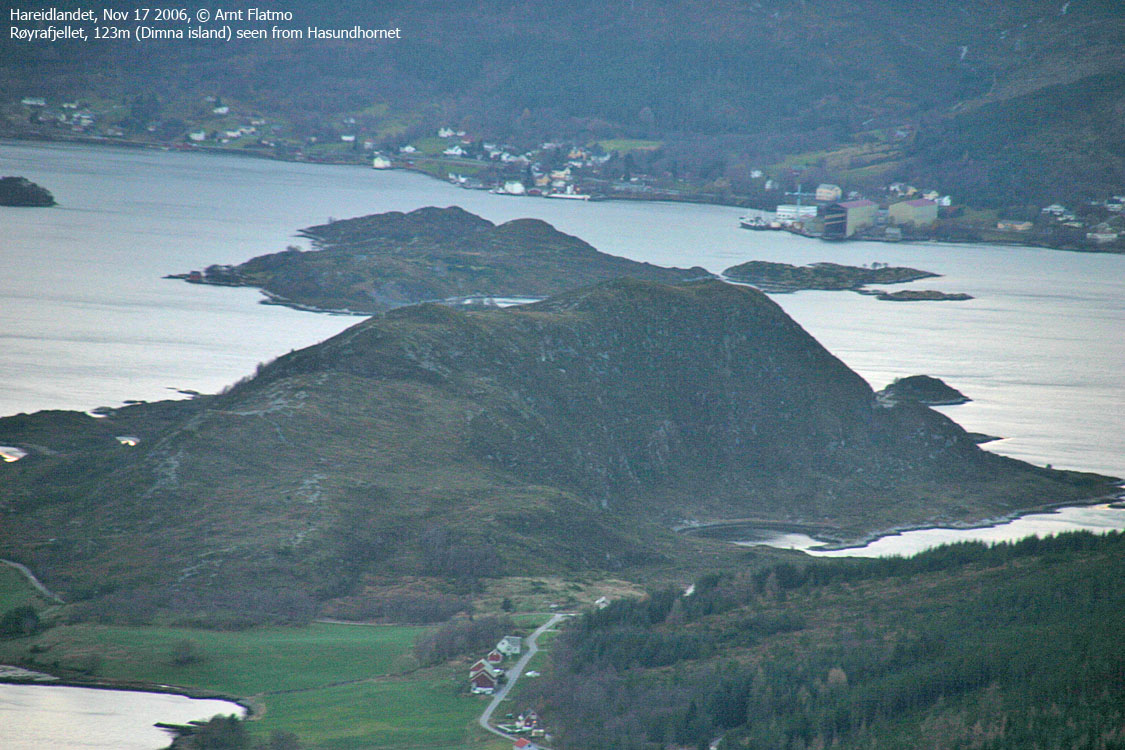
Røyrafjellet is found on the south side of Dimna island, located just southwest of Ulsteinvik. Although being a low, and fairly modest coastal top, the views are GOOD. A short, visible path runs to the top, which is (probably) regularly visited by people living on Dimna island. Or Dimnøya as the locals say.

Røyrafjellet (Norge 1:50,000: 123m, Økonomisk Kartverk: 123,13m, UTM 32 V 333290 6911720) has a primary factor of 100m, towards the higher parent Høgåsen (240m). The saddle is found in a road junction west of Ertesvågen. Ref. Økonomisk Kartverk (5m contours), the saddle is within the range 20-25m, interpolated to 23m.
Google's interactive map. You can zoom, pan and click on the markers.
Notes: Class ratings are in reference to YDS. Click here for more information.
The trails described below are not necessarily the *easiest* trails to this mountain.
|
Ertesvågen - Røyrafjellet (all seasons)
|
|


Access
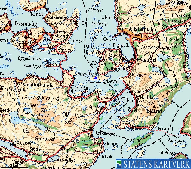
From Ålesund, follow highway E39 towards Bergen, and then RV61 towards Hareid. Take the Sulesund - Hareid ferry and follow RV61 (roughly) 3Km towards Ulsteinvik. At the roundabout junction outside Ulsteinvik, turn left and follow RV61 southbound for additional 1,4Km.
Turn right towards "Dimna", drive 1,4Km to the "Ertesvåg/Ytre Dimna" junction, and turn left towards Ertesvåg. Drive -approx.- 2,5Km and turn left in a junction. Follow this road 200m and locate the "Røyrafjellet" trailsign to your right. You find parking on the left-hand side of the road.
The route
This is a very straightforward route. Follow the path up to point 121m (not marked on Norge 1:50,000), descend slightly and head up to the 123m high point. Descend your ascent route.
Mailboxes - which may contain logbooks - are found on both high points.
 westcoastpeaks.com
Other Møre & Romsdal mountains
Other Norwegian mountains
westcoastpeaks.com
Other Møre & Romsdal mountains
Other Norwegian mountains

