
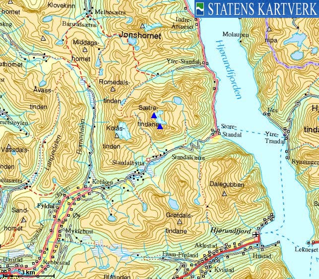
Norwegian Mountains, Møre og Romsdal
|
| Fylke/Kommune : | Møre og Romsdal/Ørsta | ||||||
| Maps : | 1219-IV Sykkylven (Statens Kartverk, Norge 1:50 000) | ||||||
| Primary factor : |
Nordre: 335m Søre: 148m |
||||||
| Visited : | Apr 2009 (Nordre) | ||||||
| See also : |
| ||||||
| See also : | Other Ørsta mountains |
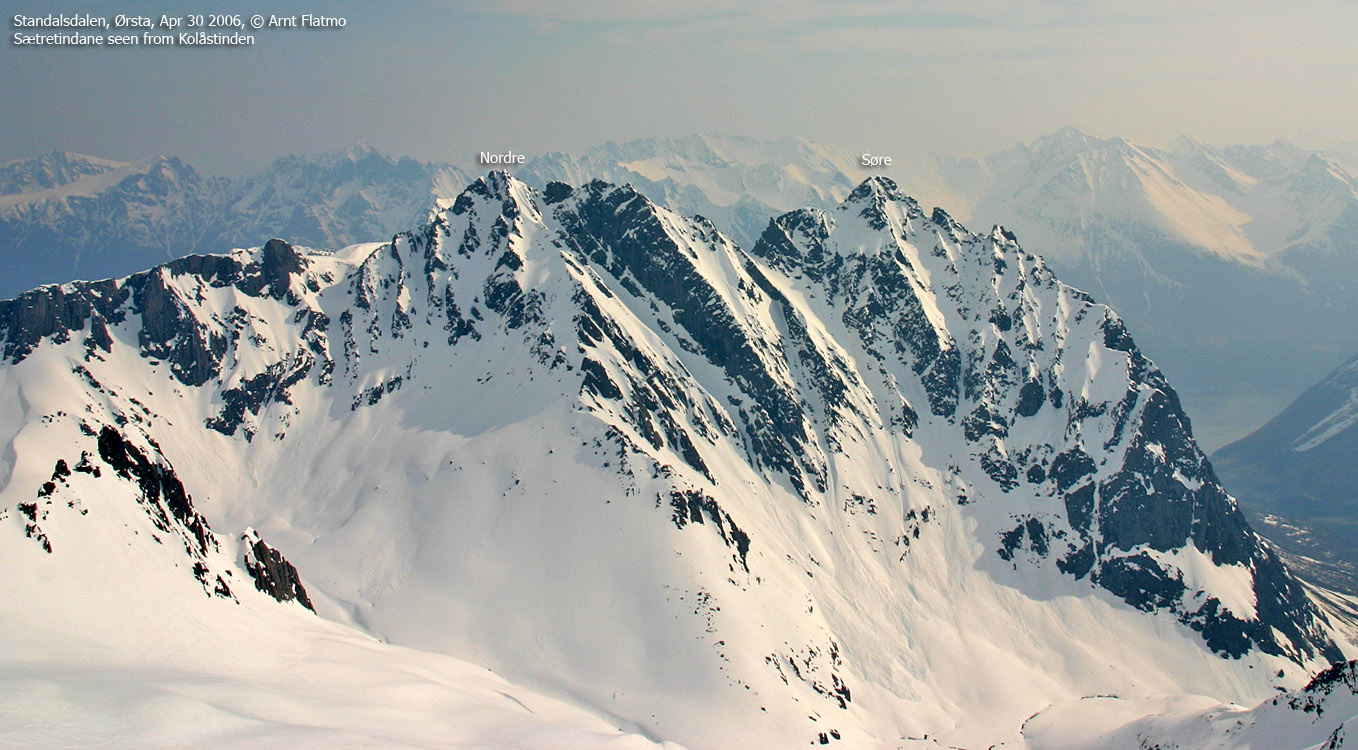
Sætretindane
(Click for larger image)
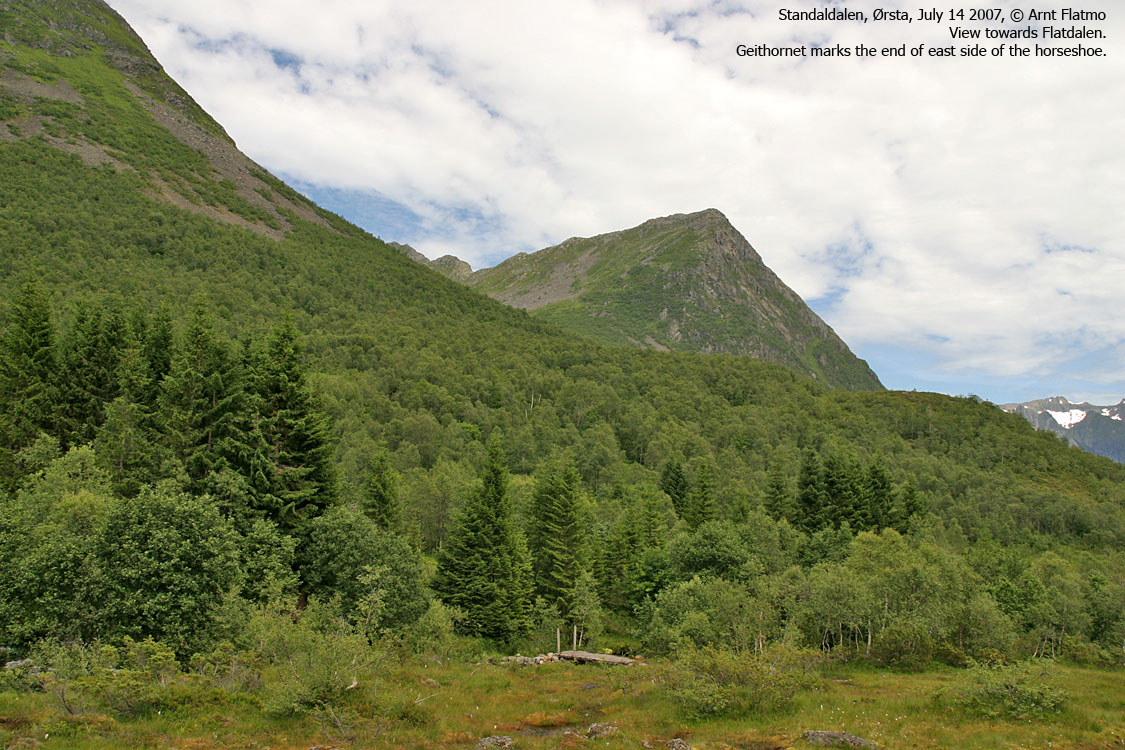
Along with Kolåstinden, Sætretindane tower high and mighty above Standalsdalen - connecting Ørsta and Hjørundfjorden. The Sætretindane massif consists of two main tops (Søre/Søndre and Nordre) and reside between the valleys Kvanndalen and Fladalen. This is alpine terrain and one can not easily get to either of the tops. Søre Sætretind is considered (much) harder than Nordre Sætretind. This web page will describe a spring route (on skis) to Nordre Sætretind via Fladalen.

Sætretindane seen from the air
(Click for larger image)
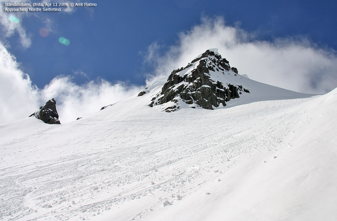
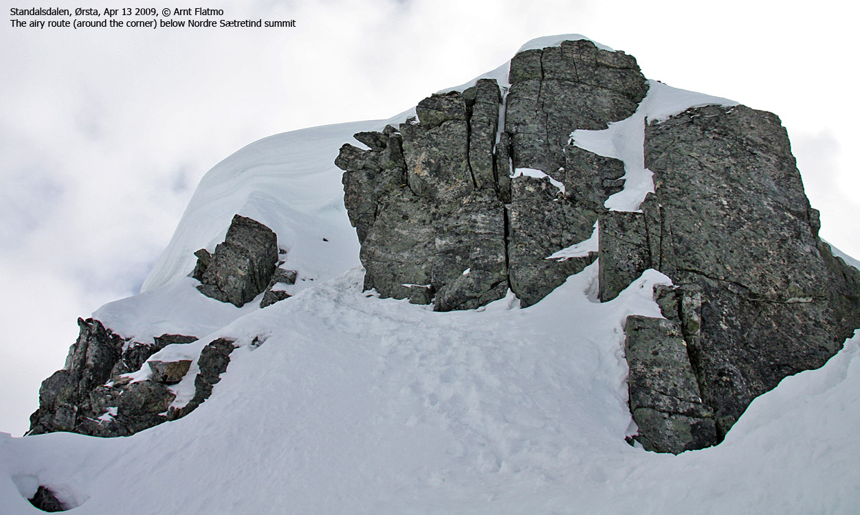
Nordre Sætretind is probably easiest to reach on snow. The ski-route up to the ridge north of the summit is easy (and the descent is beautiful). The final 20 vertical meters must be said to be airy. Some claim that this final section is "not very exposed", and that "this is an easy mountain", but as long as there is a risk of a fall (which there is), many would not want to attempt the final section without the safety of a rope. Ice-axe and crampons are mandatory on snow. The final section to Kolåstinden summit is a good comparison; The pitch up to Nordre Sætretind's summit is a bit steeper, and certainly more exposed.
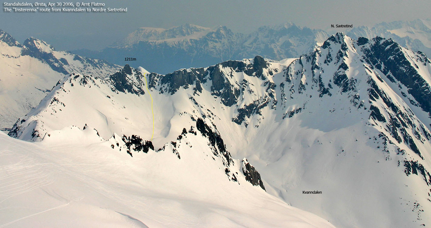
An alternative route to Nordre Sætretind runs via Kvanndalen (see the Kolåstinden page). You ascend a steep gully named Insterenna (the innermost gully - see picture), head south along the ridge before joining the Fladalen route.

The summit of Nordre Sætretind
(Click for larger image)
As mentioned above, Søre Sætretind is (much) harder than Nordre Sætretind. The normal access route begins in Fladalen, runs up a steep shoulder that will become more and more difficult during snowmelt. Once on the summit ridge (north of the summit), you can ascend the summit in various ways, but they are all climbing routes. Mind-boggling as it may seem to many; some actually ski down this mountain...
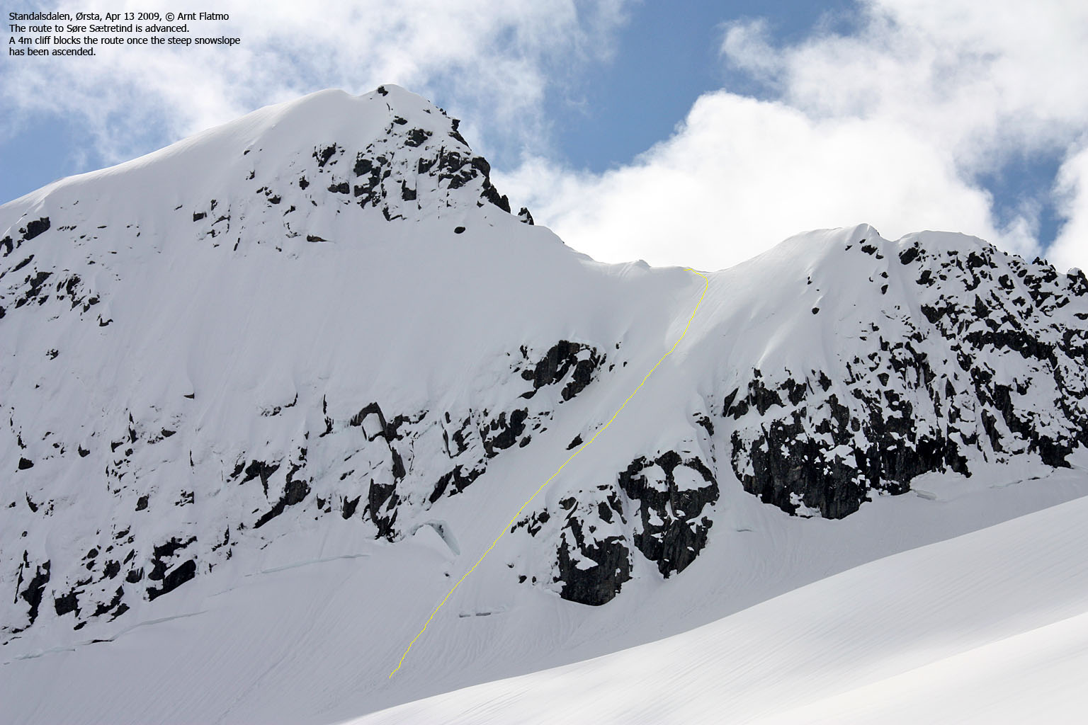
Søre Sætretind
(Click for larger image)
From Fladalen, you also have the option to ascend Langenestinden (Standalhornet).
Nordre Sætretind (Norge 1:50,000: 1365m, Økonomisk Kartverk: 1365m, UTM 32 V 362553 6907154) has a primary factor of 335m towards the higher parent Kolåstinden (1432m). The defining saddle (approx. UTM 32 V 361079 6907101) is found in Kvanndalsskardet. Ref. Økonomisk Kartverk (5m contours), the saddle is within the range 1020-1040m, interpolated to 1030m.
GPS measurement read 1365m (on the cairn, 0,5m high), averaged over a 5-minute period (error margin +/- 3,3m).
Søre Sætretind (Norge 1:50,000: 1358m, Økonomisk Kartverk: 1358m, UTM 32 V 362920 6906524) has a primary factor of 148m towards the higher parent Nordre Sætretind. The defining saddle (approx. UTM 32 V 362728 6906715) is the lowest saddle between these two tops. Ref. Økonomisk Kartverk (5m contours), the saddle is within the range 1200-1220m, interpolated to 1210m.
Google's interactive map. You can zoom, pan and click on the markers.
|
|
|
|
Route 1: Fladalen - Nordre Sætretind (on skis - spring)
|
|
Access
(all distances are approx. distances)
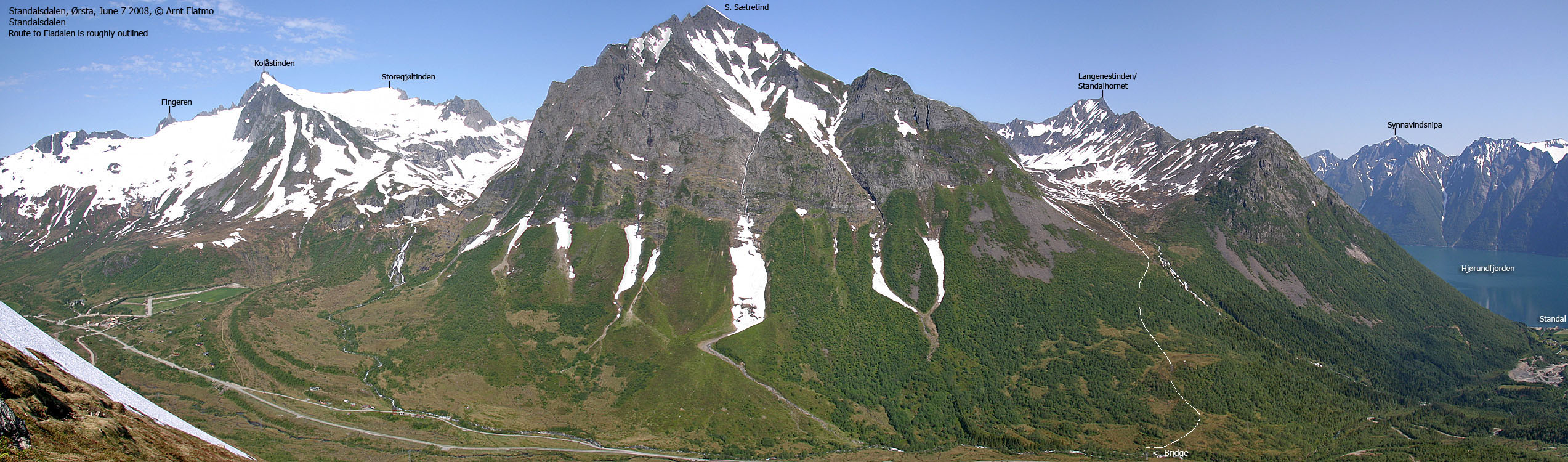
The nearest bigger city is Ålesund. From Ålesund, follow highway E39 towards Bergen/Volda to the ferry at Solavågen. Take the ferry over to Festøya. Turn left in the direction of Standal and follow the road 19,2Km (passing Standal along the way). You're now 1,8Km east of Standalvatnet. Park alongside the road. This is also the trailhead for Langenestinden, Sylvkallen and Nonshornet.
The road turns into a gravel road just after Standal. The road between Standal and Follestaddalen has traditionally been closed during winter, but according to standalalpesenter.no, the road is now open all year around.
From Ørsta; from the main junction in Ørsta, follow the road to Sæbø. After 4,7km, turn left towards Follestaddalen. Drive 8,2km and turn left towards Standal. Drive 6,6km (across Standalleidet) and find parking on the left-hand side, 140m west of the Fladalen signpost.
The route
The route up Fladalen (roughly)
(Click for larger image)
The route begins 140m east of the parking. Locate the Fladalen signpost and follow a vague path that immediately crosses the river on a bridge. If you're already on snow, just set course for Fladalen. If you have to carry the skis for a while; the path continues to the east (along the river) and descends slightly before it continues northeast up the forest, towards the river from Fladalsvatnet. The path is in overall boggy and your pants will get wet after rain (high grass).
If you want to avoid avalanche-prone terrain, don't ski too close to Søre Sætretind. Aim for the river from Fladalsvatnet and at approx. 520m, set a northwest course in the direction of a small lake (which you can't see) at 910m elevation. It will all make sense once you're there. You can ski most everywhere south of Søre Snarhornet, just don't go too close to Søre Sætretind and the glacier north of it.
Aim for the ridge north of Nordre Sætretind (and south of the cliff with the two horns). Most people would leave the skis behind at 1290m, and proceed on foot (w/crampons and axe) up the ridge towards the summit. In a tiny col just below the summit, the terrain gets airy. You have to pass alongside a small cliff in order to get into a mini-gully which will take you to the top, marked by a small summit cairn.

The route to Nordre Sætretind
(Click for larger image)
 westcoastpeaks.com
Other Møre & Romsdal mountains
Other Norwegian mountains
westcoastpeaks.com
Other Møre & Romsdal mountains
Other Norwegian mountains


