
Norwegian Mountains, Sogn og FjordaneBlåfjellet, 1401m
|
| Fylke/Kommune : | Sogn og Fjordane/Sogndal & Leikanger municipalities | ||||||||||||||||||||||||
| Maps : |
1417-IV Solvorn (Statens Kartverk, Norge 1:50 000)
1317-I Fjærland (Statens Kartverk, Norge 1:50 000) |
||||||||||||||||||||||||
| Primary factor : | 151m | ||||||||||||||||||||||||
| Hiked : | Feb 2010 | ||||||||||||||||||||||||
| See also : |
| ||||||||||||||||||||||||
| See also : | Other Sogn og Fjordane mountains on westcoastpeaks.com |

Blåfjellet
(Click for larger image)
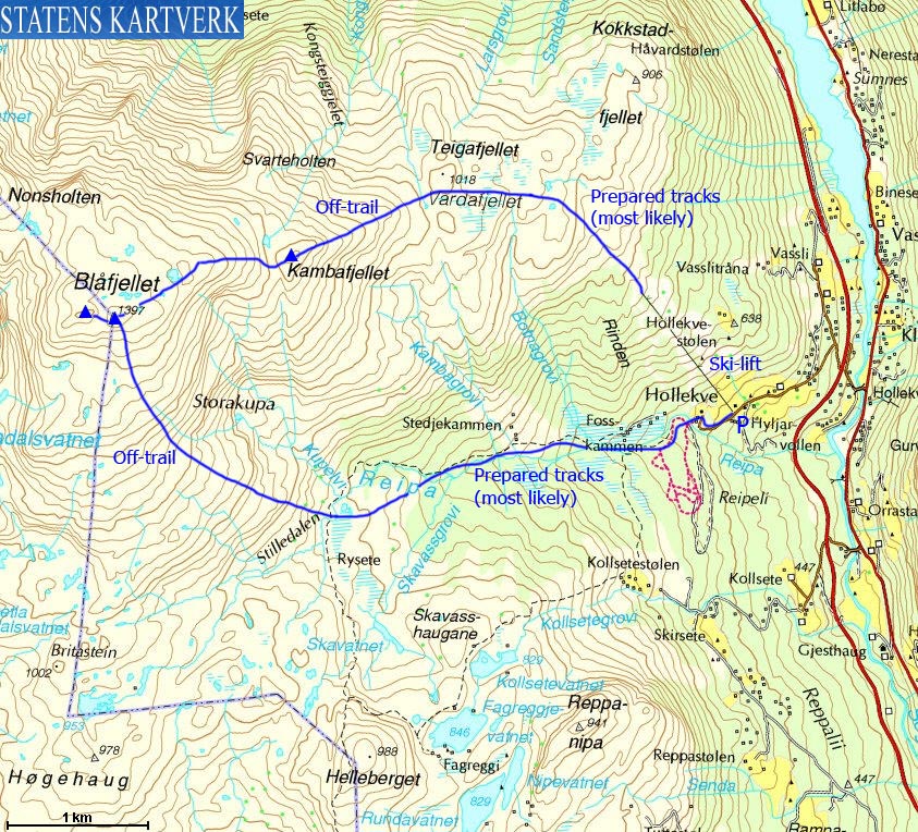
Of the mountains accessible from the Sogndalsdalen valley, Blåfjellet (Blue mountain) is the most popular one in winter. The ski lift at the Hodlekve [external link] ski-centre brings you from 500m up to 780m, leaving you only 4,5km and 620m vertical meters to climb. If the ski-centre is open, there are most likely prepared tracks up to Vardafjellet. Upon descent, you can descend the southeast ridge and follow the tracks along the river Reipa back to the trailhead. The route along Reipa also runs towards other popular points, such as Helleberget, Høgehaug and Britastein.
Blåfjellet consists of two tops. The east top (1397m, N61.29521 E6.90606) is marked by a proper cairn, and this is where the vast majority of skiers go. The Leikanger/Sogndal municipality border runs across this top. But according to the maps, there is a slightly higher top 200m to the west (N61.29557 E6.90247). A 1400m contour is found here, which suggests that the west top is at least 3 metres higher than the east top. Furthermore, this also implies that Leikanger "owns" this summit, even though half the mountain is located within Sogndal.

Blåfjellet seen from Kjeringi
(Click for larger image)
Blåfjellet (Norge 1:50,000: highest contour is 1400m ~ interpolated to 1401m, Økonomisk Kartverk: -, UTM 32 V 387624 6797517) has a primary factor of 151m towards the higher parent Synnevaskjer (1543m). The defining saddle (approx. 32 V 386521 6798526) is found between Synnevaskjer and Nonsholten. Ref. Norge 1:50,000 (20m contours), the saddle is within the range 1240-1260m, interpolated to 1250m.
The east top (32 V 387814 6797469) has a map height of 1397m.
GPS measurement read 1403m (on the ground), averaged over a 5-minute period (error margin <2m) on both tops

The east top cairn
(Click for larger image)
Google's interactive map. You can zoom, pan and click on the markers.
|
|
|
|
Route 1: Hodlekve - Blåfjellet round trip (winter)
|
|
This route description is valid per Feb 2010
Access
(all distances are approx. distances)
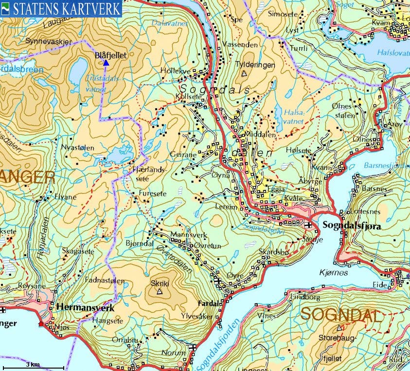
The nearest bigger town is Sogndal (has an airport). From the highway RV5/55 junction in Sogndal (roundabout), follow RV5 11km up Sogndalsdalen. Turn left when you seen the Hodlekve (Hollekve) signpost. Drive 1,1km up to the ski-centre parking. There may be a parking fee - NOK 30,- per Feb 2010.
The route
Take the ski lift up to 780m and follow prepared tracks up the mountain. Per Feb 2010, these tracks went almost up to Vardafjellet. From Vardafjellet, proceed directly towards Kambafjellet (approx. 1230m) and Blåfjellet. Note that the high point is (according to the maps) located 200m west of the Blåfjellet cairn.

The Blåfjellet round trip route
(Click for larger image)
|
|


