
|

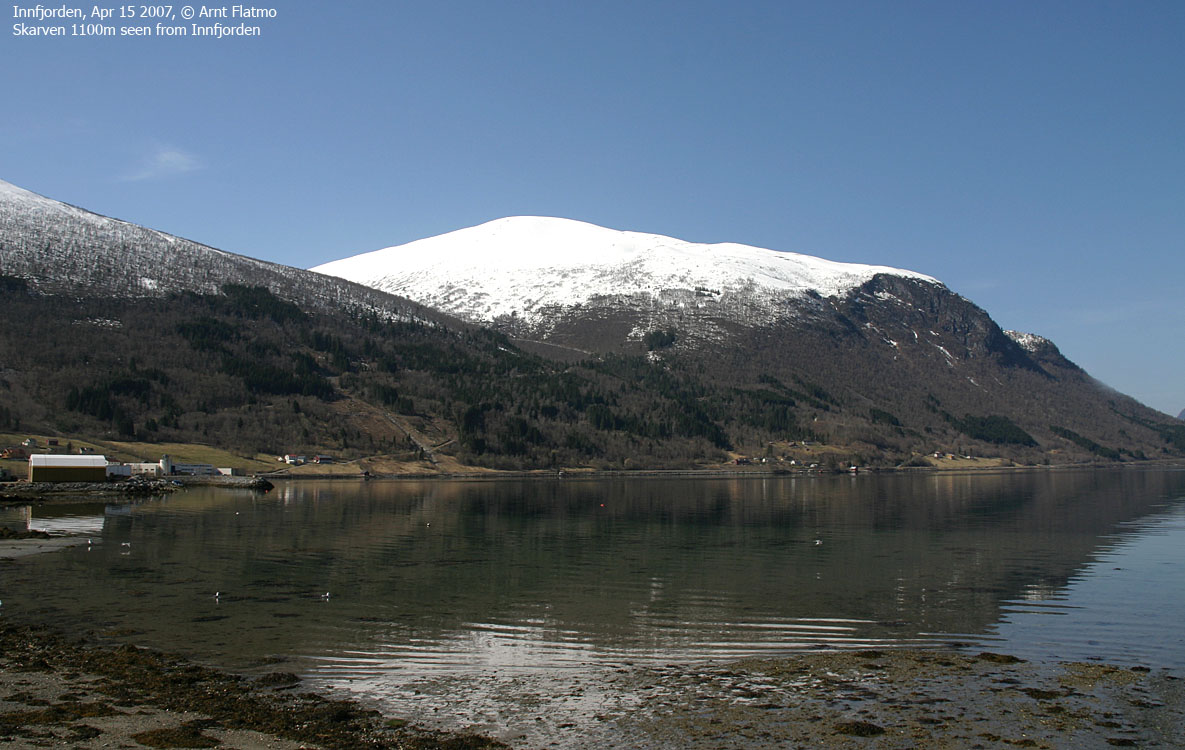
A string of peaks form a horseshoe around the Måndalen valley, with the Svartevasstinden/Prosten massif to the north, Sandfjellet/Storbua massif to the west and the Nonstinden/Middagstinden/Skjervan to the south. Skarven is Skjervan's little neighbour, located between Innfjorden and Måndalen.
Skarven has easy access from the Innfjorden side. A good forest road takes you all the way to 500m elevation, and from here on, a gentle hillside takes you to the top. In winter, this hillside offers a decent run down on skis. You have the option to ascend via Litlefjellet and descend directly towards Hovdesetra. Skarven can also be accessed from Måndalen, but this web-page describes a skiing route from Lia by Innfjorden.
Being the lowest of the independent tops in the horseshoe, one might not expect mind-boggling views, but you'll not be disappointed. First of all, the horseshoe mountains (you see all of them) is an exceptional view in its own right. And then you have the Romsdalen peaks, the Isfjorden peaks, and the tops north of Moldefjorden, from Jendemsfjellet to Reinsfjellet - a 50Km mountain range.


Skarven (Norge 1:50,000: 1100m, Økonomisk Kartverk: -, UTM 32 V 422060 6932134) has a primary factor of 330m, towards the higher parent Skjervan (1545m). The saddle (approx. UTM 32 V 421050 6930575) is found between the two tops. Ref. Norge 1:50,000 (20m contours), the saddle is defined within the range 760-780m, interpolated to 770m.
Skarven's high point is not where you find the two cairns. And probably, the cairns represent the trigonometric point as defined on the map. There is a possibility that Skarven's actual height is closer to 1105m.


Google's interactive map. You can zoom, pan and click on the markers.
Notes: Class ratings are in reference to YDS. Click here for more information.
The trails described below are not necessarily the *easiest* trails to this mountain.
|
Lia (Innfjorden) - Skarven (winter)
|
|
Access
(All distances are approx.)
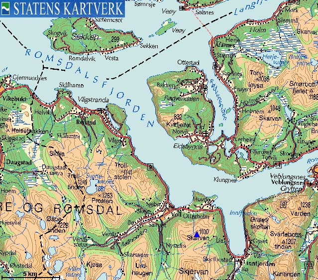
From Ålesund, follow highway E136->E39 eastbound towards Åndalsnes. You pass the place Sjøholt, drive across Ørskogfjellet, down Skorgedalen valley to the Molde/Åndalsnes junction just before you reach Tresfjorden (50Km from the last roundabout in Breivika).
Turn right towards Åndalsnes, and drive 50,5Km. Approx. 2Km before you reach the Innfjorden bay, locate a small bridge, under which Stokkelva river drains. Turn right just before this bridge. You have a house to your right, and a steep gravel road ahead. Park along the road without blocking for other traffic.
The route
Follow the gravel road up another house (you can't see it from the main road). The forest road begins by this house. Follow the road up the forest, stay left in two forks, and you'll be en route on the long forest road towards Hovdesetra.
The locals drive this road with 4WD vehicles in summer, and park by road end at 510m elevation, 300m east of Hovdesetra. From this point, set a north/northwest course, and aim for a pass east of Skarven. It is too steep for comfort to head directly up to the summit, and besides, there may be cornices.
Alternatively, pass Hovdesetra and continue all the way to the Skjervan - Skarven saddle before you head across Litlefjellet on your way to Skarven.
The hillside from Skarven to the end of the forest road offers a good ski-descent (approx. 600 vertical meters). Above the forest road, there is a birch forest, but not the dense kind. If you are the type of skier who needs to plow on forest roads, you'll never forget this 500 vertical meter descent down to the trailhead.


No Javascript:
 westcoastpeaks.com
Other Møre & Romsdal mountains
Other Norwegian mountains
westcoastpeaks.com
Other Møre & Romsdal mountains
Other Norwegian mountains

