
Norwegian Mountains, Møre og Romsdal
|
| Fylke/Kommune : | Møre og Romsdal/Ørsta,Stranda | ||||||||
| Maps : |
1219-II Geiranger (Statens Kartverk, Norge 1:50 000)
1219-III Hjørundfjord (Statens Kartverk, Norge 1:50 000) |
||||||||
| Primary factor : |
Store Smørskredtind: 1306m Nordre Smørskredtind: 156m |
||||||||
| Hiked : | July 2008 | ||||||||
| See also : |
| ||||||||
| See also : | Other Ørsta and Stranda mountains |
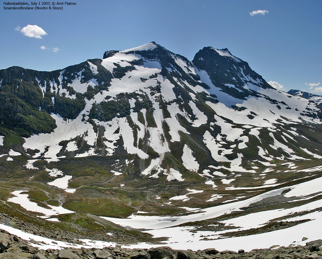
Smørskredtindane
(Click for larger image)
Smørskredtindane, Slogen and Brekketindane surround the Patchell Hut, well renowned and famous in Norwegian mountaineering history. The names of these peaks resonate well also outside Møre and Romsdal county. Smørskredtindane rise steep above the famous Norangsdalen valley and the adjacent Habostaddalen and Tverrdalen valleys. The view towards the Sunnmørsalpene mountain range is phenomenal. The Ørsta/Stranda municipality border run between the two Smørskredtindane peaks. Nordre (The northern peak) belongs to Stranda, while Store (The big one) belongs to Ørsta. The name may translate to "Peaks (tind) with good soil (smør) and a lot of avalanches (skred)".
A number of routes lead up to the two peaks. Nordre Smørskredtind can be reached on easy routes from Tverrdalen and Habostaddalen. Store Smørskredtind has 3 traditional routes; The most popular route runs from the Patchell Hut, up to the pass between the two Smørskredtindane peaks, across a small glacier and up a couloir. The route from Tverrdalen ascends Store Smørskredtind via the same couloir, and is regarded as the easiest route to the top (Tverrdalen can also be reached from Norangdalen via Langfonndalen)Another route runs from the Patchell Hut and up the west ridge. This web page will describe access (summer) via Strandamoldskreddalen and Tverrdalen valleys. The routes to Store Smørskredtind calls for experienced hikers, although the routes are not technically difficult. This page describes routes to Nordre and Store Smørskredtind from Tverrdalen.
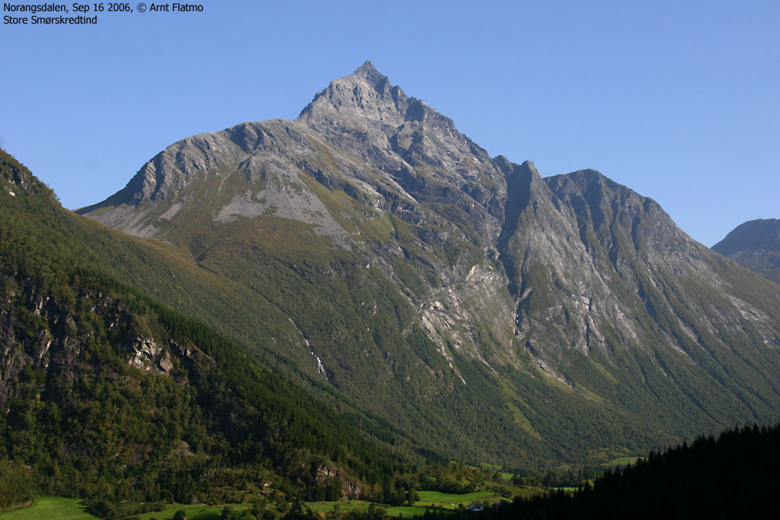
Store Smørskredtind
(Click for larger image)
Store Smørskredtind is the highest peak on the Rånahalvøya peninsula, here defined as everything east and north of the Norangdalen valley.
Store Smørskredtind (Norge 1:50,000: 1631m, Økonomisk Kartverk (ØK): -, UTM 32 V 382014 6898510) has a primary factor of 1306m towards the higher parent mountain Kvitegga (1707m). The defining saddle (approx. UTM 32 V 382339 6888419) is found near Fivelstadhaugen. Just NE of Lundheim on ØK. Ref. Økonomisk Kartverk (10m contours), the saddle is within the range 320-330m, interpolated to 325m.
GPS measurement on top of the cairn (0,5m high) read 1639m as average over a 10-minute period. Error margin was less than 3m.
Nordre Smørskredtind (Norge 1:50,000: -, Økonomisk Kartverk (ØK): -, Other source: 1606m, UTM 32 V 382537 6899017) has a primary factor of 156m towards the higher parent mountain Store Smørskredtind (1631m). The defining saddle (approx. UTM 32 V 382282 6898768) is found between the two tops. Ref. Norge 1:50,000 (20m contours), the saddle is within the range 1440-1460m, interpolated to 1450m.
GPS measurement on top of the cairn (0,5m high) read 1615m(!) as average over a 10-minute period. Error margin was less than +/-0,7m. A one-time GPS reading is not trustworthy, but this was indeed a surprising reading. The track log also agreed with the waypoint. Nordre Smørskredtind could actually be almost 10m higher than the official map height.
Google's interactive map. You can zoom, pan and click on the markers.
|
|
|
Notes: Class ratings are in reference to YDS. Click here for more information.
The trails described below are not necessarily the *easiest* trails to this mountain.
|
Route 1: Store Smørskredtind from Strandamoldskreddalen (summer)
|
|
Access
(all distances are approx. distances)
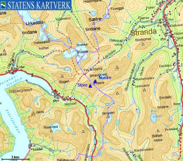
Ålesund is the nearest larger city. From Ålesund, follow highway E39 towards Bergen, and then highway RV60 (Stranda) to the Magerholm - Ørsneset ferry. This ferry runs quite often; every 20 minutes in the busy hours of the day. From Ørsneset, follow RV60 (Stranda) approx. 35Km to Stranda. Turn right and follow highway RV60 southbound approx. 7,2Km (to Habostad - not signed) and turn right onto an unsigned gravel road.
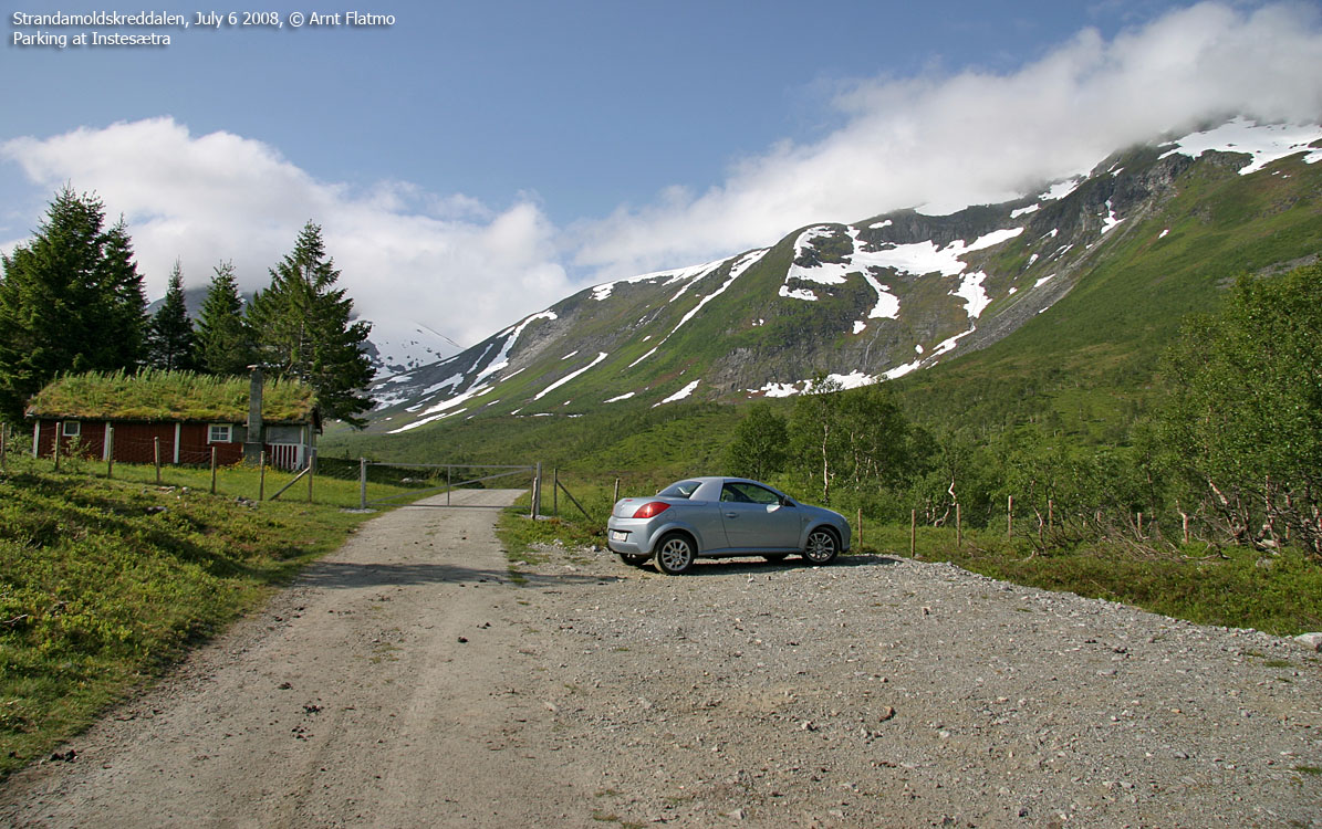
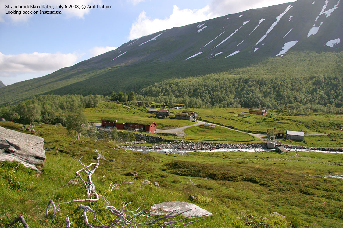
After 900m, pay toll at a self-serviced toll booth (NOK 30,- per July 2008). Follow the gravel road up Strandamoldskreddalen all the way to Instesætra (8Km from RV60), where you find parking in front of the gate.
Note that there is a "Tverrdalen" trailsign 650m north of Instestølen (by Rødsetstølen). Don't go here. There is no bridge across the river.
The route

The route to Smørskredtinden
(Click for larger image)
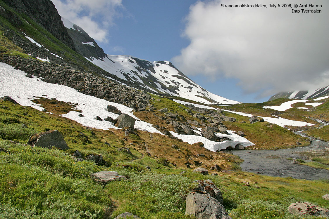
Pass the Instesætra cabins and cross the river on a gated bridge. Follow a visible path up the forest into Tverrdalen. The path runs on the south side of lake 716m. Proceed towards point 850m, which marks the top between Langfonndalen and Tverrdalen. Begin your ascent towards Smørskredtinden here (if you haven't already). The ascent to the glacier will be on a mix of small boulder and agonising scree unless you walk on snow (if there is any).
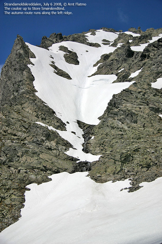
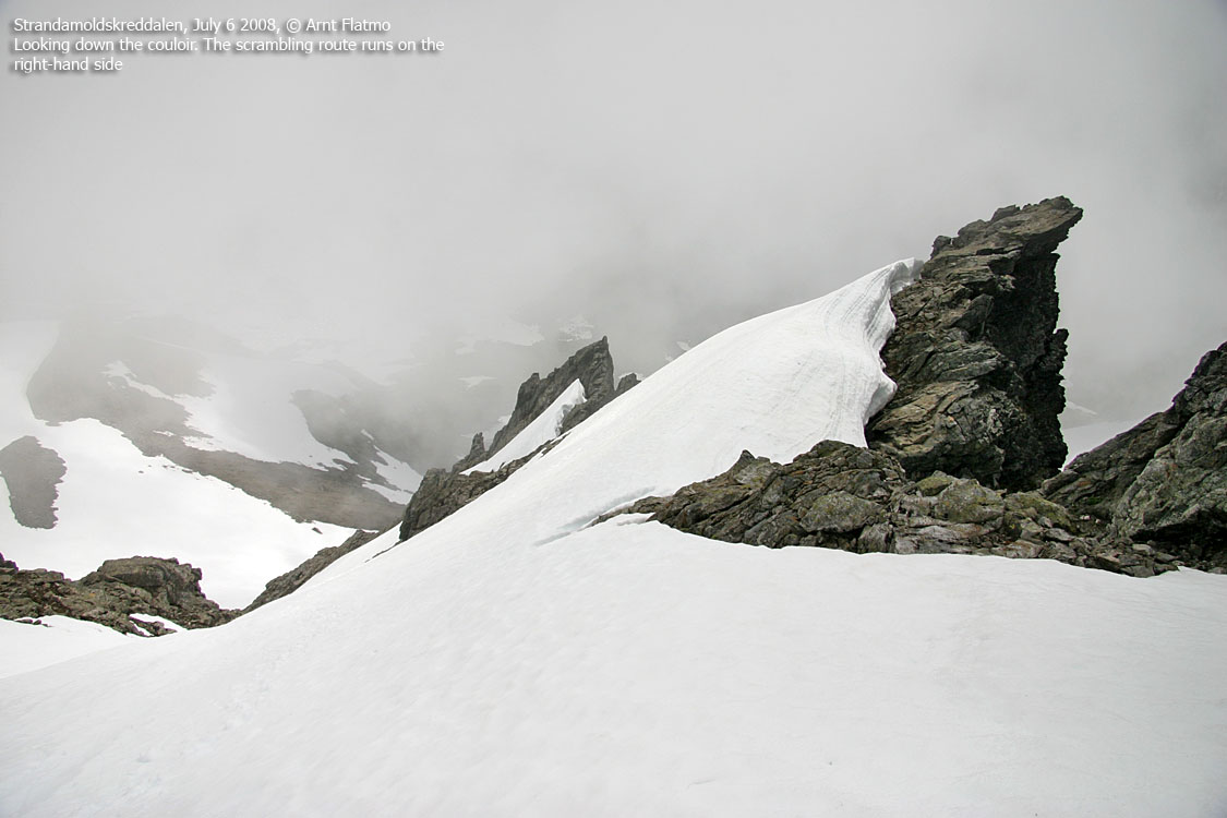
Pass the south edge of the glacier (which is normally considered safe) and head for the main couloir. Some will enter the couloir on the right-hand side, then traverse (across slabs) to the left-hand side. Some will follow the left-hand side all the way to the top. When the easiest route is found (and the rock is dry), this ascent should not be harder than YDS class 3. If your ascent involves crossing snow, ice-axe and crampons may be necessary.
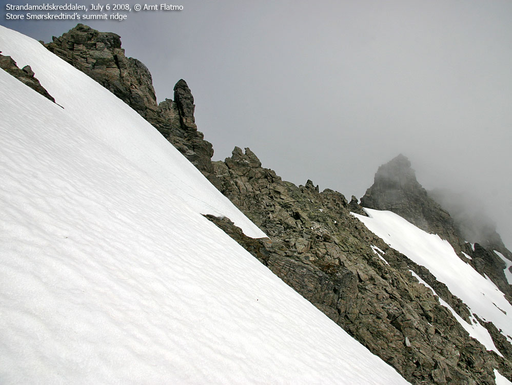
Smørskredtinden summit is the southernmost of the two tops. The summit is marked by a small cairn with a marble-white rock on top (unless someone has removed it..)
Per July 6 2008 (ref. picture above) a snowfield ran all the way up to the glacier, and the couloir towards the top was also filled with snow. While the left-hand side of the couloir was partly free of snow, crossing snow was unavoidable. August is the prime season for ascent of Store Smørskredtind.
|
Route 2: Nordre Smørskredtind from Strandamoldskreddalen (spring
skiing)
|
|
Access
(all distances are approx. distances)
Same access as for Store Smørskredtind. See above.
The route

Skiing route to Smørskredtinden
(Click for larger image)
Pass the Instesætra cabins and cross the river on a gated bridge. Follow a visible path up the forest into Tverrdalen. The path runs on the south side of lake 716m.
Head up the mountainside between Nordre Smørskredtind and Leirvasshornet. Neither the small glacier below point 1322m nor the avalanche danger is known to cause particular problems for skiers. Once on the ridge between Nordre Smørskredtind and Leirvasshornet, turn west. The direction is quite obvious. Follow the edge for additional views.
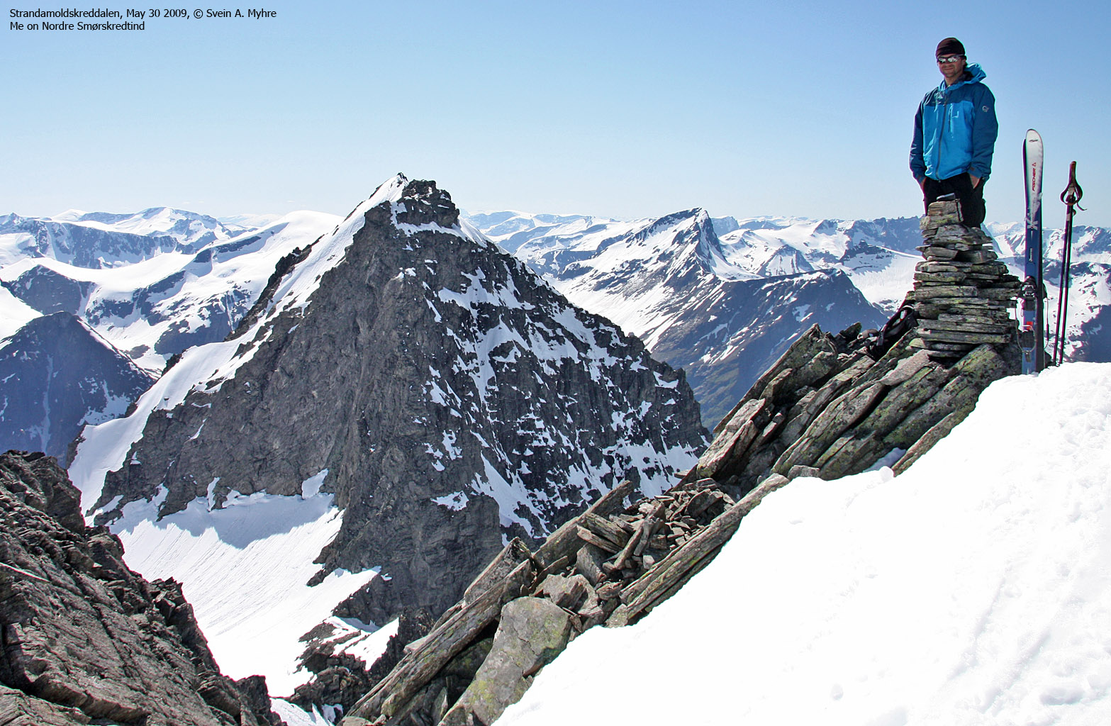
Nordre Smørskredtind is marked by a small cairn.
 westcoastpeaks.com
Other Møre & Romsdal mountains
Other Norwegian mountains
westcoastpeaks.com
Other Møre & Romsdal mountains
Other Norwegian mountains


