
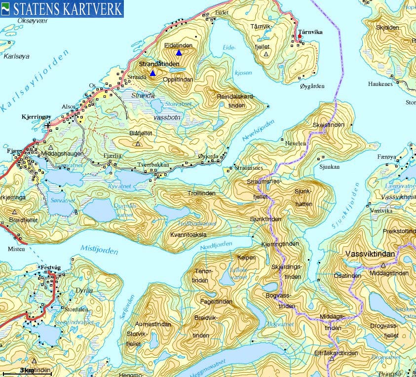
Norwegian Mountains, NordlandStrandåtinden, 862m (Store Strandåtind)
|
| Fylke/Kommune : | Nordland/Bodø |
| Maps : | 2030-II Kjerringøy (Statens Kartverk, Norge 1:50 000) |
| Primary factor : |
Eidetinden: 1002m Strandåtinden: 279m Vestre Strandåtind: 87m |
| Hiked : | July 2009 |
| See also : | Other Nordland mountains on westcoastpeaks.com |

Strandåtindan
(Click for larger image)
Strandåtindan and Eidetinden are situated on Kjerringøy - a peninsula northeast of Bodø. The actual Kjerringøya island is a tiny island - just west of the Kjerringøy village. Kjerringøy is well renowned for its spectacular nature.
Eidetinden is the highest peak on the peninsula, while Strandåtindan - Eidetinden's neighbours to the southwest - are considered by many to offer one of the very finest traverses in the Bodø region. While Eidetinden is a straightforward walk, Strandåtindan are alpine peaks, and climbing is required in order to reach the Vestre Strandåtind (also known as "Vestfortoppen") and the main Strandåtinden peak. This page will describe the routes to Eidetinden and the traverse across Strandåtindan.

Eidetinden
(Click for larger image)
Being the highest of the Kjerringøy peaks, and - being a coastal top exceeding 1000m, Eidetinden offers spectacular views towards the Steigen and Bodø mountain regions. You can see far into Sweden, and the (endless) Lofoten range to the northwest.

Eidetinden panorama

(Click for larger image)
The first ascent on Strandåtinden was done by Rubenson, Schjelderup and Jentoft in 1912 (source: mjelle.no). Since then, many routes and variations have been done, in summer as well as in winter. Today, guiding companies offer a safe journey across the rugged Strandåtindan peaks, but the clients still have to climb.
The Strandåtindan traverse has 4 notable climbing pitches (the hardest classified as 5 minus - Norwegian scale) and 7 rappels. In the climbing world, this is considered easy climbing. For those who don't normally climb mountains, this grade of climbing can be a challenge. Compared to the normal route on Stetinden, Strandåtindan isn't particularly harder in terms of the grade, but there is more climbing and many more rappels.

Strandåtinden west ridge
(Click for larger image)
Do read the fantastic story told by Ferdinand Schelderup about the first ascent of Strandåtinden (Norwegian text).
Besides hotels and motels in Bodø, consider Kjerringøy Brygge (opened May 2007) - located only 8km south of the Eidetinden/Strandåtinden trailhead at Låter.
Nordland Turselskap is the leading guiding company in the Nordland region, and arranges guided trips across Stetind and Strandåtindan.

Vestre Strandåtind
(Click for larger image)
Eidetinden is one of the 85 mountains on Petter Bjørstad's list of Norwegian mountains with a primary factor > 1000m. In fact, with 1002m, Eidetinden is at the bottom of this list.
Eidetinden (Norge 1:50,000: 1020m, Økonomisk Kartverk: -, UTM 33 W 497843 7493692) has a primary factor of 1002m towards the higher parent Skjerdingstinden (1055m). The defining saddle (approx. UTM 33 W 493628 7486283) is found between the lakes Liatjørna and Ryvatnet. Ref. Økonomisk Kartverk (5m contours), the saddle is within the range 15-20m, interpolated to 18m.
GPS measurement read 1020m (on the cairn, ~1,5m high), averaged over a 10-minute period (error margin +/- 1,2m).
Strandåtinden (Norge 1:50,000: 862m, Økonomisk Kartverk: -, UTM 33 W 496229 7492270) has a primary factor of 279m towards the higher parent Kaffetinden (885m). The defining saddle (approx. UTM 33 W 496478 7492369) is found on the ridge between Strandåtinden and point 811m. Ref. Økonomisk Kartverk (5m contours), the saddle is within the range 580-585m, interpolated to 583m.
GPS measurement read 860m (on the ground), averaged over a 5-minute period (error margin +/- 2m).
Vestre Strandåtind (Norge 1:50,000: 716m, Økonomisk Kartverk: 716m, UTM 33 W 495683 7492655) has a primary factor of 87m towards the higher parent Strandåtinden. The defining saddle (approx. UTM 33 W 495835 7492577) is found on the ridge towards Strandåtinden. Ref. Økonomisk Kartverk (5m contours), the saddle is within the range 625-630m, interpolated to 628m.
No GPS measurement was done on this top, but the track log shows 726m as the highest recorded point. It is difficult to tell if the GPS shows too high an elevation or if the top in fact is higher than 716m.
Google's interactive map. You can zoom, pan and click on the markers.
|
|
|
|
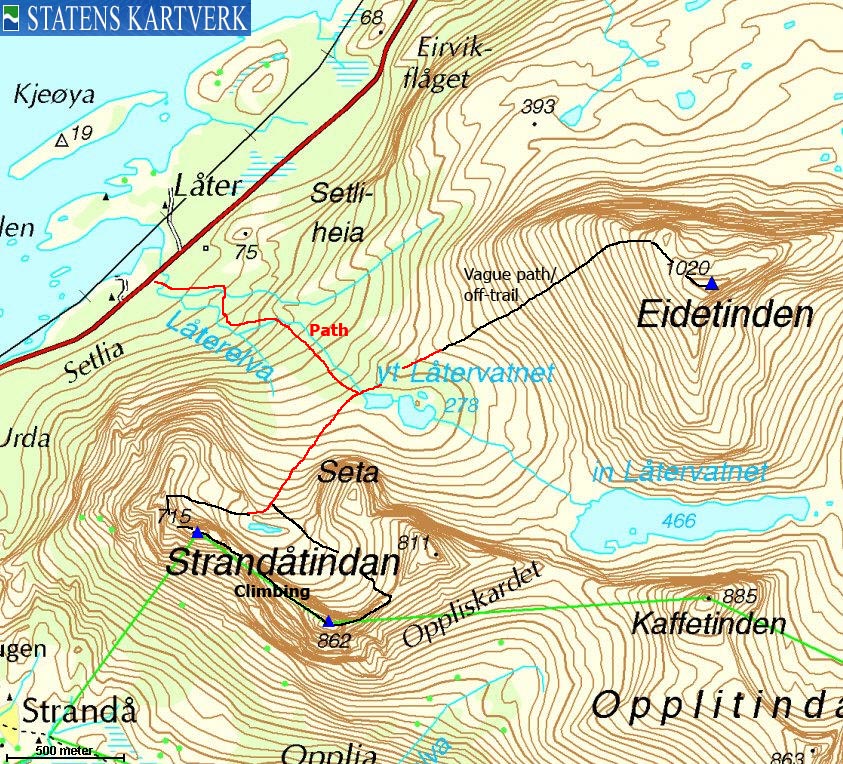
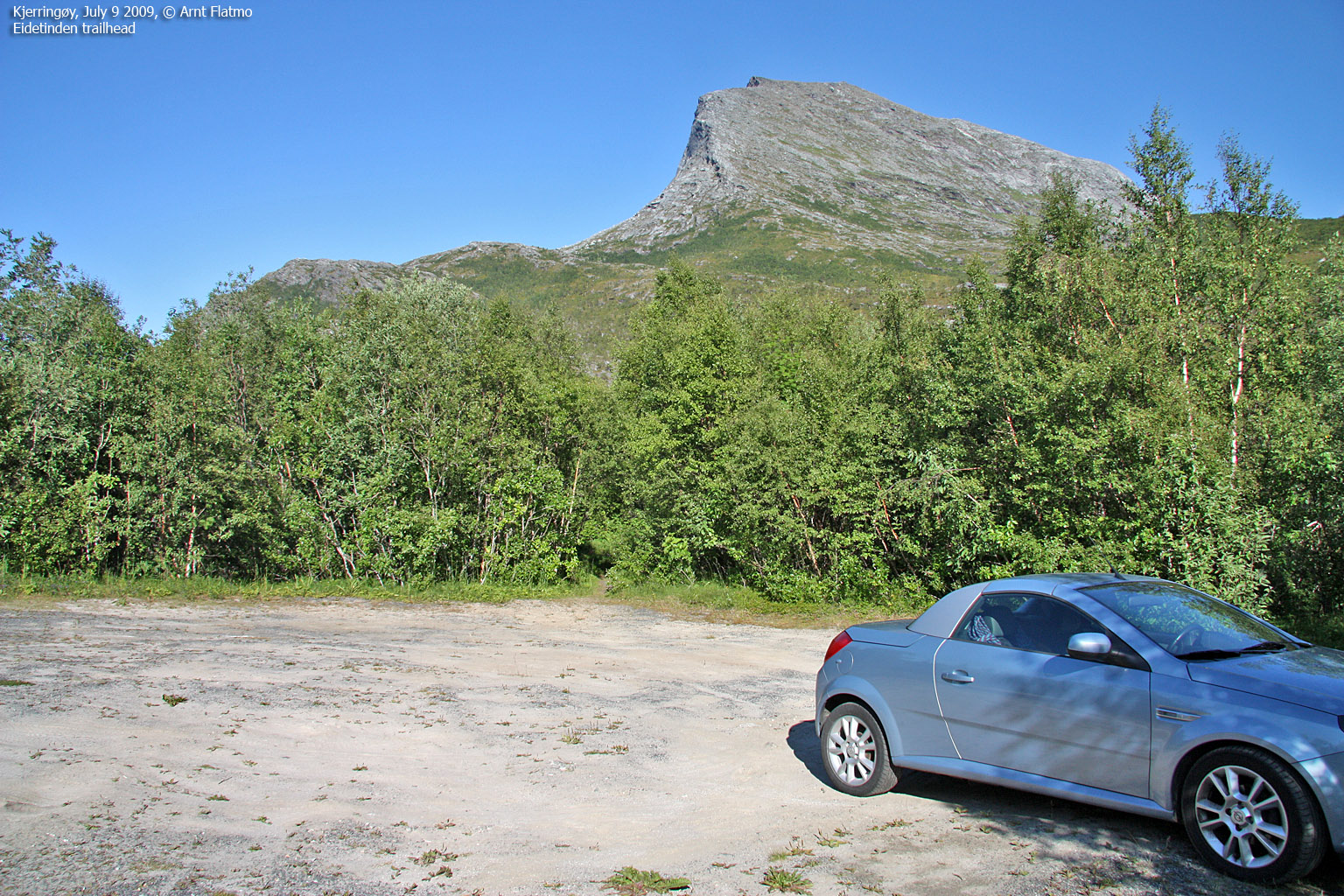
Route 1: Låter - Eidetinden (summer/autumn)
|
|
Access
(all distances are approx. distances)
The nearest bigger city is Bodø. Follow highway E834 and Kjerringøy signposts. The distance from Bodø to Festvåg (ferry) is roughly 27km. Take the ferry to Misten on Kjerringøy, and drive 19,5km to the parking just in front of the Låterelva river. Along the way, you'll pass the village of Kjerringøy.
The route
From the parking, follow a well-worn path towards Låtervatnet. You'll cross the river a couple of times, and a bridge once. Cross the drain from Låtervatnet, follow a vague path up the main ridge. The vague path continues all the way up to the ridge, but it can be time consuming trying to follow it. The final 200 vertical meters run across slab rock and boulder. The The summit is marked by a medium-sized cairn.

The route from Låtervatnet
(Click for larger image)
|
Route 2: Låter - Strandåtindan traverse (summer/autumn)
|
|
Technical
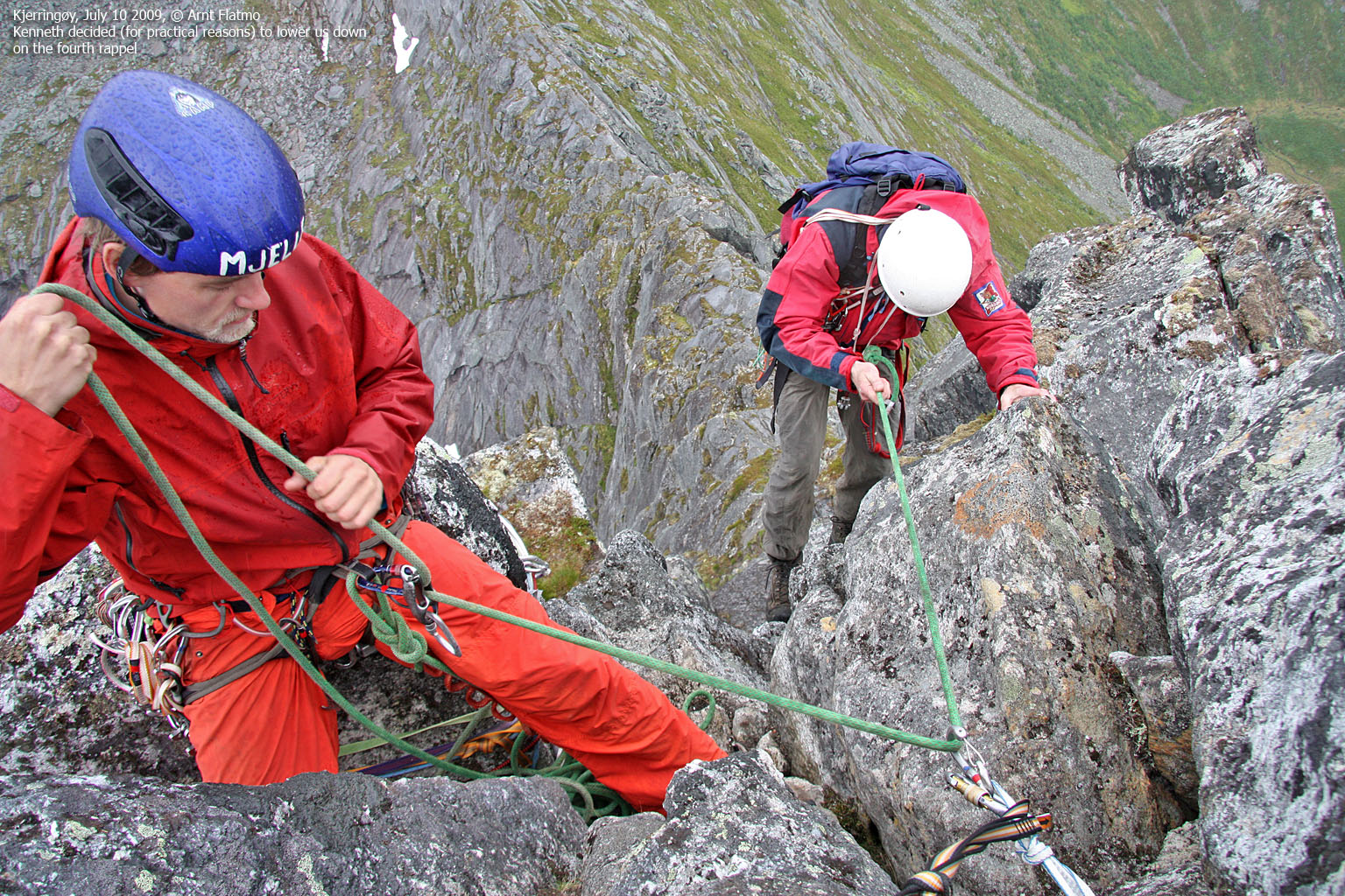
In addition to standard climbing gear, this traverse requires 2 x 50m(etre) ropes. You can also get by with one single 60m rope, in which case you will have to do 9 rappels instead of 7. A helmet is required especially because of the rappels. You can normally expect to find prepared belays for rappels, but you never have any guarantees in the mountains.
Information source
In addition to personal experience, information about the climbing & rappel pitches has also been gathered from "Veggslarv 86/2008" - a mini climbing guide by Bodø klatreklubb.
Access
Same access as for Eidetinden. See above.
The route
From the parking, follow a well-worn path towards Låtervatnet. You'll cross the river a couple of times, and a bridge once. At Låtervatnet, turn right and follow a vague path towards Strandåtindan (you'll have Seta up to your left). Just before a small lake (approx. 470m), the route turns west and the path takes you up to the ridge, to the left of a distinct top that is not part of the normal traverse. Either rope up once you're on the ridge, or climb outside a large rock (airy!) and to the normal starting point for the climb.

The Strandåtindan traverse

(Click for larger image)
Vestre Strandåtind:
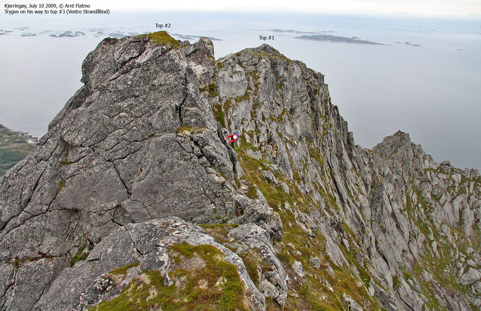
For this particular route description, Vestre Strandåtind has 4 tops. The main top is #3. The climb begins immediately with a 5m (grade 3) pitch. A bit higher up is the second pitch (5-10m, grade 4). The route continues with easy climbing, scrambling (and a lot of walking!) up to the first top.
Scramble down from the first top and up to the second top. This is the westernmost of the Vestre Strandåtind twin-tops. This top is quite flat. Scramble on to the third top - Vestre Strandåtind. One particular obstacle is best negotiated by following a very narrow path on the outside and holding on to the top of the rock. Very much like the rock you passed when you got on the ridge.
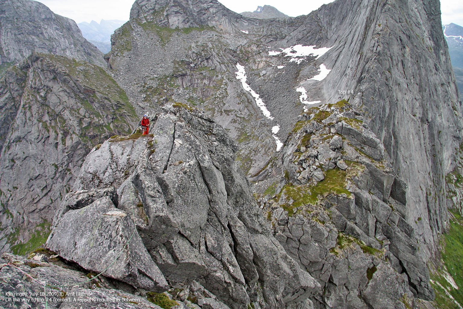
You now have the main Strandåtinden summit in clear view. Proceed along the ridge towards the fourth top. A 30m rappel is required to get there. Two more rappels are required to reach the col between Vestre and Store Strandåtind. The first rappel is roughly 10m, then you scramble down the ridge for a while, before you rappel 20m into the col. The col is a good place for lunch.
Store Strandåtind:
|
The first obstacle is known as Halls Hammer - a
15 metre wall
which would have been increasingly more difficult, had it not been for the big rock in front,
which allows you to get halfway up, fairly easily. The 5- route continues
diagonally on a ledge up to the ridge, where an outside corner marks the end of
the difficult section.
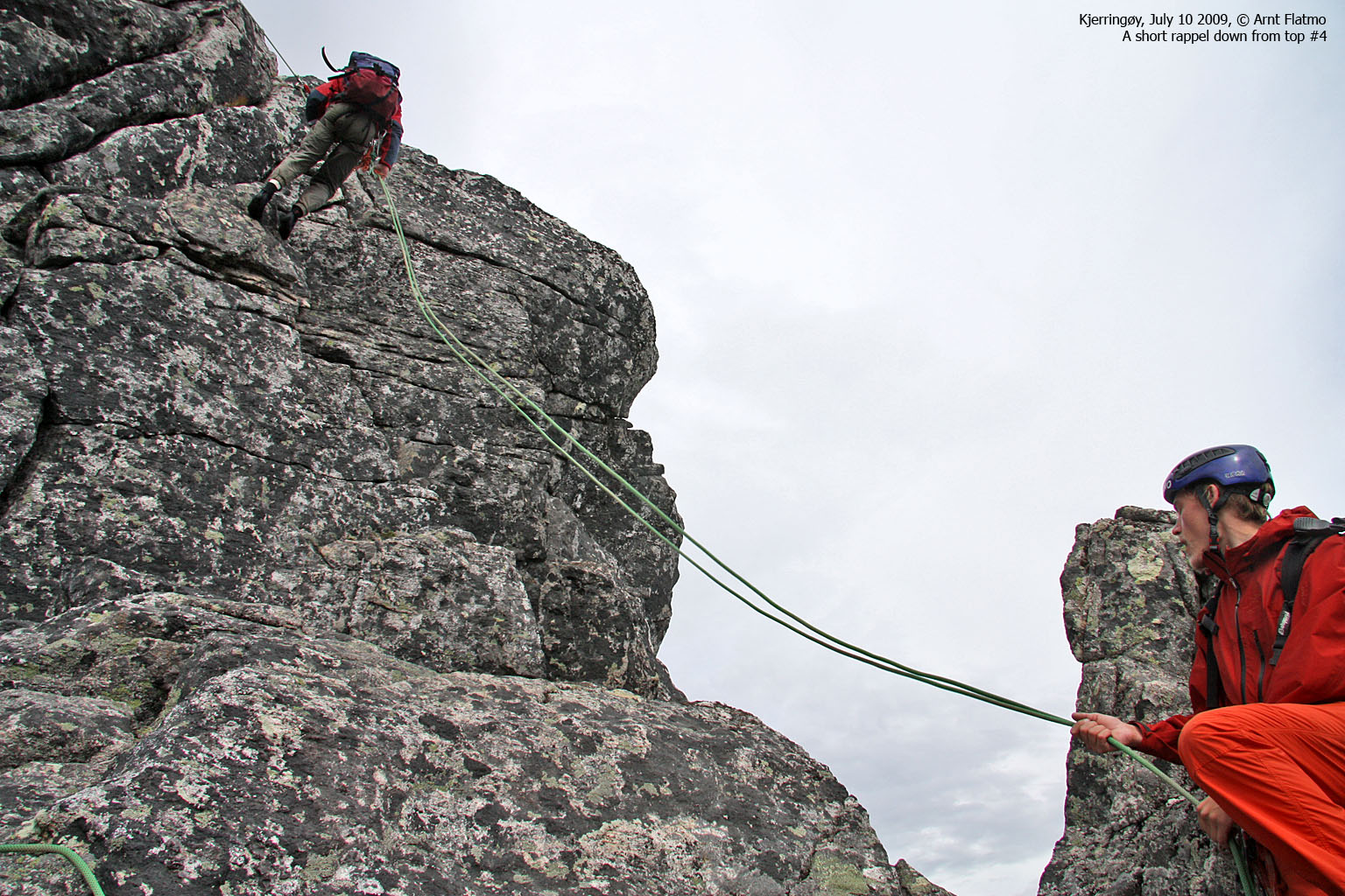
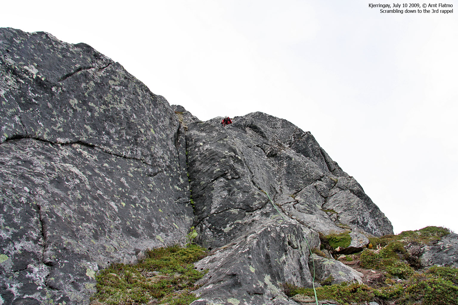
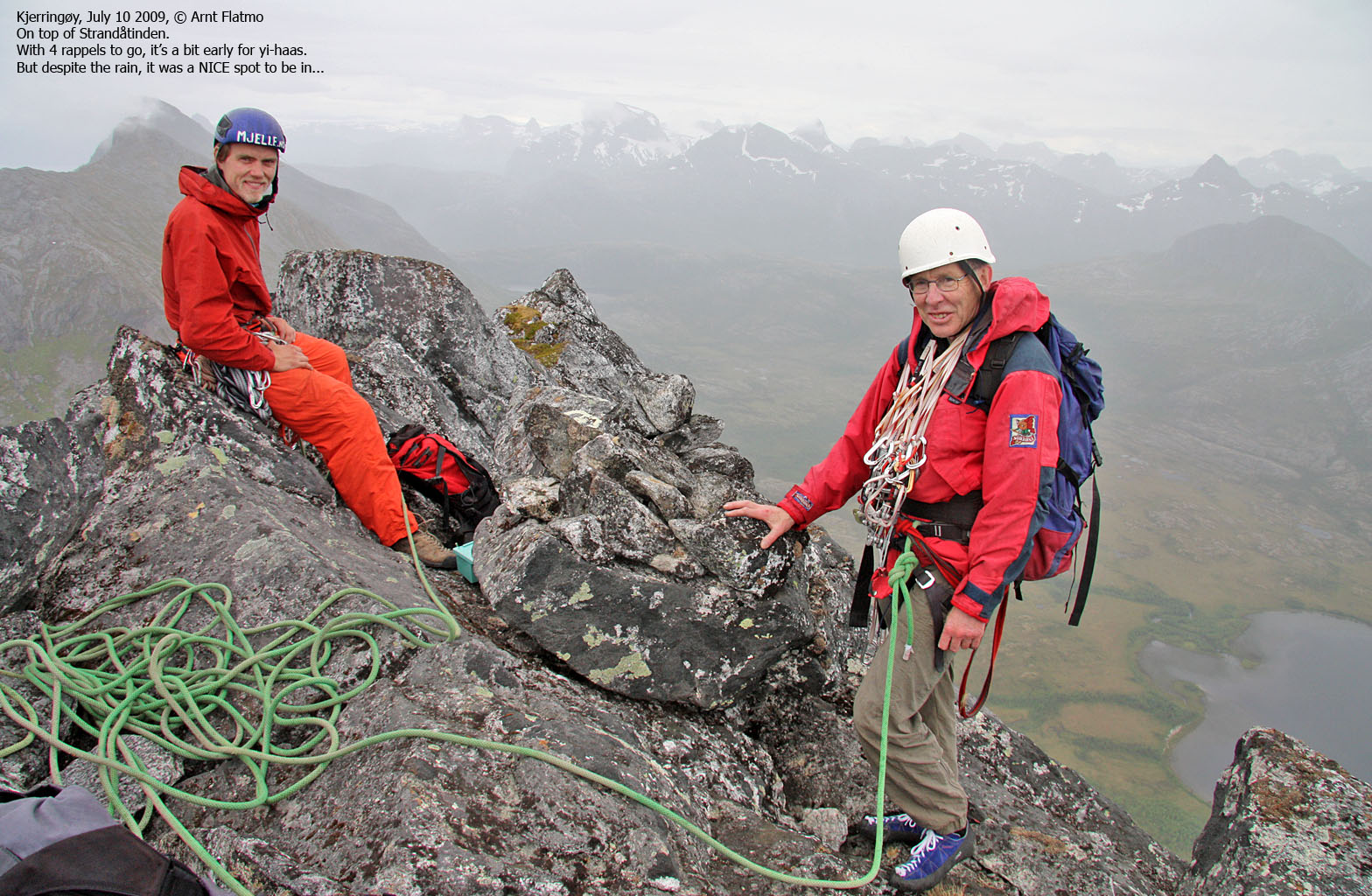
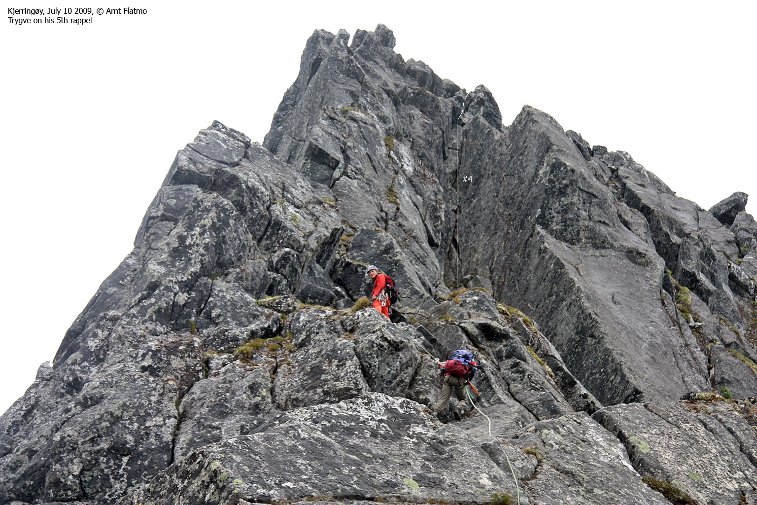
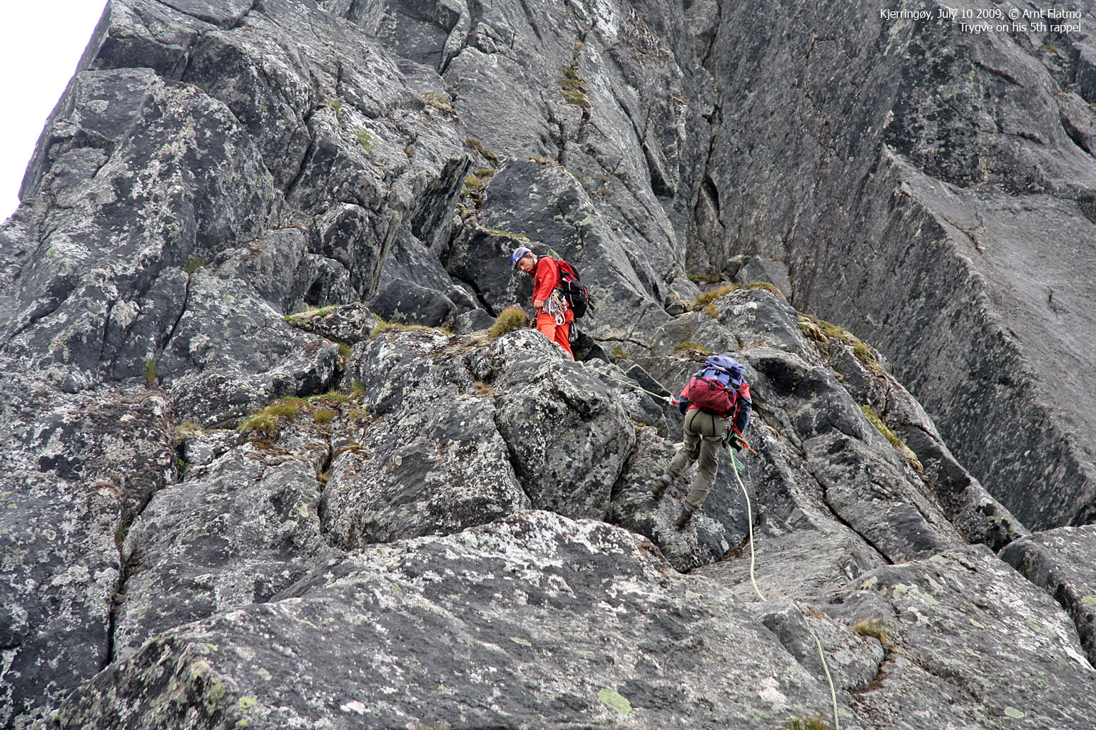
The second obstacle is a steep slab-rock cliff, (grade 3+/4-) where the climbing route is approx. 10m high (estimate). This pitch has no natural belay points, and it is gets much more difficult when wet. Continue walking/scrambling up to the foot of the summit block. Pass the summit block on the right-hand side, across slanting rocks with some exposure. (Store) Strandåtind summit is marked by a few rocks. Descent: Scramble 50-60m (estimate) along the ridge from the summit to the fourth rappel point. This (approx.) 45m rappel runs vertically into a chimney, from which you need to move sideways (to your left, face in) over to a belay point. You may see another rappel anchor on the top of the chimney. This anchor is used by those who use a 60m rope. Shortly after the belay point (and along the ridge), you'll come to the fifth rappel point. This rappel is also approx. 45m, and is not as steep as #4. After a further short scramble, the sixth rappel is awaiting. But this section is only 15m. |

The west ridge on Strandåtinden, hi-res
|
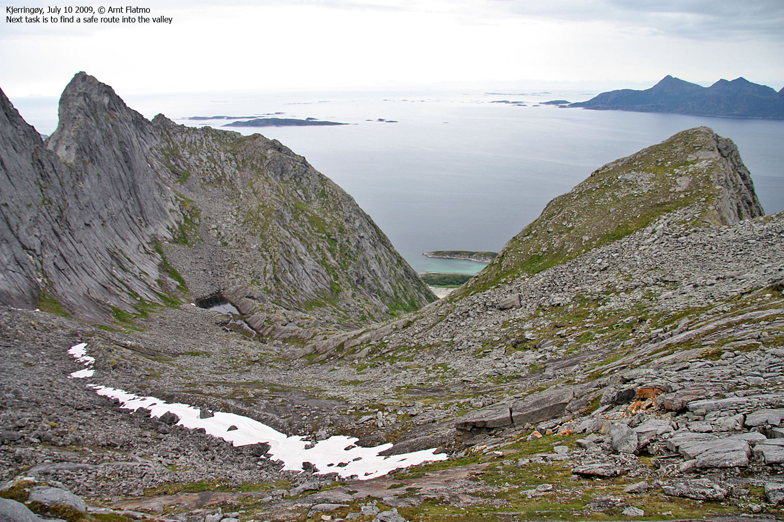
Finally, proceed to the lowest point on the ridge towards point 811m and prepare the seventh rappel (approx. 40m), which will take you down to the basin. Descend as far as you can before you unrope and look for a way down in-between the slabs. Keep right, rather than left. Rejoice as you look up. Rejoin your ascent route and follow the path down to the trailhead.
 westcoastpeaks.com
Other Nordland mountains
Other Norwegian mountains
westcoastpeaks.com
Other Nordland mountains
Other Norwegian mountains


