
Norwegian Mountains, Møre og RomsdalSukkertoppen: "Hyllene" Oct 24 2007Back to the main Sukkertoppen page

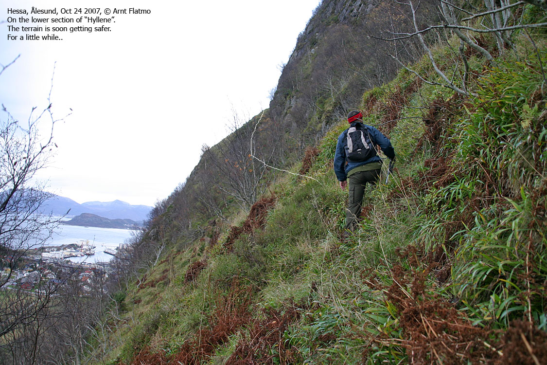
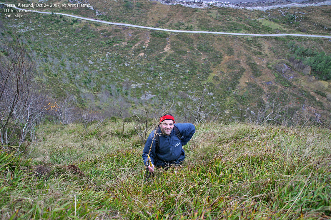
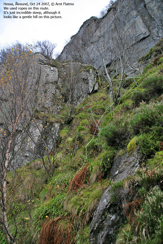
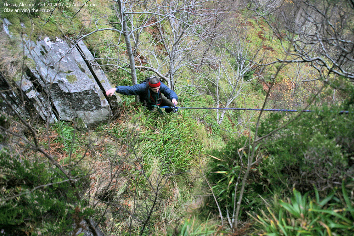
Advanced routes (including "Hyllene") on Sukkertoppen. "Hyllene"... (the shelves/ledges) is an insane route to Sukkertoppen, and is certainly NOT a recommended route to the top. We're just letting the extremists know about its existence. I "re-discovered" this route (I'm sure someone has done it in the past) Apr 14 2007. I didn't have the necessary guts to complete the route alone, so I returned May 30 2007 with my colleague Olav. Using a rope in the steepest section, we got up without any difficulties. Please... But we didn't take any pictures, and I wanted to document this route in detail. So on this October afternoon, I finally managed to get Olav to join me on a new hike. After months of rain, it had been dry for a couple of days, enough to make the route a safer one. This was not Olav's favorite route to Sukkertoppen, and his OK (sigh!!) was not not an immediate and wholeheartedly one. And off we went We headed out from Hæssabana (as the locals say) 16:04PM. It took us 40 minutes up to the entrance to the climbing section. Olav had forgotten his ice-axe and borrowed mine. Scrambling without it was less difficult than I had feared. We had agreed to use the rope this time as well. Olav belayed me while I scrambled the steep grass and climbed the trees (!). I anchored the rope around a tree above the "crux" and told Olav to come along. Since we were short on daylight, I suggested that Olav should use a jumar and climb as fast as possible. Oh NO!!!!! Just as Olav ascended the "crux" section, I did a very stupid thing. Normally, I secure items that I put away using the ice-axe, but the axe was up by the tree where I had secured the rope. I put the camera away - unsecured - as Olav was bypassing me, and the camera fell. 30 meters.... But there was not a cracking sound to be heard. Perhaps it survived? Using a sling as a prusik (I know, but it worked like a charm) I climbed back down and found it at the end coil of the rope. It looked fine, and GGMM¹, it worked fine. The extra trip up and down was good practice. I believe I am now ready to do the entire route without a rope. And perhaps with Troll in the backpack? Certainly a bonus point to be claimed there... Insane... is what Olav called the route above the crux. We were now moving unroped, and the terrain was very steep. But as long as we had roots and trees to hold on, the ascent was quite secure. We reached the top 17:45PM and decided to descend via Trollråsa. After ascending Hyllene, Trollråsa was child's play. I was more or less running down the whole route, while Olav didn't feel the need to. We were back at the trailhead 18:17PM, soon very much out of daylight. ¹: Good Golly Miss Molly
The pictures hopefully give you an impression of the route. It was rather dark (for taking pictures) already at 16:00PM, and naturally, it only got darker. See the main Sukkertoppen page for a route description. Don't try this route unless you know what you're doing (a stupid disclaimer, but still..)
Slideshow, all pics on this page:
Early morning + map of the route
Up to the climbing part
The climb/scramble
To the top
No Javascript: 0 1 2 3 4 5 6 7 8 9 10 11 12 13 14 15 16 17 18 19 20 21 22 23 24 25 26
|


