
Norwegian Mountains, Møre og RomsdalTjønesfjellet, 499m (Tynesfjellet, Tjønesnakken)

Tjønesfjellet
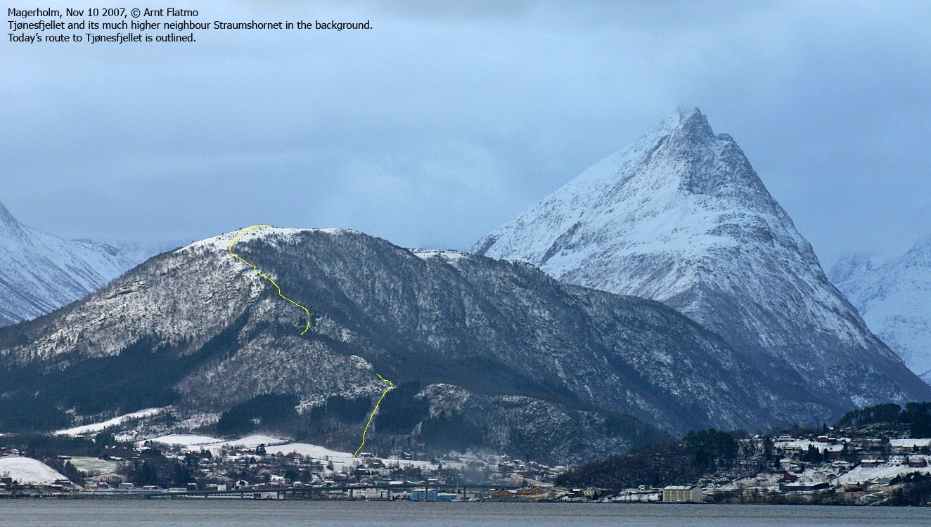
IntroductionTjønesfjellet is one of the lower Sykkylven mountains, and connects to the Straumshornet - Dravlausnyken ridge. The hill/mountain can be reached on several routes. The north ridge can be hiked from the Straumshornet trailhead. You can also get to this trailhead from Straumgjerdet. This page describes a route up the south ridge, starting at Blindheim. The mountain is also (or perhaps even more) known as Tynesfjellet. The names Tynes and Tjønes will vary between various maps. Primary factor:Tjønesfjellet (Norge 1:50,000: 498m, Økonomisk Kartverk.: 498,5m, UTM 32 V 375740 6916735) has a primary factor of 115m towards the higher parent Straumshornet (985m). The defining saddle (approx. UTM 32 V 376234 6914783) is found between the two tops. Ref. Økonomisk Kartverk (5m contours), the saddle is within the range 380-385m, interpolated to 383m.
Google mapGoogle's interactive map. You can zoom, pan and click on the markers.
Trail descriptions
Notes: Class ratings are in reference to YDS. Click here for more information.
The trails described below are not necessarily the *easiest* trails to this mountain.
Access (all distances are approx. distances) From Ålesund, follow highway E39 towards Bergen, and then highway RV60 (Stranda) to the Magerholm - Ørsneset ferry (towards Sykkylven). This ferry runs quite often; every 20 minutes in the busy hours of the day. From Ørsneset, follow RV60 (Stranda) 4,3Km. Turn left towards "Vik" (before Esso gas station (per July 2007)). Drive up to the next junction and turn right. Drive 700m and turn left (next to Hydro gas station (per July 2007)). After 600m, you reach a self-served toll booth. Find parking here.
The north ridge route
The route Cross the acre ahead of you and head for the point where the power line crosses the ridge. An opening in the forest provides easy access up to the ridge. There is also a vague path here. Cross below the power line and follow the path up the forest. In the lower forest, the path runs on the south side of the ridge. Per Nov '07, the path was marked by occasional red markers on trees. A bit higher up, the path follows the ridge proper. You'll pass a broken (unless someone raised it again) trigonometric point at UTM 32 V 375668 6917224. This is map point 452m. The (unmarked) high point is found 500m to the south. Descend your ascent route, or traverse down to point 383m and follow the Vikedalen road back down.
Trip reports and pictures
Other pictures
No Javascript:
|


