
Norwegian Mountains, Møre og Romsdal
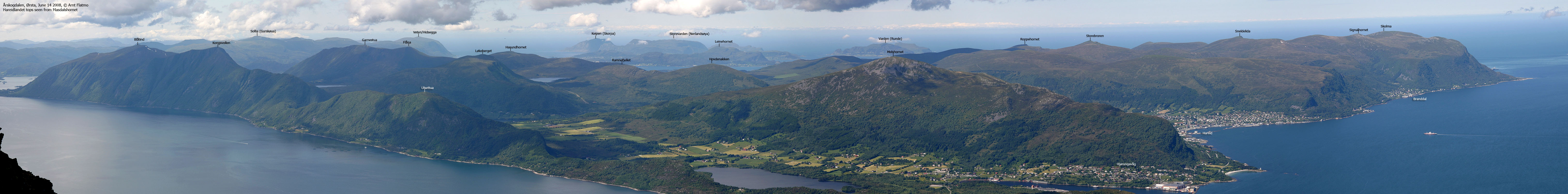
Ulsettua, 389m

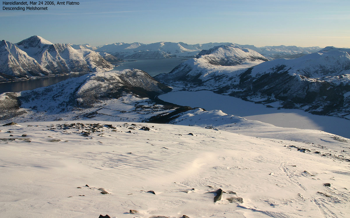
Ulsettua (left of the lake)

Introduction
Ulsettua could perhaps be translated as "the Ulset turf" - a not very pompous name
of the forest hill located above the Ulstet farms. Perhaps it is because the higher - and much
more known Melshornet mountain completely dominates this area. Ulsettua is located south of Melshornet
and southwest of the historic place Hjørungavåg.
The Ulsettua top has no cairn, not even a simple rock to mark the high point. The 365m
trig. point is located 900m southwest of the high point. Only faint paths lead up to the
top, and you need to be lucky in order to find the paths down in the boggy lowland. The views
from the top ain't bad, though, many thanks to the splendid Ørsta mountains on the
other side of Storfjorden.
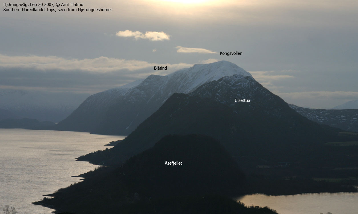
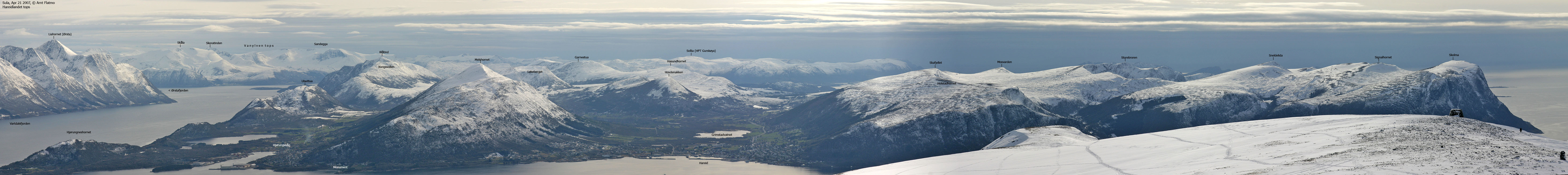
Ulsettua is a top on the long ridge that rises from the ocean east of Hjørungavåg.
The ridge span the tops Hornet (185m), Åsefjellet (141m), Ulsettua (389m), Kongsvollen (683m),
Blåtind (697m and the highest point on Hareidlandet island) and finally Haddalshornet (607m).
A complete traverse of this distinct ridge would be a very fine traverse indeed.
Hjørungavåg on Wikipedia:
Primary factor:
Ulsettua (Norge 1:50,000: -, Økonomisk Kartverk: 389m, UTM 32 V 345050 6912933)
has a primary factor of 261m
towards the higher parent mountain Kongsvollen (683m).
The defining saddle (approx. UTM 32 V 343718 6911468) is found between Kvamstua and Ulsettua.
Ref. Økonomisk Kartverk (5m contours), the saddle is within the range 125-130m, interpolated to 128m.
Personal GPS measurement averaged the elevation to 392m, over a 5-minute period. The GPS was located on the ground.
Accuracy was not recorded.

Ulsettua (left of Melshornet)
Trail descriptions:
Notes:
Class ratings are in reference to YDS. Click here for more information.
The trails described below are not necessarily the *easiest* trails to this mountain.
|
Hjørungadalen - Ulsettua (summer/autumn)
| Difficulty : | Class 1 (YDS) |
| Exposure : | No |
| Comments : | Boggy terrain |
| Distance : | Approx. 1,5Km to the top |
| Time : | Approx. 45-60 minutes to the top |
| Starting Elev.: | Approx. 85m |
| Vertical Gain : | Approx. 300m |
|
|
Access
From Ålesund, follow highway E39 towards Bergen, and then RV61 towards Hareid. Take the
Sulesund - Hareid ferry.
Option 1: Follow RV61 (roughly) 3Km in the direction of Ulsteinvik.
Turn left at the "Røyset" junction. After 1Km on the road to Røyset, stay right
in a Y-fork. Roughly 4Km later, you meet an intersecting road. Turn left and drive approx. 1,3m.
Turn right onto a rough gravel road at the end of an acre. Small-clearance vehicles can drive
approx. 200m on this road before parking.
Option 2: At Hareid, turn left in the direction of Hjørungavåg. Follow the main
road into Hjørungdalen valley, and after 7,7Km (from Hareid) turn left onto the rough
gravel road mentioned above.
The route
Expect this to be an off-trail hike. You can follow the rough road for a little while.
Then hike across a boggy meadow, stay left of the forest and gradually climb obvious ridges
that will eventually take you on the high ridge. Above 250m elevation, you should spot a faint
track that you can follow upwards. The faint track takes you south the high point, and you need
to cross a small meadow in order to get up to the high point, which is not marked in any way.
Descend your ascent route.

Ulsettua seen from Kongsvollen
Trip reports and pictures
Other pictures:


")


No Javascript:
1
2
3
4
5
6
7
8
9
10
11
12
 westcoastpeaks.com
Other Møre & Romsdal mountains
Other Norwegian mountains
westcoastpeaks.com
Other Møre & Romsdal mountains
Other Norwegian mountains


