
Norwegian Mountains, Sogn og Fjordane
Vingekvarven from Langevatnet, Aug 23 2009
To the main Vingekvarven page (maps, route descriptions, other trip reports, etc.)

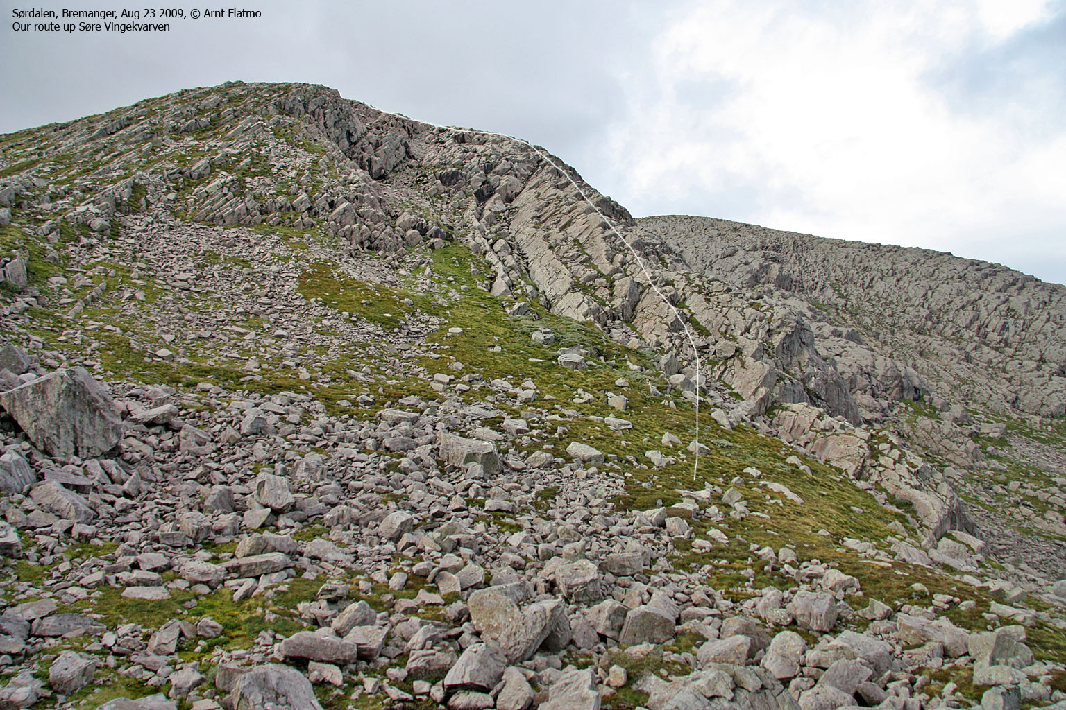
The route to Vingekvarven
(Click for larger image)
This weekend, Anne Rudsengen and I were visiting the Ålfotbreen mountain region. The day before (Saturday) we had visited Haukåbøra - a hike through a fantastic landscape. Over pizza and beer & wine at Svelgen Hotell, we discussed various options for Sunday. Gulebrystet between Nordgulen and Midtgulen was long a good candidate, but we ended up with Vingekvarven. Based on pictures I had taken from Hornelen in June, Vingekvarven seemed to have much of the same rock formations that we'd seen on Haukåbøra the day before. And we wanted more of the sort!
After breakfast at the hotel, we drove up to Langevatnet and looked for a path. We soon found one, and at 10am - we were on our way. The path was OK, and the terrain was of the gentle kind. And after a little while, we got the mountain in view.
Early on, I had set my eyes on Søre Vingekvarven's east ridge. This was surely not the normal route, but it looked fun. I told Anne that I was quite keen on checking out this ridge, and she didn't mind at all. Seen from a distance, it wasn't easy to tell how easy or difficult this ridge would be.

The east ridge on Søre Vingekvarven
(Click for larger image)
The weekend forecast for the region was still rain showers, but so far, no showers could be seen. How excellent wouldn't it be to get two super hikes without rain, on a weekend with a mediocre forecast? Especially since we had travelled some distance to get here. We were both excited about getting to the rocky part of the mountain. Anne's interest seemed to be primarily in the rock (I might be unjust here..), while I would be happy just scrambling on it...
Finally, the rocky ridge was just ahead of us. It was still hard to tell if there would be any difficult sections, so we would just need to head up and see. But although the ridge turned out to be quite friendly, we didn't pass the chance of some fun scrambling on dry and beautiful rock along the way.

Easy scrambling on Vingekvarven
(Click for larger image)
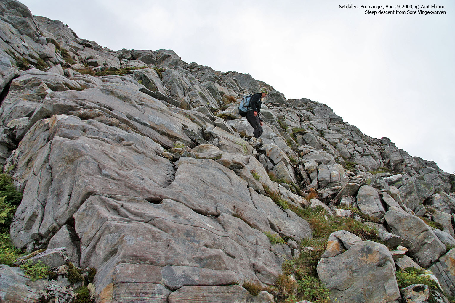
We reached the top of Søre Vingekvarven 12:16pm, and just like on Haukåbøra, the summit rock was crumbled and broken up. No slabs up here. After a short stay, we moved on and found a place to descend from the summit that wasn't too steep.
While heading up Nordre Vingekvarven, one big and lonely rock called me, and the next 15-20 minutes were spent climbing on this rock.

Scrambling below Nordre Vingekvarven
(Click for larger image)
Anne told me she would send me the Jostedalsbreen and Folgefonna book that she had been co-writing. I received this book in the mail a few days later, and I was very amused when I saw the "card" - knowing very well where it came from.

Ingenuity
(Click for larger image)
The time was 1:10pm when we reached Nordre Vingekvarven. This was also a good viewpoint. The fog that had been covering the Ålfotbreen massif was lifting, and the view towards Hornelen was stunning! And perhaps even more rewarding was the joy from getting some overview in a mountain region that was completely new to me.
We wanted to descend via the valley between the two Vingekvarven tops. This terrain was a lot of fun; an infinite number of (mini) slab gullies. - lacking a better word. It was just a matter of picking one. This was most excellent balance training, and we also got to practice on the knife-edge technique. The edge wasn't razor sharp, but sandstone smooth. Perfect, just perfect...

Knife-edge technique
(Click for larger image)
Eventually, we joined our ascent route. We took it nice and easy - didn't want to miss out any interesting details in the terrain. Just before reaching the trailhead, we passed a tree that just had to be climbed. Man, it's sure nice to be a kid from time to time.
The trip took altogether almost 6,5 hours, but it sure didn't feel that long. Must be all the kid stuff. Many thanks to Anne for good company, and I hope that the next time we meet, it will be on her home turf - Jostedalsbreen - my favourite mountain region in Norway.


