
Norwegian Mountains, Møre og Romsdal
Riste & Storholmen, July 27 2010
To the main Riste/Storholmen page (maps, route descriptions, other trip reports, etc.)

Riste
(Click for larger image)
Riste has been on my to-do list ever since I decided visit every mountain in (a.o.) Sande municipality upon moving to Ålesund in 2006. After moving to Gurskøya in 2008, this island moved several places up on the list, and I started to make inquires about how to get there. My colleague Vidar Kvalsund (now ex-colleague) was my #1 choice, having brought me to the deserted island Skorpa in 2006, and we ascended Keipen together. During the last 4 years, I've been bugging Vidar about this on a monthly basis. He was always up for the trip, but then it's the matter about finding the time during the summer...
Come July 26 2010, Vidar had only 5 working days left with our company, and I figured it was now or never. Providing stable weather, we agreed to take the trip the very next day. July 27 turned out to be an OK weather day with some wind, and the trip was on. Yeah!
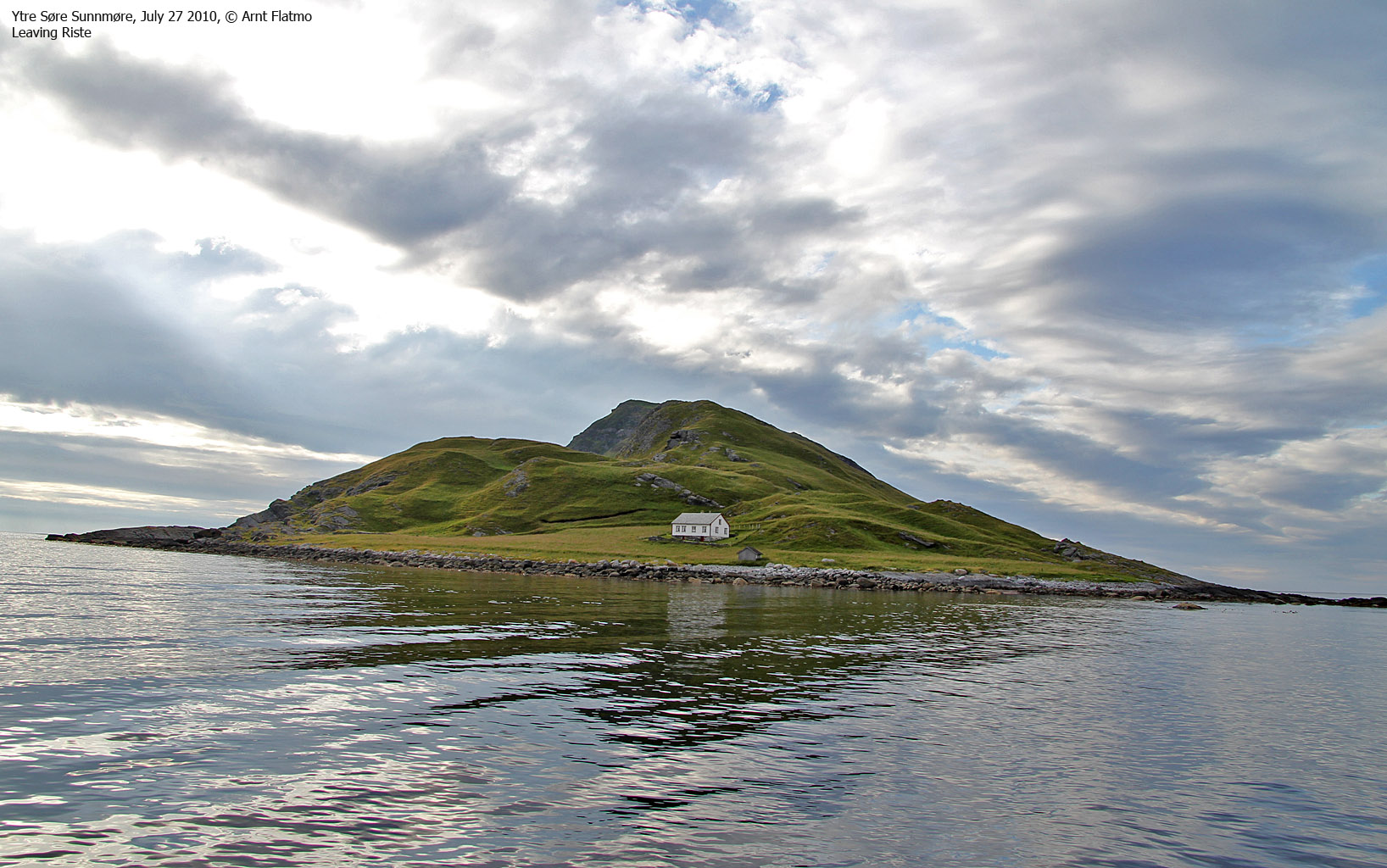
We headed out from Nerlandsøya in the afternoon in Vidar's boat, and the sea was quite rugged. I looked forward to a calmer sea when we got to the east side of Sandsøya. Not that I was getting sea-sick, but the boat was banging on the waves. After crossing under the bridge between Voksa and Sandøya, Riste appeared. Double yeah! 4 years of waiting would soon come to an end.

Approaching Riste
(Click for larger image)
After 21,1km on a rough and less rough sea, we anchored up outside Riste at low tide. In addition to the anchor, we secured the boat by two ropes. Confident that we would find the boat as we left it, we went up to the only house on the island and found a path.
Seconds after asking Vidar if we would see any sheep, a large flock appeared above us on Klettane. They weren't seeking human relations and quickly disappeared. But at least, we had seen them. The rest of the hike up to the top was a stroll, and we reached the top of Riste 6:40pm - 40 minutes after heading out.

On top of Riste
(Click for larger image)
I didn't care about the modest elevation - this was Everest good enough for me. I was finally here, and could soon to focus all my energy on a different place that I haven't been yet. But right there and then, the focus was on Riste. I looked forward to find information on the internet upon returning home. What was the history behind this deserted island? How many lived here, when did they leave, who visits this island now, etc. And what's the story about the sheep. Not all of my questions have been answered, but I know much more about this island now than I did before heading out there.
Not many people find their way to this island, but according to the visitor's register - 4 hikers had been up here earlier in the day! I expect that the number of visitors will (slightly) increase now that the World Wide Vikings have published a list of Norwegian islands on the internet...
This island is also renowned for its rich plant life, and at least, I was able to identify a handful of the 100+ species on this island.

Fine-leaved heath
(Click for larger image)
After a nice stay on top, we descended from the high point. We could see that the sheep on the south side of the island and decided to walk across Klettane to get a good view from above. The sheep quickly noticed our presence, didn't fancy it, and took off rather quickly...

Sheep taking off
(Click for larger image)
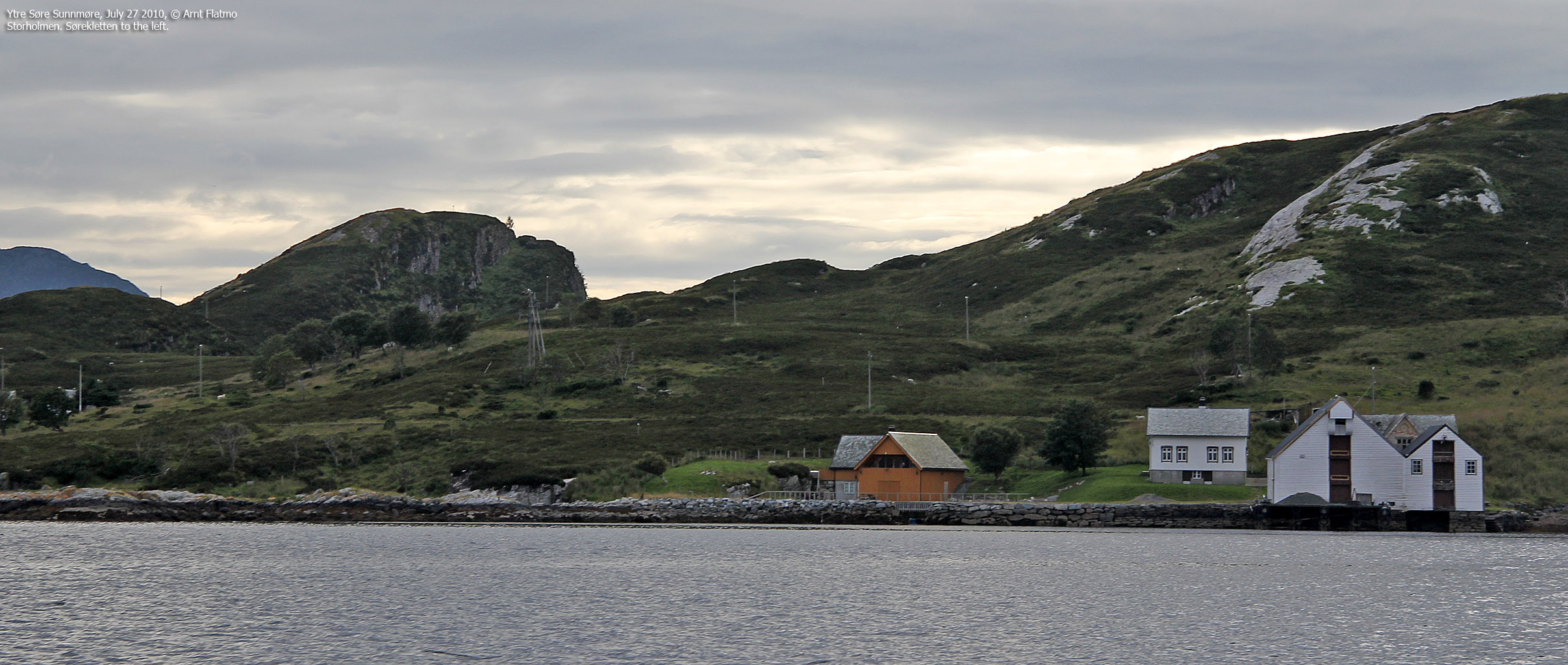
After returning to the boat, we agreed to stop by Storholmen island. My primary interest in Storholmen was that I had also made a list of Sande tops with a primary factor > 50m, and Storholmen was the only top on this list that I couldn't easily get to.
After a 8,4km boat trip (passing Kvamsøya to the east), we anchored up on Storholmen. Vidar decided to stay at the harbour while I did my thing. I followed a trail to a house, then went off-trail. Within minutes, I had breeding gulls around my feet and freaked out. There were all sorts of signs from the sky, but I didn't take notice. Screaming gulls aren't exactly unusual, but I have never been in the middle of a breeding colony before. It was a steep learning curve, and I tried to minimize my footprint as best as I could. I reached the top (without any particular joy) and decided to follow the shore back to the boat.

Busy sky above Storholmen
(Click for larger image)
26,3km later, we were back on Nerlandsøya. A splendid trip (except for the gull encounter) had come to its end. Upon returning home, I started to reading myself up on Riste and Storholmen. I found through Naturbase there was a proposal to make Riste a nature reserve, and I called the SNO representative for Møre og Romsdal county to find out more about this. I was then told that Riste had already become a nature reserve and that I had to talk to Fylkesmannen about the details.
I called Fylkesmannen's office and had a good talk with a a representative who confirmed that the mountain top was restricted area in the period May 1 - July 31. I was pointed to the details of the resolution and was informed that it would not be in effect until Aug 1 2010. As such, we had not broken the rules by visiting Riste's high point.
Through further searching on the internet, I came across one of "Ristes Vener", who seemed to know everything there was to know about Riste. He told me that the path to the top was still open during the restricted period - and that this was part of the resolution. And sure enough, after reading the document a bit closer;
|
DN viser til at forstyrrelse er en av de største truslene for hekkende sjøfugl og foreslår at området vernes som reservat og at ferdsel på land nordvest på Riste forbys i perioden 1. mai - 31. juli, jf. kart. DN tilrår at det av hensyn til friluftslivet gis unntak fra ferdselsforbudet for bruk av stien fra Riste opp til Rinden. |


")

")

