
|
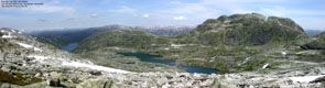
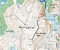
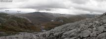
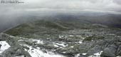
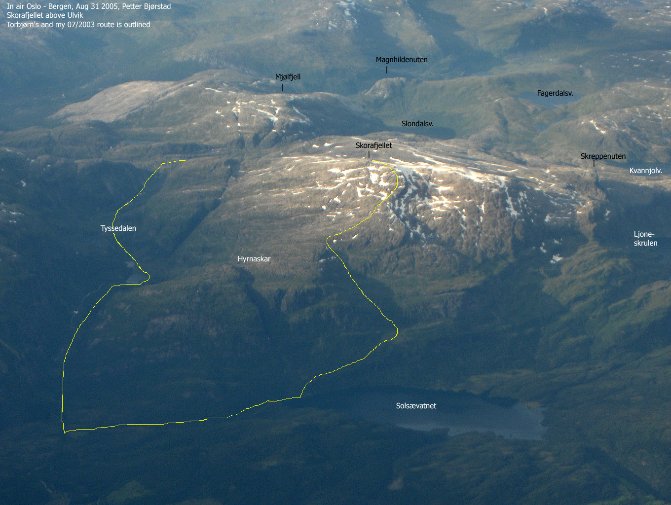
Mjølfjellet seen from Skorafjellet(No Javascript) |
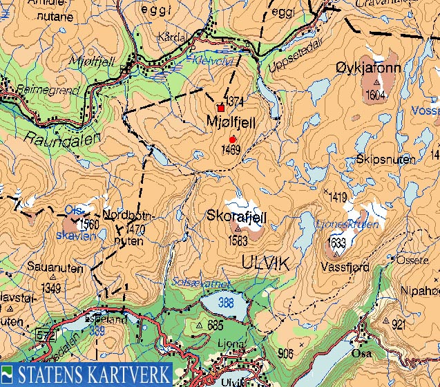
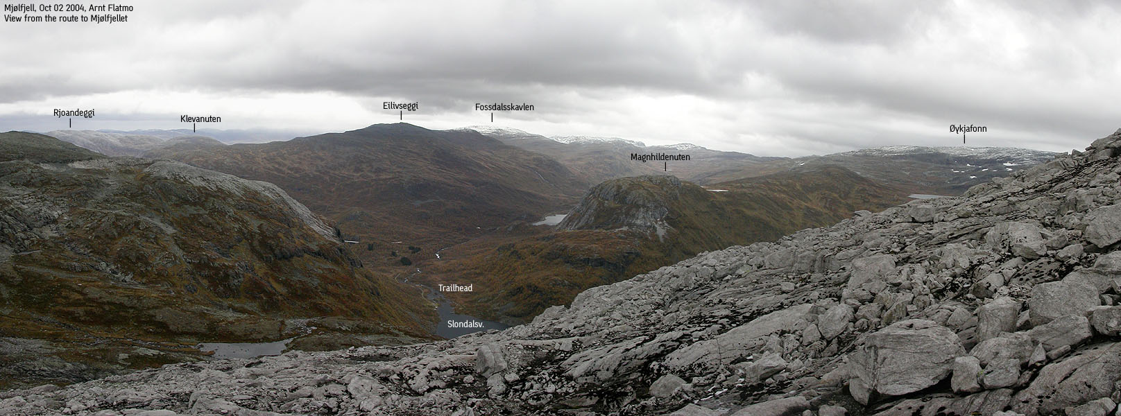
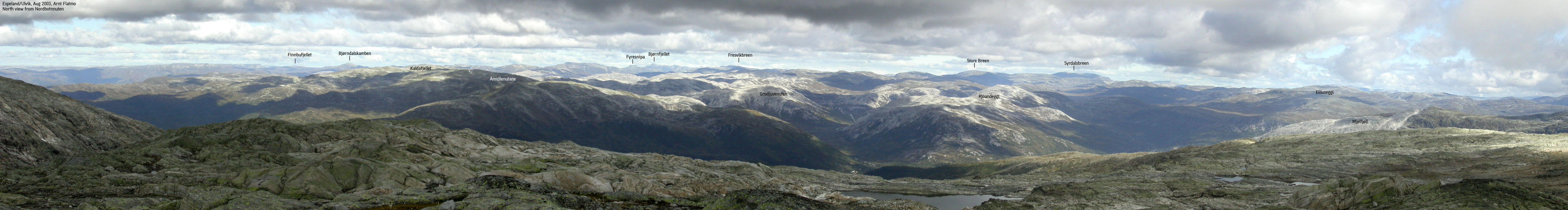
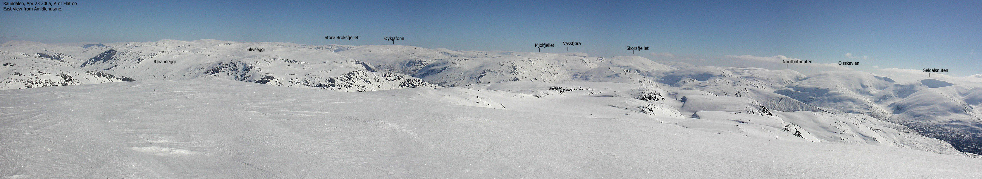
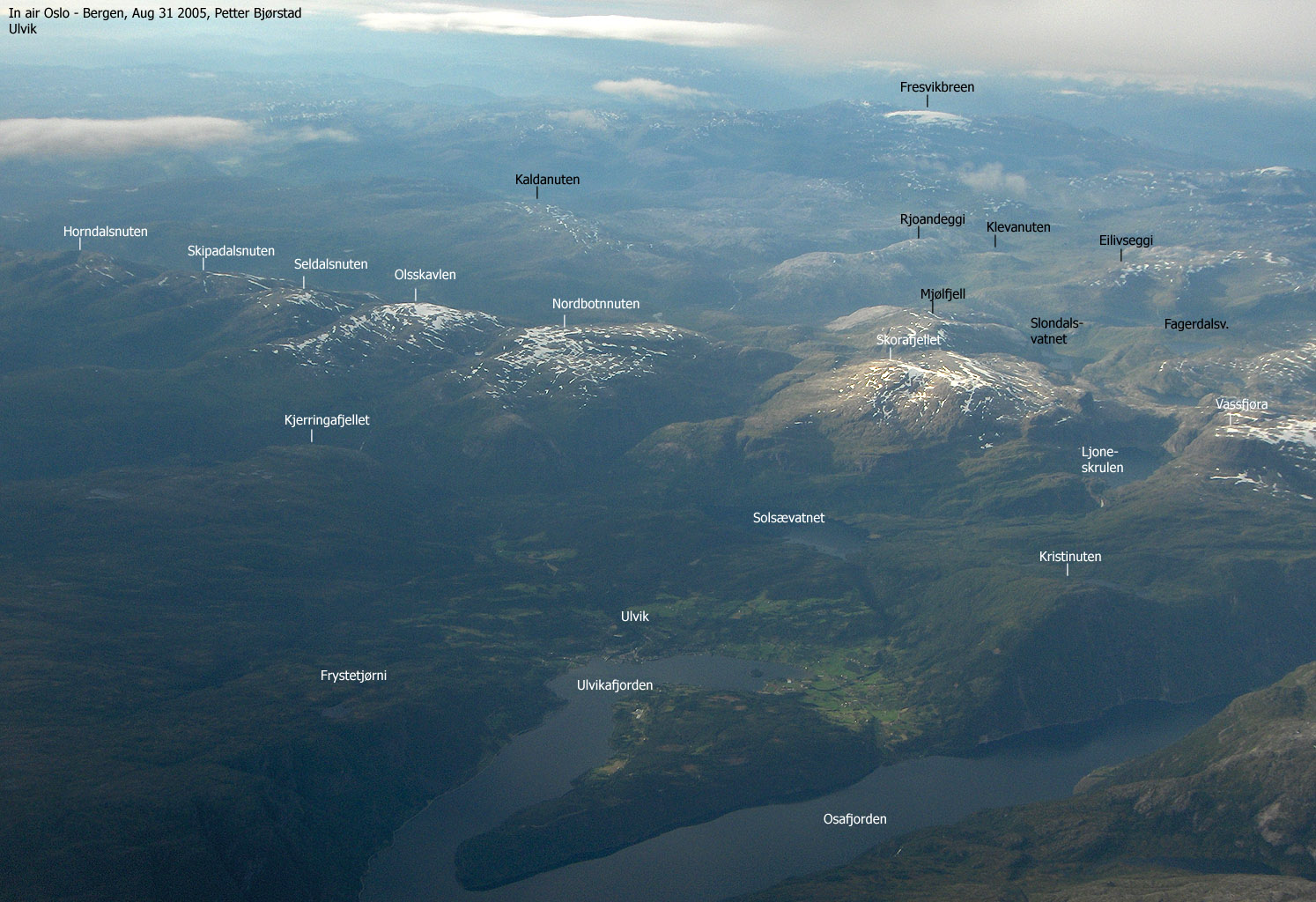
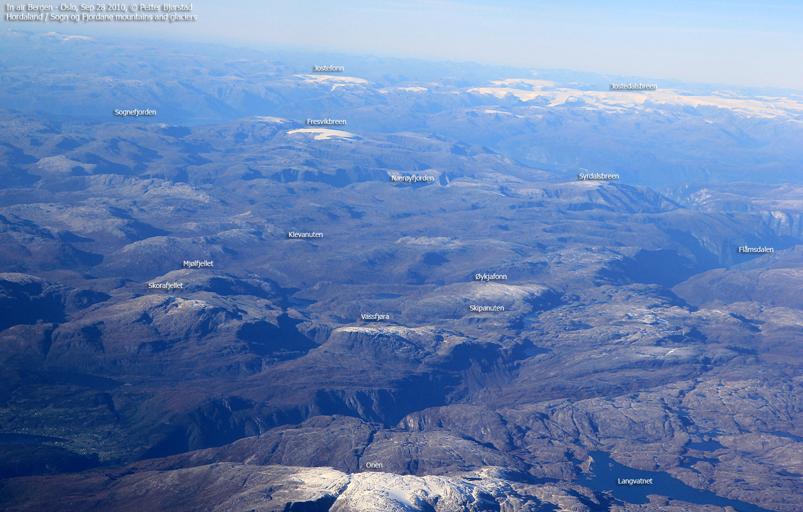
A mighty mountain range rises from Voss and towards the east. The Raundalsegga ridge, including Horndalsnuten, Skipadalsnuten, Seldalsnuten, Olsskavlen and Nordbotnnuten connects to the Ulvik mountains Skorafjellet and Vassfjøra via the Fallet (1000m elev.) pass. Mjølfjellet connects to Skorafjellet through a high pass and is logically a part of this mountain range.
While Mjølfjellet is a mountain, Mjølfjell is a place, perhaps more known as a train station along the Bergensbanen railway between Bergen and Oslo. Mjølfjellet is also as far as you can drive up the Raundalen valley. Mjølfjell is a popular cabin village, and you will also find youth hostel here.
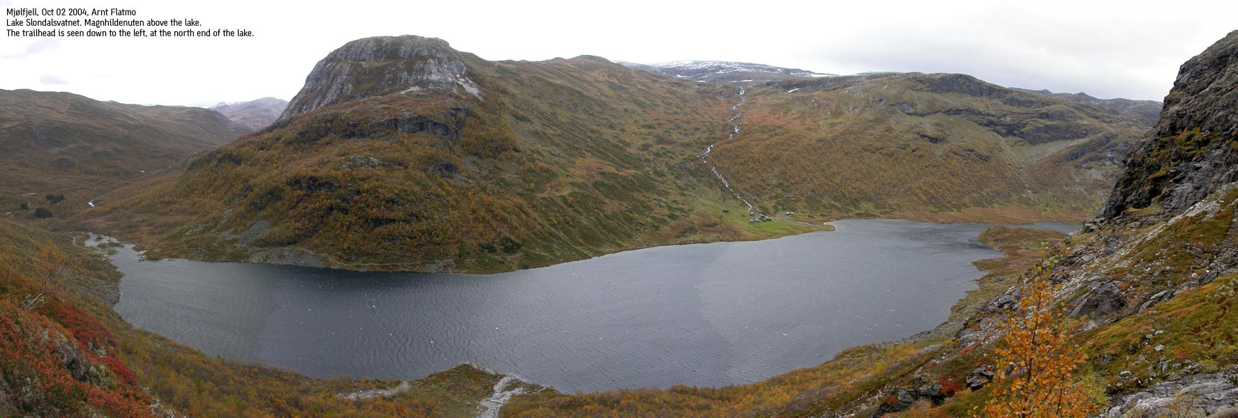
The area is very suitable for both cross-country skiing in winter and hiking in summer. From Slondalsvatnet (a bit south of Mjølfjell), several trails will take you deeper into the mountains, while a gravel road will take you to Uppsete. From Uppsete, you can follow a "T" trail to the Kaldavasshytta hut, giving you a high base (1260m) for further hiking. The mountains north of Mjølfjell - Rjoandeggi and Eilivseggi are excellent for skiing.
The Ulvik/Voss kommune border runs across the northern summit (1374m) on Mjølfjellet. The main summit (1470m) lies within Ulvik kommune. The Mjølfjell area was quite visible in the newsroom in 2003. The debate was if allied forces should be allowed to use the Mjølfjell army training field for bombing. These plans were cancelled after significant pressure from the affected communities.
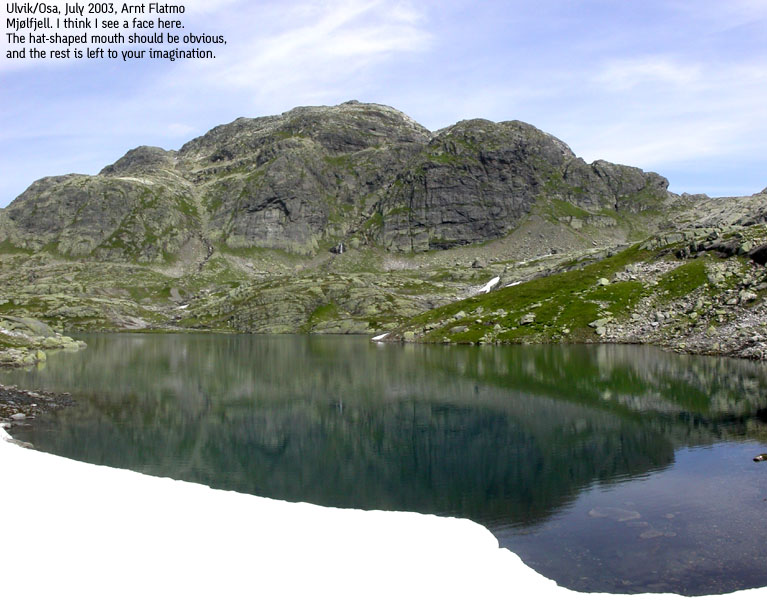
I don't know what the name "Mjølfjell" means, but "mjøl" is Norwegian for flour, and "fjell" means "mountain". One characteristic feature of the mountain is the amount of white-colored gravel and scree, and perhaps someone once felt an association between the scree and flour. This is only a wild guess on my account. If someone knows the history behind the name, please drop me a line.
Primary factor:
Mjølfjellet (1470m) has a primary factor of 240m towards the higher Skorafjellet (1583m). The saddle is found on a ridge between the two mountains. Ref. the M711 map (20m contours), you cross the 1240m contours on the high route, but not 1220m. The saddle height has been interpolated to 1230m.
Notes: Class ratings are in reference to YDS. Click here for more information.
The trails described below are not necessarily the *easiest* trails to this mountain.
|
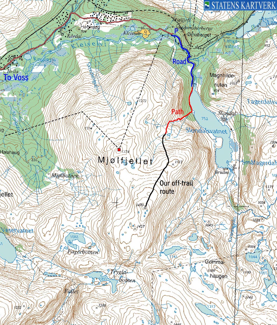
Mjølfjell - Lake Slondalsvatnet - Mjølfjellet (summer/autumn)
|
|
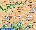
From the main traffic light in Voss, coming from Bergen, drive straight ahead ("Gjernes") instead of turning left (highway E16). Follow this road approx. 1,7Km to the highway 13 junction. Turn right onto RV13 and drive in the direction of Granvin. After 700m, turn left towards "Mjølfjell". Follow the Mjølfjell road for approx. 34,3Km to the youth hostel. The public road ends here. A gate blocks the way just up the gravel road that begins by the youth hostel. Only cabin owners are allowed to continue driving up this road. Find parking by the youth hostel.
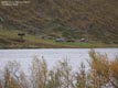
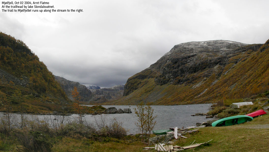
Follow the gravel road for approx. 700m. Turn right in a junction (signed "Slondal") and follow the gravel road for approx. 900m up to lake Slondalsvatnet. You will cross the river from lake Slondalsvatnet via a bridge. There is also a gate (cattle/sheep) on this bridge.
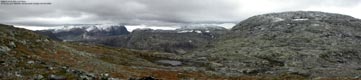
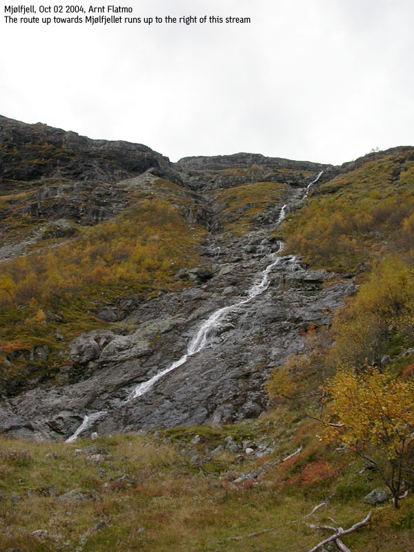
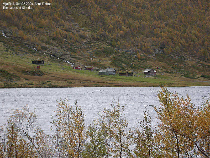
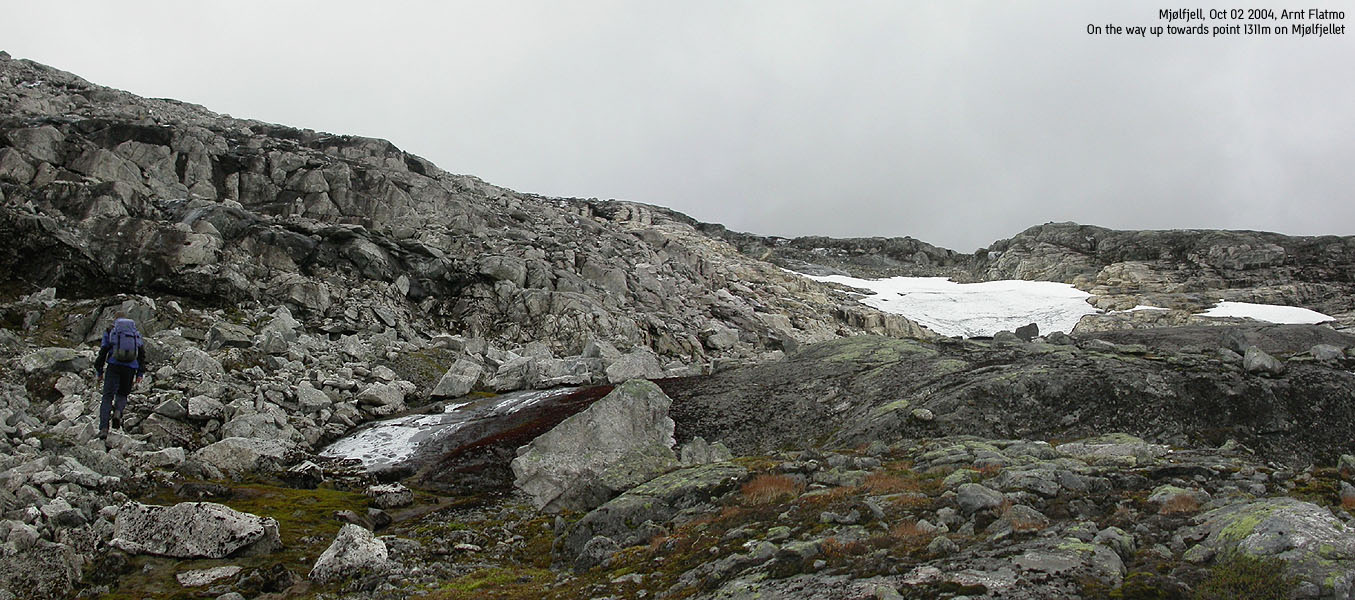
From the lake, follow a visible path along the west shore for approx. 600m. A stream from the mountains comes down here. Locate a visible path that runs up on the right hand side of the stream. The trail can be slightly cumbersome, as it runs through the birch forest. On your way up the mountain, you get good views towards the huts at Slondal and Magnhildenuten (1167m), rising high and mighty above the lake.
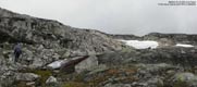
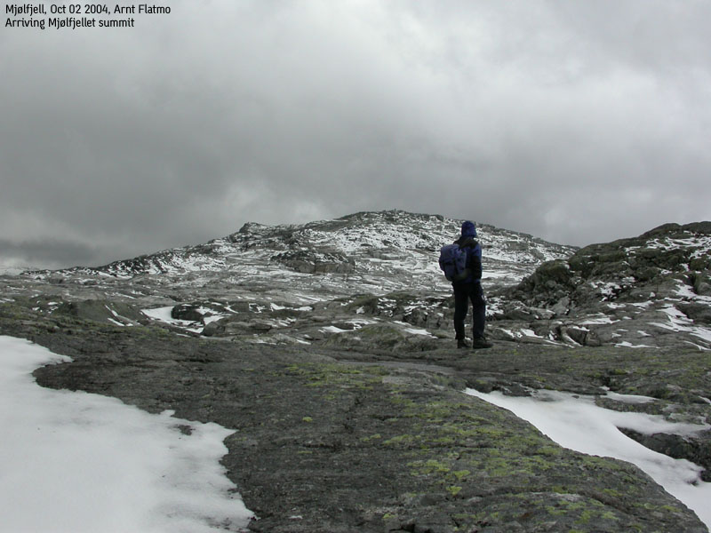
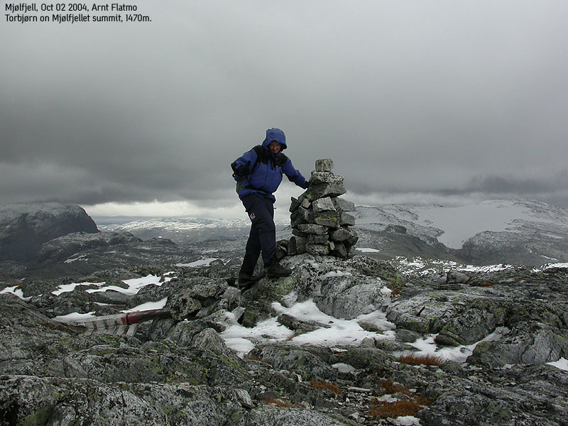
At approx. 1020m elevation, cross the stream and set a south to southwest direction which you follow all the way to the summit. There is no visible trail/path above 1100m, but no trail is required. The terrain is fairly easy to follow. Mjølfjellet summit is marked by a proper cairn.
Descend your ascent route. One option for a round-trip is the northwest ridge and via bridge to Kårdal. From Kårdal, it is approx. 3Km to the youth hostel. I don't know anything about Mjølfjellet south side, but on a good day with plenty of time, it could be worth while investigating the south ridge (to the saddle connecting Skorafjellet and Mjølfjellet). From the map, this looks like a doable route, and you can hike back along lake Slondalsvatnet. But of course, one never knows what is hidden between two contours.
|
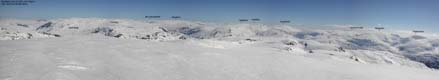
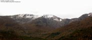
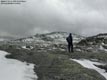
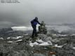
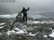
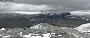
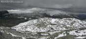
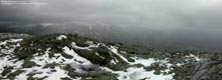
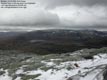
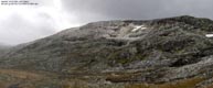
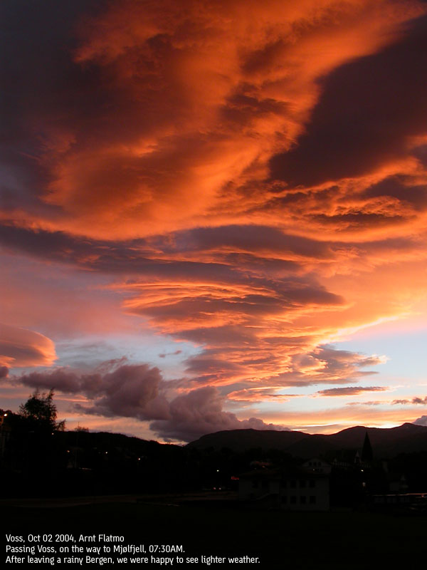
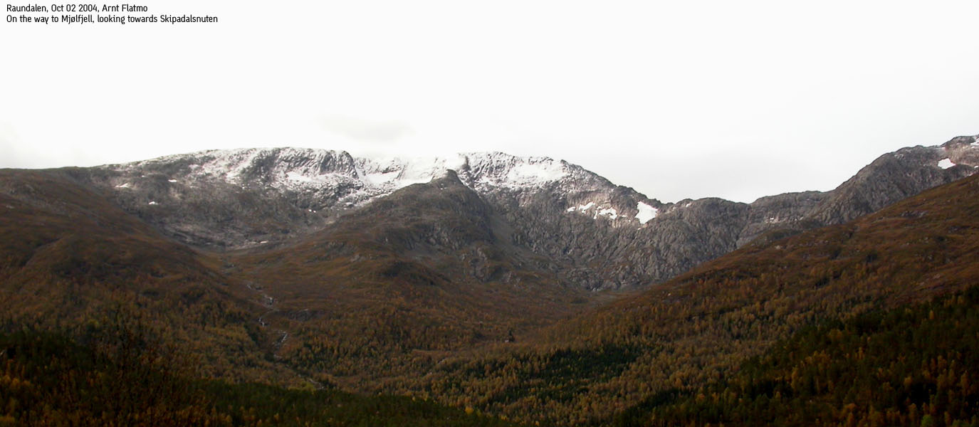
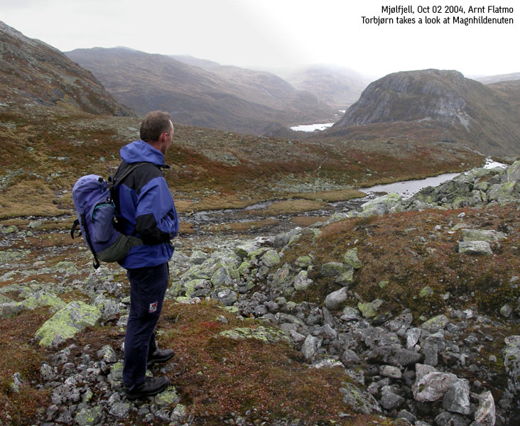
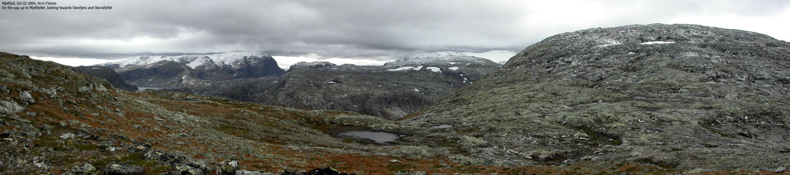
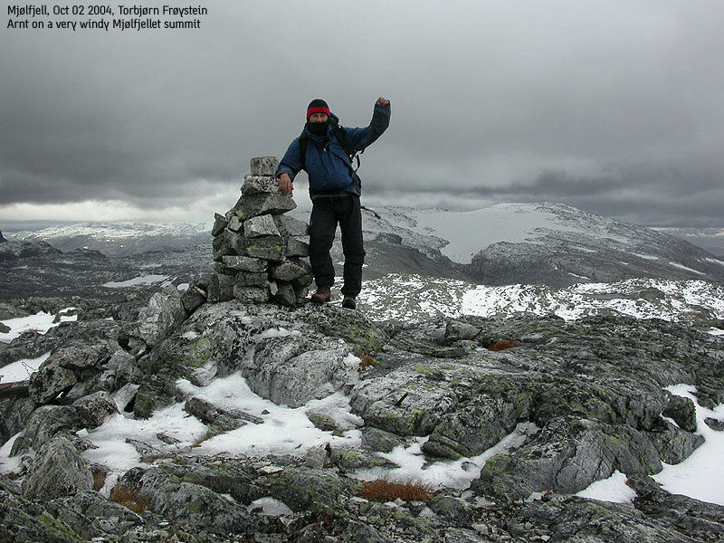
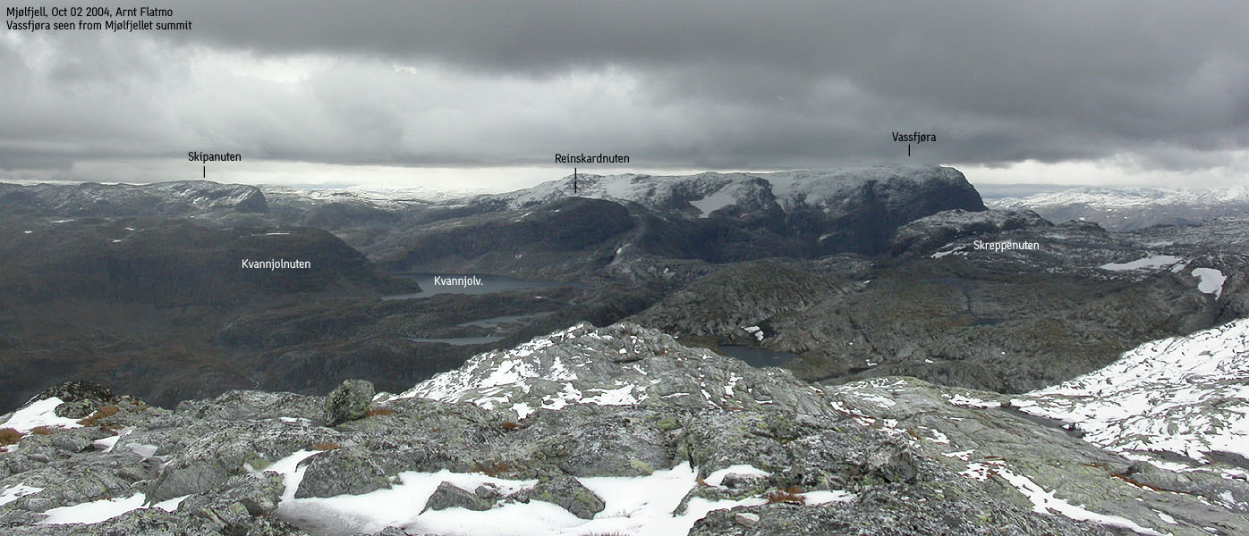
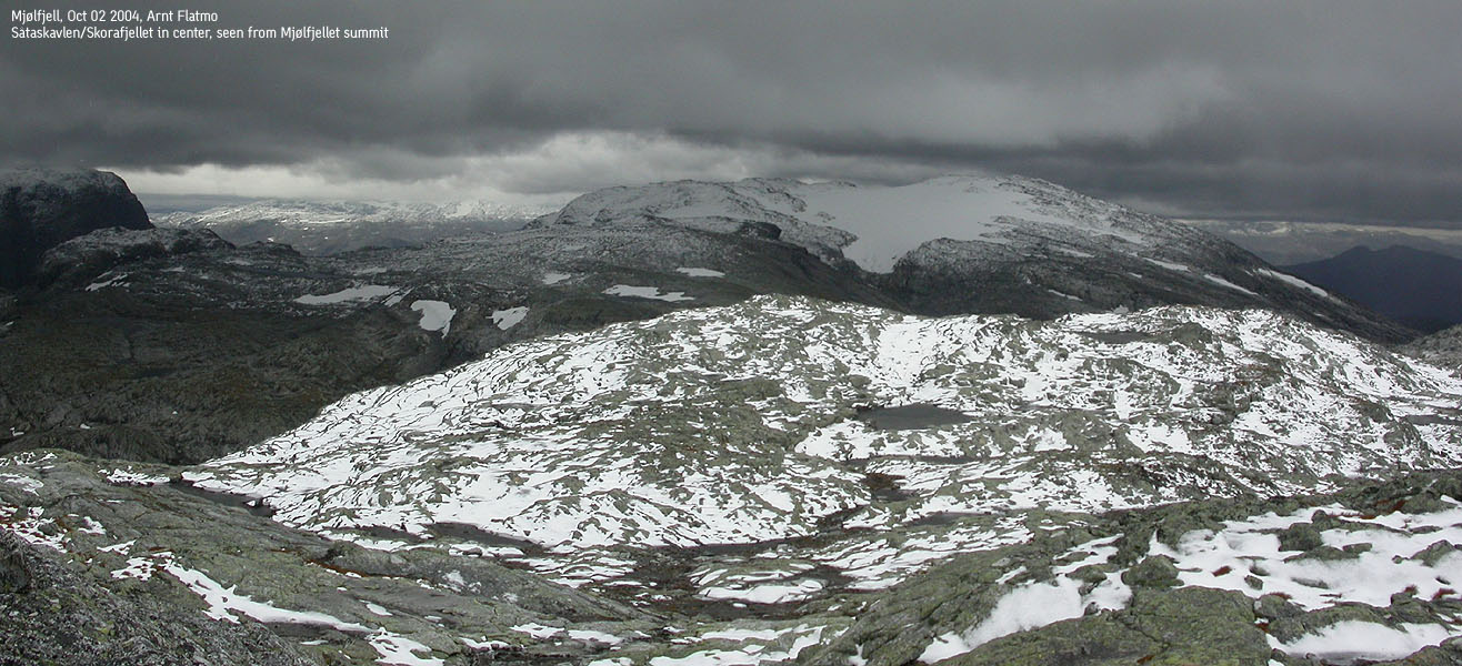
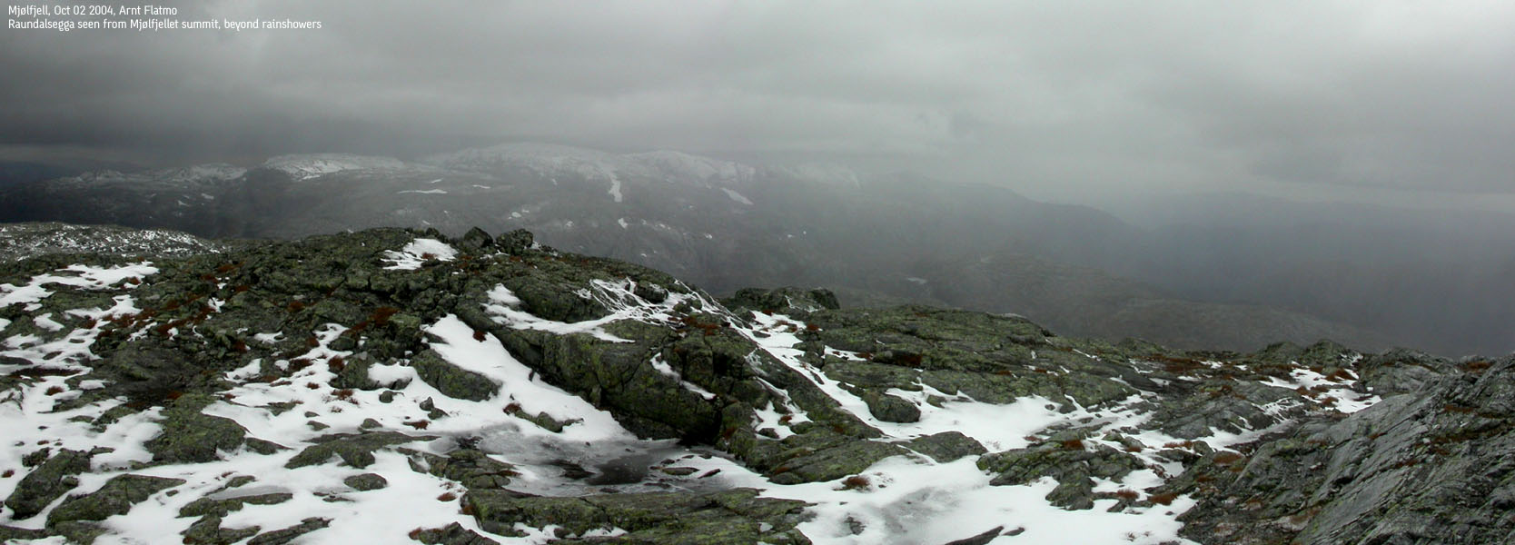
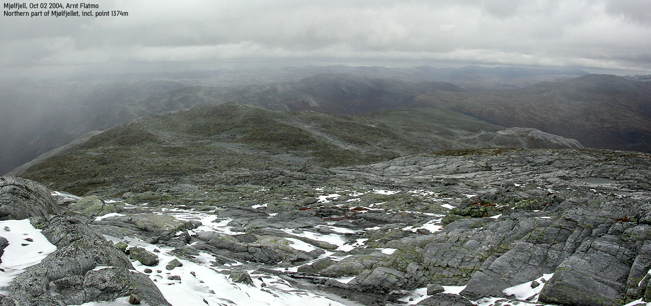
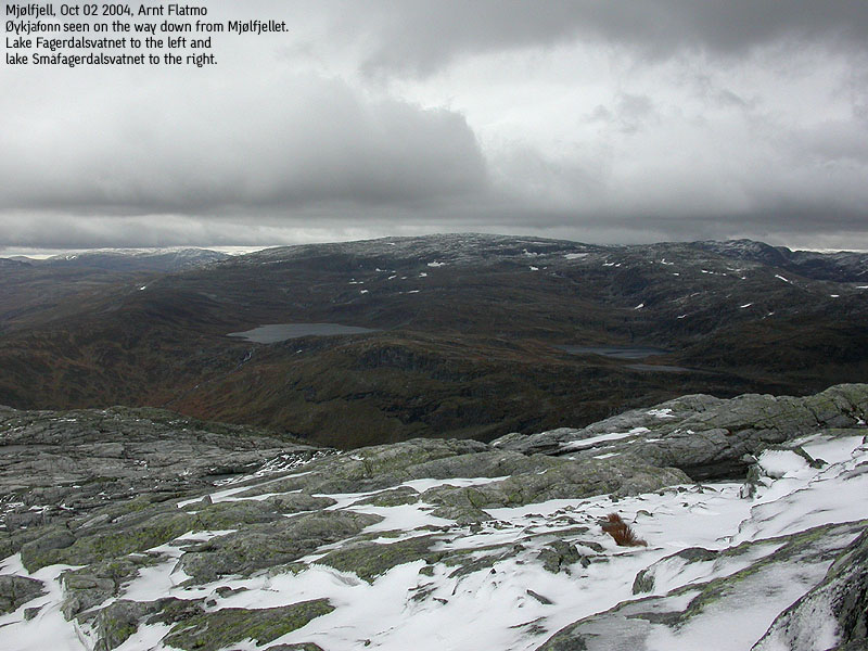
Trip Report Oct 02 2004My friend Torbjørn and I had been talking about doing a hike for quite some time now, and we decided we should go for Mjølfjellet this Saturday morning. After a few sunny and great days, another low pressure was moving in across Norway. The weather forecast said that rain would hit western Norway early. We didn't know what "early" actually meant, but figured if we left Bergen *very* early, we could perhaps outsmart the rain. I picked up Torbjørn just after 06:00AM, which both of us agreed was early enough. It was quite dark, but I noticed that the local mountains were fogged in. Besides, it had started to rain some. On the road, we were not sure if were quite early enough. But closer to Voss, things looked much better. The clouds were breaking up, and we could see the morning sun in a beautiful red glow. This caused significant optimism. After all, it's not fun driving 2,5 hours for a rainy hike. Approaching Mjølfjell, we discussed which route we should follow and decided to drive all the way to lake Slondalsvatnet and try to find a way up the mountain from the lake. Driving to the lake is only permitted for the cabin owners, but I decided to disregard this tiny detail. Troll had injured his foot and I would have to leave him in the car while we were on the mountain. As such, saving 3,2Km additional walk (up and down) would minimize the time the dog would have to be alone in the car. Furthermore, we had a rainshower to beat. This late in the season, we decided to turn "criminal". My contribution back to society is this web page, and I hope we are forgiven... We arrived the lake and were taken a bit suprise by the gale. Torbjørn did an association with a wind tunnel, and I agreed. We put on full winter gear before we started to walk. We left the car 08:50AM and headed along the lake, determined to climb up along a stream coming down the mountain further ahead of us. Next to the stream, we noticed a path up the mountain. This didn't come as a big surprise. This is a popular area. Once above the stream, a mix of snow and rain was flying around. Higher up, the weather improved and we had shelter from the wind for awhile. The hike upwards was unproblematic, and by 10:20AM, we were standing on Mjølfjellet summit. The wind speed on top was very noticeable, and we were fighting to stand upright. Taking a series of picture for a panorama stitch was impossible. Best case was two shots (one good, one blurred) before the wind moved me and the picture series got broken. We had good views towards Vassfjøra and Skorafjellet from the summit. We could also spot the Raundalsegga mountains beyond the rain showers. The rain showers weren't hitting on Mjølfjellet yet, so we were extremely satisfied with our plan so far. We left the summit 5 minutes later, and managed to drift slightly off course during our descent. This happens when you walk and talk in a less distinct landscape. After correcting the course and a quick break for food, we rejoined the path down along the stream and were back at the car by 11:45AM. It hadn't started raining yet, so the plan was now officially ranked as a success. Troll was happy to see humans again, but turned a bit disappointed when he realized that he would be stuck in the car for additional hours. The rain sat in shortly after, and the closer we got to Bergen, the more it rained. It felt tremendously good having done a high mountain on a day such as this.
Pictures from the Oct 02 2004 hike
Move cursor to read notes, and click on the images to see full version.
No Javascript: 1 2 3 4 5 6 7 8 9 10 11 12 13 14 15 16 17 18 19
|


No Javascript:
Other hordaland mountains
 Ulvik K. mountains
westcoastpeaks.com
Ulvik K. mountains
westcoastpeaks.com


