
|

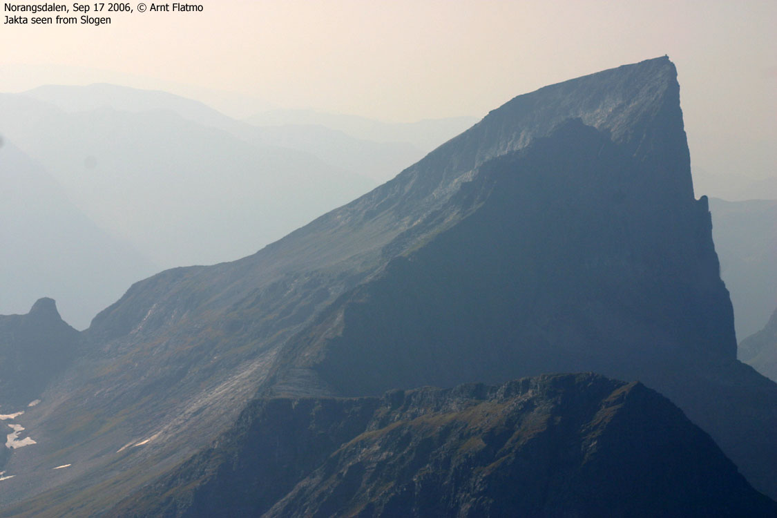
Jakta, central background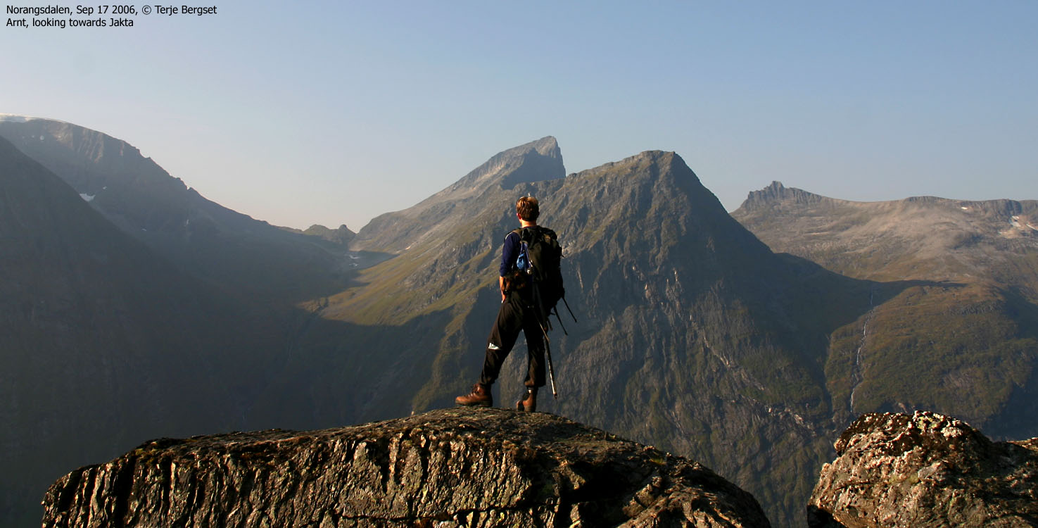
|
Jakta is located on a peninsula, defined by Norangsfjorden and Storfjorden, and belongs to the exclusive "club" of characteristic - and dominating peaks in the "Sunnmørsalpene" mountain range. The mountain can be reached from Viddal by Storfjorden and from Norang/Øye by Norangsfjorden. The route from Norang/Øye is described on this page.
Compared to Slogen (5Km to the northeast) some may feel that the easiest route to Jakta is a bit easier than to Slogen, while the hardest route to Jakta is a bit harder than Slogen. "Hard" in this context means steeper and more exposed. The booklet Rock Climbs in Sunnmøre (1953) says about Jakta; "An easy peak S of Øye. Magnificent views, but very little sport".

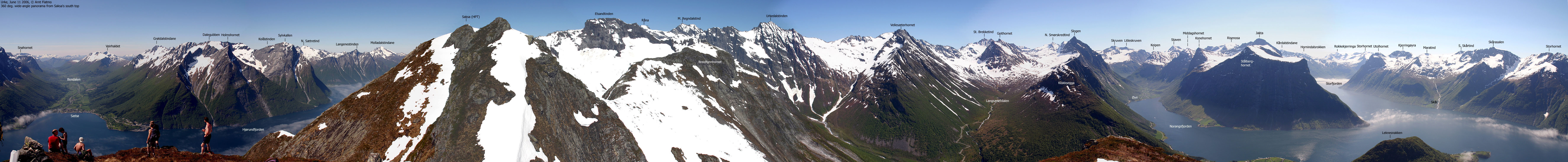
The view from Jakta is simply stunning. There are far too much to see to mention, but the view of Hjørundfjorden in its full length, should be enough to satisfy your expectations. Interestingly enough, the beautiful Slogen loses some of its might, when seen from Jakta. The slightly higher Store Brekketind lies directly behind Slogen, causing Slogen to become a bit more anonymous in the foreground. Interestingly, you have a nice view towards Store Skagastølstind and the adjacent mountains on the Styggedals- and Skagastølsrygg ridges, more than 100Km to the southeast.
Jakta is part of a mountain ridge between Hornindalsvatnet to Norangsfjorden. Jakta is one of the northernmost points on this ridge that spans other known tops, such as, Risenosa, Kårdalstindane, Kvitegga, Hornindalsrokken, Storhornet, Blåbredhornet and Gjugra. To name a few. Kvitegga (1717m) is the highest mountain on this ridge. Konedalen valley also offers routes to Some of Jakta's neighbours - Risenosa, Konehornet and Stålberghornet.


Jakta (Norge 1:50,000: 1588m, Økonomisk Kartverk: 1588,60m ~ 1589m, UTM 32 V 375890 6895525) has a primary factor of 539m towards the higher parent mountain Kvitegga (1717m). The defining saddle (approx. UTM 32 V 380364 6890406) is found between Kalveskredsnipa and Skjerdingstindane. Ref. the 1:50,000 map (20m contours), the saddle is within the range 1040-1060m, interpolated to 1050m.
Personal GPS measurement read 1593m on top of the cairn (approx. 2,3m high). On the Garmin GPS map, the high point is located 32m north of the map's summit point.
Notes: Class ratings are in reference to YDS. Click here for more information.
The trails described below are not necessarily the *easiest* trails to this mountain.
|
Norang/Øye - Jakta (summer/autumn)
|
|
Access
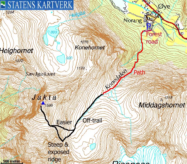
From Ålesund, follow highway E39 towards Bergen, and then highway RV60 (Stranda) to the Magerholm - Ørsneset ferry. This ferry runs quite often; every 20 minutes in the busy hours of the day. From Ørsneset, drive RV60 to Stranda (34,3Km). Turn southbound (right) and continue on RV60 to the Norangsdal junction (30,8Km). Make sure you turn right towards Stryn when you pass Hellesylt. Drive Norangsdalen to the "Norang" sign in Øye (17Km).
Drive 200m straight ahead and turn left between two buildings as the road turns right (west). Drive 200m on the forest road until you reach a junction. Your route continues up the tractor road to the right. Look for parking opportunities without blocking for other traffic.


The route
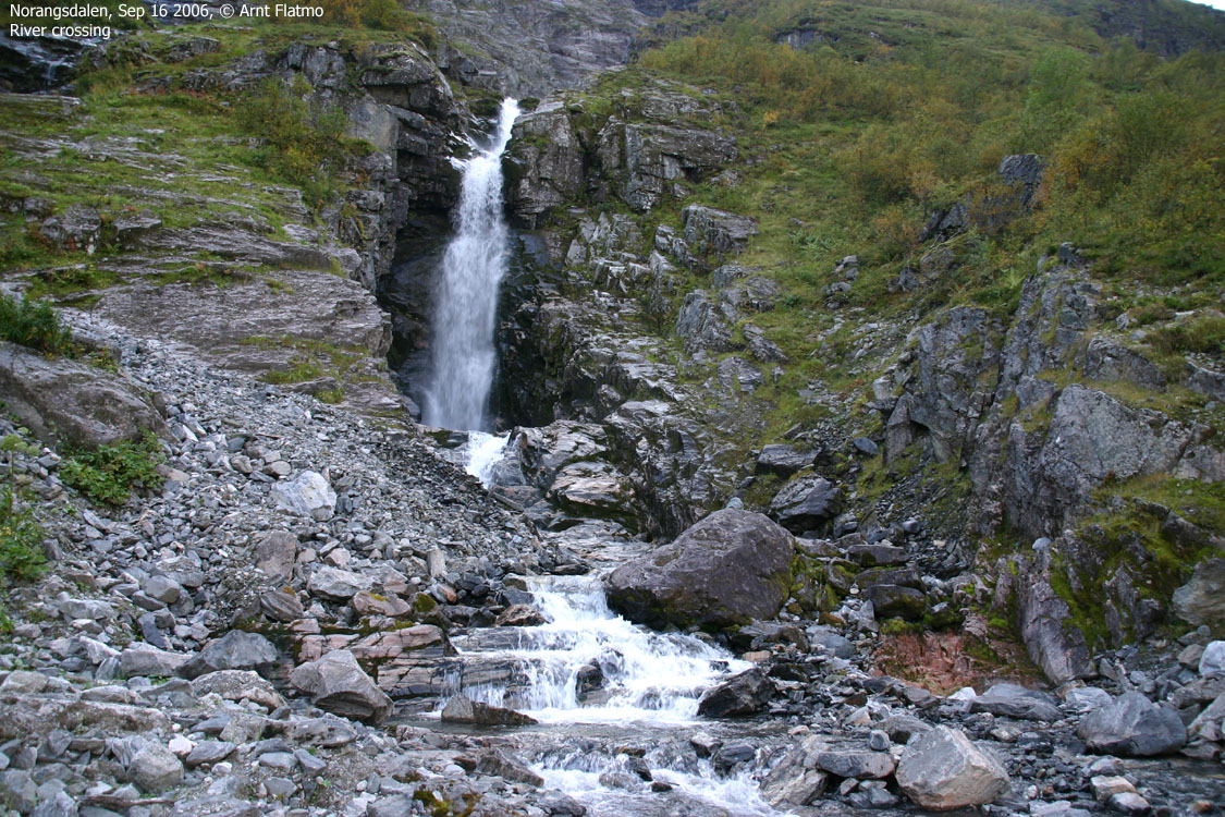
From the trailhead, follow the tractor road westbound. The tractor road turns into a forest path that runs on the left-hand side of the river. The path climbs steep up through the forest, and the path is well-worn. Can be very muddy in places. At approx. 350m elev., cross the river and proceed up the ridge on the far side. Crossing the river in summer/autumn should normally not pose any problem. In the melting season (or even after heavy rain) consider possible dangers involved by crossing here. An old wire runs across, but it is unclear if it can be trusted.
The path fades as you enter Konedalen. Cross the valley and head towards the Risenosa - Jakta saddle, a distinct col straight ahead.
Alternative #1 is to walk across boulder up to the col, turn right and scramble a couple of sections (marked by blue paint) in exposed terrain before you get to safer ground above. The scrambling is in general YDS 2+, but one point may qualify as class 3.
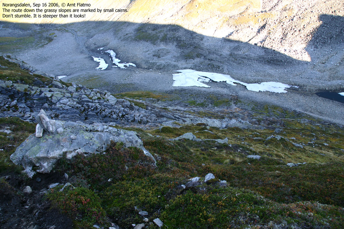
Alternative #2 is to turn right before you hill up to the col begins. Seek for the first small cairn that will guide you up between the grassy ledges. Although the route is less steep and less tricky, you can not take a stumble on this route, either.
The two routes come together at 1290m elev., and you ascend the summit across a long boulderfield. The summit is marked by a large cairn, approx. 2,3m high.

 westcoastpeaks.com
Other Møre & Romsdal mountains
Other Norwegian mountains
westcoastpeaks.com
Other Møre & Romsdal mountains
Other Norwegian mountains

